Wandelkaart Z62 Fjällkartan Akersjon - Akersjön | Lantmäteriet

0
Fantastische kaart van een belangrijk wandelgebied van Zweden. Zeer goed leesbaar, ondanks de 100.000 schaal perfect voor trekkers door het glooiende landschap. Hutten, campsites, noodtelefoons, bruggen, wandelroutes, topografische details met bijv. hoogtelijnen en grid indeling dus bruikbaar voor GPS.   Fjällkartan scale of 1: 50.000. All map she...

Verkopers met dit product

Verkoper
Bezorging
Prijs
DeZwerver.nl logo
DeZwerver.nl
2,95
19,95

Anderen bekeken ook

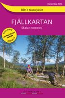
Wandelkaart BD15 Fjällkartan Nasafjället | Lantmäteriet
Fantastische kaart van een belangrijk wandelgebied van Zweden. Zeer goed leesbaar, ondanks de 100.000 schaal perfect voor trekkers door het glooiende landschap. Hutten, campsites, noodtelefoons, bruggen, wandelroutes, topografische details met bijv. hoogtelijnen en grid indeling dus bruikbaar voor GPS.   Fjällkartan scale of 1: 100000 covering 25 map sheets and covers the mountain area from Salen in the south to the boundary mark of the north. All map sheets have a back which you will find information about mountain safety, mountain weather, conservation and GPS use. you will also find information about national parks, nature reserves and proposals for suitable tours. the map is printed on a latex-impregnated paper.
19,95
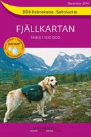
Wandelkaart BD8 Fjällkartan Kebnekaise - Saltoluokta | Lantmäteriet
Fantastische kaart van een belangrijk wandelgebied van Zweden. Zeer goed leesbaar, ondanks de 100.000 schaal perfect voor trekkers door het glooiende landschap. Hutten, campsites, noodtelefoons, bruggen, wandelroutes, topografische details met bijv. hoogtelijnen en grid indeling dus bruikbaar voor GPS.   Fjällkartan scale of 1: 100000 covering 25 map sheets and covers the mountain area from Salen in the south to the boundary mark of the north. All map sheets have a back which you will find information about mountain safety, mountain weather, conservation and GPS use. you will also find information about national parks, nature reserves and proposals for suitable tours. the map is printed on a latex-impregnated paper.
19,95
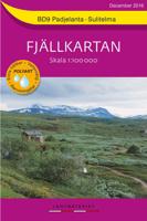
Wandelkaart BD9 Fjällkartan Padjelanta - Sulitelma | Lantmäteriet
Fantastische kaart van een belangrijk wandelgebied van Zweden. Zeer goed leesbaar, ondanks de 100.000 schaal perfect voor trekkers door het glooiende landschap. Hutten, campsites, noodtelefoons, bruggen, wandelroutes, topografische details met bijv. hoogtelijnen en grid indeling dus bruikbaar voor GPS.   Fjällkartan scale of 1: 100000 covering 25 map sheets and covers the mountain area from Salen in the south to the boundary mark of the north. All map sheets have a back which you will find information about mountain safety, mountain weather, conservation and GPS use. you will also find information about national parks, nature reserves and proposals for suitable tours. the map is printed on a latex-impregnated paper.   Lange Afstandswandelroute Nordkalottleden E1  
19,95
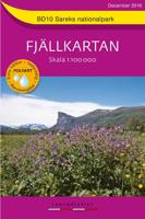
Wandelkaart BD10 Fjällkartan Sareks Nationalpark | Lantmäteriet
Fantastische kaart van een belangrijk wandelgebied van Zweden. Zeer goed leesbaar, ondanks de 100.000 schaal perfect voor trekkers door het glooiende landschap. Hutten, campsites, noodtelefoons, bruggen, wandelroutes, topografische details met bijv. hoogtelijnen en grid indeling dus bruikbaar voor GPS.   Fjällkartan scale of 1: 100000 covering 25 map sheets and covers the mountain area from Salen in the south to the boundary mark of the north. All map sheets have a back which you will find information about mountain safety, mountain weather, conservation and GPS use. you will also find information about national parks, nature reserves and proposals for suitable tours. the map is printed on a latex-impregnated paper.
19,95
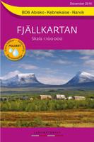
Wandelkaart BD6 Fjällkartan Abisko - Kebnekaise - Narvik | Lantmäteriet
Fantastische kaart van een belangrijk wandelgebied van Zweden. Zeer goed leesbaar, ondanks de 100.000 schaal perfect voor trekkers door het glooiende landschap. Hutten, campsites, noodtelefoons, bruggen, wandelroutes, topografische details met bijv. hoogtelijnen en grid indeling dus bruikbaar voor GPS.   Fjällkartan scale of 1: 100000 covering 25 map sheets and covers the mountain area from Salen in the south to the boundary mark of the north. All map sheets have a back which you will find information about mountain safety, mountain weather, conservation and GPS use. you will also find information about national parks, nature reserves and proposals for suitable tours. the map is printed on a latex-impregnated paper.   Lange Afstandswandelroute Nordkalottleden E1  
19,95
Wandelkaart Tour & Trail Formentera | Discovery Walking Guides
Goede, scheur- en watervaste, wandelkaart van Formentera.   Water-proof, split-proof, tear-proof, adventure-proof. Formentera Tour & Trail Super-Durable Map is simply the toughest, most accurate, easy to read, easy to use map of the island you can buy at any price. David & Ros Brawn surveyed this beautiful island in October 2015 carrying out their 'gps ground survey' pinpointing all the details needed to produce the definitive map of Formentera.   Large, 25k scale, easy to read map sheet includes a wealth of useful details. 20 metre and 100 metre contours combined with altitude shading bring the Formentera landscape to life. All of the legendary Tour & Trail attention to detail is included so that you will find those petrol stations, mirador viewpoints with parking, refreshment stops with parking and accurate road numbering that are so essential when adventuring by hire car; 'watts' new and unique to Formentera we have included the 'Electric hire car' recharging points making sure you…
15,95
Wandelkaart Tour & Trail Tenerife | Discovery Walking Guides
Uitstekende wandelkaart, met ingetekende wandelroutes, voor specifieke wandelgebieden van Tenerife. Let op: dit is niet een kaart van het hele eiland, maar puur en alleen voor de wandelgebieden > daar is deze kaart de beste in! Our latest hiking research on Tenerife has resulted in new editions of Walk! Tenerife and Tenerife Hikers' Super-Durable Maps. Thanks to Jan Kostura's research we have several new hiking adventures described in detail in Walk! Tenerife. Jan's gps records of his research for new routes and updating of current routes has provided the detailed information to produce our new fourth edition of Tenerife Hiker's Super-Durable Maps. Note that Tenerife Hikers' Super-Durable Maps is a collection of four 30k scale map sections on a double sided sheet of 840mm by 600mm which folds up to 220mm by 120mm. It is not a map of all of Tenerife.  In this edition you will find 30k scale maps covering Valle de Orotava, West, Anaga and Adeje/Arona - Teide printed on a double sided…
17,95
Wandelkaart - Wegenkaart - landkaart 308 Tinos | Terrain maps
Gedetailleerde wegenkaart en wandelkaart met alle kleine wegen, wandelpaden, hoogtelijnen en toeristische informatie aangegeven. Alle tekst is tweetalig in Engels en Grieks en de waterproof kaart is geschikt voor gebruik met GPS. This is a great map of Tinos because:   •    It is waterproof and rip-proof. You can fold and unfold it a thousand times, fold it in irregular ways, dunk it in the sea or leave it out in the rain. This map is indestructible!    •    It is the first time the island’s entire coastline is mapped. Cartography was done with TERRAIN’s specially equipped and staffed cartographic vessel. This means that you can locate all beaches of the island, down to the tiniest cove! In fact, the special features of every single beach are recorded: whether it is sandy or pebbled, whether it features natural tree shade, water, a beach bar or organized water sports, whether the seabed in front of the beach is sandy or rocky (so that you will know where to anchor).    •    It feature…
12,50
Wandelkaart 328 Chios - Hios | Terrain maps
Gedetailleerde wegenkaart en wandelkaart met alle kleine wegen, wandelpaden, hoogtelijnen en toeristische informatie aangegeven. Alle tekst is tweetalig in Engels en Grieks en de waterproof kaart is geschikt voor gebruik met GPS. THIS IS THE BEST MAP OF CHIOS, BECAUSE: • It is the only GIS map of Chios made with data collected 100% through field survey. • All major trails of Chios are shown, with distances measured in kilometers, so that you can estimate the duration of your hike. On the reverse side you‘ll find detailed descriptions of 3 of the island’s best hikes. These are also distinctly labeled on the map, so you can easily locate them. • It includes a map of the neighboring island of Inousses, showing all beaches. • It includes a detailed town plan of the island’s capital, in the scale of 1:4.000, with all sites of interest clearly indicated. • It shows more roads and hiking trails than any other map of Chios, with scenic routes marked in green. • It is printed on Polyart plasti…
11,95
Wandelkaart - Wegenkaart - landkaart 332 Ikaria | Terrain maps
Gedetailleerde wegenkaart en wandelkaart met alle kleine wegen, wandelpaden, hoogtelijnen en toeristische informatie aangegeven. Alle tekst is tweetalig in Engels en Grieks en de waterproof kaart is geschikt voor gebruik met GPS. THIS IS THE BEST MAP OF IKARIA BECAUSE: • It is the only map of Ikaria made with data collected 100% through field survey. • It comes in a more detailed scale than other map in the market. • For the first time, the entire trail network of Ikaria is shown with absolute accuracy. All trails have been measured in kilometers, so you can estimate the duration of your hike. On the back side you ‘ll find detailed descriptions of 11 of the best hikes in Ikaria. These are distinctly labeled on the map, so you can easily locate them. • It features the most complete road network, with scenic routes marked in green. • It is printed on Polyart plastic “paper”, making it totally waterproof and rip-proof. You can fold it and unfold it a hundred times, fold it in irregular w…
12,50

Klanten-reviews van Wandelkaart Z62 Fjällkartan Akersjon - Akersjön | Lantmäteriet

Er zijn nog geen beoordelingen voor dit productBen jij de eerste die een review plaatst?

Meer over Wandelkaart Z62 Fjällkartan Akersjon - Akersjön | Lantmäteriet

Productomschrijving

Fantastische kaart van een belangrijk wandelgebied van Zweden. Zeer goed leesbaar, ondanks de 100.000 schaal perfect voor trekkers door het glooiende landschap. Hutten, campsites, noodtelefoons, bruggen, wandelroutes, topografische details met bijv. hoogtelijnen en grid indeling dus bruikbaar voor GPS.   Fjällkartan scale of 1: 50.000. All map sheets have a back which you will find information about mountain safety, mountain weather, conservation and GPS use. you will also find information about national parks, nature reserves and proposals for suitable tours. the map is printed on a latex-impregnated paper.

Productinformatie

    Verken gerelateerde categorieën

    Webshop.nl maakt gebruik van cookies. Ga je verder op onze website, ga dan akkoord met het plaatsen van cookies en de verwerking van deze data door ons en vermelde partners.