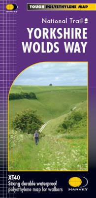
Wandelkaart Yorkshire Wolds Way | Harvey Maps

0
The Yorkshire Wolds Way is a 79 mile (127 km) walking route in the chalk landscape of the Yorkshire Wolds. The National Trail wends through some of the most tranquil and gentle countryside in England. From the banks of the mighty Humber estuary, along wooded slopes and through serene dry valleys, the walk climbs gently onto the airy tops of the ro...

Verkopers met dit product

Verkoper
Bezorging
Prijs
DeZwerver.nl logo
DeZwerver.nl
2,95
25,95

Anderen bekeken ook

Wandelkaart Yorkshire Wolds Way | Harvey Maps
The Yorkshire Wolds Way is a 79 mile (127 km) walking route in the chalk landscape of the Yorkshire Wolds. The National Trail wends through some of the most tranquil and gentle countryside in England. From the banks of the mighty Humber estuary, along wooded slopes and through serene dry valleys, the walk climbs gently onto the airy tops of the rolling hills where on a clear day you can see forever. Descending from the northern escarpment the final section of the way finishes on the dramatic headland of Filey Brigg.
25,95
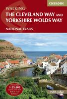
Wandelgids The Cleveland way and the Yorkshire Wolds way | Cicerone
Uitstekende wandelgids van de Cotswolds Way, waarbij naast alle noodzakelijke informatie ook gebruik gemaakt wordt van de echte topografische kaart. Inclusief gidsje met routekaarten van 1:25000 Guidebook to the Cleveland Way and Yorkshire Wolds Way National Trails, plus the Tabular Hills Walk link route. The guidebook also contains a 1:25,000 scale OS route map booklet of the Cleveland Way.   The Cleveland Way National Trail, described in seven day stages, is a fine 177km (110 miles) walk around the North York Moors National Park from Helmsley to Filey. The Yorkshire Wolds Way is one of the quietest of Britain's National Trails and wanders for 130km (80 miles) through gentle, cultivated and sparsely populated countryside. Described here in nine day stages, from Hessle near Redcar to Filey, it links end-to-end with the Cleveland Way on the coast. Also described is the three-day, 80km (50 mile) Tabular Hills Walk, a Regional Trail that allows walkers to close the loop of the Cleveland …
25,95
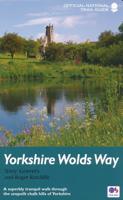
Wandelgids Yorkshire Wolds Way | Aurum Press
Een mooie wandelgids met een goede beschrijving en hele duidelijke kaarten met ingetekende route.   The Yorkshire Wolds were brought to international attention in 2012 by David Hockney’s magnificent Royal Academy exhibition of paintings of the region. Now, Tony Gowers’ completely updated, expanded and re-designed National Trail Guide offers the essential companion to the forgotten but fascinating landscape through which this Trail runs.   The Trail runs from Hessle in the south, by the Humber Bridge, to Filey on the North Yorkshire coast, through the Wolds' secluded and special 'dry valleys', a succession of tranquil villages, and past cel;ebrated locations like Thixendale woods now immortalised in Hockney's vast and dazzling paintings.   As well as comprehensive route descriptions accompanied by OS 1:25,000 maps, the book features a Philip Larkin Trail around Hull, digressions to the handsome town of Beverley with its beautiful Minster, the Holderness region made famous by Winfred Ho…
20,95
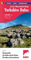
Wandelkaart Yorkshire Dales Zuid West | Harvey Maps
HARVEY launch innovative new series: Ultramap XT40. 16 titles featuring in Trail magazine through spring 2016. 40 years experience have gone into HARVEY's most creative new series. The Ultramap covers a large area yet is small enough to slip in a pocket. The Ultramap is fully detailed genuine original HARVEY mapping. The Ultramap is tough and 100% waterproof. Use it without a map case, whatever the weather! To provide the biggest area on the smallest lightest sheet, the Ultramap is printed double sided. The ingenious folding pattern allows you to open the Ultramap directly to any part and either side of the sheet. The two sides are aligned, so when you reach the edge of the Ultramap sheet you simply flip it over without re-folding. There's an overlap as well so you can map read continuously. The magic scale of 1:40,000 enables the Ultramap to provide all the detail you would expect to find on a large scale walking map including rights of way and boundaries. Actual size 73mm x 152mm. P…
20,95

Klanten-reviews van Wandelkaart Yorkshire Wolds Way | Harvey Maps

Er zijn nog geen beoordelingen voor dit productBen jij de eerste die een review plaatst?

Meer over Wandelkaart Yorkshire Wolds Way | Harvey Maps

Productomschrijving

The Yorkshire Wolds Way is a 79 mile (127 km) walking route in the chalk landscape of the Yorkshire Wolds. The National Trail wends through some of the most tranquil and gentle countryside in England. From the banks of the mighty Humber estuary, along wooded slopes and through serene dry valleys, the walk climbs gently onto the airy tops of the rolling hills where on a clear day you can see forever. Descending from the northern escarpment the final section of the way finishes on the dramatic headland of Filey Brigg.

Productinformatie

    Verken gerelateerde categorieën

    Webshop.nl maakt gebruik van cookies. Ga je verder op onze website, ga dan akkoord met het plaatsen van cookies en de verwerking van deze data door ons en vermelde partners.