webshop.nl

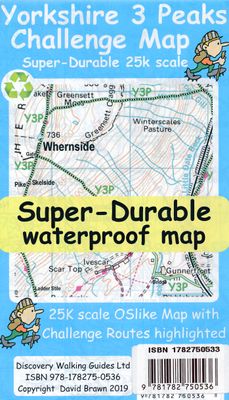
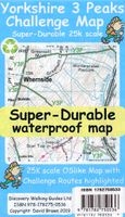
Wandelkaart Yorkshire 3 Peaks Challenge Map | Discovery Walking Guides

0
Goede scheur- en watervaste wandelkaart. OS 50k scale mapping is doubled in size to produce a 25k map but the features, text and logos are now doubled in size making them much easier to read under challenge conditions.  Y3P 12 Hour Challenge Route, and its options for ascending Whernside, are added and specially highlighted so that the route stand...

Webshops met dit product

Webshop
Bezorging
Prijs
DeZwerver.nl logo
DeZwerver.nl
niet bekend
15,95

Anderen bekeken ook

Wandelkaart National 3 Peaks Challenge Map | Discovery Walking Guides
Goede scheur- en watervaste wandelkaart. National 3 Peaks Challenge Maps. Ben Nevis, Scafell Pike and Snowdon at 20k scale. Waterproof, tearproof and 100% recyclable 820mm by 420mm double sided map sheet.   Taking OS mapping at 50k scale we expand the mapping to produce 20k scale maps of the three challenge peaks, Ben Nevis, Scafell Pike and Snowdon. By expanding the OS mapping the features of names, roads, tracks and trails are more than doubled in size making them easier to read under Challenge conditions. We then add the Challenge Routes, specially highlighted to make them stand out against the OS map background information and add in additional information that will help your challenge.   Each map covers the region to show the access roads as well as the walking routes. Ben Nevis includes the Glen Nevis Information Centre starting point and Glen Nevis Youth Hostel starting point. Scafell Pike includes the Wasdale and Seathwaite Challenge Routes.   Snowdon includes the Pyg Track, M…
15,95
Wandelkaart Isle of Wight | Discovery Walking Guides
Goede scheur- en watervaste wandelkaart. Isle of Wight Walkers' Map at 32k scale with challenge routes and walking trails highlighted. OS 50k scale mapping is expanded in size to produce a 32k map. The OS features, text and logos are now 50% larger making them much easier to read under outdoor conditions.   Isle of Wight Challenge Route (66 miles) is specially highlighted in green and white so that the route stands out against the OS background map. Then we add the Earl Mountbatten Hospice's Walk (26.5 miles) highlighted in gold and white. A large range of gps surveyed walking trails are then highlighted in grey and white.   The result is an easy to read `OSlike' map with walking trails specially highlighted. We then split the island into East (cover side) and West (reverse side) with a ten mile common overlap to the two sides; meaning you will only have to turn the map over if you are undertaking the longest Challenge or Earl Mountbatten routes. The result is a double sided 840mm by …
15,95
Wandelkaart Coast 2 Coast | Discovery Walking Guides
Goede scheur- en watervaste wandelkaart. The whole Coast 2 Coast on one double sided, 960mm by 694mm, map sheet. All 193 miles (308 kilometres) of the Wainwright route along with its alternatives are highlighted across 9 map sections at 40k scale. Ordnance Survey accuracy is combined with Tour & Trail map design to produce 40k scale map sections which are easy to read.   OS 50k Landranger mapping is expanded to 40k scale making the text and features over 40% larger making them easy to read and understand. Wainwright's C2C walking routes, and their alternatives, are specially highlighted in Tour & Trail style making the routes easy to find on the map and on the ground. Public `Rights of Way' paths and bridleways are also highlighted in Tour & Trail style making them easy to recognise and find.   Coast 2 Coast Challenge Map design is then printed on Polyart using 100% oxygenation inks to produce a lightweight, Super-Durable, waterproof map that is tough enough to shrug off the worst tha…
15,95
Wandelkaart Tour & Trail Gran Canaria | Discovery Walking Guides
Goede, scheur- en watervaste, wandelkaart van Gran Canaria.   Gran Canaria Tour & Trail Super-Durable Map covers the whole island at 50,000 scale  in a double sided map sheet of North and South with a generous overlap common to both North and South map sheets.   For the best adventures, use the best map.  Gran Canaria is a large island of dramatic landscapes. Gran Canaria Tour & Trail Super-Durable Map (50k scale) is a large 960mm by 700mm double sided map sheet which folds to its 235mm by 120mm pocket size. A special concertina map fold makes the map easy to unfold and refold in use.  Super-Durable means water-proof and tear-proof, simply wipe clean with a damp cloth if your map gets dirty. This map has a "2 Year Guarantee" covering adventurous use.   Gran Canaria North is on one side with South on the reverse side, while a generous common overlap minimises your map turning.    Now in its 5th edition Gran Canaria Tour & Trail Super-Durable Map, 50k scale, is the result o…
15,95
Wandelgids Walk! Lanzarote | Discovery Walking Guides
Engelstalige wandelgids Lanzarote, met uitgebreide beschrijvingen van wandelroutes, routekaartjes, praktische informatie zoals bussen en accommodatie. Walk! Lanzarote 5th edition builds on the reputation of our earlier editions with more walks and comprehensive updating so that it caters for the needs of the increasing number of people who would like to combine some walking with a holiday on the Fire island. Walk Lanzarote explodes the myth that there is nowhere worth walking on the island as we range through strolling on coastal promenades, walking across alpine style meadows, striding over the lava sea, dropping into volcanoes, sitting on high mountain seats - quite simply you will be amazed at the wide variety of stunning landscapes the Fire island has to offer the adventurous leisure walker.   new extended coastal route from Arrieta to Los Cocoteros to Costa Teguise, new Playa Blanca to Las Brenas to Yaiza on the GR131, which also updates our Yaiza to Las Brenas circular, newly re…
18,50
Wandelkaart Tour & Trail Menorca | Discovery Walking Guides
Goede, scheur- en watervaste, wandelkaart van Menorca. Menorca Tour & Trail Super-Durable Map covers this beautiful island at 40k scale resulting in the most detailed and toughest map of Menorca that you can buy.  Menorca is a large island (700 sq kms) resulting in a large, 840mm by 600mm, double sided map sheet with East on one side and the West on the reverse.  A generous common overlap reduces the need to turn the map over when navigating.  Our special ‘concertina map fold’ makes the map easy to unfold and refold to its pocket size of 215mm by 120mm.  Super-Durable Maps include a 2 year adventurous use wear and tear guarantee.   At 40k scale, the level of detail we can include on Menorca Tour & Trail Super-Durable Map is awesome. Building on our previous editions, we have our legendary level of Tour & Trail detail including the named archaeological sites.  New in 2018 for our 7th edition are the road widening works on the ME-1 main road across the island, 30 new Official Walking Ro…
15,95
Wandelkaart Tour & Trail Madeira | Discovery Walking Guides
Goed gedetallieerde wandelkaart van Madeira, schaal 1:40.000, scheur en watervast papier. Wandelroutes staan ingetekend. Our large 1:40,000 scale, combined with splitting the island into East and West with a generous overlap, produces double sided map whose total size is 840mm by 600mm and folds to 235mm by 120mm. You get the most detailed map of Madeira that is produced including our 'Tour & Trail' level of detail ranging from major roads to secondary roads to minor roads to streets and camino rural narrow country roads, plus dirt roads and walking trails. Altitude background colouring is designed to clearly show the altitude range when travelling across the island by car or on foot. 100 metre and 50 metre contours are clearly shown on the map along with a large number of individual height points and all of the official 'Trig' points. Tour & Trail attention to detail is legendary as is our useful symbol range including miradors, picnic areas, petrol stations, bar/restaurants and park…
15,95
Wandelkaart Tour & Trail Tenerife | Discovery Walking Guides
Uitstekende wandelkaart, met ingetekende wandelroutes, voor specifieke wandelgebieden van Tenerife. Let op: dit is niet een kaart van het hele eiland, maar puur en alleen voor de wandelgebieden > daar is deze kaart de beste in! Our latest hiking research on Tenerife has resulted in new editions of Walk! Tenerife and Tenerife Hikers' Super-Durable Maps. Thanks to Jan Kostura's research we have several new hiking adventures described in detail in Walk! Tenerife. Jan's gps records of his research for new routes and updating of current routes has provided the detailed information to produce our new fourth edition of Tenerife Hiker's Super-Durable Maps. Note that Tenerife Hikers' Super-Durable Maps is a collection of four 30k scale map sections on a double sided sheet of 840mm by 600mm which folds up to 220mm by 120mm. It is not a map of all of Tenerife.  In this edition you will find 30k scale maps covering Valle de Orotava, West, Anaga and Adeje/Arona - Teide printed on a double sided…
17,95
Wandelkaart Tour & Trail Lanzarote | Discovery Walking Guides
De Lanzarote Tour & Trail Super-Durable wandelkaart (4de editie) beslaat dit grote eiland op een schaal van 1: 40.000 wat resulteert in de meest gedetailleerde en sterkste kaart van Lanzarote die u kunt kopen.   For your best adventures, use the best map. Water-proof, split-proof, tear-proof, adventure-proof. Lanzarote Tour & Trail Super-Durable Map is simply the toughest, most accurate, easy to read, easy to use multipurpose map that you can get. A large 960mm by 694mm double sided map sheet covers Lanzarote and its neighbouring island La Graciosa at 1:40,000 scale. A generous overlap and an extra mini-map reduce the need of turning the map in use. Whether you plan to walk, or discover the island by car or the bus, this is the map for you. New for the 6th edition is a summary of Lanzarote bus system, with overview of bus lines and actual bus routes highlighted in the map. Also new is a summary and a mini-guide to main tourist attractions of Lanzarote, with tips for a successful…
18,95
Wandelkaart Tour & Trail Ibiza | Discovery Walking Guides
Scheur- en watervaste wandelkaart van Ibiza.   Water-proof, split-proof, tear-proof, adventure-proof. Ibiza Tour & Trail Super-Durable Map is simply the toughest, most accurate, easy to read, easy to use map of the island you can buy at any price. David & Ros Brawn have partnered with Walking World to include the highlighted routes for 39 detailed walking routes on the island, plus the 20 Official mountain bike cycling routes are also highlighted on their detailed routes.   Large, 40k scale, easy to read map sheets include a wealth of useful details. 20 metre and 100 metre contours combined with altitude shading bring these impressive Ibiza landscapes to life. All of the legendary Tour & Trail attention to detail is included so that you will find those petrol stations, mirador viewpoints with parking, refreshment stops with parking and accurate road numbering that are so essential when adventuring by hire car.   'Off-Tarmac' Ibiza Tour & Trail Map is in a league of its own thanks to a…
15,95

Klanten-reviews van Wandelkaart Yorkshire 3 Peaks Challenge Map | Discovery Walking Guides

Er zijn nog geen beoordelingen voor dit productBen jij de eerste die een review plaatst?

Meer over Wandelkaart Yorkshire 3 Peaks Challenge Map | Discovery Walking Guides

Productomschrijving

Goede scheur- en watervaste wandelkaart.

OS 50k scale mapping is doubled in size to produce a 25k map but the features, text and logos are now doubled in size making them much easier to read under challenge conditions.  Y3P 12 Hour Challenge Route, and its options for ascending Whernside, are added and specially highlighted so that the route stands out against the OS background map. Then we add any additional detail you might need including the popular Challenge starting points of the Pen Y Ghent Cafe, Station Inn and Hill Inn.   On the reverse of the map sheet are the Challenge and OS Legends, cover design, and an access map (approx 60k scale) for road access from the nearest towns of Ingleton and Settle.   The result is a double sided 600mm by 600mm OSlike Super-Durable Map. 

Verken gerelateerde categorieën

Webshop.nl maakt gebruik van cookies. Ga je verder op onze website, ga dan akkoord met het plaatsen van cookies en de verwerking van deze data door ons en vermelde partners.