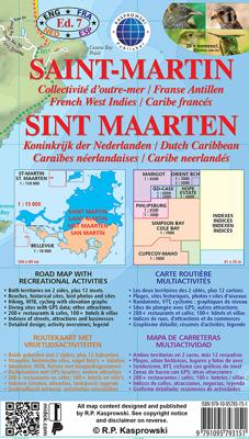
Wandelkaart - Wegenkaart - landkaart Sint Maarten - St. Martin | Kasprowski Maps

0
Bijzonder gedetailleerde kaart (1:15000 !) van alleen het eiland Sint Maarten - Saint Martin. Zowel de wegen als ook de wandelpaden staan er op vermeld. Stranden, interessante plekken en bovendien de meeste duikplakken staan met diepte helder weergegeven op de kaart. Met stadsplattegronden van Philipsburg en Marigot.   The most recent edition of ...

Verkopers met dit product

Verkoper
Bezorging
Prijs
DeZwerver.nl logo
DeZwerver.nl
2,95
18,50

Anderen bekeken ook

Nieuw
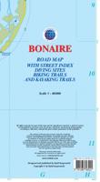
Wegenkaart - landkaart Bonaire | Kasprowski Maps
Bijzonder gedetailleerde kaart (1:40000) van alleen het eiland Bonaire. Zowel de wegen als ook de wandelpaden staan er op vermeld. Stranden, interessante plekken en bovendien de meeste duikplakken staan met diepte helder weergegeven op de kaart. Met stadsplattegrond van Kralendijk. The most up-to-date and only complete road map of Bonaire ( Scale 1 : 28 000 ), as well as the Kralendijk urban area, spanning from Santa Barbara Crowns, through the airport, to Punt Vierkant (Scale 1 : 15 000). An inset of Rincon (Scale 1 : 12 000) is also included. All maps and insets come with thorough street indexes.   All of the official diving sites around Bonaire and Klein Bonaire are displayed, most of them with their GPS locations, as recorded by STINAPA, the island's official conservation foundation.   The map shows all the island's known roads and streets with their names, as well as an extensive set of biking routes and kayaking trails.   The map is sold folded, measuring 5 1/4" x 9 5/8" ( 13.5 …
18,50
Nieuw
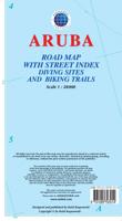
Wegenkaart - landkaart Aruba | Kasprowski Maps
Bijzonder gedetailleerde kaart (1:28000) van alleen het eiland Aruba. Zowel de wegen als ook de wandelpaden staan er op vermeld. Stranden, interessante plekken en bovendien de meeste duikplakken staan met diepte helder weergegeven op de kaart. Met stadsplattegrond van Oranjestad. The most up-to-date and only complete road map of Aruba with street-level detail of the entire island ( Scale 1 : 28 000 ).   The map shows all the island's known roads and streets with their names, displays its many diving sites and an extensive set of biking routes, and locates all the major hotels by name.   The map is sold folded, measuring 4 7/8" x 8 7/8" ( 12.5 cm x 22.5 cm ) and is designed for easy opening and refolding. Its full unfolded format is 26 3/8" x 38 1/2" ( 67 cm x 98 cm ). The map can be hung on a wall to show the entire island.   It contains the following features: Attractive full color layout with high-quality glossy finish; rich topographic detail; Symbol key and scale; Main and seconda…
18,50
Nieuw
Wegenkaart - landkaart Curacao | Kasprowski Maps
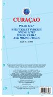
Bijzonder gedetailleerde kaart (1:55000) van alleen het eiland Curacao. Zowel de wegen als ook de wandelpaden staan er op vermeld. Stranden, interessante plekken en bovendien de meeste duikplakken staan met diepte helder weergegeven op de kaart. Met stadsplattegrond van Willemstad. The most up-to-date and only complete road map of Curaçao (Scale 1 : 55 000), as well as the entire Willemstad urban area on the reverse, spanning from the international airport to Spanse (Scale 1 : 18 500). Insets of the Willemstad center (Scale 1 : 8 000), Grote Berg (Scale 1 : 6 000), Tera Kora (Scale 1 : 6 000), Barber (Scale 1 : 6 000), and the island Klein Curaçao (Scale 1 : 55 000) are also included. All maps and insets come with thorough street indexes.   The map shows all the island's known roads and streets with their names, displays its many diving sites, and indicates an extensive set of biking routes and hiking trails..   The double-sided map is sold folded, measuring 4 7/8" x 8 7/8" ( 12.5 cm …
18,50
Nieuw
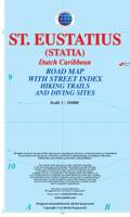
Wandelkaart - Wegenkaart - landkaart St. Eustatius | Kasprowski Maps
Bijzonder gedetailleerde kaart (1:10.000 !) van alleen het eiland St. Eustatius. Zowel de wegen als ook de wandelpaden staan er op vermeld. Stranden, interessante plekken en bovendien de meeste duikplakken staan met diepte helder weergegeven op de kaart. This first and only complete road and street map with a street index of the Dutch Caribbean island of Saint Eustatius (Statia), ( Scale 1 : 10 000 ) renders roads and streets with their names and locates hiking trails and diving sites.    The map is sold folded, measuring 4 7/8" x 8 7/8" ( 12.5 cm x 22.5 cm ), and is designed for easy opening and refolding. Its full unfolded format is 26 3/8" x 35"  ( 67 cm x 89 cm ).   Designed for travelers, this excellent map has unsurpassed coverage of the island, and its extensive information and depth of detail fit a broad range of interests. The map has hill shading, three levels of roads (footpaths, secondary roads, and main roads) and symbols representing a large number of physical features. …
18,50
Nieuw
Wandelkaart - Wegenkaart - landkaart Saba | Kasprowski Maps
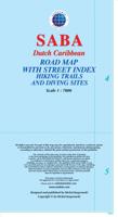
Bijzonder gedetailleerde kaart (1:7000 !) van alleen het eiland Saba. Zowel de wegen als ook de wandelpaden staan er op vermeld. Stranden, interessante plekken en bovendien de meeste duikplakken staan met diepte helder weergegeven op de kaart. This first and only complete road map with a street index of Saba ( Scale 1 : 7000 ) renders all the island's known roads and streets with their names and locates hiking trails and diving sites.   The map is sold folded, measuring 4 7/8" x 8 7/8" ( 12.5 cm x 22.5 cm ), and is designed for easy opening and refolding. Its full unfolded format is 26 3/8" x 38 1/2"  ( 67 x 98 cm ).   It contains the following features Attractive full color layout; Rich topographic detail; Symbol key and scale; Main and secondary roads, hiking trails, diving sites, an airport, geological formations, marine parks, ports, beacons, churches, cemeteries, gas station, old sulphur mine and other points of interest; Depth curves, soundings in meters, longitude and latitude …
18,50
Nieuw
Wandelkaart - Wegenkaart - landkaart 322 Skyros | Terrain maps
Gedetailleerde wegenkaart en wandelkaart met alle kleine wegen, wandelpaden, hoogtelijnen en toeristische informatie aangegeven. Alle tekst is tweetalig in Engels en Grieks en de waterproof kaart is geschikt voor gebruik met GPS. Skyros belongs to the island complex of the Northern Sporades, but in terms of natural environment it is divided into two: the northern part of the island is covered by a dense pine forest like all the other islands of the northern Sporades, while the southern part is characterized by the wild rocky landscapes of Mount Kochylas, more reminiscent of the Cyclades. Throughout the island there are many old walking trails, making Skyros a growing hiking destination, although - so far - the marking and maintenance of the paths remains problematic.   This fully updated hiking and touring map of Skyros by TERRAIN accurately shows all the paths and trails of the island with point-to-point distances, and of course the entire road network, beaches, archaeological sit…
12,50
Nieuw
Wandelkaart - Wegenkaart - landkaart 308 Tinos | Terrain maps
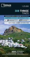
Gedetailleerde wegenkaart en wandelkaart met alle kleine wegen, wandelpaden, hoogtelijnen en toeristische informatie aangegeven. Alle tekst is tweetalig in Engels en Grieks en de waterproof kaart is geschikt voor gebruik met GPS. This is a great map of Tinos because:   •    It is waterproof and rip-proof. You can fold and unfold it a thousand times, fold it in irregular ways, dunk it in the sea or leave it out in the rain. This map is indestructible!    •    It is the first time the island’s entire coastline is mapped. Cartography was done with TERRAIN’s specially equipped and staffed cartographic vessel. This means that you can locate all beaches of the island, down to the tiniest cove! In fact, the special features of every single beach are recorded: whether it is sandy or pebbled, whether it features natural tree shade, water, a beach bar or organized water sports, whether the seabed in front of the beach is sandy or rocky (so that you will know where to anchor).    •    It feature…
12,50
Nieuw
Wandelkaart - Wegenkaart - landkaart St Helena & Dependencies | Gizi Map
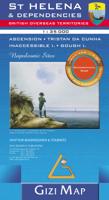
Met name door het kleurgebruik een mooie kaart: heel duidelijk wordt het landschap weergegeven. Daarnaast veel topografische details.  St. Helena at 1:35,000 from Gizi Map, with the other islands of the British Overseas Territories in the Atlantic: Tristan da Cunha, plus Ascension, Inaccessible and Gough Islands at 1:75,000, with superb cartography and places of interest.    The map excellently presents the topography of all the islands, with bright colouring and vivid relief shading, accompanied by spot heights and names of many peaks, valleys and other geographic features. Small settlements and many individual buildings are shown, roads and local tracks are marked. On St. Helena hiking trails are also highlighted and local administrative boundaries are marked.    The map indicates locations with tourist accommodation and prominently shows various places of interest. Special highlighting marks sites associated with Napoleon’s exile on St Helena and the map also shows the boundary of …
15,95
Nieuw
Wegenkaart - landkaart British Columbia South (Canada) | ITMB
Deze wegenkaart van British Columbia bestrijkt het gebied tussen Vancouver en Calgary, en is de perfecte toeristische kaart voor het verkennen van de regio Rocky Mountain. Alle wegen en spoorlijnen tussen de twee steden worden getoond, evenals campings en parken.   This map covers the area between Vancouver and Calgary, and is the perfect tourist map for exploring the Rocky Mountain region. All roads and rail lines between the two cities are shown, as well as camp grounds, parks. Legend Includes: Points of interests, airports, RV and camping sites, wilderness camps, picnic areas, waterfalls, tourist information, museums, golf courses, gas stations, outdoor activities and other information. Folded paper, road and travel map in color. Scale 1:900,000. Distinguishes roads ranging from divided highways to other roads-4WD/dry weather. Legend includes railways, trails, ferry routes, glaciers, points of interest, international airports, domestic airports, museums, mountain peaks, camping/rec…
13,95
Nieuw
Wandelkaart 304 Sifnos | Terrain maps
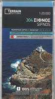
Erg goede wandelkaart van Sifnos, weerbestendig en volledig. Bezienswaardigheden, campings en andere praktische zaken staan op de kaart aangegeven. GPS toepasbaar. This is a great map of Sifnos because: It is waterproof and rip-proof. You can fold and unfold it a thousand times, fold it in irregular ways, dunk it in the sea or leave it out in the rain. This map is indestructible!  It features more trails than any other map of Sifnos on the market. For example, take a look at the area between Apollonia and Kastro, which is where most visitors choose to hike. The trail from Plakoto and the chapel of Aghia Anastasia to Kastro, the trail ascending to Exambela and the branch leading to Apollonia, the trail to Kato Petali, the trail from Aghios Loukas to Kastro and so many more, appear on a map of Sifnos for the first time – in fact, the length of all trails is measured in kilometers so you can estimate the duration of your hike. Also, unlike other hiking maps, SKAI maps do not depict any…
11,95

Klanten-reviews van Wandelkaart - Wegenkaart - landkaart Sint Maarten - St. Martin | Kasprowski Maps

Er zijn nog geen beoordelingen voor dit productBen jij de eerste die een review plaatst?

Meer over Wandelkaart - Wegenkaart - landkaart Sint Maarten - St. Martin | Kasprowski Maps

Productomschrijving

Bijzonder gedetailleerde kaart (1:15000 !) van alleen het eiland Sint Maarten - Saint Martin. Zowel de wegen als ook de wandelpaden staan er op vermeld. Stranden, interessante plekken en bovendien de meeste duikplakken staan met diepte helder weergegeven op de kaart. Met stadsplattegronden van Philipsburg en Marigot.   The most recent edition of the first and only complete road map of the French-Dutch island of Saint-Martin/Sint Maarten renders all known roads and streets with their names; indicates hiking trails, biking routes and diving sites; maps restaurants and hotels; features insets of the Marigot and Philipsburg capitals, as well as Tintamarre Island. Street, hotel, and restaurant indexes are printed on the reverse side of the map.   NEW FEATURES:   Street and road additions, incl. Simpson Bay Causeway; Over 200 restaurants and hotels mapped and indexed; Tintamarre island inset; Biking routes; Birding and turtle nesting sites, other natural attractions; Snorkeling sites; Kayaking trails; More historic sites, with dates; More diving sites, diving site depths; More hiking trails; More scenic views. The map is sold folded and is designed for easy opening and refolding. Its full unfolded format is 34 7/8" x 40 1/2" (88.5 cm x 103 cm). Folded, the map measures 5 1/8" x 8 3/4" (13 cm x 22 cm).   List of map features:   Attractive full color layout; Rich topographic detail; Symbol key and scale; Insets of both capital cities and Tintamarre Island, main and secondary roads, hotels and restaurants, sugar mill vestiges and other historic sites, diving sites and depths, snorkeling sites, shipwrecks, mooring locations, hiking trails, biking routes, kayaking trails, beaches, reefs, geological formations, natural attractions and reserves, bird-watching areas, sea turtle nesting sites, melocactus fields, national and international airports, bridges, lighthouses, marinas, ports, ferry lines, churches, cemeteries, parking areas, gas stations, tourist offices, information panels, and other points of interest; Depth curves, soundings in meters, longitude and latitude lines and other identifiers.
 

Verken gerelateerde categorieën

Webshop.nl maakt gebruik van cookies. Ga je verder op onze website, ga dan akkoord met het plaatsen van cookies en de verwerking van deze data door ons en vermelde partners.