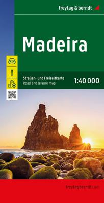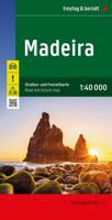
Wandelkaart - Wegenkaart - landkaart Madeira | Freytag & Berndt

0
Duidelijke kaart met hoofdwegen en kleine wegen. Afstanden zijn gemarkeerd, Schaduwwerking en en bergtekening tonen de hoogte. De Levada's - de kanalen waarlangs uitstekend gewandeld kan worden - staan goed ingetekend. Verder met veel toeristische symbolen voor bezienswaardigheden, campings, nationaal park grenzen, etc. Ingevoegd een simpele kaart...

Verkopers met dit product

Webshop
Bezorging
Prijs
DeZwerver.nl logo
DeZwerver.nl
niet bekend
14,95

Anderen bekeken ook

Wegenkaart - landkaart 4 Noorwegen Noordkaap - Hammerfest | Freytag & Berndt
Goede duidelijke wegenkaart aan twee kanten bedrukt. Wel een grote lap kaart, maar daardoor bestrijkt het een groot gebied. Alle toeristische details staan er op, ook campings worden vermeld. De berijdbare wegen zijn goed weergeven, zowel de hoofdwegen als provinciale en lokale wegen; wegnummers worden vermeld. Afstanden tussen plaatsen zijn in kilometers op de kaart ingetekend, daarnaast worden ook op belangrijke plekken benzinepompen gemarkeerd.   In het kaartbeeld wordt door middel van schaduw het reliëf weergegeven en soms enkele punten in het landschap met de daadwerkelijke hoogte. Provinciegrenzen zijn goed terug te vinden, nationale parken en reservaten ook. Met allerhande symbolen worden toeristische bezienswaardigheden weergegeven als monumenten, historisch belangrijke plekken en uitzichtpunten. In bepaalde plaatsen zijn hotels en campings te vinden, luchthavens, treinverbindingen en havens vindt u er ook op!   This detailed road map of Norway North Cape is very suitable for …
14,95
Wandelkaart - Wegenkaart - landkaart La Palma | Freytag & Berndt
Goede overzichtskaart van La Palma. Juist deze kaart is bij uitstek geschikt voor vele doeleinden. Zowel voor de auto als voor de aktieve vakantieganger goed.  Overigens vinden wij dat de Freytag & Berndt kaarten van de Spaanse en Portugese eilanden iets meer gericht zjin op algemeen toerisme en iets minder op wandelen; voor wandelen raden we toch de Kompass - kaarten serie aan die van de meest eilanden ook voor handen is.   The La Palma road map on a scale of 1:40,000 contains all the important information for holidaymakers who want to visit La Palma. The extensive road network is precisely represented and many tourist attractions are shown on the map. Drivers and motorcyclists particularly appreciate the precise cartography from freytag & berndt for route planning and on-site orientation. Hikers can also use the map for hiking tours thanks to the detailed scale and contour lines.   Information about the La Palma road map   Scale 1:40,000 Hiking trails Tourist information Innenstadtp…
14,95
Wegenkaart - landkaart Thailand | Freytag & Berndt
Gedetailleerde, tweezijdige landkaart van Thailand, prima geschikt voor planning en rondtrekken over alle eilanden. De berijdbare wegen zijn goed weergeven, zowel de hoofdwegen als provinciale en lokale wegen; wegnummers worden vermeld. Afstanden tussen plaatsen zijn in kilometers op de kaart ingetekend, daarnaast worden ook op belangrijke plekken benzinepompen gemarkeerd. In het kaartbeeld wordt door middel van schaduw het reliëf weergegeven en soms enkele punten in het landschap met de daadwerkelijke hoogte. Provinciegrenzen zijn goed terug te vinden, nationale parken en reservaten ook. Met allerhande symbolen worden toeristische bezienswaardigheden weergegeven als monumenten, historisch belangrijke plekken en uitzichtpunten. In bepaalde plaatsen zijn hotels en campings te vinden, luchthavens, treinverbindingen en havens vindt u er ook op! Thailand on a large, double-sided, indexed road map from Freytag & Berndt, with clear presentation of the countrys road network, its topography, …
14,95
Nieuw
Wegenkaart - landkaart 572 Asturias - Cantabria - Oviedo - Santander | Michelin
Zoals je van Michelin mag verwachten zijn het onmisbare overzichtskaarten van een uitstekende kwaliteit: een duidelijk en goed leesbaar kaartbeeld.  Vrijwel alle berijdbare wegen staan er op ingetekend, in kleur verschillend voor grote en kleine wegen. Andere weginformatie omvat bijvoorbeeld kilometer-afstanden, tolwegen, helling-aanduiding, winterafsluitingen, tankstations maar ook de bekende groene routes: de mooiste wegen om te rijden.   Daarnaast geeft de kaart toeristische informatie met symbolen weer: bezienswaardigheden als kastelen, kloosters, musea, maar ook campings (niet allemaal overigens). De kaart is voorzien van een 4-talige legenda.   Toch hebben de makers door een beperkt gebruik van symbolen geen drukke kaart gemaakt. De kracht zit hem dan ook in de combinatie van meer dan voldoende informatie en goede leesbaarheid.  Part of the orange regional series from Michelin, this Asturia, Cantabria map shows this part of Spain in excellent detail. Primary & secondary road net…
11,95
Wegenkaart - landkaart Kanada - Canada | Marco Polo
Marco Polo Canada Map: the ideal map for your trip   Let the Marco Polo Canada Map guide you around this incredible country. Plan your great Canadian road trip with this highly durable, overview map of Canada. It folds away easily and is always on standby to help when you're stuck.   Perfect touring map - the scale is 1 : 4 000 000* ideal to help you tour the main highways by car, RV or campervan Easy to use - the super clear mapping in strong colours and clear text will help you navigate easily Includes 6 city maps - detailed street maps of Calgary, Montreal, Ottawa, Quebec, Toronto, Vancouver as well as maps of key National Parks including Jasper, Banff, Yoho, Kootenay and Waterton Lakes Canada highlights - major sights and key points of interest are marked on the map by numbered stars and these are listed in the index booklet with a brief description to help you pick the best places to see en route Extensive index - the thorough index is fully cross-referenced to the map to help yo…
14,95
Wegenkaart - landkaart Portugal | Marco Polo
Duidelijke wegenkaart van Marco Polo: alle wegen, zowel de verharde als belangrijke onverharde wegen zijn weergegeven.  Mooie toeristisch interessante wegen die de moeite waard zijn, zijn groen gearceerd. Veel toeristische informatie is toegevoegd zoals de nationale parken, campings, kastelen en vliegvelden. Afstanden tussen belangrijke steden en benzinestations staan ook op de kaart. Een plaatsnamenregister ontbreekt niet.   ---   This Marco Polo map features really easy to read cartography. Topography is highlighted with relief shading and loads of spot heights and the road network is clearly shown with roads ranging from motorways all the way through to minor secondary roads. The map also clearly indicates airports, places of interest, scenic/tourist routes, view points etc.   The map includes a booklet attached to the cover that contains some useful information and a very extensive index that covers locations, places of interest and geographical features. Also included are a dista…
14,95
Nieuw
Wegenkaart - landkaart EF0021 Bodensee mit Bodensee-Radweg, Erlebnisführer | Freytag & Berndt
Lake Constance is an ideal holiday region simply because of its geographic location. Its shore touches Switzerland, Austria and Germany, and so it offers the opportunity to visit three countries in a short time. The Lake Constance cycle path near the shore is marked on the map section. The information section of the adventure guide provides information about the many tourist attractions directly on the lake or in its immediate vicinity: the islands of Mainau and Reichenau, the Zeppelin Museum in Friedrichshafen, the Collegiate Church of St.Gallen, the Old Castle in Meersburg or the Art Museum in Bregenz, etc are presented on the back of the Lake Constance adventure guide.   Der Bodensee ist allein schon durch seine geografische Lage eine ideale Urlaubsregion. Sein Ufer berührt die Schweiz, Österreich und Deutschland, und so bietet er die Möglichkeit, in kurzer Zeit gleich drei Länder zu besuchen. Der ufernahe Bodenseeradweg ist im Kartenteil eingezeichnet. Der Infoteil des Erlebnisfüh…
9,95
Wegenkaart - landkaart Europe - Europa | Marco Polo
Duidelijke wegenkaart van Marco Polo: alle wegen, zowel de verharde als belangrijke onverharde wegen zijn weergegeven.  Mooie toeristisch interessante wegen die de moeite waard zijn, zijn groen gearceerd. Veel toeristische informatie is toegevoegd zoals de nationale parken, campings, kastelen en vliegvelden. Afstanden tussen belangrijke steden staan ook op de kaart. Een plaatsnamenregister ontbreekt niet.   ---   This Marco Polo map features really easy to read cartography. Topography is highlighted with relief shading and loads of spot heights and the road network is clearly shown with roads ranging from motorways all the way through to minor secondary roads. The map also clearly indicates airports, places of interest, scenic/tourist routes, view points etc.   The map includes a booklet attached to the cover that contains some useful information and a very extensive index that covers locations, places of interest and geographical features. Also included are a distance/driving time ch…
14,95
Wegenkaart - landkaart Cuba | Marco Polo
Duidelijke wegenkaart van Marco Polo: alle wegen, zowel de verharde als belangrijke onverharde wegen zijn weergegeven.  Mooie toeristisch interessante wegen die de moeite waard zijn, zijn groen gearceerd. Veel toeristische informatie is toegevoegd zoals de nationale parken, campings, kastelen en vliegvelden. Afstanden tussen belangrijke steden en benzinestations staan ook op de kaart. Een plaatsnamenregister ontbreekt niet.   ---   This Marco Polo map features really easy to read cartography. Topography is highlighted with relief shading and loads of spot heights and the road network is clearly shown with roads ranging from motorways all the way through to minor secondary roads. The map also clearly indicates airports, places of interest, scenic/tourist routes, view points etc.   The map includes a booklet attached to the cover that contains some useful information and a very extensive index that covers locations, places of interest and geographical features. Also included are a dista…
14,95
Wegenkaart - landkaart Slovenia - Slovenië - Istrie | Marco Polo
Duidelijke wegenkaart van Marco Polo: alle wegen, zowel de verharde als belangrijke onverharde wegen zijn weergegeven.  Mooie toeristisch interessante wegen die de moeite waard zijn, zijn groen gearceerd. Veel toeristische informatie is toegevoegd zoals de nationale parken, campings, kastelen en vliegvelden. Afstanden tussen belangrijke steden en benzinestations staan ook op de kaart. Een plaatsnamenregister ontbreekt niet.   ---   This Marco Polo map features really easy to read cartography. Topography is highlighted with relief shading and loads of spot heights and the road network is clearly shown with roads ranging from motorways all the way through to minor secondary roads. The map also clearly indicates airports, places of interest, scenic/tourist routes, view points etc.   The map includes a booklet attached to the cover that contains some useful information and a very extensive index that covers locations, places of interest and geographical features. Also included are a dista…
14,95

Klanten-reviews van Wandelkaart - Wegenkaart - landkaart Madeira | Freytag & Berndt

Er zijn nog geen beoordelingen voor dit productBen jij de eerste die een review plaatst?

Meer over Wandelkaart - Wegenkaart - landkaart Madeira | Freytag & Berndt

Productomschrijving

Duidelijke kaart met hoofdwegen en kleine wegen. Afstanden zijn gemarkeerd, Schaduwwerking en en bergtekening tonen de hoogte. De Levada's - de kanalen waarlangs uitstekend gewandeld kan worden - staan goed ingetekend. Verder met veel toeristische symbolen voor bezienswaardigheden, campings, nationaal park grenzen, etc. Ingevoegd een simpele kaart van het centrum van Funchal en een inzet van Porto Santo op schaal 1:50.000.


This detailed road map of Madeira is very suitable for planning and traveling around the country. The road network is well represented, both the main roads, provincial and local roads. Road numbers are also clearly stated. Distances between places are marked on the map in kilometers, and gas stations are also marked in important places. Shadow shows the relief and sometimes some points with the actual height. Province borders, national parks and reserves are easy to find. Symbols indicate the location of tourist sites, monuments, historically important places and viewpoints. In certain places you can find hotels and campsites, airports, train connections and ports.     Neben der übersichtlichen Gestaltung bietet die "Straßen- und Freizeitkarte Madeira 1:40.000" zahlreiche Zusatzinformationen wie z.B. Sehenswürdigkeiten, Campingplätze und einen Innenstadtplan.Mit dem umfangreichen Ortsregister gelingt eine rasche Orientierung. - Infoguide- Besondere Ausflugsziele - Cityplan Funchal- Ortsregister mit PLZ- GPS KoordinatenDer beiliegende, mehrsprachige Infoguide bietet Informationen zu besonderen und sehenswerten Ausflugszielen der Inseln. Sprachen: Portugiesisch, Deutsch, Englisch, Französisch, Italienisch, Spanisch, Niederländisch, Tschechisch, Slowakisch, Ungarisch.  

Verken gerelateerde categorieën

Webshop.nl maakt gebruik van cookies. Ga je verder op onze website, ga dan akkoord met het plaatsen van cookies en de verwerking van deze data door ons en vermelde partners.