webshop.nl
Categorieën
  Sluiten

Meer Freytag & Berndt
Meer Freytag & Berndt in Reisgidsen & talen boeken

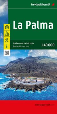
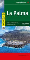
Wandelkaart - Wegenkaart - landkaart La Palma | Freytag & Berndt

0
Goede overzichtskaart van La Palma. Juist deze kaart is bij uitstek geschikt voor vele doeleinden. Zowel voor de auto als voor de aktieve vakantieganger goed.  Overigens vinden wij dat de Freytag & Berndt kaarten van de Spaanse en Portugese eilanden iets meer gericht zjin op algemeen toerisme en iets minder op wandelen; voor wandelen raden we toch ...

Webshops met dit product

Webshop
Bezorging
Prijs

Anderen bekeken ook

Wandelkaart - Wegenkaart - landkaart La Palma | Freytag & Berndt
Goede overzichtskaart van La Palma. Juist deze kaart is bij uitstek geschikt voor vele doeleinden. Zowel voor de auto als voor de aktieve vakantieganger goed.  Overigens vinden wij dat de Freytag & Berndt kaarten van de Spaanse en Portugese eilanden iets meer gericht zjin op algemeen toerisme en iets minder op wandelen; voor wandelen raden we toch de Kompass - kaarten serie aan die van de meest eilanden ook voor handen is.   The La Palma road map on a scale of 1:40,000 contains all the important information for holidaymakers who want to visit La Palma. The extensive road network is precisely represented and many tourist attractions are shown on the map. Drivers and motorcyclists particularly appreciate the precise cartography from freytag & berndt for route planning and on-site orientation. Hikers can also use the map for hiking tours thanks to the detailed scale and contour lines.   Information about the La Palma road map   Scale 1:40,000 Hiking trails Tourist information Innenstadtpl…
14,95
Wegenkaart - landkaart 16 Allgäu | Freytag & Berndt
Een aangepaste versie van de Duitse provinciekaarten van Freytag & Berndt: duidelijk veel meer toegespitst op de toeristische aspecten van de streek.   Deze bijzonder gedetailleerde Freytag & Berndt Wegenkaart van Allgäu is aan één kant geprint en heeft een schaal van 1:150.000. Op deze kaart staan o.a. campings, toeristische wegen en bezienwaardigheden aangegeven.    Nu met een digitaal boekje en index - toegang tot alle informatie snel en gemakkelijk op uw mobiele telefoon!     With the Allgau road map on a scale of 1:150,000, holidaymakers traveling by car, motorbike or caravan can easily find their way around. The dense road network is depicted precisely, distances and tourist destinations in the Allgau are shown on the map.   Information about the Allgäu car map   Scale 1:150,000 Tourist information Campsites and pitches Top Tips Location register with postal codes Downtown map Format: 124 x 86 cm The best car map for the Allgau Whether hiking, cycling, water sports o…
14,95
Wandelkaart Tour & Trail La Palma | Discovery Walking Guides
Goede, scheur- en watervaste, wandelkaart van La Palma. Water-proof, split-proof, tear-proof, adventure-proof.  La Palma Tour & Trail Super-Durable Map is simply the toughest, most accurate, easy to read, easy to use map of the island you can buy at any price.  Super-Durable Maps now come with a 2 year adventurous use wear and tear guarantee, see Discovery Walking Guides website for details.    7th Edition of our La Palma Tour & Trail Super-Durable Map is a large 1:40,000 scale map, splitting the island into a North (Landscape view) and South (Portrait view) with a generous overlap, produces double sided map of 840mm by 600mm and folds to 235mm by 120mm. Our legendary 'Tour & Trail' level of detail ranges from major roads to secondary roads to minor roads to streets and camino rural narrow country roads, plus dirt roads and walking trails.  Altitude background colouring is designed to clearly show the altitude range when travelling across the island by car or on foot. 100 metre and 50 …
15,95
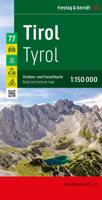
Wegenkaart - landkaart 77 Tirol | Freytag & Berndt
Gedetailleerde wegenkaart van een deel van Oostenrijk. Deze kaart is bijzonder duidelijk leesbaar en door de schaal met veel details als campings, berghutten, hoofdwandelroutes en alle berijdbare wegen en plaatsen. Met register This is  a series of detailed road maps at 1:150,000 from Freytag & Berndt   The road and leisure map of Tyrol on a scale of 1:150,000 contains a lot of information that is useful and helpful for a trip to the west of Austria. The complex road and rail network is shown in detail and many regional cycle paths and long-distance cycle paths are shown on the map. Tourist roads and scenic roads are highlighted in color and many attractive destinations are visible.   The Top Tips series offers a brief summary of the ten most attractive places in Tyrol and their sights. All texts are also translated into English. Popular tourist attractions include Innsbruck's old town, the Kufstein Fortress or Landeck Castle. Nature lovers can visit the Karwendel Nature Park and f…
14,95
Wegenkaart - landkaart Vorarlberg | Freytag & Berndt
Gedetailleerde wegenkaart van een deel van Oostenrijk. Deze kaart is bijzonder duidelijk leesbaar en door de schaal met veel details als campings, berghutten, hoofdwandelroutes en alle berijdbare wegen en plaatsen. Met register. Top 10 Tips" Map in a series of detailed road maps at 1:150,000 from Freytag & Berndt, covering popular tourist regions of Italy and highlighting each area's top 10 sights, all with brief descriptions in the accompanying booklets which also provide street plan(s) of main town(s) in the region.   Relief is portrayed by hill-shading without distracting from other detail. Road network shows minor roads and selected cart tracks, and includes information indispensable for happy holiday driving: motorway service stations and motels, gradients on steep roads, restricted entry for cars or caravans and seasonal closures, routes not recommended for caravans, scenic roads and special tourist routes, etc. Railways, cable cars, and ferry connections also shown, as well as s…
14,95
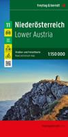
Wegenkaart - landkaart Niederösterreich | Freytag & Berndt
Uitstekende overzichtskaart, tweezijdig, met register, met veel details, alle berijdbare wegen etc.    Top 10 Tips" Map in a series of detailed road maps at 1:150,000 from Freytag & Berndt, covering popular tourist regions of Italy and highlighting each area's top 10 sights, all with brief descriptions in the accompanying booklets which also provide street plan(s) of main town(s) in the region.   Relief is portrayed by hill-shading without distracting from other detail. Road network shows minor roads and selected cart tracks, and includes information indispensable for happy holiday driving: motorway service stations and motels, gradients on steep roads, restricted entry for cars or caravans and seasonal closures, routes not recommended for caravans, scenic roads and special tourist routes, etc. Railways, cable cars, and ferry connections also shown, as well as selected long--distance hiking trails.   Picturesque towns are highlighted and 10 selected places of interest are prominently m…
14,95
Wegenkaart - landkaart Vorarlberg | Freytag & Berndt
Gedetailleerde wegenkaart van een deel van Oostenrijk. Deze kaart is bijzonder duidelijk leesbaar en door de schaal met veel details als campings, berghutten, hoofdwandelroutes en alle berijdbare wegen en plaatsen. Met register. Top 10 Tips" Map in a series of detailed road maps at 1:150,000 from Freytag & Berndt, covering popular tourist regions of Italy and highlighting each area's top 10 sights, all with brief descriptions in the accompanying booklets which also provide street plan(s) of main town(s) in the region.   Relief is portrayed by hill-shading without distracting from other detail. Road network shows minor roads and selected cart tracks, and includes information indispensable for happy holiday driving: motorway service stations and motels, gradients on steep roads, restricted entry for cars or caravans and seasonal closures, routes not recommended for caravans, scenic roads and special tourist routes, etc. Railways, cable cars, and ferry connections also shown, as well as s…
14,95

Klanten-reviews van Wandelkaart - Wegenkaart - landkaart La Palma | Freytag & Berndt

Er zijn nog geen beoordelingen voor dit productBen jij de eerste die een review plaatst?

Meer over Wandelkaart - Wegenkaart - landkaart La Palma | Freytag & Berndt

Productomschrijving

Goede overzichtskaart van La Palma. Juist deze kaart is bij uitstek geschikt voor vele doeleinden. Zowel voor de auto als voor de aktieve vakantieganger goed.  Overigens vinden wij dat de Freytag & Berndt kaarten van de Spaanse en Portugese eilanden iets meer gericht zjin op algemeen toerisme en iets minder op wandelen; voor wandelen raden we toch de Kompass - kaarten serie aan die van de meest eilanden ook voor handen is.   The La Palma road map on a scale of 1:40,000 contains all the important information for holidaymakers who want to visit La Palma. The extensive road network is precisely represented and many tourist attractions are shown on the map. Drivers and motorcyclists particularly appreciate the precise cartography from freytag & berndt for route planning and on-site orientation. Hikers can also use the map for hiking tours thanks to the detailed scale and contour lines.   Information about the La Palma road map   Scale 1:40,000 Hiking trails Tourist information Innenstadtpläne: Santa Cruz de La Palma, Los Llanos de Aridane Format: 86 x 124 cm The ideal road map for La Palma drivers, motorcyclists and camping lovers will not only find remote and lesser-known places in this road map, but also scenic routes that are particularly highlighted. Campsites are of course also listed. Printed in Austria.

Productspecificaties

Artikelnummer(s)
Brand
Freytag & Berndt

Verken gerelateerde categorieën

Webshop.nl maakt gebruik van cookies. Ga je verder op onze website, ga dan akkoord met het plaatsen van cookies en de verwerking van deze data door ons en vermelde partners.