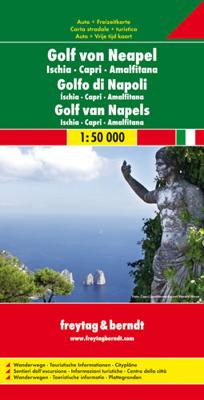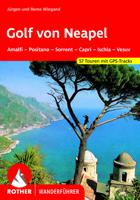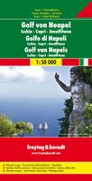
Wandelkaart - Wegenkaart - landkaart Golf von Neapel-Ischia-Capri-Amalfi - Golf van Napels | Freytag & Berndt

0
Gedetallieerde kaart van de Golf van Napels met bekende wandelgebieden als de kust van Amalfi, Pompei en Capri. Wandelroutes staan ingetekend, alle noodzakelijke kaartinfo aanwezig. Met stadsplattegrond, dubbelzijdig bedrukt. Explore the Bay of Naples (Golfo di Napoli) with this Freytag & Berndt double-sided road and leisure map. The map will allo...

Verkopers met dit product

Verkoper
Bezorging
Prijs
DeZwerver.nl logo
DeZwerver.nl
2,95
14,95

Anderen bekeken ook

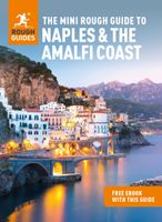
Reisgids Mini Rough Guide Naples & the Amalfi Coast | Rough Guides
This pocket-sized travel guide to Naples & the Amalfi Coast is a convenient, quick-reference companion to discovering what to do, what to see and how to get around the destination. It covers top attractions like Campi Flegrei, The Blue Grotto, Pompeii's Villas, the Museo Nazionale di Capodimonte, Piazza del Plebiscito as well as hidden gems, including Piazza San Domenico Maggiore and Castello Aragonese. Our Naples & the Amalfi Coast guide book will save you time and enhance your exploration of this fascinating region.   This Naples & the Amalfi Coast travel guide has been fully updated post-COVID-19. This Mini Rough Guide to NAPLES & THE AMALFI COAST covers: Naples, Campi Flegrei, Vesuvius, Herculaneum, Pompeii, Capri, Ischia and Procida, Sorrento and its Peninsula, the Amalfi Coast, Paestum. In this guide book to Naples & the Amalfi Coast you will find:RECOMMENDATIONS FOR EVERY TYPE OF TRAVELLERExperiences selected for every kind of trip to Naples & the Amalfi Coast, from cultural ex…
12,50
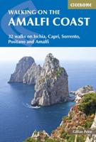
Wandelgids Walking on the Amalfi Coast | Cicerone
Wandelgids met 32 dagtochten op Ischia, Capri, Sorrento, Positano and Amalfi. Goede omschrijvingen, veel praktische informatie. Mager kaartmateriaal. (goede wandelkaart Kompass / zie landkaarten)+ The 32 routes in this guidebook explore the coastline between Sorrento and Amalfi, together with the islands of Capri and Ischia. Ranging from 3km to 11km, the hikes are all designed to be fitted into a single day, with a panoramic picnic stop halfway round and perhaps a plunge into the sparkling Mediterranean at the end. Hikes are graded on a scale of 1-3 and are suitable for a range of abilities, from family strolls to strenuous treks across rugged terrain.  Recognised as a World Heritage Site, the steep southern edge of the Sorrento peninsula on the Gulf of Naples is famous for its medieval villages perched atop plunging cliffs, with their near-vertical vineyards and lemon orchards and the famous volcano Vesuvius an ever-present backdrop.  Split into the five sections of Ischia, Capri, …
20,95
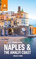
Reisgids Pocket Rough Guide Naples & the Amalfi Coast | Rough Guides
This compact, pocket-sized Naples & the Amalfi Coast travel guidebook is ideal for travellers on shorter trips, who want to make sure they experience the destination's highlights. The book includes highly practical, ready-made walks and tours that allow you to organise your short break in Naples & the Amalfi Coast without losing time planning.   This Naples & the Amalfi Coast pocket guidebook covers: The Centro Storico, Chiaia and Vomero, The Catacombs and Museums, The Campi Flegrei, Pompeii, Vesuvius and Herculaneum, The Sorrentine Peninsula, Positano, Amalfi and Ravello, Capri, Ischia, Procida.   Inside this Naples & the Amalfi Coast travel book, you will find:   - 12 ready-made walks and tours - easy-to-follow walking and driving tour itineraries featuring the best places to visit, as well as what to do and where to eat along the way - Itinerary details - each walk or tour starts with pointers on the time taken, distance covered and how to connect with other itineraries in the book…
14,95
Wandelkaart - Wegenkaart - landkaart Kefallonia - Kefalonia | Freytag & Berndt
Goede wegenkaart van Kefallonia / Kefalonia, waarbij ook de kleinere wegen nog goed te lezen zijn. Gedetailleerde schaal van 1:50.000. Veel toeristische symbolen voor bezienswaardigheden als grotten, tempels, opgravingen maar ook mooie stranden etc. Ook handig is de Nederlandstalige Reisgids van Kefalonia "Ontdek Kefalonia" "Ontdek Kefalonia" Explore Kefallonia, the largest of the Ionian Islands located in Greece; with this Freytag & Berndt single-sided road and leisure map. The map will allow you to travel independently, and plan your journey well.   The map also features full colour photographs of some of the scenery to be found on Kefallonia, as well as an inset showing Kefallonia's position within the nation of Greece. An inset is also provided showing a city plan of the main township on Kefallonia, Argostoli. The topography is clear, with shading showing land gradients.    As with all Freytag & Berndt maps, icons and markings are used to denote tourist information and points of i…
14,95
Wegenkaart - landkaart Italie - Italien | Freytag & Berndt
Gedetailleerde, tweezijdige landkaart van Italië, prima geschikt voor planning en rondtrekken. De berijdbare wegen zijn goed weergeven, zowel de hoofdwegen als provinciale en lokale wegen; wegnummers worden vermeld. Afstanden tussen plaatsen zijn in kilometers op de kaart ingetekend, daarnaast worden ook op belangrijke plekken benzinepompen gemarkeerd. In het kaartbeeld wordt door middel van schaduw het reliëf weergegeven en soms enkele punten in het landschap met de daadwerkelijke hoogte. Provinciegrenzen zijn goed terug te vinden, nationale parken en reservaten ook. Met allerhande symbolen worden toeristische bezienswaardigheden weergegeven als monumenten, historisch belangrijke plekken en uitzichtpunten. In bepaalde plaatsen zijn hotels en campings te vinden, luchthavens, treinverbindingen en havens vindt u er ook op! Explore Italy with this Freytag & Berndt double-sided road map. The best way to plan your trip, prepare your itinerary, and to travel independently in this country. A…
14,95
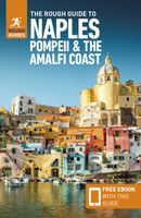
Reisgids Naples and the Amalfi Coast - Napels | Rough Guides
Zeer goede reisgids voor zowel de georganiseerde maar vooral voor de zelfstandige reiziger. Boordevol informatie over reizen, slapen, eten, maar ook musea en cultuur. Voor Europese landen meestal completer en beter dan de Lonely Planet ! This practical travel guide to Naples, Pompeii & the Amalfi Coast features detailed factual travel tips and points-of-interest structured lists of all iconic must-see sights as well as some off-the-beaten-track treasures. Our itinerary suggestions and expert author picks of things to see and do will make it a perfect companion both, ahead of your trip and on the ground. This Naples, Pompeii & the Amalfi Coast guide book is packed full of details on how to get there and around, pre-departure information and top time-saving tips, including a visual list of things not to miss.   Our colour-coded maps make Naples, Pompeii & the Amalfi Coast easier to navigate while you're there. This guide book to Naples, Pompeii & the Amalfi Coast has been fully updat…
20,95
Wandelkaart - Wegenkaart - landkaart Chios - Hios | Freytag & Berndt
Freytag & Berndt kaarten op schaal 1:50.000 (of kleiner) zijn zeer overzichtelijk, wandelpaden werden erop ingekleurd, ze bevatten voldoende details om een wandeltocht in te schatten en worden meestal geleverd met een wandelgids waarin beknopte gegevens van wandelingen naar almen en hutten terug te vinden is alsook heel wat nuttige toeristische informatie en een tabel met GPS-punten. gedetailleerde landkaart met toeristische informatie, ook te gebuiken als fietskaart - met uitgebreide legenda en plaatsnamenregister.  Explore Chios with this Freytag & Berndt road map. The best way to plan your trip, prepare your itinerary, and to travel independently in this country.    As with all Freytag & Berndt maps the cartography is clear and detailed with the topography shown by relief shading with plenty of spot heights.   The map includes a detailed index and legend, along with tourist information and National Park information.   Distances between points are shown as well as indications of ste…
14,95
Wegenkaart - landkaart 16 Allgäu | Freytag & Berndt
Een aangepaste versie van de Duitse provinciekaarten van Freytag & Berndt: duidelijk veel meer toegespitst op de toeristische aspecten van de streek.   Deze bijzonder gedetailleerde Freytag & Berndt Wegenkaart van Allgäu is aan één kant geprint en heeft een schaal van 1:150.000. Op deze kaart staan o.a. campings, toeristische wegen en bezienwaardigheden aangegeven.    Nu met een digitaal boekje en index - toegang tot alle informatie snel en gemakkelijk op uw mobiele telefoon!     With the Allgau road map on a scale of 1:150,000, holidaymakers traveling by car, motorbike or caravan can easily find their way around. The dense road network is depicted precisely, distances and tourist destinations in the Allgau are shown on the map.   Information about the Allgäu car map   Scale 1:150,000 Tourist information Campsites and pitches Top Tips Location register with postal codes Downtown map Format: 124 x 86 cm The best car map for the Allgau Whether hiking, cycling, water sports …
14,95
Wegenkaart - landkaart Ierland | Freytag & Berndt
Goede tweezijdige wegenkaart van het hele land. Met register en enkele stadsplattegronden.   De berijdbare wegen zijn goed weergeven, zowel de hoofdwegen als provinciale en lokale wegen; wegnummers worden vermeld. Afstanden tussen plaatsen zijn in kilometers op de kaart ingetekend, daarnaast worden ook op belangrijke plekken benzinepompen gemarkeerd.   In het kaartbeeld wordt door middel van schaduw het reliëf weergegeven en soms enkele punten in het landschap met de daadwerkelijke hoogte. Provinciegrenzen zijn goed terug te vinden, nationale parken en reservaten ook. Met allerhande symbolen worden toeristische bezienswaardigheden weergegeven als monumenten, historisch belangrijke plekken en uitzichtpunten. In bepaalde plaatsen zijn hotels en campings te vinden, luchthavens, treinverbindingen en havens vindt u er ook op!Explore Ireland with this Freytag & Berndt double-sided road map. The best way to plan your trip, prepare your itinerary, and to travel independently in this country. …
14,95
Wandelkaart - Wegenkaart - landkaart El Hierro | Freytag & Berndt
Freytag & Berndt kaarten op schaal 1:50.000 (of kleiner) zijn zeer overzichtelijk, wandelpaden werden erop ingekleurd, ze bevatten voldoende details om een wandeltocht in te schatten. Overigens vinden wij dat de Freytag & Berndt kaarten van de Spaanse en Portugese eilanden iets meer gericht zjin op algemeen toerisme en iets minder op wandelen; voor wandelen raden we toch de Kompass - kaarten serie aan die van de meest eilanden ook voor handen is. The island of Hierro at 1:30,000 on a contoured, GPS compatible tourist map from Freytag & Berndt highlighting various places of interest, as well as waymarked hiking routes. Contours at 50m intervals are enhanced by bold relief shading and names of numerous peaks to provide a very clear picture of the island’s topography.  Road network includes local roads and country tracks, indicating locations of petrol stations and driving distances on main routes. Picturesque towns and villages or sites are clearly highlighted, and symbols mark other pl…
14,95

Klanten-reviews van Wandelkaart - Wegenkaart - landkaart Golf von Neapel-Ischia-Capri-Amalfi - Golf van Napels | Freytag & Berndt

Er zijn nog geen beoordelingen voor dit productBen jij de eerste die een review plaatst?

Meer over Wandelkaart - Wegenkaart - landkaart Golf von Neapel-Ischia-Capri-Amalfi - Golf van Napels | Freytag & Berndt

Productomschrijving

Gedetallieerde kaart van de Golf van Napels met bekende wandelgebieden als de kust van Amalfi, Pompei en Capri. Wandelroutes staan ingetekend, alle noodzakelijke kaartinfo aanwezig. Met stadsplattegrond, dubbelzijdig bedrukt.

Explore the Bay of Naples (Golfo di Napoli) with this Freytag & Berndt double-sided road and leisure map. The map will allow you to travel independently, and plan your journey well. The topography of the land is well displayed using shading.   The map also features full colour photographs of some of the scenery to be found in the area. You will also find plans of the townships of Amalfi, Ischia Ponte, Capri, Pompeii, Naples City and Sorrento as well as some enlargements of the islands of Capri and Ischia.   As with all Freytag & Berndt maps, icons and markings are used to denote tourist information and points of interest. These include:   Roads, foot paths, shipping routes, airports Places to see such as churches, monasteries, castles, museums, ruins and archaeological sites Caves and camp sites   Distances between points are shown in kilometres. The legend is in German, English, French and Italian.

Productinformatie

    Verken gerelateerde categorieën

    Webshop.nl maakt gebruik van cookies. Ga je verder op onze website, ga dan akkoord met het plaatsen van cookies en de verwerking van deze data door ons en vermelde partners.