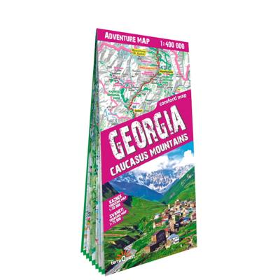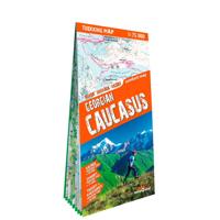
Wandelkaart - Wegenkaart - landkaart Adventure map Georgië - Kaukasus - Caucasus | TerraQuest

0
Uitstekende wandelkaart van een deel van de Kaukasus. Alle noodzakelijke gegevens staan er op, de kaart is gebaseerd op topografische kaarten en voorzien van ingetekende wandelroutes. De kaart is geplastificeerd. Voor een uitsnede welk gebied deze kaart dekt. Met detailkaarten van Kazbek mountains en Svaneti gebied. ...

Verkopers met dit product

Verkoper
Bezorging
Prijs
DeZwerver.nl logo
DeZwerver.nl
2,95
12,50

Anderen bekeken ook

Wegenkaart - landkaart Caucasus - Kaukasus | ITMB
Een degelijke kaart met aanduidingen van o.a. nationale parken, vliegvelden en grote wegen. Als overzichtskaart goed te gebruiken. Tweezijdig. The traditional geographic border between Europe and Asia has been the mountainous region between the Black and the Caspian Seas. This double-sided map shows the entire region in excellent detail, with Georgia on one side, and Armenia and Azerbaijan on the other. The map also has insets of Yerevan and Tbilisi and Baku. It also shows significant touristic sites, churches, fortresses, and museums. This map would be ideal for anyone exploring all three countries during one visit.  Legend Includes: Roads, tracks, accommodations, tourist info, parks & reserves, ruins / archaeological sites, ferry routes, hydrography / elevation info.
13,95
Wegenkaart - landkaart Kaukasus - Caucasus | Gizi Map
  The Caucasus at 1:1,000,000 from Gizi Map, presenting the region in a road edition with relief shading to show its topography and make the road network stand out better against the background. Coverage includes the southern republics of Russia. International boundaries are clearly marked.    Within Georgia the map indicates the boundaries of South Ossetia, Abkhazia and Adjara; in Azerbaijan the border of Nagorno Karabach and the ceasefire line are marked. Coverage within Russia extends north of Krasnodar and Stavropol, with boundaries of individual republics including Chechnya, North Ossetia and Dagestan. Place names are shown in Latin alphabet, but within Georgia, Armenia and Russia larger towns are also named in local script.   Relief shading with plenty of names of geographical features such as individual mountain ranges, peaks, swamps, salt flats, etc, presents the topography. Road network is graded in six types, with driving distances on main and selected connecting routes. Rai…
15,95
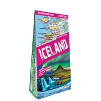
Wegenkaart - landkaart Adventure map Iceland - IJsland | TerraQuest
De kracht zit hem in het feit dat deze kaart in delen is geplastificeerd en daardoor ook - ondanks de plastic laag - makkelijk in delen is te vouwen.  Van het gebeid Skogar - Landmannalaugar is een detailkaart 1:75.000 ingevoegd. Terraquest say 'TerraQuest maps are designed and developed primarily for tourists preparing for treks to remote corners of the world. Our proven map laminating technology allows you to freely use the maps even in harsh conditions, while appreciating the clear and easy-to-read information compiled by our team of qualified cartographers. The distinctive feature of terraQuest laminated maps is the manufacturing method. Due to a special lamination process and patented map joining techniques, the maps easily adjust to your choice of format , even for one-hand use only. They are exceptionally durable and may be folded repeatedly. You can also add and erase your own notes directly onto the map with an erasable pen without damage to the map'
12,50
Wegenkaart - landkaart Adventure map Transylvania - Transsylvanië | TerraQuest
De kracht zit hem in het feit dat deze kaart in delen is geplastificeerd en daardoor ook - ondanks de plastic laag - makkelijk in delen is te vouwen.    Terraquest say 'TerraQuest maps are designed and developed primarily for tourists preparing for treks to remote corners of the world. Our proven map laminating technology allows you to freely use the maps even in harsh conditions, while appreciating the clear and easy-to-read information compiled by our team of qualified cartographers. The distinctive feature of terraQuest laminated maps is the manufacturing method. Due to a special lamination process and patented map joining techniques, the maps easily adjust to your choice of format , even for one-hand use only. They are exceptionally durable and may be folded repeatedly. You can also add and erase your own notes directly onto the map with an erasable pen without damage to the map'
12,95
Wandelkaart Trekking map Central Pyrenees - Pyreneeën | TerraQuest
Uitstekende wandelkaart van een deel van de Pyreneën. Alle noodzakelijke gegevens staan er op, de kaart is gebaseerd op topografische kaarten en voorzien van ingetekende wandelroutes. De kaart is geplastificeerd. Voor een uitsnede welk gebied deze kaart dekt. This is the 1:50,000 trekking map for the Central Pyrenees covering Lourdes, Trebons and Capvern on the north edge of the map and down to Monte Perdido in the south.   Terraquest say 'TerraQuest maps are designed and developed primarily for tourists preparing for treks to remote corners of the world. Our proven map laminating technology allows you to freely use the maps even in harsh conditions, while appreciating the clear and easy-to-read information compiled by our team of qualified cartographers. The distinctive feature of terraQuest laminated maps is the manufacturing method. Due to a special lamination process and patented map joining techniques, the maps easily adjust to your choice of format , even for one-hand use only. …
18,50
Wegenkaart - landkaart Kaukasus : Armenië - Azerbeidzjan - Georgië | Reise Know-How Verlag
Tweetalige kaart (Engels en Duits). Door ingetekende lengte- en breedtegraden is het gebruik van GPS mogelijk. Met hoogtelijnen en uitgebreid wegennetwerk: daarnaast worden ook de afstanden tussen belangrijke plaatsen duidelijk leesbaar weergegeven. Het kleurgebruik is zodanig dat je een goede indruk krijgt van hoogteverschillen en soorten landschap. Natuurlijk staan de toeristische bezienswaardigheden duidelijk vermeld.   Gedrukt op water- en scheurvast papier! Polyart is een synthetisch product vrij van giftige stoffen dus duurzaam. Het papier gaat echt lang mee.   Topography is indicated by altitude colouring with numerous spot heights and names of mountain ranges and passes. Salt lakes, swamps, seasonal rivers and glacier are also shown. Detailed presentation of the road network includes minor roads and tracks and railways are also shown.   Internal administrative units are presented with their boundaries and names. National parks and other protected areas are highlighted. A wide …
11,50
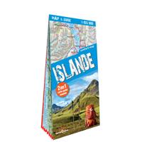
Wegenkaart - landkaart Map & Guide ijsland / Islande | TerraQuest
Een wegenkaart van IJsland met schaal 1:615.000. De kracht zit hem in het feit dat deze kaart in delen is geplastificeerd en daardoor ook - ondanks de plastic laag - makkelijk in delen is te vouwen.    Inclusief kleine plattegronden van Reykjavik en Akureyri en op de achterzijde van de kaart een kleine reisgids met de top bezienswaardigheden en praktische informatie.     Une carte routière de l'Islande à l'échelle 1:615 000. Sa force réside dans le fait que cette carte est plastifiée en plusieurs parties et donc - malgré la couche de plastique - facile à plier en plusieurs parties.   Y compris de petites cartes de Reykjavik et d'Akureyri et au dos de la carte un petit guide de voyage avec les principaux sites touristiques et des informations pratiques.  
12,50

Klanten-reviews van Wandelkaart - Wegenkaart - landkaart Adventure map Georgië - Kaukasus - Caucasus | TerraQuest

Er zijn nog geen beoordelingen voor dit productBen jij de eerste die een review plaatst?

Meer over Wandelkaart - Wegenkaart - landkaart Adventure map Georgië - Kaukasus - Caucasus | TerraQuest

Productomschrijving

Uitstekende wandelkaart van een deel van de Kaukasus. Alle noodzakelijke gegevens staan er op, de kaart is gebaseerd op topografische kaarten en voorzien van ingetekende wandelroutes. De kaart is geplastificeerd. Voor een uitsnede welk gebied deze kaart dekt.

Met detailkaarten van Kazbek mountains en Svaneti gebied. 

Productinformatie

    Verken gerelateerde categorieën

    Webshop.nl maakt gebruik van cookies. Ga je verder op onze website, ga dan akkoord met het plaatsen van cookies en de verwerking van deze data door ons en vermelde partners.