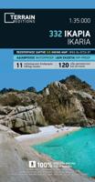
Wandelkaart - Wegenkaart - landkaart 332 Ikaria | Terrain maps

0
Gedetailleerde wegenkaart en wandelkaart met alle kleine wegen, wandelpaden, hoogtelijnen en toeristische informatie aangegeven. Alle tekst is tweetalig in Engels en Grieks en de waterproof kaart is geschikt voor gebruik met GPS. THIS IS THE BEST MAP OF IKARIA BECAUSE: • It is the only map of Ikaria made with data collected 100% through field surv...

Verkopers met dit product

Verkoper
Bezorging
Prijs
DeZwerver.nl logo
DeZwerver.nl
2,95
12,50

Anderen bekeken ook

Wandelkaart - Wegenkaart - landkaart 332 Ikaria | Terrain maps
Gedetailleerde wegenkaart en wandelkaart met alle kleine wegen, wandelpaden, hoogtelijnen en toeristische informatie aangegeven. Alle tekst is tweetalig in Engels en Grieks en de waterproof kaart is geschikt voor gebruik met GPS. THIS IS THE BEST MAP OF IKARIA BECAUSE: • It is the only map of Ikaria made with data collected 100% through field survey. • It comes in a more detailed scale than other map in the market. • For the first time, the entire trail network of Ikaria is shown with absolute accuracy. All trails have been measured in kilometers, so you can estimate the duration of your hike. On the back side you ‘ll find detailed descriptions of 11 of the best hikes in Ikaria. These are distinctly labeled on the map, so you can easily locate them. • It features the most complete road network, with scenic routes marked in green. • It is printed on Polyart plastic “paper”, making it totally waterproof and rip-proof. You can fold it and unfold it a hundred times, fold it in irregular w…
12,50
Wandelkaart - Wegenkaart - landkaart 308 Tinos | Terrain maps
Gedetailleerde wegenkaart en wandelkaart met alle kleine wegen, wandelpaden, hoogtelijnen en toeristische informatie aangegeven. Alle tekst is tweetalig in Engels en Grieks en de waterproof kaart is geschikt voor gebruik met GPS. This is a great map of Tinos because:   •    It is waterproof and rip-proof. You can fold and unfold it a thousand times, fold it in irregular ways, dunk it in the sea or leave it out in the rain. This map is indestructible!    •    It is the first time the island’s entire coastline is mapped. Cartography was done with TERRAIN’s specially equipped and staffed cartographic vessel. This means that you can locate all beaches of the island, down to the tiniest cove! In fact, the special features of every single beach are recorded: whether it is sandy or pebbled, whether it features natural tree shade, water, a beach bar or organized water sports, whether the seabed in front of the beach is sandy or rocky (so that you will know where to anchor).    •    It feature…
12,50
Wandelkaart - Wegenkaart - landkaart 10.51 Ikaria | Anavasi
The new Anavasi map of Ikaria on a scale of 1:35.000 figures dozens of footpaths, the complete road network and all the beaches of the island, which is also well known for its summer feasts (panigiria) and the longevity of its inhabitants. The island was named after the mythical Icarus, the young man who flew too close to the sun and plunged into the sea, close to Ikaria.   Ikaria has a well-marked network of hiking trails. The island is indeed perfect for days of hiking pleasure with lots of vegetation, deep river valleys with plenty of hidden, refreshingly cold (and clean) water pools, relatively level top plateaus and a ridge line that climbs up to about 900-1000m above sea level with amazing views and nice beaches to end the walks. Printing on waterproof, rip-proof polyart paper
10,95
Wandelkaart - Wegenkaart - landkaart 336 Leros | Terrain maps
Gedetailleerde wegenkaart en wandelkaart met alle kleine wegen, wandelpaden, hoogtelijnen en toeristische informatie aangegeven. Alle tekst is tweetalig in Engels en Grieks en de waterproof kaart is geschikt voor gebruik met GPS. THIS IS THE BEST MAP OF LEROS BECAUSE:  •    It is the first GIS map of the island, meaning that this is the first time Leros is mapped with a topographic precision in proportion to the map scale.    •    It is waterproof and rip-proof. You can fold and unfold it a thousand times, fold it in irregular ways, dunk it in the sea or leave it out in the rain. This map is indestructible!    •    It is the first time the island’s entire coastline is mapped. Cartography was done with TERRAIN’s specially equipped and staffed cartographic vessel. This means that you can locate all beaches of the island, down to the tiniest cove! In fact, the special features of every single beach are recorded: whether it is sandy or pebbled, whether it features natural tree shade, wate…
12,50
Wandelkaart - Wegenkaart - landkaart 319 Skiathos | Terrain maps
Gedetailleerde wegenkaart en wandelkaart met alle kleine wegen, wandelpaden, hoogtelijnen en toeristische informatie aangegeven. Alle tekst is tweetalig in Engels en Grieks en de waterproof kaart is geschikt voor gebruik met GPS. This is a great map of Skiathos because:   • It comes in the detailed scale of 1:15.000, showing everything very clearly (competitor maps are in the 1:25.000 scales).   • It is printed on Polyart plastic “paper”, making it totally waterproof and rip-proof. You can fold it and unfold it a hundred times, fold it in irregular ways, dunk it in the sea or leave it out in the rain. This map is indestructible!   • The island’s entire coastline is mapped for the first time with TERRAIN’s specially equipped and staffed cartographic vessel. This means that you can locate all beaches of the island, down to the tiniest cove! In fact, the special features of every single beach are recorded: whether it is sandy or pebbled, whether it features natural tree shade, water, a …
12,50
Wandelkaart - Wegenkaart - landkaart 338 Kos | Terrain maps
Gedetailleerde wegenkaart en wandelkaart met alle kleine wegen, wandelpaden, hoogtelijnen en toeristische informatie aangegeven. Alle tekst is tweetalig in Engels en Grieks en de waterproof kaart is geschikt voor gebruik met GPS. This is a great map because: It is the first GIS map of the island, meaning that this is the first time Kos is mapped with a topographic precision in proportion to the map scale.  The road network of Kos is featured so completely for the first time. Every road, down to the secondary dirt roads and dead-ends, is illustrated on the map with precision. Naturally the main road network is clearly depicted, along with residential areas, the airport, the ports and the entire tourist infrastructure of Kos.  It is waterproof and rip-proof. You can fold and unfold it a thousand times, fold it in irregular ways, dunk it in the sea or leave it out in the rain. This map is indestructible!  It is remarkably detailed, as its scale is much larger (i.e. more detailed) tha…
12,50
Wandelkaart - Wegenkaart - landkaart 342 Rhodes - Rhodos | Terrain maps
Gedetailleerde wegenkaart en wandelkaart met alle kleine wegen, wandelpaden, hoogtelijnen en toeristische informatie aangegeven. Alle tekst is tweetalig in Engels en Grieks en de waterproof kaart is geschikt voor gebruik met GPS. This is a great map because: It is the first and only –to date – GIS map of Rhodes, and the only one made with data collected 100% through field survey, making it the only truly accurate and GPS compatible map of the island. Also, It comes in the most detailed scale available (competitor maps are in the 1:100,000 scale)  It is printed on Polyart material, making it totally waterproof and rip-proof. You can fold it and unfold it a hundred times, fold it in irregular ways, dunk it in the sea or leave it out in the rain. This map is indestructible!  It features the most complete road network. Also, on the back side of the map there is a detailed plan of the town of Rhodes and an enlarged one of the old town, listing all sights, restaurants, hotels and bars.  …
12,50
Wandelkaart - Wegenkaart - landkaart 209 Mount Athos | Terrain maps
Gedetailleerde wegenkaart en wandelkaart met alle kleine wegen, wandelpaden, hoogtelijnen en toeristische informatie aangegeven. Alle tekst is tweetalig in Engels en Grieks en de waterproof kaart is geschikt voor gebruik met GPS. The first highly accurate map of Mt Athos.    Created with GPS technology and extensive field survey, this map of Mt. Athos from TERRAIN Editions offers to the visitor a unique wealth of information. If you plan to hike from one monastery to the other, explore the mainland or climb to the top of Mt. Athos, this precise and reliable map will prove invaluable. FEATURES  Κaryes town plan in 1:3.000 scale and Κaryes area map in 1:10.000 scale All monasteries, scetes, cells, seats and huts, marked with distinctive symbols and their names All walking trails, with measured distances A concise guide to the monasteries, and general information on Mt. Athos Printed on polyart
12,50
Wandelkaart - Wegenkaart - landkaart 322 Skyros | Terrain maps
Gedetailleerde wegenkaart en wandelkaart met alle kleine wegen, wandelpaden, hoogtelijnen en toeristische informatie aangegeven. Alle tekst is tweetalig in Engels en Grieks en de waterproof kaart is geschikt voor gebruik met GPS. Skyros belongs to the island complex of the Northern Sporades, but in terms of natural environment it is divided into two: the northern part of the island is covered by a dense pine forest like all the other islands of the northern Sporades, while the southern part is characterized by the wild rocky landscapes of Mount Kochylas, more reminiscent of the Cyclades. Throughout the island there are many old walking trails, making Skyros a growing hiking destination, although - so far - the marking and maintenance of the paths remains problematic.   This fully updated hiking and touring map of Skyros by TERRAIN accurately shows all the paths and trails of the island with point-to-point distances, and of course the entire road network, beaches, archaeological sit…
12,50
Wandelkaart - Wegenkaart - landkaart 412 Halkidiki - Chalkidiki | Terrain maps
Gedetailleerde wegenkaart en wandelkaart met alle kleine wegen, wandelpaden, hoogtelijnen en toeristische informatie aangegeven. Alle tekst is tweetalig in Engels en Grieks en de waterproof kaart is geschikt voor gebruik met GPS. We walked all trails. We drove all roads. We sailed around each and every island. We recorded every single sight. And we proudly present the best maps ever made for travelers of Greece. Terrain maps are the only maps featuring:   100% field research Waterproof, rip-proof Polyart paper Highly detailed coastline mapping Climbing, biking, diving and canyoning information The new era in cartography is here. It was made for you, the demanding traveler, explorer, and nature lover. Forget about compromises and pseudo-maps. Travel with the best. Travel with Terrain.
12,50

Klanten-reviews van Wandelkaart - Wegenkaart - landkaart 332 Ikaria | Terrain maps

Er zijn nog geen beoordelingen voor dit productBen jij de eerste die een review plaatst?

Meer over Wandelkaart - Wegenkaart - landkaart 332 Ikaria | Terrain maps

Productomschrijving

Gedetailleerde wegenkaart en wandelkaart met alle kleine wegen, wandelpaden, hoogtelijnen en toeristische informatie aangegeven. Alle tekst is tweetalig in Engels en Grieks en de waterproof kaart is geschikt voor gebruik met GPS.

THIS IS THE BEST MAP OF IKARIA BECAUSE:

• It is the only map of Ikaria made with data collected 100% through field survey.

• It comes in a more detailed scale than other map in the market.

• For the first time, the entire trail network of Ikaria is shown with absolute accuracy. All trails have been measured in kilometers, so you can estimate the duration of your hike. On the back side you ‘ll find detailed descriptions of 11 of the best hikes in Ikaria. These are distinctly labeled on the map, so you can easily locate them.

• It features the most complete road network, with scenic routes marked in green.

• It is printed on Polyart plastic “paper”, making it totally waterproof and rip-proof. You can fold it and unfold it a hundred times, fold it in irregular ways, dunk it in the sea or leave it out in the rain. This map is indestructible!

• The island’s entire coastline is mapped for the first time with TERRAIN’s specially equipped and staffed cartographic vessel. This means that you can locate all beaches of the island, down to the tiniest cove! In fact, the special features of every single beach are recorded: whether it is sandy or pebbled, whether it features natural tree shade, water, a beach bar or organized water sports, whether the seabed in front of the beach is sandy or rocky (so that you will know where to anchor).

• It indicates the boundaries of NATURA 2000 areas so that you will know which parts of the island are of special environmental interest and beauty – thus you can enjoy traveling through them, but also take care to protect them.

• It features a detailed town plan of Aghios Kirikos, in the scale 1:2.500.

• Mountain-bike routes are indicated, for the first time.

• The reverse side features an illustrated mini travel guide, with information on the island’s myths and history, geography and natural environment, sights and major attractions.

Productinformatie

    Verken gerelateerde categorieën

    Webshop.nl maakt gebruik van cookies. Ga je verder op onze website, ga dan akkoord met het plaatsen van cookies en de verwerking van deze data door ons en vermelde partners.