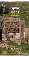
Wandelkaart - Wegenkaart - landkaart 10.30 Tinos | Anavasi

0
Goede wandelkaart van Tinos. Tinos island landscape is like a hand made embroidery. Rural huts, dovecotes, churches, terraces and villages are woven into a net of trails. In the first edition of the map, along with my partner Charles Merlin we had recorded several dozens of kilometers of footpaths. From then until the present second edition, Charl...

Verkopers met dit product

Verkoper
Bezorging
Prijs
DeZwerver.nl logo
DeZwerver.nl
2,95
10,95

Anderen bekeken ook

Nieuw
Wandelkaart - Wegenkaart - landkaart 308 Tinos | Terrain maps
Gedetailleerde wegenkaart en wandelkaart met alle kleine wegen, wandelpaden, hoogtelijnen en toeristische informatie aangegeven. Alle tekst is tweetalig in Engels en Grieks en de waterproof kaart is geschikt voor gebruik met GPS. This is a great map of Tinos because:   •    It is waterproof and rip-proof. You can fold and unfold it a thousand times, fold it in irregular ways, dunk it in the sea or leave it out in the rain. This map is indestructible!    •    It is the first time the island’s entire coastline is mapped. Cartography was done with TERRAIN’s specially equipped and staffed cartographic vessel. This means that you can locate all beaches of the island, down to the tiniest cove! In fact, the special features of every single beach are recorded: whether it is sandy or pebbled, whether it features natural tree shade, water, a beach bar or organized water sports, whether the seabed in front of the beach is sandy or rocky (so that you will know where to anchor).    •    It feature…
12,50
Nieuw
Wandelkaart - Wegenkaart - landkaart 10.24 Santorini | Anavasi
As you enter the caldera of Santorini by ferry sheer cliffs rise up dramatically, exposing richly coloured rock strata, crowned by the colored houses of the cliff-top settlements. Equally magnificent is the sunset from the heights of the caldera towards the sea and the remnants of prehistoric rounded island Strogyli, Thirasia, the New and Old Kameni. However, there is more than the visual excitement to discover and if you don’t take the time to walk the island you will have learnt little of Santorini.   The new Anavasi map will take hiking in every corner, beach and hill top of Santorini and Thirassia to discover landscapes with visible signs of the traditional rural culture, with orchards stonewalls, threshing floors, huts, chapels, inland villages with a well preserved medieval core (called Castelo), routes with wonderful vistas, lost beaches quiet even in the heart of summer.   On the reverse side of the map, there is a brief description of the 25 proposed hiking routes and a short…
10,95
Wandelkaart - Topografische kaart 163 OS Explorer Map Gravesend, Rochester | Ordnance Survey
Immerse yourself in Gravesend with its maritime history, Charles Dickens links and even a Cold War bunker! Contrast the medieval magnificence of Rochester where the cathedra was founded in 604 and the imposing Rochester Castle keeps watch over the Medway crossing.   Explore the Hoo Peninsula and the North Kent marshes that inspired Charles Dickens to write Great Expectations Discover the Medway towns of Chatham and Gillingham, home to the Historic Dockyard Chatham and the Royal Engineers Museum Walk and cycle along the Saxon Shore Way and other popular recreational paths including the Wealdway and North Downs Way Met zijn 4cm voor 1 km (2 ½ cm voor 1 mijl) schaal, is de OS Explorer kaartenserie de ideale en meest gedetailleerde kaartenreeks voor mensen die graag outdoor-activiteiten zoals fietsen, wandelen, paardrijden, klimmen en watersporten. Deze kaart is nog gedetailleerder dan de 'gewone' Landranger maps. Voor- en achterzijde bedrukt! Zeker op de moors en andere natuurgebieden…
19,50
Nieuw
Wandelkaart - Topografische kaart 163 OS Explorer Map | Active Gravesend / Rochester | Ordnance Survey
Immerse yourself in Gravesend with its maritime history, Charles Dickens links and even a Cold War bunker! Contrast the medieval magnificence of Rochester where the cathedra was founded in 604 and the imposing Rochester Castle keeps watch over the Medway crossing.   Explore the Hoo Peninsula and the North Kent marshes that inspired Charles Dickens to write Great Expectations Discover the Medway towns of Chatham and Gillingham, home to the Historic Dockyard Chatham and the Royal Engineers Museum Walk and cycle along the Saxon Shore Way and other popular recreational paths including the Wealdway and North Downs Way Met zijn 4cm voor 1 km (2 ½ cm voor 1 mijl) schaal, is de OS Explorer kaartenserie de ideale en meest gedetailleerde kaartenreeks voor mensen die graag outdoor-activiteiten zoals fietsen, wandelen, paardrijden, klimmen en watersporten.   Deze kaart is nog gedetailleerder dan de 'gewone' Landranger maps. Voor- en achterzijde bedrukt! Zeker op de moors en andere natuurgebieden …
25,95
Nieuw
Wegenkaart - landkaart 731 Tsjechië en Slowakije | Michelin
Zoals je van Michelin mag verwachten is deze kaart zeer overzichtelijk en heeft een duidelijk helder kaartbeeld. De kaart geeft uitgebreid toeristische informatie weer. Met register, afstanden en reistijden. Wegen worden naar verschillende klasse ingedeeld en - mooi van Michelin - de interessante mooie routes worden gemarkeerd met een groene streep.    Hindernissen voor automobilisten met caravans zijn gemarkeerd: steile hellingen, bergpassen of een anderzins moeilijke route. Bezienswaardigheden als een kasteel, religieus gebouw, ruine of grot is door een symbool goed te vinden.   The Michelin National road map of the Czech and Slovak Republics at 1:600,000 scale is ideal for route planning and touring. The map gives comprehensive coverage of national road networks showing all major motorways, dual carriageways, national & regional main roads and most single-lane roads. The map is divided by grid showing latitude and logitude.   Distances between major locations are marked along roads…
11,95
Nieuw
Wandelkaart - Wegenkaart - landkaart Kefallonia - Kefalonia | Freytag & Berndt
Goede wegenkaart van Kefallonia / Kefalonia, waarbij ook de kleinere wegen nog goed te lezen zijn. Gedetailleerde schaal van 1:50.000. Veel toeristische symbolen voor bezienswaardigheden als grotten, tempels, opgravingen maar ook mooie stranden etc. Ook handig is de Nederlandstalige Reisgids van Kefalonia "Ontdek Kefalonia" "Ontdek Kefalonia" Explore Kefallonia, the largest of the Ionian Islands located in Greece; with this Freytag & Berndt single-sided road and leisure map. The map will allow you to travel independently, and plan your journey well.   The map also features full colour photographs of some of the scenery to be found on Kefallonia, as well as an inset showing Kefallonia's position within the nation of Greece. An inset is also provided showing a city plan of the main township on Kefallonia, Argostoli. The topography is clear, with shading showing land gradients.    As with all Freytag & Berndt maps, icons and markings are used to denote tourist information and points of i…
14,95
Wegenkaart - landkaart Tahiti - French Polynesia | ITMB
Anyone who has visited Tahiti retains fond memories of a wonderful Polynesian paradise. This map shows the major islands of French Polynesia as a series of large insets on Side 1. An overall inset map showing the many islands is also shown, but for showing detail, one must expand the individual islands. The largest one is the volcanic Tahiti Nui, with the capital city of Pape’ete (or Papeete in English), for which a detailed inset map is included. Most visitors stay in the vicinity of Papeete, along the coast. We show several popular resorts. There is a good circular road around the island’s shoreline, but no roads in the interior. The island is joined to another, called Tahiti Iti, or Little Tahiti, and roads extend partway around this less-developed part of the combined island. Most of the other islands are rarely visited, although they have resorts, beaches, and a lifestyle of their own. Names like Huahine, Riatea, Tahaa, and Maiao may not be as familiar as they should be, but all …
14,95
Wandelkaart Tour & Trail Tenerife | Discovery Walking Guides
Uitstekende wandelkaart, met ingetekende wandelroutes, voor specifieke wandelgebieden van Tenerife. Let op: dit is niet een kaart van het hele eiland, maar puur en alleen voor de wandelgebieden > daar is deze kaart de beste in! Our latest hiking research on Tenerife has resulted in new editions of Walk! Tenerife and Tenerife Hikers' Super-Durable Maps. Thanks to Jan Kostura's research we have several new hiking adventures described in detail in Walk! Tenerife. Jan's gps records of his research for new routes and updating of current routes has provided the detailed information to produce our new fourth edition of Tenerife Hiker's Super-Durable Maps. Note that Tenerife Hikers' Super-Durable Maps is a collection of four 30k scale map sections on a double sided sheet of 840mm by 600mm which folds up to 220mm by 120mm. It is not a map of all of Tenerife.  In this edition you will find 30k scale maps covering Valle de Orotava, West, Anaga and Adeje/Arona - Teide printed on a double sided…
17,95
Wandelkaart - Wegenkaart - landkaart 336 Leros | Terrain maps
Gedetailleerde wegenkaart en wandelkaart met alle kleine wegen, wandelpaden, hoogtelijnen en toeristische informatie aangegeven. Alle tekst is tweetalig in Engels en Grieks en de waterproof kaart is geschikt voor gebruik met GPS. THIS IS THE BEST MAP OF LEROS BECAUSE:  •    It is the first GIS map of the island, meaning that this is the first time Leros is mapped with a topographic precision in proportion to the map scale.    •    It is waterproof and rip-proof. You can fold and unfold it a thousand times, fold it in irregular ways, dunk it in the sea or leave it out in the rain. This map is indestructible!    •    It is the first time the island’s entire coastline is mapped. Cartography was done with TERRAIN’s specially equipped and staffed cartographic vessel. This means that you can locate all beaches of the island, down to the tiniest cove! In fact, the special features of every single beach are recorded: whether it is sandy or pebbled, whether it features natural tree shade, wate…
12,50
Nieuw
Fietskaart - Wandelkaart 076 Nebelstein - Gmünd - Weitra - Gross Gerungs | Freytag & Berndt
The Nebelstein hiking map on a scale of 1:50,000 is the ideal companion for excursions, hikes and bike tours in the Oberes Waldviertel, Waldviertel Mitte and Mühlviertler Alm Freistadt regions Lainsitz, the Castles and Castles Trail, the St. John's Trail and the Life Trail. The hiking trails on the map are easy to follow thanks to the exact cartography by freytag & berndt and the ideal scale. Also for cyclists and mountain bikersthe Nebelstein hiking map is very suitable. In addition to demanding mountain bike routes, the course of the Waldviertel cycle path and parts of the EuroVelo 13 - Iron Curtain Trail can also be followed. Information on the Nebelstein hiking map 1:50,000 Hiking and long-distance hiking trails Cycle paths and mountain bike tours Attractive excursion destinations With info guide GPX Tracks zum Download Waterproof and tear resistant 90 x 61 cm, double-sided Info guide The "short and compact" info guide offers a journey through the regions of the Upper Waldviertel,…
13,95

Klanten-reviews van Wandelkaart - Wegenkaart - landkaart 10.30 Tinos | Anavasi

Er zijn nog geen beoordelingen voor dit productBen jij de eerste die een review plaatst?

Meer over Wandelkaart - Wegenkaart - landkaart 10.30 Tinos | Anavasi

Productomschrijving

Goede wandelkaart van Tinos.

Tinos island landscape is like a hand made embroidery. Rural huts, dovecotes, churches, terraces and villages are woven into a net of trails. In the first edition of the map, along with my partner Charles Merlin we had recorded several dozens of kilometers of footpaths. From then until the present second edition, Charles made a bet and target to enrich the map in paths, - and put in the game and his friend George Kennedy. Actually the recorded paths, doubled, and plenty of churches, bridges, huts, dovecotes were added beside the paths. Along with the improvements in topographic background and color palette, the map of Tinos has reached very high standards - because we don't like the easy path. On the back side there are several proposed hiking trails with short descriptions and updated information for marking of the paths.

Verken gerelateerde categorieën

Webshop.nl maakt gebruik van cookies. Ga je verder op onze website, ga dan akkoord met het plaatsen van cookies en de verwerking van deze data door ons en vermelde partners.