webshop.nl
Categorieën
  Sluiten

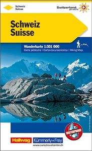
Wandelkaart Wanderkarte Schweiz - Zwitserland overzichtskaart | Kümmer

0
Vanwege de schaal vooral geschikt als overzichtskaart. Hiking map with the official routes "Hiking in Switzerland" with hiking times and distances. More than 750 additional hiking routes. With index and a regional approach map. Water- and rip-proof map. Switzerland’s national and regional long-distance hiking paths on a waterproof and tear-resistan...

Webshops met dit product

Webshop
Bezorging
Prijs

Anderen bekeken ook

Wandelkaart Wanderkarte Schweiz - Zwitserland overzichtskaart | Kümmer
Vanwege de schaal vooral geschikt als overzichtskaart. Hiking map with the official routes "Hiking in Switzerland" with hiking times and distances. More than 750 additional hiking routes. With index and a regional approach map. Water- and rip-proof map. Switzerland’s national and regional long-distance hiking paths on a waterproof and tear-resistant indexed map at 1:301,000 from Kümmerly + Frey, with numerous local trails, plus a list of all the long-distance routes. The departure and arrival points of each long-distance route are clearly marked, and each route is divided into stages by highlighting intermediate locations, with the distances and hiking times in both directions indicated for the individual sections. Symbols show mountain huts, campsites, youth hostels, Friends of Nature Houses and selected local hotels. On the reverse an extensive index includes lists of geographical features (peaks, passes, rivers, etc), huts, places of interest, etc. Also provided is a list of the six…
16,95
Wandelkaart Cabo de Gata - Nijar | Editorial Alpina
Zeer gedetailleerde wandelkaart van een klein gebied. Met ingetekende wandelroutes en andere informatie. Spaanstalig, maar uitstekende kaart. Coordinaten zijn weergegeven, dus GPS compatible met UTM grid.    Op de topografische wandelkaart worden o.a. berghutten, campings aangeduid en hoogtelijnen, ingetekende wandelroutes en de GR paden (doorgaande langeafstandswandelpaden).  Cabo da Gata-Níjar Natural Park in an extensive and very popular series of walking maps from Editorial Alpina covering the Pyrenees, Catalonia and other selected hiking areas in Spain, including Picos de Europa, Sierra Nevada and parts of Andalucía, Majorca, etc. Scales vary from 1:50,000 to 1:10,000, with the majority of the titles at 1:25,000. The maps have contours, usually at 20m or 10m intervals, with additional hill shading and spot heights. An overprint highlights hiking trails, long-distance footpaths, campsites, mountain huts, refuges, etc. Many maps also show climbing sites, potholing caves, mountain bi…
16,95
Fietskaart Cycling guides Exmoor - North Devon | Goldeneye
Scheur- en watervast foetskaart van Exmoor en Noord Devon met ingetekende fietsroutes.   Our maps are double-sided, printed on an A2 sheet with a concertina fold. This allows for easy folding and folding, and an ease of access to the mapping. The material is rain and tear-resistant. Our early maps were designed at the scale of 2 miles to 1 inch/1:126,720. The later designs along with digitalisation are 1: 100,000. We were encouraged by the Cycle Touring Club to convert our cartography toward the cycle market (to replace the out-of-print Bartholomew series). As time and the series progressed we have added more data: The National Cycle Network routes, Regional Routes, and Traffic-Free Family Routes, as and when they are developed. These routes are in addition to the Circular Routes Goldeneye Commissioned at the outset of our publishing schedule. We are also adding to new editions; bike shops, cycle hire, and tea rooms, along with the tourist attractions already featured. Our plan is to m…
12,95
Wandelkaart 03 Bow Lake and Saskatchewan Crossing | Gem Trek Maps
This map covers the trails departing from the southern section of the Icefields Parkway from Rampart Creek south to Hector Lake. A 1:100 000-scale inset map on the back of the map increases coverage to the adjoining Mosquito Creek/Fish Lakes area.   The area covered on this map is prime hiking terrain with scenery as superb as the rest of Banff National Park, but with the trails less busy than those in the Banff townsite and Lake Louise areas. Besides spotting marmots in the boulders near Helen Lake, you also have an excellent chance of seeing moose.   On the back of the map are trail descriptions and photos of 16 recommended day hikes, ranging from short and easy to long and strenuous, as well as descriptions of five overnight trips. Classic trails covered include Bow Glacier Falls, Helen Lake, Bow Summit Lookout, Sunset Pass, and Cirque, Chephren and and Glacier Lake trails. All trails are referenced to the front. Contact numbers for parks and info on lodges, campgrounds and hostels …
16,95
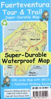
Wandelkaart Tour & Trail Fuerteventura | Discovery Walking Guides
For the best adventures, use the best map. Fuerteventura is a large, 1,660 square kilometres, island. At 65k scale Fuerteventura Tour & Trail Super-Durable Map is a large 960mm by 620mm, double sided map sheet, which folds down to its 220mm by 120mm pocket size.   A specialist concertina map fold means this map is easy to unfold for use and then refold to its pocket size. Super-Durable means that the Tour & Trail Map is printed on a plastic substrate using specially curing inks to produce a map that feels like silk but is tougher than any other map. Super-Durable is backed by a Discovery Walking Guides (DWG) 2-Year Guarantee against failure in the adventurous use for which the map is designed.   If your Super-Durable Map gets dirty then gently wipe clean with a soft wet cloth and allow to fully dry before refolding to pocket size. On one side of the map is the island's north with the south on the reverse side. There's a generous common overlap to minimise turning the map in use.   100 …
15,95
Fietskaart Cycling guides Exmoor - North Devon | Goldeneye
Scheur- en watervast foetskaart van Exmoor en Noord Devon met ingetekende fietsroutes.   Our maps are double-sided, printed on an A2 sheet with a concertina fold. This allows for easy folding and folding, and an ease of access to the mapping. The material is rain and tear-resistant. Our early maps were designed at the scale of 2 miles to 1 inch/1:126,720. The later designs along with digitalisation are 1: 100,000. We were encouraged by the Cycle Touring Club to convert our cartography toward the cycle market (to replace the out-of-print Bartholomew series). As time and the series progressed we have added more data: The National Cycle Network routes, Regional Routes, and Traffic-Free Family Routes, as and when they are developed. These routes are in addition to the Circular Routes Goldeneye Commissioned at the outset of our publishing schedule. We are also adding to new editions; bike shops, cycle hire, and tea rooms, along with the tourist attractions already featured. Our plan is to m…
12,95
Wandelkaart Tour & Trail Fuerteventura | Discovery Walking Guides
For the best adventures, use the best map. Fuerteventura is a large, 1,660 square kilometres, island. At 65k scale Fuerteventura Tour & Trail Super-Durable Map is a large 960mm by 620mm, double sided map sheet, which folds down to its 220mm by 120mm pocket size.   A specialist concertina map fold means this map is easy to unfold for use and then refold to its pocket size. Super-Durable means that the Tour & Trail Map is printed on a plastic substrate using specially curing inks to produce a map that feels like silk but is tougher than any other map. Super-Durable is backed by a Discovery Walking Guides (DWG) 2-Year Guarantee against failure in the adventurous use for which the map is designed.   If your Super-Durable Map gets dirty then gently wipe clean with a soft wet cloth and allow to fully dry before refolding to pocket size. On one side of the map is the island's north with the south on the reverse side. There's a generous common overlap to minimise turning the map in use.   100 …
15,95
Wandelkaart 04 Lake Louise & Yoho | Gem Trek Maps
Gedetailleerde kaart van dit prachtige gebied; deze kaart is geplastificeerd, scheur- en watervast. Gem Trek’s LAKE LOUISE & YOHO MAP is designed for visitors looking to explore one of North America’s premier day hiking destinations. Whether you are new to hiking or experienced in backcountry travel, you’ll find the waterproof and tear-resistant Lake Louise & Yoho Map to be an invaluable tool.   This map features detailed cartography, accurate hiking trails with distances, and details such as campgrounds, lodges, huts, teahouses, and picnic areas. On the reverse side of  the map are photos and trail descriptions of 11 recommended day hikes covered on the main map, ranging from easy lakeshore walks to more demanding hikes into alpine country. Four overnight or multi-day trips are also featured, along with contact information for two backcountry lodges, Skoki Lodge and Twin Falls Chalet.   Lake Louise & Yoho Map Coverage The Lake Louise & Yoho Map centres on Lake Louise, but also …
17,95
Wandelgids Canadian Rockies Trail Guide | Summerthought
The best loved and most detailed Canadian Rockies hiking guidebook is now in full color.   First published in 1971 and now in its 10th edition, the Canadian Rockies Trail Guide was the original guidebook with accurate distances and detailed descriptions to the trails of the Canadian Rockies.   Whether you’re a Canadian Rockies local or a visitor, the Canadian Rockies Trail Guide provides the best resource for hiking in the region, with everything from short interpretive trails to week-long backcountry treks. Now in its 10th edition and known affectionately as the “Bible” by outdoor enthusiasts, the popular tome is the most comprehensive and well-known guidebook to hiking in the region.   Having spent their entire adult lives hiking in the Canadian Rockies and writing about their experiences, authors Brian Patton and Bart Robinson are regarded as the ultimate authority on hiking in the Canadian Rockies. The Canadian Rockies Trail Guide is the only hiking guide to the region recommended …
29,95
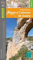
Wandelkaart 11 Sierra y Cañones de Guara, Canyons National Park | Edit
Zeer gedetailleerde wandelkaart van een klein gebied. Met ingetekende wandelroutes en andere informatie. Spaanstalig, maar uitstekende kaart. Coordinaten zijn weergegeven, dus GPS compatible met UTM grid.    Op de topografische wandelkaart worden o.a. berghutten, campings aangeduid en hoogtelijnen, ingetekende wandelroutes en de GR paden (doorgaande langeafstandswandelpaden). De kaart is inclusief een Spaanstalig boekje met extra informatie over aanwezige voorzieningen en enkele routes.   Gebied: Huesca, Urriales, Bárcabo, Alquézar, Buera, Adahuesca, Salas Altas, Ibieca, Bastarás, Chibluco, Pedruel, Otín, Lúsera, Arguis, Lúsera, Nueno, Igriés, Loporzano, Chibluco, Bara, Nocito, Used, Tozal de Guara, Tozal de la Cabeza A topographic tourist map and hiking guide with details of tourist attractions, hiking & sporting activities as well as transport information. An excellent folded map & booklet. Sierra de Guara in an extensive and very popular series of walking maps from Editorial Alpina …
19,95

Klanten-reviews van Wandelkaart Wanderkarte Schweiz - Zwitserland overzichtskaart | Kümmer

Er zijn nog geen beoordelingen voor dit productBen jij de eerste die een review plaatst?

Meer over Wandelkaart Wanderkarte Schweiz - Zwitserland overzichtskaart | Kümmer

Productomschrijving

Vanwege de schaal vooral geschikt als overzichtskaart. Hiking map with the official routes "Hiking in Switzerland" with hiking times and distances. More than 750 additional hiking routes. With index and a regional approach map. Water- and rip-proof map. Switzerland’s national and regional long-distance hiking paths on a waterproof and tear-resistant indexed map at 1:301,000 from Kümmerly + Frey, with numerous local trails, plus a list of all the long-distance routes. The departure and arrival points of each long-distance route are clearly marked, and each route is divided into stages by highlighting intermediate locations, with the distances and hiking times in both directions indicated for the individual sections. Symbols show mountain huts, campsites, youth hostels, Friends of Nature Houses and selected local hotels. On the reverse an extensive index includes lists of geographical features (peaks, passes, rivers, etc), huts, places of interest, etc. Also provided is a list of the six national long-distance routes and 53 regional long-distance trails.

Verken gerelateerde categorieën

Webshop.nl maakt gebruik van cookies. Ga je verder op onze website, ga dan akkoord met het plaatsen van cookies en de verwerking van deze data door ons en vermelde partners.