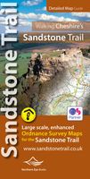
Wandelkaart Walking Cheshire's Sandstone Trail - 1:25,000 OS Map Book | Northern Eye Books

0
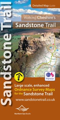
Large-scale Ordnance Survey maps for walking Cheshire’s Sandstone Trail in a handy pocket size book. Cheshire’s Sandstone Trail is probably the most popular middle-distance walk in Northwest England.   Here, in handy, pocket size book format are all the maps you need to walk Cheshire’s entire 55 kilometre/34 mile Trail.   Enlarged and enhanced, l...

Verkopers met dit product

Verkoper
Bezorging
Prijs
DeZwerver.nl logo
DeZwerver.nl
2,95
16,50

Anderen bekeken ook

Wandelkaart Walking Cheshire's Sandstone Trail - 1:25,000 OS Map Book | Northern Eye Books
Large-scale Ordnance Survey maps for walking Cheshire’s Sandstone Trail in a handy pocket size book. Cheshire’s Sandstone Trail is probably the most popular middle-distance walk in Northwest England.   Here, in handy, pocket size book format are all the maps you need to walk Cheshire’s entire 55 kilometre/34 mile Trail.   Enlarged and enhanced, large scale 1:25,000 Ordnance Survey mapping for the whole Sandstone Trail Up-to-date route of Sandstone Trail clearly highlighted in yellow Extra map symbols for pubs, tea rooms, parking and more Trail introduction and photo mosaic Useful information section Ideal for walkers and all outdoor enthusiasts along Cheshire’s sandstone ridge Contains relevant mapping from two OS maps for the price of one
16,50
Wandelgids Easy Walks from the Sandstone Trail | Northern Eye Books
One in the popular Top 10 Walks series of pocket-sized, full colour walking guides written by the author of the Official Guide to the Sandstone Trail. This attractive and cleverly structured guide gives walkers ten of the best new short circular walks from Cheshire's Sandstone Trail in a popular format. With clear information, large scale Ordnance Survey maps, eye-grabbing panoramic photographs, and interpretation of points of interest along the way, these guides set a new standard in clarity and ease-of-use. Featured walks include: Hillforts above the Mersey, Around Blakemere, Over the Old Pale, Kelsborrow Castle, Cheshire's twin castles, Around the Peckforton Hills, Pheasant Inn circuit, Willow Hill & Sarra Lane, Rawhead circuit, and Around Bickerton Hill.  
10,95
Wandelgids Cheshire & Wirral Pub Walks | Northern Eye Books
These attractive and cleverly structured guides will give walkers ten of the best themed short circular walks to Cheshire's finest pubs. With clear information, an overview and introduction for each walk, expertly written directions, large scale Ordnance Survey maps, superb photographs, and interpretation of points of interest along the way, these guides set a new standard in clarity and ease-of-use. Featured walks in Cheshire Pub Walks include: Brewery Tap, West Kirby; Harp Inn, Neston; Ring o' Bells, Frodsham; George and Dragon, Great Budworth; Boot Inn, Kelsall; Pheasant Inn, Burwardsley; Swan, Marbury; Swan Inn, Wybunbury; White Lion, Barthomley and the Ship Inn, Wincle.  
10,95
Fietskaart Sandstone Way - Northumberland Cycle Route Map | Northern Heritage Services
The Sandstone Way is a 120-mile mountain biking route between Berwick upon Tweed and Hexham that runs along the sandstone ridge in North Northumberland, linking numerous sandstone crags and outcrops. From one end of Northumberland to the other, the Sandstone Way traverses an ever-changing landscape which is rich in history, geology and iconic scenery.   Both Hexham and Berwick upon Tweed are served by rail. Between these two towns, the route passes through numerous villages and small communities including Wooler, Rothbury and Bellingham. It has been designed to safely cross rivers, main roads and railways.   The Sandstone Way is designed for mountain bikers and as much of the route as possible is off-road. It will appeal to riders of all abilities and most will take 3 or 4 days to complete it. The ‘fit and the fast’ could possibly ride the route in 2 days but in all probability, most would wish they had taken 3 days. Almost certainly a few mountain bikers will try to ride the whole ro…
16,50
Wandelkaart North Wales Coast Path Map | Northern Eye Books
Enhanced, large scale (1: 25,000) Ordnance Survey mapping in a handy atlas format with all the mapping you need to walk a complete North Wales Coast section of the Wales Coast Path.   Continuous OS mapping covering the complete route from Chester to Bangor, on the Menai Strait. Contains generous coastal extracts from large-scale OS Explorer maps 266, 265, 264 and OL17.   The North Wales Coast Ordnance Survey mapping book is part of a series of map atlases covering the whole of the 870-mile long Wales Coast Path. The enhanced OS 1:25,000 maps are accurate, up-to-date and reliable. Additional map symbols show tea shops, cafes, extra parking, and public toilets.   A brief introduction to the North Wales Coast includes a fascinating photo mosaic highlighting notable views, places of interest and wildlife you’ll meet along the way. There is also a section of detailed Useful Information at the back of the atlas.   Laminated flapped covers showing Wales Coast Path signs and waymarkers, route…
16,50
Wandelgids Best Pub Walks in Cheshire | Northern Eye Books
CHESHIRE IS WELL KNOWN for both its beautiful countryside and its country pubs. This fully revised and updated, 3rd edition of a classic guide book combines the two with superb walks through varied countryside, each one visiting a walker-friendly pub that is well known for its food and drink.   The 220-page book ideal for those with a connoisseur’s interest in Real Ale, and for walkers wanting a convenient starting point and route directions – plus some of the best pub lunches in Cheshire.   There are 30 circular walks included, covering the entire county from west to east and north to south. Each walk is graded in terms of mileage and difficulty — so families with young children can choose the easy ones, and enthusiasts can find more challenging routes to work up a thirst!
16,50
Wandelgids Pembrokeshire | Northern Eye Books
OS Map Books: Wales Coast Path: Pembrokeshire Coast Path Map Atlas | Ordnance Survey ‘Explorer’ Large-scale 1:25,000 maps for the Pembrokeshire Coast in compact book format | Pocket Atlas | Walking Wales | UK Long-Distance Trails | Hiking | Adventure   One of seven handy Ordnance Survey Map Books covering the entire 870 mile/1400 kilometre-long, world-class Wales Coast Path — from Chester in the north to Chepstow in the south.   Enjoy enhanced, large scale (1:25,000) Ordnance Survey Explorer mapping in compact atlas format with all the detailed mapping you need to walk the Pembrokeshire Coast section of the Wales Coast Path.   Continuous, full colour OS mapping covering the Wales Coast Path between Cardigan and Amroth. Contains extracts from large scale Explorer maps OL 35 and OL 36. The enhanced OS 1:25,000 maps are accurate, up-to-date and reliable. Additional map symbols show tea shops, cafes, extra parking, and public toilets.   A brief introduction to Pembrokeshire Coast includes…
17,50
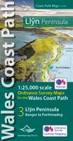
Wandelatlas Wales Coast Path Llyn Peninsula Map | Northern Eye Books
Enhanced, large scale (1: 25,000) Ordnance Survey mapping in a handy atlas format with all the mapping you need to walk a complete circuit of the Anglesey section of the Wales Coast Path.   Continuous OS mapping covering the complete route from Bangor to Porthmadog. Contains coastal extracts from large scale Explorer maps 253 and 254.   The Llyn Peninsula Ordnance Survey mapping book is part of a series of map atlases covering the whole of the 870-mile long Wales Coast Path. The enhanced OS 1:25,000 maps are accurate, up-to-date and reliable. Additional map symbols show tea shops, cafes, extra parking, and public toilets.   A brief introduction to the Llyn Peninsula includes a fascinating photo mosaic highlighting notable views, places of interest and wildlife you’ll meet along the way. There is also a section of detailed Useful Information at the back of the atlas.   Laminated flapped covers showing Wales Coast Path signs and waymarkers, route details and map symbols make these atlas…
13,95
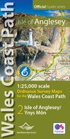
Wandelatlas Wales Coast Path: Isle of Anglesey | Northern Eye Books
Enhanced, large scale (1: 25,000) Ordnance Survey mapping in a handy atlas format with all the mapping you need to walk a complete circuit of the Anglesey section of the Wales Coast Path.   Continuous OS mapping covering the complete circuit from Menai Bridge. Contains coastal extracts from large scale Explorer maps 262 and 263.   The Isle of Anglesey/Ynys Mon Ordnance Survey mapping book is part of a series of map atlases covering the whole of the 870-mile long Wales Coast Path. The enhanced OS 1:25,000 maps are accurate, up-to-date and reliable. Additional map symbols show tea shops, cafes, extra parking, and public toilets.   A brief introduction to Anglesey includes a fascinating photo mosaic highlighting notable views, places of interest and wildlife you’ll meet along the way. There is also a section of detailed Useful Information at the back of the atlas.   Laminated flapped covers showing Wales Coast Path signs and waymarkers, route details and map symbols make these atlases si…
13,95

Klanten-reviews van Wandelkaart Walking Cheshire's Sandstone Trail - 1:25,000 OS Map Book | Northern Eye Books

Er zijn nog geen beoordelingen voor dit productBen jij de eerste die een review plaatst?

Meer over Wandelkaart Walking Cheshire's Sandstone Trail - 1:25,000 OS Map Book | Northern Eye Books

Productomschrijving

Large-scale Ordnance Survey maps for walking Cheshire’s Sandstone Trail in a handy pocket size book. Cheshire’s Sandstone Trail is probably the most popular middle-distance walk in Northwest England.   Here, in handy, pocket size book format are all the maps you need to walk Cheshire’s entire 55 kilometre/34 mile Trail.  
  • Enlarged and enhanced, large scale 1:25,000 Ordnance Survey mapping for the whole Sandstone Trail
  • Up-to-date route of Sandstone Trail clearly highlighted in yellow
  • Extra map symbols for pubs, tea rooms, parking and more
  • Trail introduction and photo mosaic
  • Useful information section
  • Ideal for walkers and all outdoor enthusiasts along Cheshire’s sandstone ridge
  • Contains relevant mapping from two OS maps for the price of one

Productinformatie

    Verken gerelateerde categorieën

    Webshop.nl maakt gebruik van cookies. Ga je verder op onze website, ga dan akkoord met het plaatsen van cookies en de verwerking van deze data door ons en vermelde partners.