webshop.nl
Categorieën
  Sluiten

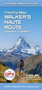
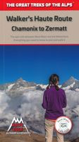
Wandelkaart Walker's Haute Route: Chamonix to Zermatt | Knife Edge Outdoor

Een hele goede kaart van én van de grote wandeltochten in de Alpen: Haute Route Chamonix-Zermatt. Deze wandelkaart op scheur- en watervast papier gedrukt geeft de hele route weer op een gedetailleerde schaal. Alle noodzakelijke informatie vind je er op terug.   The best sheet map for the Walker's Haute Route: Chamonix to Zermatt. This is the only m...
23,95

Webshops met dit product

Webshop
Bezorging
Prijs

Anderen bekeken ook

Wandelgids Walker's Haute Route: Chamonix to Zermatt | Knife Edge Outdoor
Overzichtelijke routegids van deze prachtige wandelroute. Per etappe vind je een hoogteprofiel, goede beschrijvingen van de wandelroute, een topografische kaart op gedetailleerde schaal. Voor en achterin de gids staat aanvullende praktische informatie zoals adressen van campings, andere accommodaties en bijvoorbeeld een paar pagina's over de flora en fauna.  The only guidebook for the Walker's Haute Route with Real Maps: 1:25,000/1:50,000 mapping included for each stage. This makes navigation easy and saves you money: no need to buy additional maps. Also includes:* Unique Itinerary Planner: plan a bespoke itinerary to match your ability and vacation schedule. All difficult calculations of time, distance and altitude gain are done for you* 6 Proposed Itineraries of between 10 and 14 days* Everything the trekker needs to know to plan the route: route descriptions, costs, budget, difficulty, weather, how to get there, and more* Full accommodation listings: spectacularly situated mountain …
20,95
Wandelatlas 4001 Topographic Map Guide Haute Route Chamonix to Zermatt | National Geographic
- Waterproof - Tear-Resistant - Topographic Map The Haute Route--aka the High Route or Mountaineers' Route--traverses the French and Swiss Alps. It was conceived as a summer mountaineering route in the mid-nineteenth century by members of the English Alpine Club. Though originally called The High-Level Route by members of the Alpine Club, in 1911, a group first successfully established a winter route from Bourg St. Pierre to Zermatt on skis and afterwards the name of the route was translated into French. As a result of their success, the French term stuck, and the journey gained a reputation amid skiers and ski mountaineers as a classic must-do winter/spring tour. There is also a non-technical Walker's Haute Route that has gained in popularity and become a classic in and of itself. This Topographic Map Guide outlines two different variations of the Haute Route from Chamonix, France to Zermatt, Switzerland: one for hikers and one for skiers. The northernmost route or, Walker's Route, de…
16,95
Wandelgids Chamonix to Zermatt | Cicerone
Uitstekende wandelgids die in etappes de route nauwkeurig beschrijft; ook de zijtakken en alternatieve routes koman aan bod. Kaarten zijn schetsmatig en in onze ogen onvoldoende, zeker bij slechte weersomstandigheden. Wij raden dan ook om er losse kaarten bij te kopen. A guidebook to the classic Chamonix to Zermatt trek from Mont Blanc to the Matterhorn. The 225km Walker's Haute Route through the French and Swiss Alps crosses 11 passes, gains more than 14,000m in height and is a strong contender for the title of Most Beautiful Walk in Europe. The high-level route is described in 14 day stages, with optional variants, and is suitable for walkers with a good level of fitness and some previous alpine trekking experience. The final approach to Zermatt adopts the dramatic Europaweg, a high-level traverse of the east wall of the Mattertal, crossing the 500-metre suspension bridge at Randa. An alternative valley route to Zermatt can be taken if this does not appeal. Alongside clear route desc…
22,95
Wandelgids Haute Route Zwitserland | Rother Bergverlag
Uitstekende wandelgids met een groot aantal dagtochten in dal en hooggebergte. Met praktische informatie en beperkt kaartmateriaal! Wandelingen in verschillende zwaarte weergegeven in rood/blauw/zwart. Die Haute Route ist der »Urahn« aller Alpen-Durchquerungen – vor mehr als 150 Jahren wurde diese hochalpine Tour von Chamonix nach Zermatt »erfunden« und bis heute hat sie nichts von ihrer Attraktivität eingebüßt. Diese großartige Tour ist ein unvergessliches Erlebnis für alle Hochtourengeher. Und auch für diejenigen, die nicht über die Gletscher gehen wollen, gibt es eine Variante: sie führt genussvoll über aussichtsreiche Höhenwege. Der Rother Wanderführer »Haute Route« stellt sowohl die alpine Hochtourenroute als auch die Wanderroute vor. Die klassische alpine Haute Route zieht ohne große technische Schwierigkeiten, aber über hohe Gletscherpässe an den großen Gipfeln vorbei vom Mont Blanc ins Wallis. Für hochalpin erfahrene Bergsteiger wird darüber hinaus auch eine anspruchsvollere Va…
17,50
Wandelgids Walks In The Valais | Cicerone
Uitstekende wandelgids van dit geweldige gebied. goed beschreven met veel praktische informatie om de route te kunnen lopen, inclusief redelijke kaarten. 120 routes throughout the Swiss Valais in the Pennine Alps, with such peaks as the Matterhorn, Dent Blanche and Monte Rosa providing a perfect background. Detailed coverage of Bettmeralp, Lötschental, Saastal, Mattertal, Turtmanntal, Val d’Annivers, Val d’Hérens, Val de Nendaz, Val de Bagnes, Val d’Entremont, Val ferret, Vallée de Trient. The Matterhorn, Monte Rosa, Zinarothorn, Ober Gabelhorn, Dent Blanche, Weisshorn, Bietschhorn, Grand Combin – these are some of the most dramatic mountains in Europe. Here they form a backdrop to a series of routes that should answer the dreams of any keen mountain walker. Best known, perhaps, for the resorts of Zermatt and Saas Fee, the Valais district of Switzerland is also the location of the Lötschental and Turtmanntal, the Vals d'Anniviers, Hérens, Bagnes and Ferret – valleys in which there are …
24,95
Wandelgids Walking Chamonix Mont Blanc | Knife Edge Outdoor
The 20 hikes in the Chamonix Valley that need to be on your Bucket List. No fillers. Only must-do hikes are included.   ► Real IGN Maps inside: 1:25,000 ► Detailed information on public transport, including cable cars ► Our secret tips on how to get away from the crowds ► Numbered waypoints linking the Real Maps to our clear descriptions ► Graded routes to suit all abilities ► Everything the hiker needs to know: route descriptions, difficulty, weather, how to get there, and more ► Information on Wildlife and Plants   Our walks have been carefully selected to enable easy access by public transport, including the Chamonix Valley’s incredible cable car network.   Chamonix is the most famous mountain town in the world. It is where mountaineering began.  Its peerless reputation owes everything to the mighty Mont Blanc, the highest peak in Western Europe: our hikes will take you to the finest viewpoints of the mountain and its glaciers.
19,50
Wandelgids Walking in the Haute Savoie North | Cicerone
Uitstekende wandelgids van dit geweldige gebied. Goed beschreven met veel praktische informatie om de route te kunnen lopen, inclusief redelijke kaarten. A guidebook of half and full-day walks in the lovely Haute Savoie mountains of France. This guide describes 30 circular routes of between 7 and 13km, based around Evian-les-Bains, Morzine, Abondance, Châtel, St-Julien-en-Genevois, Bellevaux, Boège and Habère-Poche. Graded from easy to difficult, there are walks to suit most abilities, but a few have some exposed sections and need a head for heights.   The guide is divided into 6 areas covering the Salève and Vuache, the Vallée Verte, the Vallée du Brevon, Pre-Alpes du Léman and Val d'Abondance. Alongside a detailed route description and map, each walk has a summary of all you need to know before you set out (distance, time to walk, ascent, maximum altitude and instructions for accessing the start). The guidebook includes advice on travel, accommodation and equipment, as well as inform…
20,95
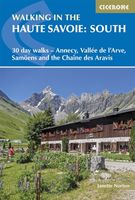
Wandelgids Walking in the Haute Savoie: South | Cicerone
Uitstekende wandelgids van dit geweldige gebied. goed beschreven met veel praktische informatie om de route te kunnen lopen, inclusief redelijke kaarten.   A guidebook of walks in the lovely Haute Savoie mountains of France. This guide describes 30 circular routes of between 7 and 20km, based around Annecy, La Clusaz, Grand Bornand, Plateau d'Assy, Samoëns, Sixt, Sallanches, Thônes, la Roche-sur-Foron. Graded from easy to difficult, there are walks to suit most abilities, but a few have some exposed sections and need a head for heights.   The guidebook is divided into 6 areas covering the Arve Valley, the Haut Giffre valley, the Chaîne des Aravis (north and south), Plateau de la Borne and Lake Annecy. Alongside a detailed route description and map, each walk has a summary of all you need to know before you set out (distance, time to walk, ascent, maximum altitude, grade and instructions for accessing the start). There is advice on travel, accommodation and equipment, as well as informa…
20,95
Wandelgids Trekking in the Alps | Cicerone
All the rich scenic diversity for which the Alps are renowned is celebrated here, while the 20 treks described include well-known classics as well as newly-created multi-day routes. The eight talented writers and photographers brought together to produce this book are among the most experienced of Alpine trekkers. Between them they have explored every corner of Europe’s premier mountain range, written dozens of guides and, in some cases, led trekking holidays there in order to share their enthusiasm for the Alps with other walkers. And that is the prime motivation for Trekking in the Alps – an inspiration and a celebration of the very best of these mountains. Best-known treks Tour of Mont Blanc; Tour of the Matterhorn; Tour of Monte Rosa; Walker’s Haute Route; Tour of the Jungfrau Region; Tour of the Vanoise; Dolomites AV 1 & 2 Longer trans-Alpine treks GR5 (Lake Geneva to Nice); Eastern Alps E5; Italian Alps GTA; Traverse of the Slovenian Alps For the Alpine adventurer Alpine Pass Rou…
25,95
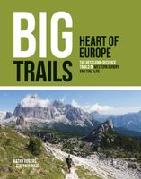
Wandelgids - Reisinspiratieboek Big Trails: Heart of Europe | Vertebrate Publishing
Mooi inspiratieboek met 25 langeafstandswandelingen in West-Europa. Met foto's, een beschrijving van de route en wat praktische informatie is dit boek perfect om uit te vinden wat het volgende grote wandelavontuur gaat worden.   Big Trails: Heart of Europe is an indispensable guide to the most spectacular and popular long-distance trails in the Western European countries of France, Belgium, Netherlands, Luxembourg, Germany, Switzerland, Austria and Italy.   The twenty-five featured routes cover the best that European trails have to offer, sweeping from the GR21 along the Normandy Coast to the GR1 Tour de Paris and King Ludwig’s Way in Germany. Culminating in trails such as the Tour du Mont Blanc and Chamonix–Zermatt Haute Route, the jewels of the Alps, this delves deep into Western Europe’s most iconic routes.   The book will inspire big adventures. Rather than being carried along the route, this guide provides everything you need to plan and explore further, including a general overvi…
24,95

Klanten-reviews van Wandelkaart Walker's Haute Route: Chamonix to Zermatt | Knife Edge Outdoor

Er zijn nog geen beoordelingen voor dit productBen jij de eerste die een review plaatst?

Meer over Wandelkaart Walker's Haute Route: Chamonix to Zermatt | Knife Edge Outdoor

Productomschrijving

Een hele goede kaart van én van de grote wandeltochten in de Alpen: Haute Route Chamonix-Zermatt. Deze wandelkaart op scheur- en watervast papier gedrukt geeft de hele route weer op een gedetailleerde schaal. Alle noodzakelijke informatie vind je er op terug.   The best sheet map for the Walker's Haute Route: Chamonix to Zermatt. This is the only map available that displays the entire route and numerous variants on a single sheet: perfect for planning and navigation. 1:40,000 - larger scale and more detail than any other map. 1:10,000: for select areas where navigation is challenging. Made specifically for the Walker's Haute Route by Knife Edge Outdoor Guidebooks:   - English/French/German map key - 1:40,000/1:10,000 - Numerous variants - Includes free GPX downloads for the trail - GPS compatible - Tougher than traditional maps: try to tear me! - More water-resistant than traditional maps - Lighter than traditional maps - Huts/accommodation marked on the map   The Walker's Haute Route is an incredible trek between the two most famous mountain towns in the Alps. Travelling from Chamonix in France to Zermatt in Switzerland, you will start at Mont Blanc and finish at the Matterhorn. On the way, pass the largest collection of snowy 4000m summits in the Alps: Mont Blanc, Grand Combin, the Weisshorn, the Zinalrothorn, the Dom, the Täschhorn, the Breithorn and the Matterhorn, to name a few. The sister trek to the Tour du Mont Blanc crosses unspoilt and remote mountain terrain: amazing glaciers, snow frosted summits, beautiful valleys and pastures, shimmering lakes, carpets of wild flowers and the soothing sound of cow bells. This trek should be on your hiking bucket list.   - 206km - 10-14 days - 14,000m of altitude gain - 12 mountain passes - 2 countries: France and Switzerland
Webshop.nl maakt gebruik van cookies. Ga je verder op onze website, ga dan akkoord met het plaatsen van cookies en de verwerking van deze data door ons en vermelde partners.