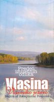
Wandelkaart Vlasina - Vlasinsko jezero | Geokarta

0
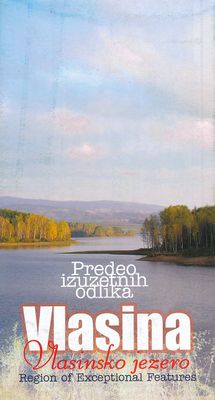
Gedetailleerde wandelkaart met hoogtelijnen, wandelroutes en toeristische informatie ingetekend van het gebied rond het Vlasinameer, Gramasa, Strezimirovci, Streser, Bozica (ten oosten van Surdulica) in zuidoost Servië Vlasina Lake is a topographic map of the lake and surrounding areas, also known for its cross country skiing and varied flora and ...

Verkopers met dit product

Verkoper
Bezorging
Prijs
DeZwerver.nl logo
DeZwerver.nl
niet bekend
12,95

Anderen bekeken ook

Reisgids Transylvania - Transsylvanië | Bradt Travel Guides
De enige reisgids over Transsylvanië! Een goede, vooral praktische reisgids met veel info over overnachten, eetgelegenheden, vervoer, maar ook wandelingen. Daarnaast nog aandacht voor achtergronden als geschiedenis, cultuur en landschap. Sober uitgevoerd, maar complete reisgids. This new, fourth edition of Bradt's Romania: Transylvania remains the only standalone, full-length, English-language travel guidebook to Transylvania – the legendary, enchanting and increasingly popular region of Romania. Co-authored by former British Ambassador to Romania Paul Brummell, Romania: Transylvania has been thoroughly updated by prolific travel writer Tim Burford, who wrote his first Romania guide in 1991.   Transylvania (the ‘land beyond the forest') is a wild, wooded, intensely romantic region, filled with mountains and gorges, myths and legends, dragons, bears, wolves – and vampires. Bram Stoker called it ‘one of the wildest and least-known parts of Europe', a description that remains true today.…
26,50
Reisgids Insel|Trip Santorin - Santorini | Reise Know-How Verlag
Santorin, die griechische Insel in der südlichen Ägäis, beeindruckt seine Besucher mit verwitterten Felsformationen, karger Vegetation und der verschachtelten Architektur seiner weiß hingetupften Häuser. Gemeinsam mit seinen Nachbarinseln bietet es abwechslungsreiche Touren an Land und auf dem Wasser. Taucher lockt die vulkanische Unterwasserwelt der Kaldéra. Zahlreiche Museen, Kapellen und antike Ausgrabungsstätten bis hin zum vermuteten Grab des Homer auf Íos sind für historisch Interessierte ein besonderes Erlebnis. Und die lokale Küche begeistert mit abwechslungsreichen Mezédes, begleitet von echtem santorinischen Wein und einem Kafé ellinikó als krönendem Abschluss.   Dieser aktuelle Reiseführer ist der ideale Begleiter, um alle Seiten der Kykladeninsel selbstständig zu entdecken: Die interessantesten Orte, Sehenswürdigkeiten und Attraktionen ausführlich vorgestellt und bewertet Die schönsten Strände rund um die Insel Die besten Hotspots zum Schnorcheln, Tauchen und Segeln Ausgew…
18,50
Wandelkaart Suva Planina - Servië | Geokarta
One side topographic marked with footpaths, ski trails, ski lifts, camp sites, picnic sites, mountain huts, also notable features in the landscape. Other side further information, additional words and pics of notable features, mountain huts etc. Suva Mountains with the Gorges of the Jelašnicka River on a detailed contoured map at 1:55,000, plus extensive information on the tourist facilities in the area with colour photos of mountain shelters, notes on fauna and flora, etc. The map has contours at 20m intervals with relief shading and colouring for woodlands. Different levels of protection zones are marked and areas where hunting is allowed are indicated. An overprint highlights waymarked hiking trails including the 130km long-distance trail across the Niš range. Also marked are different types of tourist accommodation including campsites and hunting lodges, paragliding sites, skiing areas, etc. The map has latitude and longitude lines at intervals of 5’. Map legend includes English. …
13,95
Wandelkaart - Topografische kaart 744 Adirondack Park - Northville - Raquette Lake | National Geographic
Prachtige geplastificeerde kaart van het bekende nationaal park. Met alle recreatieve voorzieningen als campsites, maar ook met topografische details en wandelroutes ed. Door uitgekiend kleurgebruik zeer prettig in gebruik. Scheur en watervast! National Geographic's Trails Illustrated map of Adirondack Park Northville/Raquette Lake is a two-sided, waterproof, topographic trail map designed to meet the needs of outdoor enthusiasts with unmatched durability and detail. This map was created in cooperation with the Adirondack Mountain Club and is loaded with valuable recreation information for boating, hiking, fishing, sailing, cycling, ice fishing, skiing, and snowmobiling. Trails and major roads are clearly distinguished, from the picturesque foothills to the northern peaks and around lakes of all sizes. Campgrounds, climbing areas, marinas, and museums are labeled and easy to find and boundaries for park lands, wilderness, primitive, forest, and protected areas are clearly marked. Disc…
17,95
Reisinspiratieboek - Reisboek Book of the Alps | Marmota Maps
The Book of the Alps  the great illustrated book about the Alps.290 pages with over 1000 illustrations, graphics, and maps on geography, sports, history, culture, climate, environment and much more. Understand the Alps like never before.Created in cooperation with the Alpine clubs of Germany, Austria, and South Tyrol. CONTENTS The Book of the Alps has 46 chapters in seven subject areas: Geography   Flora and Fauna   Climate and Environment    Alpinism   Mountain Sports   Society and Economy   Arts and Culture   GEOGRAPHY Geological Formation Ice Age Mountains Valleys Mountain Passes Lakes and Rivers Glaciers The Alps are unique. How did they form and evolve? How do glaciers, passes, valleys, lakes, and rivers shape the landscape? Answers to these and many more questions can be found in the geography chapter.   FLORA AND FAUNA Biodiversity Plants Forests Animals National Parks The Alpine environment is fascinating. Alpine flowers such as the edelweiss and Alpine anima…
44,95
Wandelkaart 12 Jasper Up-Close | Gem Trek Maps
Water- en scheurvaste wandelkaart van Jasper. Met op de achterzijde een overzicht van de belangrijkste bezienswaardigheden.   Waterproof and tear-resistant hiking and recreation map for the town of Jasper and surrounds in the Canadian Rockies.   Designed for both locals and visitors, Gem Trek’s 1:35,000 Banff Up-Close Map is a detailed relief-shaded topographic map of the Jasper area. On the back of the Jasper Up-Close Map are descriptions of recommended sights, museums and scenic drives to make it easier to plan your day. We’ve also included a hand-picked list of the best six easy walks and day hikes in the area, noting the highlights of each trail, as well as distance, elevation gain and directions to the trailhead. Colour photos and three inset maps, including a town map of Jasper, accompany the descriptions of sights and hikes on the back of the map.   Map specs   Edition: 6th Scale: 1:35,000 Folded size: 4.5 x 9.5 inches Flat size: 18 x 24 inches Paper: Waterproof and tear-resist…
13,95
Wandelkaart 06 Canmore & Kananaskis Village | Gem Trek Maps
This map covers some of the most popular terrain for hikers and mountain bikers in Kananaskis Country - Bow Valley Provincial Park, the Canmore area, the Smith-Dorrien/Spray Lakes area south to Mount Shark trailhead, Barrier Lake, and the Kananaskis Village area from Ribbon Creek south to Galatea Lakes trailhead.   Updated trails on this sixth edition include those on both sides of the Bow Valley, including the Highline Trail and its connectors on the south side of Highway 1, and the Benchlands trails on the north side of Highway 1. The new snowshoe trails in the Ribbon Creek area have also been added. And for those of you who have been asking, the relief shading is back, and the map is printed on waterproof material.   Other classic trails covered on this map include Grassi Lakes, Yamnuska, Ha Ling, Lady Macdonald, Barrier Lake Lookout, Mt. Allen via Centennial Ridge (the highest maintained trail in the Canadian Rockies), Ribbon Falls and Ribbon Lake, Lillian and Galatea lakes, Karst…
18,95
Natuurgids - Reisgids Crossbill Guides Southern Morocco - Zuid Marokko | KNNV Uitgeverij
Zeer gedegen natuurgids van het betreffende gebied. Unieke gids met streekinformatie, plekken waar je echt  moet zijn, routes en veel achtergrondinformatie over het landschap, de ecologie, ontstaansgeschiedenis en de flora en fauna. De routes en plekken die beschreven worden in de gids zijn zo gekozen dat je een heel compleet beeld krijgt van het gebied: landschappelijk, flora en fauna ... alle toppers van de streek zijn goed te vinden. Echt een aanrader voor elke natuurliefhebbers die zich wat meer in het gebied wil verdiepen.   This nature travel guidebook to Southern Morocco contains routes and background info on landscape, flora and fauna.   Landscape history Ecosystems Geology Flora and Fauna Where to watch birds Finding mammals, reptiles, butterflies, dragonflies and wildflowers 25 detailed routes with tips for finding wildlife and 29 site descriptions   Region covered by this Crossbill Guide The Crossbill Guide Southern Morocco covers the part of Morocco that lies ro…
29,95
Natuurgids - Reisgids Crossbill Guides Western Andalucia - Andalusie west | KNNV Uitgeverij
Zeer gedegen natuurgids van het betreffende gebied. Unieke gids met streekinformatie, plekken waar je echt  moet zijn, routes en veel achtergrondinformatie over het landschap, de ecologie, ontstaansgeschiedenis en de flora en fauna. De routes en plekken die beschreven worden in de gids zijn zo gekozen dat je een heel compleet beeld krijgt van het gebied: landschappelijk, flora en fauna ... alle toppers van de streek zijn goed te vinden. Echt een aanrader voor elke natuurliefhebbers die zich wat meer in het gebied wil verdiepen.   Beschrijft de volgende gebieden: Huelva, Sevilla, Cádiz en Málaga   de enige reisgids die flora en fauna, en vogels beschrijft wandelroutes, vogelkijk- en observatietips achtergrondinformatie over landschap en ecologie This Crossbill Guide is a thorough and practical guide for naturalists and nature lovers. It covers all of Andalucía west of the line Malaga-Córdoba, which coincides with the provinces of Huelva, Sevilla, Cádiz and the western half of Malaga. W…
29,95
Reisgids Northern Tanzania Safari guide - Noord Tanzania | Bradt Travel Guides
The Bradt safari guide with Kilimanjaro & Zanzibar. Perfecte gids voor alle safari-gangers in dit waanzinnige land: Ngorogoro, Serengeti, maar ook Tangarire en onbekende vulkanen. Zeer compleet met meer informatie dan de Lonely Planet. This new, thoroughly updated fifth edition of Bradt's Northern Tanzania Safari Guide remains the only full-length guidebook focussed exclusively on the country's north and on Zanzibar. Reflecting tourism's shift away from backpackers and budget camping safaris to upper-end and mid-range safaris and beach holidays, it is tailored closely to the requirements of anyone going on a safari to northern Tanzania, followed by a few days on Zanzibar. Northern Tanzania is dominated by Africa's finest safari circuit, offering spectacular game-viewing year round.   Centred on the legendary Serengeti National Park and its world-famous wildebeest migration, this circuit also incorporates the Ngorongoro Crater and surrounding Ngorongoro Conservation Area, Lake Manya…
26,50

Klanten-reviews van Wandelkaart Vlasina - Vlasinsko jezero | Geokarta

Er zijn nog geen beoordelingen voor dit productBen jij de eerste die een review plaatst?

Meer over Wandelkaart Vlasina - Vlasinsko jezero | Geokarta

Productomschrijving

Gedetailleerde wandelkaart met hoogtelijnen, wandelroutes en toeristische informatie ingetekend van het gebied rond het Vlasinameer, Gramasa, Strezimirovci, Streser, Bozica (ten oosten van Surdulica) in zuidoost Servië

Vlasina Lake is a topographic map of the lake and surrounding areas, also known for its cross country skiing and varied flora and fauna.   Full colour on both sides

Verken gerelateerde categorieën

Webshop.nl maakt gebruik van cookies. Ga je verder op onze website, ga dan akkoord met het plaatsen van cookies en de verwerking van deze data door ons en vermelde partners.