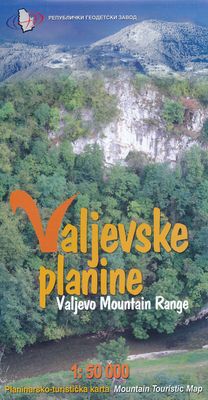
Wandelkaart Valjevske planine - mountain range | GeoSrbija

0
Gedetailleerde wandelkaart met ingetekende wandelroutes. Hoogtelijnen, hutten staan vermeld. Op de achterzijde informatie over flora en fauna en toeristische bezienswaardigheden. North-West Serbia   This map covers the popular tourist areas   Very detailed full colour topographc mapping   Footpaths and hiking trails clearly marked   Spot heights a...

Verkopers met dit product

Verkoper
Bezorging
Prijs
DeZwerver.nl logo
DeZwerver.nl
niet bekend
2,95
12,95

Anderen bekeken ook

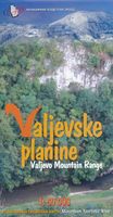
Wandelkaart Valjevske planine - mountain range | GeoSrbija
Gedetailleerde wandelkaart met ingetekende wandelroutes. Hoogtelijnen, hutten staan vermeld. Op de achterzijde informatie over flora en fauna en toeristische bezienswaardigheden. North-West Serbia   This map covers the popular tourist areas   Very detailed full colour topographc mapping   Footpaths and hiking trails clearly marked   Spot heights and relief shading   Contours at 20m vertical intervals   Reverse on map includes useful local information in English and Serbian
12,95
Wandelkaart Rajac suvoborski | Geokarta
Gedetailleerde wandelkaart met hoogtelijnen, wandelroutes en toeristische informatie ingetekend van het Suvobor Rajac gebergte in noord Servië. This map covers the popular tourist areas   Rajac is famous for it's limestone caverns, climbing, hiking routes and orienteering events   Very detailed full colour topographc mapping   Footpaths and hiking trails clearly marked   Spot heights and relief shading   Contours at 5m vertical intervals   Reverse on map includes useful local information in English and Serbian
12,95
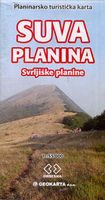
Wandelkaart Suva Planina - Servië | Geokarta
One side topographic marked with footpaths, ski trails, ski lifts, camp sites, picnic sites, mountain huts, also notable features in the landscape. Other side further information, additional words and pics of notable features, mountain huts etc. Suva Mountains with the Gorges of the Jelašnicka River on a detailed contoured map at 1:55,000, plus extensive information on the tourist facilities in the area with colour photos of mountain shelters, notes on fauna and flora, etc. The map has contours at 20m intervals with relief shading and colouring for woodlands. Different levels of protection zones are marked and areas where hunting is allowed are indicated. An overprint highlights waymarked hiking trails including the 130km long-distance trail across the Niš range. Also marked are different types of tourist accommodation including campsites and hunting lodges, paragliding sites, skiing areas, etc. The map has latitude and longitude lines at intervals of 5’. Map legend includes English. …
13,95
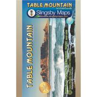
Wandelkaart South Africa: Table Mountain | Slingsby Maps
This highly detailed map shows all approved paths on the mountain and includes full GPS information. The map shows the Hoerikwaggo and the Peoples Trail, and covers the area from Signal Hill to Devils Peak and Llandudno to Constantia Nek and the Vlakkenberg Plateau. This is the only map of the mountain endorsed by the Table Mountain National Park, and approved by the Mountain Club of South Africa.   Distances and estimated times shown for all paths above the Contour Path or Pipe Track Long/Lat grid at 10" intervals as well as the 200 metre square UTM grid; Completely revised vegetation distribution Some vanished paths removed; some new ones added Three Firs, Oudekraal Ravine and Constantia Corner routes upgraded; Clearer depiction of many features, including dangerous routes All approved paths, with DD MM SS GPS coordinates for major junctions 10 metre contours & delicate colour height shading bring the topography to life Forty quality photos of the most prominent mountain flow…
29,95
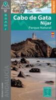
Wandelkaart Cabo de Gata / Nijar | Editorial Alpina
Zeer gedetailleerde wandelkaart van een klein gebied. Met ingetekende wandelroutes en andere informatie. Spaanstalig, maar uitstekende kaart. Coordinaten zijn weergegeven, dus GPS compatible met UTM grid.    Op de topografische wandelkaart worden o.a. berghutten, campings aangeduid en hoogtelijnen, ingetekende wandelroutes en de GR paden (doorgaande langeafstandswandelpaden).  Cabo da Gata-Níjar Natural Park in an extensive and very popular series of walking maps from Editorial Alpina covering the Pyrenees, Catalonia and other selected hiking areas in Spain, including Picos de Europa, Sierra Nevada and parts of Andalucía, Majorca, etc. Scales vary from 1:50,000 to 1:10,000, with the majority of the titles at 1:25,000. The maps have contours, usually at 20m or 10m intervals, with additional hill shading and spot heights. An overprint highlights hiking trails, long-distance footpaths, campsites, mountain huts, refuges, etc. Many maps also show climbing sites, potholing caves, mountain b…
17,95
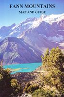
Wandelkaart - Topografische kaart Fann Mountains | EWP
Het Fann-gebergte maakt deel uit van het westelijke Pamir-Alay-gebergte in de provincie Sughd in Tadzjikistan, tussen het Zarafshan-gebergte in het noorden en het Gissar-gebergte in het zuiden.    This is one of a series of topographic maps of the mountain ranges of Central Asia.  The map is at a scale of 1:100,000 (1cm = 1km) and contours are shown at 50m intervals with master contours every 200m.  There are two smaller maps on the reverse, one at 1:100,000 of the ridges, passes, summits and glaciers and one at 1:5,000,000 showing the area covered within the map in it's location within Central Asia.   The reverse of the map is the guide which includes the following:   Location Geology and Relief Climate Glaciation Rivers and lakes Altitude Zoning Mountains and Passes Fauna History Population and language Guides and Donkeys Accommodation and food Conservation and Rubbish/Garbage Countryside and Traditions Useful local works in Russian and Tajik Access, Visas and Permits Useful Contact…
19,95
Wandelkaart Toubkal & Marrakech | Cordee
Een uitstekende (geplastificeerde) wandelkaart (1:50.000) van de omgeving van de Toubkal. Uitermate geschikt voor de beklimming en aansluitende trektocht. Met op de achterkant een stadsplattegrond van Marrakech. A detailed, accurate and up-to-date trekking map of Jebel Toubkal in the High Atlas mountains of Morocco, the highest peak in North Africa and popular trekking destination. A street plan of Marrakech is on the reverse. 1:50,000 topographic map detail includes contours at 20m intervals, hill-shading, woodland and scrub areas, springs, creeks, rivers and dry riverbeds. Road detail includes tracks and footpaths, and funicular railways and ski-lifts are also indicated. Isolated buildings are marked and symbols show ski-stations, refuges and religious buildings. A 1km UTM grid is drawn over the map and margin ticks are at 1’ intervals. n the reverse is a clear plan of Marrakech at approximately 1:8,700. It covers the Medina district and extends westwards to the main railway terminu…
19,95
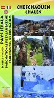
Wandelkaart Rif Occidental, Chefchaouen - Chauen | Editorial Piolet
 Gedetailleerde topografische wandelkaart van het westelijke Rifgebergte, Pays Jebala, het Parc national de Talassemtane en het Parc naturel de Bouhachem in Marokko. De kaart bestrijkt een gebied met een straal van 25-30 km rondom Chefchaouen, grofweg tussen Es Soukkane, Oued Laou, Bkikcha en Beni Derkoul.   De kaart toont hoogtelijnen (interval 20 m), ingetekende wandelroutes, accommodaties, bezienswaardigheden, klimgebieden, etc. Op de achterzijde staat informatie over het gebied in drie talen (Engels, Frans, Spaans).   -------   Chefchaouen (Chauen) region of northern Morocco, south-east of Tangier and Tetouan, at 1:75,000 on a contoured and GPS compatible map from Editorial Piolet, highlighting recommended hiking trails, various tourist facilities and places of interest, etc.    Topography is vividly presented by contours at 20m intervals, enhanced by relief shading and altitude colouring. The map shows local roads, country tracks and footpaths, and highlights nine recommended …
14,95
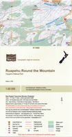
Wandelkaart Ruapehu - Round the Mountain | NewTopo NZ
Een kaartenserie van NewTopoNZ van vrijwel alle nationale parken, meerdaagse tochten en belangrijke wandelgebieden in Nieuw Zeeland. We hebben een selectie van de kaarten op voorraad.    Het zijn bijzonder leesbare kaarten met een helder kaartbeeld in goede kleurstelling. Alle belangrijke topografische details kun je er op terugvinden: hoogtelijnen, bergtoppen, stromen en rivieren, vegatatietype, gletsjers. De kaarten zijn bruikbaar samen met GPS.    Daarnaast is er toeristische informatie toegevoegd in de vorm van symbolen (zoals bruggen, stranden, watertaxi's, uitzichtspunten en parkeerplaatsen) en staan campings en hutten aangeduid. De wandelroutes zijn ingetekend met een rode lijn, verschillend naar gemarkeerd en ongemarkeerd, zelfs afstanden tussen hutten worden vaak vermeld.    This map shows the tramping route circumnavigating Mount Ruapehu in Tongariro National Park and its unique volcanic mountain environment at a scale where all features can be identified increasing both the…
9,95
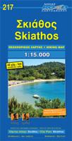
Wandelkaart 217 Skiathos | Road Editions
Gedetailleerde wegenkaart met aanduiding van de wandelwegen, lijst van hotels en toeristische informatie. Voor alle doeleinden een zeer geschikte kaart.   The features that make this and every other ROAD island map unique are: *The coastline, hydrography and precision geophysical background based on data provided by the Hellenic Military Geographic Service and electronically processed by us for clarity and legibility. We have highlighted the mountain masses in shades of brown between the contour lines (at 20m intervals on this map) to outline clearly the relief of the island. *The beaches are indicated by a special symbol next to which we have noted their names, as well as all the roads and footpaths leading to them (since most people primarily visit the islands for the beaches!). We have even included a short text in which the island’s best beaches are concisely referred to, to save you going on a wild goose hunt in search of them. *The road network is mapped out with impressive and …
9,95

Klanten-reviews van Wandelkaart Valjevske planine - mountain range | GeoSrbija

Er zijn nog geen beoordelingen voor dit productBen jij de eerste die een review plaatst?

Meer over Wandelkaart Valjevske planine - mountain range | GeoSrbija

Productomschrijving

Gedetailleerde wandelkaart met ingetekende wandelroutes. Hoogtelijnen, hutten staan vermeld. Op de achterzijde informatie over flora en fauna en toeristische bezienswaardigheden.

North-West Serbia   This map covers the popular tourist areas   Very detailed full colour topographc mapping   Footpaths and hiking trails clearly marked   Spot heights and relief shading   Contours at 20m vertical intervals   Reverse on map includes useful local information in English and Serbian

Productinformatie

    Verken gerelateerde categorieën

    Webshop.nl maakt gebruik van cookies. Ga je verder op onze website, ga dan akkoord met het plaatsen van cookies en de verwerking van deze data door ons en vermelde partners.