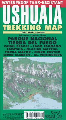
Wandelkaart Ushuaia Trekkingmap | Zagier & Urruty

0
Wandelkaart gebaseerd op satellietfoto met ingetekende hoogtelijnen, campsites, routes en hutten. The first trekking map of this legendary area. 40 meter contour lines, timed trails, shelters, camping and inns. Realistic relief based in satelital imagery. Tierra del Fuego National Park, Lapataia, Beagle Channel, Lake Fagnano, Martial Glacier, Tier...

Verkopers met dit product

Verkoper
Bezorging
Prijs
DeZwerver.nl logo
DeZwerver.nl
2,95
17,95

Anderen bekeken ook

Wegenkaart - landkaart - Wandelkaart trekkingmap Tierra del Fuego & Isla Navarino | Zagier & Urruty
Kaart gebaseerd op satellietfoto's met ingetekende hoogtelijnen, campsites, routes en hutten. Bedenk dat het allemaal wel heel globaal is, het is niet de meest ideale schaal om op te lopen. The Argentine and Chilean sectors of Tierra del Fuego. Satellital relief, winter resorts, secondary roads, tracks, distances. Special maps of Staten Land, Navarino Island and beagle Channel. The most updated available. Isla Navarino 1:200.000 rest 1:500.000
17,95
Wandelkaart Monte Fitz Roy - Cerro Torre - Lago del Desierto | Zagier & Urruty
Wandelkaart van het fascinerende Fitz Roy massif. Ideale kaart voor trekkings in de regio. Fitz Roy en Cerro Torre in schaal 50.000 en Lago del Desierto in 100.000 Trekking and mountaineering map based on aerophotography. Relief, contours forms, glaciers, woods, camping and trails. Geological chart and landsat image. Includes Lago del Desierto and Route 23 that reaches the zone. Also new trails and shelters. Landscape view of the peaks with their name and height. Afmeting 65 x 95 cm
17,95
Wegenkaart - landkaart Ushuaia to Antarctica - Drake Passage | Zagier & Urruty
Deze kaart is geschikt voor bootreizen van Ushuaia naar Antarctica. De kaart bevat behalve dieptemeters en stromingen ook de plaatsen van scheepswrakken en andere interessante plekken. The ship voyage from South America to the Antarctic Peninsula is a travel of a lifetime. After two days navigating on a sea of miles deep with the strongest and wildest currents and winds, the traveler arrives to a paradise for people looking for nature, history and adventure. This map is based in the Argentine Hydrographic Survey and the Ushuaia Maritime Museum charts and includes historic sites in the area as well as place for stamps and signatures from the ship and stations crew. A certificate for having crossed the Drake Passage is printed, too. afmeting 65 x 95 cm
17,95
Wegenkaart - landkaart Parque Nacional los Glaciares | Zagier & Urruty
LOS GLACIARES NATIONAL PARK ECOMAP The most incredible Park of Patagonia, including Perito Moreno Glacier and Mount Fitz Roy. Satellite relief, roads, navigation, camping, inns and estancias, etc. El Parque mas espectacular de la Patagonia, donde sobresalen el Glaciar Perito Moreno y el Monte Fitz Roy. Rutas, navegaciones, estancias turisticas, paradores, camping, etc. Spanish / English edition. Southern Patagonia’s main National Park, Los Glaciares, with the world's only advancing glacier. The map uses satellite imagery, enhanced with colours and hill-shading to give a vivid representation of the relief. Many local peaks, glaciers and other geographical features are marked and named. Road network includes unpaved roads and dirt tracks, with locations of petrol stations and intermediate driving distances. Ferry connections on the region’s numerous lakes are also indicated. Symbols highlight accommodation and restaurant facilites. Latitude and longitude lines are drawn at 15' intervals…
17,95
Wegenkaart - landkaart Antarctic Peninsula - Antarctica | Zagier & Urruty
Kaart van het Antarctisch Schiereiland met tekeningen van de voorkomende Fauna. Dit is het stuk van Antarctica waar vrijwel alle toeristen rondvaren op de cruiseschepen of zeilboten. The North of the Peninsula is the most visited part of Antarctica every summer. Glaciers, inlets and sailing ports, scientific stations, etc. On the back side large maps of the main visited islands and ports. Artistic drawings of birds and mammals.
17,95
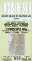
Wegenkaart - landkaart Lagos del Sur - Araucania - Puerto Montt - Bariloche | Zagier & Urruty
Overzichtskaart van dit met name door Zuidamerikanen zelf veel bezocht gebied. The most popular Parks of northern Patagonia: Nahuel Huapi, Lanin, Los Arrayanes, Villarrica, Puyehue, Alerce Andino, Vicente Perez Rosales, Hornopiren. Relief, roads, trails, distances, camping, fishing, etc. Roads to Bariloche, Puerto Montt, San Mart�n de los Andes, Alumine, El Bolson, La Angostura, Osorno, Temuco, Valdivia. afmeting 70 x 95 cm
17,95

Klanten-reviews van Wandelkaart Ushuaia Trekkingmap | Zagier & Urruty

Er zijn nog geen beoordelingen voor dit productBen jij de eerste die een review plaatst?

Meer over Wandelkaart Ushuaia Trekkingmap | Zagier & Urruty

Productomschrijving

Wandelkaart gebaseerd op satellietfoto met ingetekende hoogtelijnen, campsites, routes en hutten.

The first trekking map of this legendary area. 40 meter contour lines, timed trails, shelters, camping and inns. Realistic relief based in satelital imagery. Tierra del Fuego National Park, Lapataia, Beagle Channel, Lake Fagnano, Martial Glacier, Tierra Mayor, Cerro Krund, Winter ski resorts, etc. Ushuaia City plan.

Productinformatie

    Verken gerelateerde categorieën

    Webshop.nl maakt gebruik van cookies. Ga je verder op onze website, ga dan akkoord met het plaatsen van cookies en de verwerking van deze data door ons en vermelde partners.