Wandelkaart trekkingmap Kilimanjaro-Kibo | Climbing-map

0
Topographic and thematic climbing map with useful information and illustrations: city maps of Moshi and Arusha, description of climbing routes, trekking profiles, general map, vegetation profile, GPS information....

Verkopers met dit product

Verkoper
Bezorging
Prijs
DeZwerver.nl logo
DeZwerver.nl
2,95
21,95

Anderen bekeken ook

Wandelkaart trekkingmap Aconcagua | Climbing-map
Gedetailleerde kaart voor de beklimming van de Aconcagua met op de ene zijde een detailkaart van het hoogste gedeelte met schaal 1:40.000 en op de andere zijde een trekkingmap van de omgeving met de berg in een schaal van 1:100.000. Topographic and thematic climbing map with useful information and illustrations: city map of Mendoza, village map of Puente del Inca, trekking map, description of climbing routes, climatic diagram, vegetation profile, GPS information. Inhalt: Topografische und thematische Bergsteigerkarte 1:40.000 mit diversen Abbildungen und nützlichen Informationen.   Details: Vorderseite: + Topografische Karte Aconcagua im Massstab 1:40.000 + Legende + Panoramabild + Plan Boulderblöcke   Rückseite: + Trekkingkarte 1:100.000  + Streckenprofil von Trekkings und Aufstiegen + Stadtplan Mendoza  + Dorfplan Puente del Inca  + Beschreibung der Aufstiegsrouten in 4 Sprachen  + Routenskizzen von 3 verschiedenen Seiten + Vegetationsstufenprofil  + nützliche allgemeine Information…
21,95
Wandelkaart trekkingmap Elbrus | Climbing-map
Topographic climbing map; village map of Terskol, Cheget and Azau; general map 1:670'000; panorama map; description of climbing routes; route profile; vegetation illustrations, climatic diagram; GPS- information. Sprachen: Englisch, Deutsch, Russisch   Inhalt: Topografische Bergsteigerkarte, Dorfpläne Terskol, Cheget und Azau, Übersichtskarte 1:670'000, Panorama, Routenbeschreibungen, Streckenprofil, Vegetation, Klimadiagramm, GPS-Informationen.   Details: Vorderseite: + Topografische Karte Elbrus im Massstab 1:50.000 + Legende + Panoramabild + GPS Points + Dorfplan Azau   Rückseite: + Übersichtskarte 1:670.000  + Panoramaübersicht  + Elbrus-Chronik  + Streckenprofil  + Dorfplan Terskol  + Dorfplan Cheget  + Beschreibung der Aufstiegsrouten in 3 Sprachen  + Routenskizzen von Süd und Nord  + Flora-Übersicht  + nützliche allgemeine Informationen  + Koordinatensystem: WGS 84 / UTM - Netz      Idee:  Wer als Bergsteiger oder Trekkingtourist weltweit unterwegs ist, stellt bald einmal fest,…
21,95
Wandelkaart trekkingmap Cotopaxi - Ecuador | Climbing-map
Gedetailleerde kaart voor de beklimming van de Cotopaxi  met schaal 1:40.000, op de achterkant een overzichtskaart met schaal 1:250.000. Topographic climbing map with useful information and illustrations: city map of Quito, general map 1:250'000, Avenida de los Volcanes, description of climbing routes, vegetation profile, climatic diagram, GPS- information.. Sprachen: Englisch, Deutsch, Spanisch Inhalt: Topografische Bergsteigerkarte, Stadtplan Quito, Übersichtskarte 1:250'000, Avenida de los Volcanes, Krokis 5 weiterer Vulkane, Routenbeschreibungen, Vegetationsprofil, Klimadiagramm, GPS-Informationen.   + Koordinatensystem: WGS 84 / UTM - Netz    Idee:  Wer als Bergsteiger oder Trekkingtourist weltweit unterwegs ist, stellt bald einmal fest, dass vielerorts kaum brauchbares topografisches Kartenmaterial existiert. Von touristisch bedeutenden Bergen gibt es zwar oftmals haufenweise Bücher und Reiseführer, die Qualität der erhältlichen topografischen Karten lässt aber zu wünschen übrig…
21,95
Wandelkaart Kilimanjaro National Park Map | Harms IC Verlag
Detailed 1:100 000 topographic map of the extended National Park area contains controus, coloured elevation layers and vegetation zones. To improve its 3D impression of the relief, it includes a quality hillshading. The map shows the official Kilimanjaro trekking routes, all GPS approved and captured by mountain guides, also various map symbols with tourist information - huts, viewpoints, points of interest and more. Uselful additions are city maps of Arusha and Moshi, a detailed 1:50 000 of the Kibo area and a general map of northern Tanzania. English, German, French and Kisuaheli Comprehensive guide in englisha and german describing the tekking/climbing routes, the geology and botany of the area - also coloured photos. Das gesamte Nationalparkgebiet wird im Maßstab 1:100.000 detailgetreu wiedergegeben. Die Geländeformen werden durch Höhenlinien, farbige Höhenschichten und eine Reliefschummerung ideal repräsentiert. Die Karte enthält sämtliche aktuelle Trekkingrouten auf den Mount Ki…
14,75
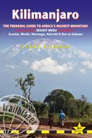
Wandelgids Kilimanjaro - A Trekking Guide to Africa's Highest Mountain | Trailblazer Guides
Dat dit boek je met de planning helpt is geen loze kreet. Werkelijk alle facetten van de berg en zijn omgeving komen aan bod. De auteur geeft informatie over hoe je een reis naar de Kili kunt boeken, hoe je er komt, wat je er kunt verwachten en hoe je vervolgens de top kunt bereiken. Maar hij is ook erg duidelijk voor wat betreft het bereiken van die top: doe dat alleen onder begeleiding van een erkende gids en doe het op je gemak. Kilimanjaro is immers niet voor niets de hoogste berg van Afrika en daarmee één van de beruchte 'seven summits'. Practical, best-selling guide to climbing Mount Kilimanjaro, Africa's highest mountain and most popular trek.   Fully updated 6th edition with amendments in 2024.   At 5895m (19,341ft) Kilimanjaro is Africa's highest mountain. Yet with no mountaineering skills necessary to reach the summit, even non-climbers can experience the thrill of climbing one of the world's greatest peaks. Taking you from the dusty plains of East Africa through jungle…
25,95
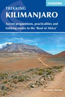
Wandelgids Kilimanjaro trekking | Cicerone
Goede trekking - wandelgids van de Kilimanjaro. Beklimmingen kunnen van alle kanten in vele vormen en vrijwel alle routes staan goed beschreven  in deze gids. Veel praktische informatie en een duidelijke routebeschrijving, duidelijke enigszins schetsmatige kaarten en een uitgebreide inleiding over wat je wel en niet moet meenemen, regelen en voorbereiden. At 5895m, Kilimanjaro is Africa's highest point and the highest freestanding mountain in the world, yet it is possible to reach its summit, Uhuru Peak, without any technical climbing ability. However, that is not to say that it is an easy undertaking: each year, many people fail in their attempt, often due to poor preparation or insufficient acclimatisation. Those who do make it to 'the Roof of Africa' are richly rewarded, enjoying outstanding views, the unique experience of being 'on top of the world' and, of course, a tremendous sense of achievement.   Guidebook describing all the trekking routes on Kilimanjaro (5895m), one of the …
23,95
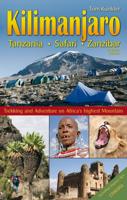
Reisgids Klimgids Kilimanjaro, Tanzania, Safari, Zanzibar | Tom Kunkler
Uitgebreide wandelgids, klimgids en reisgids in één.   Updated in 2015, this book offers a complete and comprehensive guide for climbing Mount Kilimanjaro in Tanzania. Well-known in Germany for many years and now, finally available in English! The author, Tom Kunkler, documents detailed and exciting information of his successful climbs up Mount Kilimanjaro via all six routes, as well as Mount Meru and Ol Doinyo Lengai. Included are important insider tips from A to Z, from altitude training to Zanzibar.    Political and cultural history, information about Tanzania s world famous national parks, and the spice island of Zanzibar are presented to the reader in detail and with remarkable color photos. Tom Kunkler's familiarity with the legendary Maasai provides additional fascinating insights into Tanzania.  364 pages 295 photos 35 maps and city maps 6 elevation profiles All current routes Tips from A-Z Health and medicine Climate, flora and fauna People and the country and more
23,95

Klanten-reviews van Wandelkaart trekkingmap Kilimanjaro-Kibo | Climbing-map

Er zijn nog geen beoordelingen voor dit productBen jij de eerste die een review plaatst?

Meer over Wandelkaart trekkingmap Kilimanjaro-Kibo | Climbing-map

Productomschrijving

Topographic and thematic climbing map with useful information and illustrations: city maps of Moshi and Arusha, description of climbing routes, trekking profiles, general map, vegetation profile, GPS information.

Productinformatie

    Verken gerelateerde categorieën

    Webshop.nl maakt gebruik van cookies. Ga je verder op onze website, ga dan akkoord met het plaatsen van cookies en de verwerking van deze data door ons en vermelde partners.