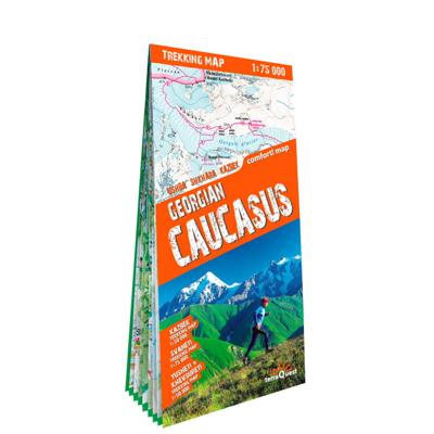
Wandelkaart Trekking map Georgian Caucasus - Trekking map Georgië Kaukasus | TerraQuest

0
Uitstekende wandelkaart van een deel van de Kaukasus. Alle noodzakelijke gegevens staan er op, de kaart is gebaseerd op topografische kaarten en voorzien van ingetekende wandelroutes. De kaart is geplastificeerd.   Kazbek trekking map in scale 1:50'000 Svaneti trekking map in scale 1:75'000 Tusheti & Khevsureti trekking map in scale 1:110'000 Lami...

Verkopers met dit product

Verkoper
Bezorging
Prijs
DeZwerver.nl logo
DeZwerver.nl
2,95
18,50

Anderen bekeken ook

Wandelkaart Trekking map Aconcagua | TerraQuest
Gedetailleerde wandelkaart - trekking map van de Aconcagua en omgeving. Handig uitgevoerd: geplastificeerd maar toch makkelijk om te slaan en op te vouwen met de gewenste kant voor. De wandelroutes staan ingetekend, zo ook de berghutten en kampen. Dé kaart om de hoogste berg van Zuid Amerika te beklimmen. Laminated topographic map of Mount Aconcagua (Argentina) published by Terra Quest in 2013. Waterproof and tear-resistant, contoured and GPS compatible map, providing coverage of the Aconcagua Provincial Park with access from the road linking Punta de Vascas, Los Penitentes, Puente del Inca and the Cristo Redentor Tunnel crossing to Chile.   The map divides the area north/south with a good overlap between the sides, extending north to Cerro La Mano on the northern boundary of the park, and south of the road to include Cerro Panitentes. A hiking map characterized by topographic data (contours). An overprint highlights the approach routes to Aconcagua, indicating main trails and difficu…
18,50
Nieuw
Wandelkaart Trekking map Central Pyrenees - Pyreneeën | TerraQuest
Uitstekende wandelkaart van een deel van de Pyreneën. Alle noodzakelijke gegevens staan er op, de kaart is gebaseerd op topografische kaarten en voorzien van ingetekende wandelroutes. De kaart is geplastificeerd. Voor een uitsnede welk gebied deze kaart dekt. This is the 1:50,000 trekking map for the Central Pyrenees covering Lourdes, Trebons and Capvern on the north edge of the map and down to Monte Perdido in the south.   Terraquest say 'TerraQuest maps are designed and developed primarily for tourists preparing for treks to remote corners of the world. Our proven map laminating technology allows you to freely use the maps even in harsh conditions, while appreciating the clear and easy-to-read information compiled by our team of qualified cartographers. The distinctive feature of terraQuest laminated maps is the manufacturing method. Due to a special lamination process and patented map joining techniques, the maps easily adjust to your choice of format , even for one-hand use only. …
18,50
Nieuw
Wandelkaart Trekking map Drakensbergen - Zuid Afrika | TerraQuest
Geplastificeerde trekking-kaart. Relatief zeer gedetailleerd. Het Ukhahlamba Park ligt op de grens van Zuid-Afrika en Lesotho met de hoogste berg en het meest interessante gebied van de Draak. Met wandelroutes, toeristische info, GPS coordinaten in WGS-84. Hiking map of the Drakensberg in the Ukhahlamba Park, on the South Africa and Lesotho border. Waterproof and tear resistant map published by Terraquest. The map is double-sided and covers the park in two overlapping sections. Coverage extends north-west to include the Royal Natal National Park. The map covers the entire Ukhahlamba Park - the highest in the Drakensberg area.   The map is distinguished by its topographical accuracy (contour) and the detailed content focused on tourism (symbols show locations of hotels, mountain refuges and campsites, bivouac and picnic places, restaurants, car parks and petrol stations, medical facilities, viewpoints, etc...) The map shows rural roads and footpaths, and highlights trekking trails indi…
18,50
Wandelkaart Trekking map Lake Como - Lago di Como | TerraQuest
Uitstekende wandelkaart van het gebied rond het Comomeer. Alle noodzakelijke gegevens staan er op, de kaart is gebaseerd op topografische kaarten en voorzien van ingetekende wandelroutes. De kaart is geplastificeerd. terraQuest maps are designed and developed primarily for tourists preparing for treks to remote corners of the world. Our proven map laminating technology allows you to freely use the maps even in harsh conditions, while appreciating the clear and easy-to-read information compiled by our team of qualified cartographers. The distinctive feature of terraQuest laminated maps is the manufacturing method. Due to a special lamination process and patented map joining techniques, the maps easily adjust to your choice of format , even for one-hand use only. They are exceptionally durable and may be folded repeatedly. You can also add and erase your own notes directly onto the map with an erasable pen without damage to the map.  
18,50
Wandelkaart Trekking map Madeira | TerraQuest
De kracht zit hem in het feit dat deze kaart in delen is geplastificeerd en daardoor ook - ondanks de plastic laag - makkelijk in delen is te vouwen. Deze kaart is gericht op het wandelen met de ingetekende wandelroutes in rood en groen.  Terraquest say 'TerraQuest maps are designed and developed primarily for tourists preparing for treks to remote corners of the world. Our proven map laminating technology allows you to freely use the maps even in harsh conditions, while appreciating the clear and easy-to-read information compiled by our team of qualified cartographers. The distinctive feature of terraQuest laminated maps is the manufacturing method. Due to a special lamination process and patented map joining techniques, the maps easily adjust to your choice of format , even for one-hand use only. They are exceptionally durable and may be folded repeatedly. You can also add and erase your own notes directly onto the map with an erasable pen without damage to the map'
12,50
Nieuw
Wandelkaart Trekking map Indian Himalaya | TerraQuest
Mooie gedetailleerde kaart, geplastificeerd. De kaart heeft op de ene kant een algemeen overzicht van de Indische Himalaya met schaal 1/750.000 en op de andere zijde vind je de 22 trekking routes op schaal 1/350.000. Op zich geen zeer gedetailleerde wandelkaart. Er van uitgaande dat je de tochten toch met een gids of met een groep doet, dan is dit een uitstekende kaart. Dubbelzijdig geplastificeerde wandelkaart en overzichtskaart van de Indiase Himalaya (Noord-India) en op de achterzijde inzetkaarten met hoogtelijnen en trekkingroutes en voetpaden ingetekend van verschillende wandelroutes in Kashmir, Ladakh, Zanskar, Lahul, Rupshu, Spiti, Kinnaur, Garhwal, Kumaon en Sikim en verder toeristische informatie in symbolen aangegeven
22,50
Nieuw
Wandelkaart Trekking map Annapurna Dhaulagiri | TerraQuest
De kracht zit hem in het feit dat deze kaart in delen is geplastificeerd en daardoor ook - ondanks de plastic laag - makkelijk in delen is te vouwen. Deze kaart is gericht op de trekkings in het gebied die nauwkeurig staan ingetekend, zo ook de mogelijke campsites onderweg.  Terraquest say 'TerraQuest maps are designed and developed primarily for tourists preparing for treks to remote corners of the world. Our proven map laminating technology allows you to freely use the maps even in harsh conditions, while appreciating the clear and easy-to-read information compiled by our team of qualified cartographers. The distinctive feature of terraQuest laminated maps is the manufacturing method. Due to a special lamination process and patented map joining techniques, the maps easily adjust to your choice of format , even for one-hand use only. They are exceptionally durable and may be folded repeatedly. You can also add and erase your own notes directly onto the map with an erasable pen withou…
18,50
Nieuw
Wandelkaart Trekking map Rila - Pirin | TerraQuest
De kracht zit hem in het feit dat deze kaart in delen is geplastificeerd en daardoor ook - ondanks de plastic laag - makkelijk in delen is te vouwen. Deze kaart is gericht op het wandelen met de ingetekende wandelroutes in rood en groen. Op de ene kant staat het Pirin geberhte en op de andere zijde her Rila gebergte.   Terraquest say 'TerraQuest maps are designed and developed primarily for tourists preparing for treks to remote corners of the world. Our proven map laminating technology allows you to freely use the maps even in harsh conditions, while appreciating the clear and easy-to-read information compiled by our team of qualified cartographers. The distinctive feature of terraQuest laminated maps is the manufacturing method. Due to a special lamination process and patented map joining techniques, the maps easily adjust to your choice of format , even for one-hand use only. They are exceptionally durable and may be folded repeatedly. You can also add and erase your own notes dire…
18,50
Nieuw
Wandelkaart Fagaras | TerraQuest
De kracht zit hem in het feit dat deze kaart in delen is geplastificeerd en daardoor ook - ondanks de plastic laag - makkelijk in delen is te vouwen. Deze kaart is gericht op het wandelen met de ingetekende wandelroutes in rood en groen.  Terraquest say 'TerraQuest maps are designed and developed primarily for tourists preparing for treks to remote corners of the world. Our proven map laminating technology allows you to freely use the maps even in harsh conditions, while appreciating the clear and easy-to-read information compiled by our team of qualified cartographers. The distinctive feature of terraQuest laminated maps is the manufacturing method. Due to a special lamination process and patented map joining techniques, the maps easily adjust to your choice of format , even for one-hand use only. They are exceptionally durable and may be folded repeatedly. You can also add and erase your own notes directly onto the map with an erasable pen without damage to the map'
18,50

Klanten-reviews van Wandelkaart Trekking map Georgian Caucasus - Trekking map Georgië Kaukasus | TerraQuest

Er zijn nog geen beoordelingen voor dit productBen jij de eerste die een review plaatst?

Meer over Wandelkaart Trekking map Georgian Caucasus - Trekking map Georgië Kaukasus | TerraQuest

Productomschrijving

Uitstekende wandelkaart van een deel van de Kaukasus. Alle noodzakelijke gegevens staan er op, de kaart is gebaseerd op topografische kaarten en voorzien van ingetekende wandelroutes. De kaart is geplastificeerd.   Kazbek trekking map in scale 1:50'000 Svaneti trekking map in scale 1:75'000 Tusheti & Khevsureti trekking map in scale 1:110'000 Laminated

Productinformatie

    Verken gerelateerde categorieën

    Webshop.nl maakt gebruik van cookies. Ga je verder op onze website, ga dan akkoord met het plaatsen van cookies en de verwerking van deze data door ons en vermelde partners.