Wandelkaart Trekking map Ganesh Himal - Paldor Base Camp | Himalayan Maphouse

0
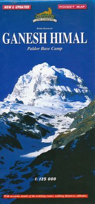
Bijzonder handige pocketmap van het gebied in Ganesh Himal met Paldor Base Camp . Vrij grove schaal, maar juist op trek goed te gebruiken, Details en begeleiding komt toch van de Nepali-crew, dit geeft meer een prachtig overzicht van hoe de route loopt en de hoge pieken die je ziet. ...

Verkopers met dit product

Verkoper
Bezorging
Prijs
DeZwerver.nl logo
DeZwerver.nl
2,95
8,95

Anderen bekeken ook

Wandelkaart NP108 Mustang - Nepal | Himalayan Maphouse
  Zeer gedetailleerde topografische wandelkaart. Dit is een nieuwe serie kaarten die de Great Himalaya Trail (GHT) in Nepal volgt. Kaart 1 begint in het oosten van Nepal, de volgende kaarten lopen richting noordwest  tot India.    Watervaste trekkingkaart met ingetekende GHT High route en andere belangrijke trekkingroutes in de omgeving: GHT Cultural Trail, Main Trekking Route. Geeft wandelwegen weer, hoogtelijnen, nederzetingen, campings, tempels en kloosters, tourist infos, hotels etc.   The Far West is one of the least explored areas of Nepal. Its area is bounded to the east by mighty, turquoise Karnali river which flows from Tibet's sacred Mount Kailash. Myth and superstition remain part of the fabric of life here. One Nepali visitor described his visit as “fascinating, like travelling back to the 18th century.”   Humla, the Hidden Himalaya, is also known as the Gateway to Mt. Kailash and many pilgrims make their way along the turquoise Karnali river, 'the pulse of the earth', …
19,95
Wandelkaart NE513 Dolpo circuit | Himalayan Maphouse
De kaart als het gaat om de mooie routes in Dolpo: helder kaartbeeld, goed leesbaar met alle noodzakelijke gegevens. De trekking routes staan er goed op ingetekend. Schaal lijkt grof maar is meer dan voldoende, je mag er immers toch niet zo maar dwalen: alles moet met een lokale gids. Maar wel een prachtige kaart voor het overzicht. Gebied op de kaart: Jumla in het westen, Juphal en Tarakot in het zuiden, Saldang in het noorden en Dho Tarap en Tinje in het oosten    
12,95
Wandelkaart NS504 Upper and Lower Dolpa - Dolpo | Himalayan Maphouse
Goede duidelijk leesbare  map voor trekkings in Dolpo. Van Juphal en Jejargaon in het westen tot Kagbeni in Mustang aan de oostkant van de kaart. De trekkingroutes staat goed ingetekend. Shey Phoksundo National Park staat er ook geheel op.  Large area centred on Dho Tarap, lying between the Upper and Lower Dolpa regions, in the Nepa Maps series which provides extensive coverage of trekking areas of Nepal on detailed contoured maps with trekking routes and hiking trails, huts and camp sites, local places of interest and other tourist information.   Cartography is based on the country’s topographic survey, with contours usually at 40m or 50m intervals, enhanced by relief shading, colouring and graphics to show various features of the terrain, including glaciers, forested or cultivated areas, etc. Numerous peaks, with additional spot heights, plus names of glaciers and mountain ranges are prominently shown. The network of rivers, streams and lakes is shown in great detail, with many smal…
12,95
Wandelkaart 3001 Adventure Map trekking map Everest Base Camp | National Geographic
Mooie gedetailleerde topografische kaart, voorzien van veel extra info en gedrukt op water- en scheurvast materiaal. Each Adventure Map is highly detailed, incredibly durable, waterproof and tear-resistant. Stunning shaded relief brings each map to life, giving you the power to discover, plan and dream. Trail routes, villages, cultivated areas, park boundaries and points of interest make these maps essential gear. Each map includes a beautifully crafted map of the Kingdom of Nepal, inset maps of Kathmandu and Thamel, and a comprehensive index of villages, passages and peaks. The very name evokes majesty, mystery and magnificence! Earth's highest peaks soar above, beckoning adventurers to one of the world's most dramatic regions. Includes trail routes, villages, cultivated areas, park boundaries, and points of interest. Printed on waterproof, tear-resistant material that stands up to the rigors of travel. Follow National Geographic to one of the world's most exotic locations with this …
16,50

Klanten-reviews van Wandelkaart Trekking map Ganesh Himal - Paldor Base Camp | Himalayan Maphouse

Er zijn nog geen beoordelingen voor dit productBen jij de eerste die een review plaatst?

Meer over Wandelkaart Trekking map Ganesh Himal - Paldor Base Camp | Himalayan Maphouse

Productomschrijving

Bijzonder handige pocketmap van het gebied in Ganesh Himal met Paldor Base Camp . Vrij grove schaal, maar juist op trek goed te gebruiken, Details en begeleiding komt toch van de Nepali-crew, dit geeft meer een prachtig overzicht van hoe de route loopt en de hoge pieken die je ziet. 

Productinformatie

    Verken gerelateerde categorieën

    Webshop.nl maakt gebruik van cookies. Ga je verder op onze website, ga dan akkoord met het plaatsen van cookies en de verwerking van deze data door ons en vermelde partners.