webshop.nl
Categorieën
  Sluiten

Wandelkaart Trekking map Drakensbergen - Zuid Afrika | TerraQuest

Geplastificeerde trekking-kaart. Relatief zeer gedetailleerd. Het Ukhahlamba Park ligt op de grens van Zuid-Afrika en Lesotho met de hoogste berg en het meest interessante gebied van de Draak. Met wandelroutes, toeristische info, GPS coordinaten in WGS-84. Hiking map of the Drakensberg in the Ukhahlamba Park, on the South Africa and Lesotho border....
18,50

Webshops met dit product

Webshop
Bezorging
Prijs

Anderen bekeken ook

Wandelkaart Trekking map Aconcagua | TerraQuest
Gedetailleerde wandelkaart - trekking map van de Aconcagua en omgeving. Handig uitgevoerd: geplastificeerd maar toch makkelijk om te slaan en op te vouwen met de gewenste kant voor. De wandelroutes staan ingetekend, zo ook de berghutten en kampen. Dé kaart om de hoogste berg van Zuid Amerika te beklimmen. Laminated topographic map of Mount Aconcagua (Argentina) published by Terra Quest in 2013. Waterproof and tear-resistant, contoured and GPS compatible map, providing coverage of the Aconcagua Provincial Park with access from the road linking Punta de Vascas, Los Penitentes, Puente del Inca and the Cristo Redentor Tunnel crossing to Chile.   The map divides the area north/south with a good overlap between the sides, extending north to Cerro La Mano on the northern boundary of the park, and south of the road to include Cerro Panitentes. A hiking map characterized by topographic data (contours). An overprint highlights the approach routes to Aconcagua, indicating main trails and difficul…
18,50
Wegenatlas Traveller's Atlas Southern Africa - Zuidelijk Afrika | A3-Formaat | Ringband | Tracks4Africa
Deze atlas omvat tien landen in zuidelijk Afrika en is speciaal gericht op reizigers die zelf rijden. De betrokken landen zijn: Angola, Botswana, Lesotho, Malawi, Mozambique, Namibië, Zuid-Afrika, Swaziland, Zambia en Zimbabwe.   De Atlas bevat 223 kaartpagina's met hetzelfde vertrouwde kaartdetail waarvoor Tracks4Africa bekend is.   De wegenatlas is afgedrukt in A3 formaat, weegt 2750g, heeft een stevige omslag, spiraal gebonden en de pagina's zijn afgedrukt op dik papier.   Bigger coverage than ever before: 1:4m maps for Southern and Eastern Africa – ideal for macro planning. 1:1m maps for Southern Africa, covering the following countries: Angola, Botswana, eSwatini, Lesotho, Malawi, Mozambique, Namibia, South Africa, Zambia and Zimbabwe. 1:500k maps for South Africa, Malawi, most part of Zambia and the area around Moremi/Chobe in Botswana. Road coverage: This Atlas is designed for overland travel and compiled from the same data used on our famous GPS maps. Use it for trip pl…
79,95
Wegenkaart - landkaart - Wandelkaart Jasper National Park (Alberta) | Gem Trek Maps
Waterproof and tear-resistant map for Jasper National Park in the Canadian Rockies.   Whether you are a first-time visitor or a long-time local, you’ll find Gem Trek’s Jasper National Park Map to be an invaluable tool. Researched and designed by locals, and printed in Canada, this map features accurate cartography and subtly colored relief that puts the mountainous region in perspective. The map is printed on high-quality synthetic waterproof paper that can be folded and refolded hundreds of times.   The 1:250,000 scale is ideal for discovering the very best of Jasper National Park. Highlights and our recommended hiking trails are marked by numbered stars, then cross-referenced on the reverse side with descriptions. Also included are all mountains and their elevations, along with natural features such as waterfalls, hot springs, and glaciers.   In addition to descriptions for the top highlights and most popular hiking trails, the reverse side has inset maps for the town of Jasper…
16,95
Wegenkaart - landkaart 04 Mpumalanga, Kruger National Park & Panorama Route | MapStudio
Toeristische wegenkaart met veel aanduidingen van interessante punten. Heldere kaart, goed leesbaar. speciaal stukje Africa: Mpumalanga, Kruger National Park and Panorama Route Road Map covers the entire Kruger National Park, includes a detailed exploring map of Mpumalanga and the Panorama Route, plans of camps in the Kruger National Park and is up-to-date with all research compiled and updated in Africa   Detailed streetmaps and site maps with text and photography of Pilgrims Rest, Mashishing (Lydenburg), Dullstroom, Sudwala Caves, eMakhazeni (Belfast), eNtokozweni (Machadodorp), White River, Sabie, eMgwenya (Waterval Boven), Hazyview, Mbombela (Nelspruit) and Barberton   Easy-to-use map symbols showing hotel, lodges, rest camps, campsites, concession areas, bush camps, private rest camps and lodges, caravan facilities, caves, lookout points, waterholes, hides and much more. Information on hiking, trekking, walking and fly-fishing areas. Along with an alphabetised index, enlarged map …
16,95
Wandelkaart Ruka Oulanka Karhunkierros | Karttakeskus
Prachtige wandelkaart van dit mooie, wilde natuurgebied in Noordoost Finland. Gedetailleerde topografische wandelkaart van Finland met hoogtelijnen en aangegeven natuurparken. De kaart bevat ook ski- en wandelroutes, Loipen, kanoroutes en toeristische informatie als hutten, campings, hotels en bezienswaardigheden.   The outdoor map Ruka Oulanka Karhunkierros 1:50 000 / 1:25 000 is printed on synthetic material. The durable Finnish outdoor maps can be identified by the yellow marking on the cover.   The double-sided map covers the most beautiful trekking areas of Kuusamo. Included are the popular Karhunkierros (Bear's Trail) Hiking Trail, Oulanka National Park, the hiking trails and cross-country ski trails in the vicinity of Ruka Resort and the inviting fishing spots of the River Kuusinkijoki. The region is popular among cross-country skiers, hikers, fishers and snowmobilers.   The material of the map is fully waterproof and can withstand almost limitless folding, and it will not …
22,95
Wegenkaart - landkaart Zuid Afrika - South Africa | ITMB
Uitstekende wegenkaart van Zuid Afrika met zowel de toeristische informatie als Nationale Parken en bezienswaardigheden, maar ook de topografische details en afstanden. Gedrukt op 'waterproof' papier. Double-sided map of South Africa printed on waterproof and tear-resistant synthetic paper, with plans of Cape Town, Johannesburg and Pretoria. The map divides the country east/west with a small overlap between the two sides. Elevation tinting in feet shows the general relief. Mountain passes are marked, but there are no spot heights. Road network includes selected local tracks, gives driving distances on major and secondary roads and indicates border crossings. Railways, major ferry connections and local airports are also shown. National parks and protected areas are marked and symbols highlight various places of interest, campsites or huts, rest houses and other tourist accommodation, beaches and diving sites, etc. Presentation of Lesotho and Swaziland is the same as for South Africa. La…
13,95
Fietskaart 01 Cycling guides Cornwall | Goldeneye
Our maps are double-sided, printed on an A2 sheet with a concertina fold. This allows for easy folding and folding, and an ease of access to the mapping. The material is rain and tear-resistant. Our early maps were designed at the scale of 2 miles to 1 inch/1:126,720. The later designs along with digitalisation are 1: 100,000. We were encouraged by the Cycle Touring Club to convert our cartography toward the cycle market (to replace the out-of-print Bartholomew series). As time and the series progressed we have added more data: The National Cycle Network routes, Regional Routes, and Traffic-Free Family Routes, as and when they are developed. These routes are in addition to the Circular Routes Goldeneye Commissioned at the outset of our publishing schedule. We are also adding to new editions; bike shops, cycle hire, and tea rooms, along with the tourist attractions already featured. Our plan is to make available digital versions for cell phones and tablets and to update, on an annual ba…
15,95
Wandelkaart Trekking map Central Pyrenees - Pyreneeën | TerraQuest
Uitstekende wandelkaart van een deel van de Pyreneën. Alle noodzakelijke gegevens staan er op, de kaart is gebaseerd op topografische kaarten en voorzien van ingetekende wandelroutes. De kaart is geplastificeerd. Voor een uitsnede welk gebied deze kaart dekt. This is the 1:50,000 trekking map for the Central Pyrenees covering Lourdes, Trebons and Capvern on the north edge of the map and down to Monte Perdido in the south.   Terraquest say 'TerraQuest maps are designed and developed primarily for tourists preparing for treks to remote corners of the world. Our proven map laminating technology allows you to freely use the maps even in harsh conditions, while appreciating the clear and easy-to-read information compiled by our team of qualified cartographers. The distinctive feature of terraQuest laminated maps is the manufacturing method. Due to a special lamination process and patented map joining techniques, the maps easily adjust to your choice of format , even for one-hand use only. T…
18,50
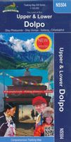
Wandelkaart NS504 Upper and Lower Dolpa - Dolpo | Himalayan Maphouse
Goede duidelijk leesbare  map voor trekkings in Dolpo. Van Juphal en Jejargaon in het westen tot Kagbeni in Mustang aan de oostkant van de kaart. De trekkingroutes staat goed ingetekend. Shey Phoksundo National Park staat er ook geheel op.  Large area centred on Dho Tarap, lying between the Upper and Lower Dolpa regions, in the Nepa Maps series which provides extensive coverage of trekking areas of Nepal on detailed contoured maps with trekking routes and hiking trails, huts and camp sites, local places of interest and other tourist information.   Cartography is based on the country’s topographic survey, with contours usually at 40m or 50m intervals, enhanced by relief shading, colouring and graphics to show various features of the terrain, including glaciers, forested or cultivated areas, etc. Numerous peaks, with additional spot heights, plus names of glaciers and mountain ranges are prominently shown. The network of rivers, streams and lakes is shown in great detail, with many small…
12,95
Wandelkaart Banff - Egypt Lake | Gem Trek Maps
Mooie, gedetailleerde kaart uit de serie van Gem Trek Hiking map-guides. Helder kleurgebruik en met de beste / mooiste wandelroutes, hikes en interessante plaatsen erop aangegeven. Gem Trek’s 1:50,000-scale BANFF–EGYPT LAKE MAP covers the most popular hiking trails in the immediate area of the town of Banff in more detail than our Banff & Mount Assiniboine Map.   The Banff–Egypt Lake Map features detailed cartography, accurate hiking trails with distances, and details such as side trips and backcountry campgrounds. For road travellers, it includes viewpoints, picnic areas, and campgrounds.   On the back of the map are trail descriptions of 17 recommended day hikes and four classic multi-day trips, all referenced to the map on the front. Also on the back is a list of trails recommended for early season, birdwatching, wildflowers, waterfalls, expansive views, awe-inspiring scenery, alpine meadows and rainy days. Included are contact numbers for visitor centres and backcountry bookin…
17,95

Klanten-reviews van Wandelkaart Trekking map Drakensbergen - Zuid Afrika | TerraQuest

Er zijn nog geen beoordelingen voor dit productBen jij de eerste die een review plaatst?

Meer over Wandelkaart Trekking map Drakensbergen - Zuid Afrika | TerraQuest

Productomschrijving

Geplastificeerde trekking-kaart. Relatief zeer gedetailleerd. Het Ukhahlamba Park ligt op de grens van Zuid-Afrika en Lesotho met de hoogste berg en het meest interessante gebied van de Draak. Met wandelroutes, toeristische info, GPS coordinaten in WGS-84. Hiking map of the Drakensberg in the Ukhahlamba Park, on the South Africa and Lesotho border. Waterproof and tear resistant map published by Terraquest. The map is double-sided and covers the park in two overlapping sections. Coverage extends north-west to include the Royal Natal National Park. The map covers the entire Ukhahlamba Park - the highest in the Drakensberg area.   The map is distinguished by its topographical accuracy (contour) and the detailed content focused on tourism (symbols show locations of hotels, mountain refuges and campsites, bivouac and picnic places, restaurants, car parks and petrol stations, medical facilities, viewpoints, etc...) The map shows rural roads and footpaths, and highlights trekking trails indicating difficult sections.   It has been specially designed for lovers of active leisure considering embarking on a trek in the Drakensberg. Fully laminated trekking map, which ensures easy handling, even in the worst weather in the mountains. Indication of hiking trails, tourist facilities, natural attractions and other tourist attractions, shaded relief, representing the three-dimensional topography of the region. GPS compatibility (geographic coordinates WGS84). Scale 1 : 100,000.  
Webshop.nl maakt gebruik van cookies. Ga je verder op onze website, ga dan akkoord met het plaatsen van cookies en de verwerking van deze data door ons en vermelde partners.