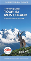
Wandelkaart Tour du Mont Blanc | Knife Edge Outdoor

0
Wandelkaart Tour du Mont Blanc – Alle accommodaties, eten & vervoer op één kaart De enige wandelkaart voor de Tour du Mont Blanc waarop álle accommodaties, eetgelegenheden en transportopties staan vermeld. De volledige route én varianten op één overzichtelijke kaart – ideaal voor planning en navigatie. Schaal 1:40.000 – groter en gedetailleerder...

Verkopers met dit product

Verkoper
Bezorging
Prijs
DeZwerver.nl logo
DeZwerver.nl
niet bekend
2,95
22,95

Anderen bekeken ook

Wandelkaart Tour du Mont Blanc | Knife Edge Outdoor
Wandelkaart Tour du Mont Blanc – Alle accommodaties, eten & vervoer op één kaart De enige wandelkaart voor de Tour du Mont Blanc waarop álle accommodaties, eetgelegenheden en transportopties staan vermeld. De volledige route én varianten op één overzichtelijke kaart – ideaal voor planning en navigatie. Schaal 1:40.000 – groter en gedetailleerder dan andere enkele-kaartopties Speciaal ontworpen voor de TMB door Knife Edge Outdoor Guidebooks Alle voorzieningen gemarkeerd: accommodaties, eten, vervoer Legenda in Engels, Frans en Duits Inclusief talloze varianten van de hoofdroute Gratis GPX-downloads van de wandelroute GPS-compatibel Sterker en scheurvaster dan traditionele kaarten Beter waterbestendig dan standaard wandelkaarten Lichter van gewicht – ideaal voor op de rugzak De ultieme kaart voor de Tour du Mont Blanc De legendarische Tour du Mont Blanc is een van de mooiste meerdaagse wandeltochten van Europa. Deze spectaculaire route doorkruist de bergen …
22,95
Wandelgids Tour Du Mont Blanc | Knife Edge Outdoor
Overzichtelijke routegids van deze prachtige wandelroute. Per etappe vind je een hoogteprofiel, goede beschrijvingen van de wandelroute, een topografische kaart op gedetailleerde schaal. Voor en achterin de gids staat aanvullende praktische informatie zoals adressen van campings, andere accommodaties en bijvoorbeeld een paar pagina's over de flora en fauna.    Complete guidebook for planning and trekking the Tour du Mont Blanc, the world's most famous trek   Real maps for each stage: 1:25,000. No need to buy a separate map!   Unique Itinerary Planner: plan a bespoke itinerary to match your ability and vacation schedule. All difficult calculations of time, distance and altitude gain are done for you   Everything the trekker needs to know: route descriptions, costs, budget, difficulty, weather, how to get there, and more   Full accommodation listings: spectacularly situated mountain huts, villages and hamlets   Full section on camping: a complete list of camping locations   10 exciting …
20,95
Wandelgids Walking Chamonix Mont Blanc | Knife Edge Outdoor
The 20 hikes in the Chamonix Valley that need to be on your Bucket List. No fillers. Only must-do hikes are included.   Real IGN Maps inside: 1:25,000 Detailed information on public transport, including cable cars Our secret tips on how to get away from the crowds Numbered waypoints linking the Real Maps to our clear descriptions Graded routes to suit all abilities Everything the hiker needs to know: route descriptions, difficulty, weather, how to get there, and more Information on Wildlife and Plants   Our walks have been carefully selected to enable easy access by public transport, including the Chamonix Valley’s incredible cable car network.   Chamonix is the most famous mountain town in the world. It is where mountaineering began.  Its peerless reputation owes everything to the mighty Mont Blanc, the highest peak in Western Europe: our hikes will take you to the finest viewpoints of the mountain and its glaciers.
19,50
Wandelkaart Tour des Combins trekking map | Knife Edge Outdoor
The best sheet map for the Tour des Combins. Displays the entire route and variants on a single sheet: perfect for planning and navigation.       1:40,000 - larger scale and more detail than any other map.       Made specifically for the Tour des Combins by Knife Edge Outdoor Guidebooks:       English/French/German map key 1:40,000 Numerous variants Includes free GPX downloads for the trail GPS compatible Tougher than traditional maps: try to tear it! More water-resistant than traditional maps Lighter than traditional maps Huts/accommodation marked on the map     The Tour des Combins is an epic trek in the Swiss and Italian Alps. It traverses some of Europe's wildest mountain terrain. The sublime scenery makes it a worthy alternative to the more famous Tour du Mont Blanc (which is only a stone's throw away).       Hike along the edge of the Corbassière Glacier, one of the longest in Europe. Enjoy snow frosted summits, magnificent valleys and pastures, sparkling azure lakes, carpets of…
23,90
Wandelkaart Walker's Haute Route: Chamonix to Zermatt | Knife Edge Outdoor
Een hele goede kaart van én van de grote wandeltochten in de Alpen: Haute Route Chamonix-Zermatt. Deze wandelkaart op scheur- en watervast papier gedrukt geeft de hele route weer op een gedetailleerde schaal. Alle noodzakelijke informatie vind je er op terug.   The best sheet map for the Walker's Haute Route: Chamonix to Zermatt. This is the only map available that displays the entire route and numerous variants on a single sheet: perfect for planning and navigation. 1:40,000 - larger scale and more detail than any other map. 1:10,000: for select areas where navigation is challenging. Made specifically for the Walker's Haute Route by Knife Edge Outdoor Guidebooks:   - English/French/German map key - 1:40,000/1:10,000 - Numerous variants - Includes free GPX downloads for the trail - GPS compatible - Tougher than traditional maps: try to tear me! - More water-resistant than traditional maps - Lighter than traditional maps - Huts/accommodation marked on the map   The Walker's Haute Route…
23,95
Wandelgids Tour of the Ecrins National Park GR54 | Knife Edge Outdoor
Overzichtelijke routegids van deze prachtige wandelroute. Per etappe vind je een hoogteprofiel, goede beschrijvingen van de wandelroute, een topografische kaart op gedetailleerde schaal. Voor en achterin de gids staat aanvullende praktische informatie zoals adressen van campings, andere accommodaties en bijvoorbeeld een paar pagina's over de flora en fauna.  The Tour of the Ecrins National Park is also known as the GR54. It is arguably the best trek in the Alps. It is an incredible walk of 193km (120 miles) around the incomparable Ecrins National Park in the Southern French Alps. It takes  9-12 days. On the way, 14 magnificent mountain passes are crossed. It is almost certainly the finest trek that you have never heard of! The Ecrins Massif is the second highest range of mountains in the French Alps: the Mont Blanc Massif is of course the highest.   Unspoilt and remote high mountain terrain: snow frosted summits, beautiful valleys and pastures, sparkling azure lakes, carpets of wil…
26,95
Wandelgids Trekking the Tour Des Combins | Knife Edge Outdoor
The definitive guidebook for the Tour des Combins: the new bucket list trek in the Swiss/Italian Alps. A superb alternative to the more famous Tour du Mont Blanc. Two-way guide: both clockwise and anti-clockwise routes are described in full. Real Maps: full mapping inside (1:40,000), made specifically for Knife Edge Outdoor Guidebooks. All accommodation/campsites are numbered and marked on the maps. 10 different itineraries: schedules of 6, 7, 8 and 9 days for hikers and runners. Includes both clockwise and anti-clockwise itineraries. Difficult calculations of time, distance and altitude gain/loss are done for you. Also includes: * Detailed information on equipment and travelling light * Full accommodation/campsite listings * Wild camping rules explained * Everything the trekker needs to know: route, costs, difficulty, weather and more * Travel to the trail-head * Essential info for both self-guided and guided trekkers * Information on plants and wildlife * Numbered wayp…
27,50
Wandelkaart Tour du Mont Blanc | L'Escursionista editore
Deze kaart dekt de hele route door Frankrijk, Zwitserland en Italie. Uitstekende wandelkaart van een lange afstands wandeling, de Tour du Mont Blanc, op schaal 1:50.000.Op de kaart staan alle noodzakelijke gegevens als hutten, de route en hoogtelijnen.  Descrive il trekking ad anello di 11 tappe che parte da Courmayeur Vengono fornite le informazioni essenziali per le varie tappe e varianti Allegata carta topografica 1:50.000 con reticolo WGS84 compatibile con GPS.  Nella carta vengono riportate le varie tappe del trekking, le varianti ed i principali sentieri
17,95
Wandelkaart Tour of Monte Rosa Trekking Map | Knife Edge Outdoor
The best sheet map for the Tour of Monte Rosa. Displays the entire route and variants on a single sheet: perfect for planning and navigation.   1:40,000 - larger scale and more detail than any other map.   Made specifically for the Tour of Monte Rosa by Knife Edge Outdoor Guidebooks:   English/French/German map key 1:40,000 Numerous variants Includes free GPX downloads for the trail GPS compatible Tougher than traditional maps: try to tear it! More water-resistant than traditional maps Lighter than traditional maps Huts/accommodation marked on the map   The Tour of Monte Rosa is one of the classic Alpine treks. It leads the trekker on an epic circuit around the Monte Rosa massif. The largest group of 4000m peaks in the Alps is on display: the Weisshorn, the Zinalrothorn, the Dom, the Täschhorn, the Breithorn and the Matterhorn, to name a few.   It is the sister trek to the Walker’s Haute Route and crosses unspoilt and remote mountain terrain: amazing glaciers, snow frosted summits, be…
23,95
Wandelkaart 89025 Tour du Mont Blanc | IGN - Institut Géographique National
Goede, handzame, tweezijdig bedrukte kaart van de Tour du Mont Blanc Tour (TMB) met hoogte profielen en ingetekende route. 3 landen: Frankrijk, Italië en Zwitserland totale lengte 170 kilometer Inclusief 10.000 meter hoogteverschil Schaal 1: 50.000 (1 cm = 500 m) Een onmisbare hulp bij de voorbereiding van de route: de etappen, accommodaties, Veiligheid, advies, trailomstandigheden Hoogteprofiel van de routes Van de uitgever Une carte à l’échelle du 1 : 50 000 (1cm = 500m) incontournable pour parcourir le mythique GR TMB® Tour du Mont Blanc.   Le Tour du Mont Blanc est une randonnée spectaculaire qui se développe autour du massif du Mont-Blanc et qui traverse 3 pays (l'Italie, la Suisse et la France), 170 kilomètres de randonnée cumulant 10 000 mètres de dénivelé.   En plus du parcours représenté de façon très précise, cette carte est également une aide précieuse dans la planification des étapes grâce aux informations et liens touristiques (ou manger, ou dormir, quoi visiter……
11,95

Klanten-reviews van Wandelkaart Tour du Mont Blanc | Knife Edge Outdoor

Er zijn nog geen beoordelingen voor dit productBen jij de eerste die een review plaatst?

Meer over Wandelkaart Tour du Mont Blanc | Knife Edge Outdoor

Productomschrijving

Wandelkaart Tour du Mont Blanc – Alle accommodaties, eten & vervoer op één kaart

De enige wandelkaart voor de Tour du Mont Blanc waarop álle accommodaties, eetgelegenheden en transportopties staan vermeld. De volledige route én varianten op één overzichtelijke kaart – ideaal voor planning en navigatie.

  • Schaal 1:40.000 – groter en gedetailleerder dan andere enkele-kaartopties

  • Speciaal ontworpen voor de TMB door Knife Edge Outdoor Guidebooks

  • Alle voorzieningen gemarkeerd: accommodaties, eten, vervoer

  • Legenda in Engels, Frans en Duits

  • Inclusief talloze varianten van de hoofdroute

  • Gratis GPX-downloads van de wandelroute

  • GPS-compatibel

  • Sterker en scheurvaster dan traditionele kaarten

  • Beter waterbestendig dan standaard wandelkaarten

  • Lichter van gewicht – ideaal voor op de rugzak

De ultieme kaart voor de Tour du Mont Blanc

De legendarische Tour du Mont Blanc is een van de mooiste meerdaagse wandeltochten van Europa. Deze spectaculaire route doorkruist de bergen van Frankrijk, Italië en Zwitserland, rond de imposante Mont Blanc – de hoogste top van de Alpen.

Geniet van ongerepte berglandschappen, met besneeuwde toppen, schilderachtige dalen, alpenweides, fonkelende meren en een overvloed aan wilde bloemen. Luister naar het rustgevende geluid van koeienbellen terwijl je over goed gemarkeerde paden loopt.

Deze tocht hoort thuis op je wandel-bucketlist!

Productinformatie

    Verken gerelateerde categorieën

    Webshop.nl maakt gebruik van cookies. Ga je verder op onze website, ga dan akkoord met het plaatsen van cookies en de verwerking van deze data door ons en vermelde partners.