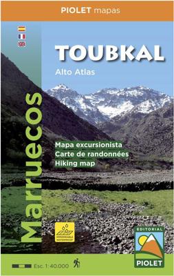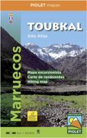
Wandelkaart Toubkal, Hoge Atlas - Marokko | Editorial Piolet

0
Uitstekende wandelkaart met veel topografische details op scheur- en watervast papier. O.a. hoogtelijnen, berghutten en wandelpaden zijn ingetekend. Geschikt voor GPS.  Most of the region shown on the map is within the limits of the Toubkal National Park. Due to its location, only 70 km away from the city Marrakech, it`s the most visited park in a...

Verkopers met dit product

Verkoper
Bezorging
Prijs
DeZwerver.nl logo
DeZwerver.nl
2,95
15,95

Anderen bekeken ook

Wandelkaart Toubkal, Hoge Atlas - Marokko | Editorial Piolet
Uitstekende wandelkaart met veel topografische details op scheur- en watervast papier. O.a. hoogtelijnen, berghutten en wandelpaden zijn ingetekend. Geschikt voor GPS.  Most of the region shown on the map is within the limits of the Toubkal National Park. Due to its location, only 70 km away from the city Marrakech, it`s the most visited park in all os Morocco. Its a region wiht an exceptional  natural and scenic heritage, in an area containing the highest mountains in northem Africa. This area is also home to a diverse collections of vegetacion and animal life, as well as several human sttlements inhabited by Berbers who live in harminy with their environment.   We recommend hiring a hiking guide to reach the región because of the treacherous topogragraphy, with numerous valleys and mountains, where it is dificult to navigate. A guide is also useul to facilitate communication wiht the native people. Dorpen:  El Bour, Imlil, Oukaimeden, Tioudou, Bou, Iguenouane, Aksoual, Tiziane, Azro…
15,95
Wandelkaart Andorra | Editorial Piolet
Topographic map and hiking guide (multilingual, in 4 languages) that contain all the necessary information for the hiker.   It presents 30 itineraries, grouped in ascents and excursions that allow you to discover the country in all its facets. Each itinerary is described in detail and incorporates a technical sheet that includes the slope, duration, difficulty and the material necessary to carry out each of the excursions.   The guide is complemented by photographs of the most emblematic places of each itinerary.   On the 1: 40,000 scale map, all the itineraries described in the guide are represented, as well as the network of trails that run through the area.   In short, it is an essential tool to discover Andorra from a new perspective.
16,95
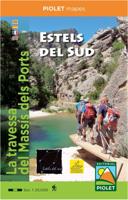
Wandelkaart Estels del Sud | Editorial Piolet
Handzame scheur- en watervaste wandelkaart de 5-daagse trekking Estels del Sud met adressen van de 5 accomodaties.   It's a five days ramble across de Massís dels Ports (Ports Mountains). You'll sleep in a different 'star' every night and during the day, following its trail, you'll enjoy one of the most unspoiled and unknown environments in the country.   Five-day circular journey through the Massif of the Natural Park of the Ports of Beceite. Every night he stays in one of the five establishments (Refugio Font Ferrera, Ca les Barberes (Paüls), Lo Corral d'Arnes, La Fàbrica de Solfa (Beseit) and Refugio Caro). The journey can be done in any direction of travel and start at the establishment you want.   Map printed on waterproof paper
14,95
Wandelkaart Rif Occidental, Chefchaouen - Chauen | Editorial Piolet
 Gedetailleerde topografische wandelkaart van het westelijke Rifgebergte, Pays Jebala, het Parc national de Talassemtane en het Parc naturel de Bouhachem in Marokko. De kaart bestrijkt een gebied met een straal van 25-30 km rondom Chefchaouen, grofweg tussen Es Soukkane, Oued Laou, Bkikcha en Beni Derkoul.   De kaart toont hoogtelijnen (interval 20 m), ingetekende wandelroutes, accommodaties, bezienswaardigheden, klimgebieden, etc. Op de achterzijde staat informatie over het gebied in drie talen (Engels, Frans, Spaans).   -------   Chefchaouen (Chauen) region of northern Morocco, south-east of Tangier and Tetouan, at 1:75,000 on a contoured and GPS compatible map from Editorial Piolet, highlighting recommended hiking trails, various tourist facilities and places of interest, etc.    Topography is vividly presented by contours at 20m intervals, enhanced by relief shading and altitude colouring. The map shows local roads, country tracks and footpaths, and highlights nine recommended …
14,95
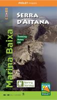
Wandelkaart Marina Baixa - Serra d'Aitana, Costa Blanca mountains west | Editorial Piolet
Heel nauwkeurige wandelkaart van een mooi wandelgebied net ten noorden van Benidorm. Dit is de west kaart van het gebied, de oostkant wordt gedekt door de kaart Serra de Bernia. De Spaanse uitgever Editorial Piolet maakt bijzonder gedetailleerde kaarten van deelgebieden in Spanje, geschikt voor wandelaars en MTB-ers. Van ouds her zijn ze begonnen in de regio rond Barcelona maar ze breiden steeds meer uit richting andere delen van Spanje,   De kaarten hebben een topografische ondergrond met hoogtelijnen, toppen, schaduwtekening bij bergruggen, wegen en dorpen, gehuchten en zelfs boerderijen. Daarbij hebben ze enkele wandelpaden gemarkeerd, met name de GR paden en de PR paden, de regionale lange-afstands paden. Andere wandelpaden staan wel ingetekend, maar met de gewone zwarte lijntjes in plaats van een opvallende kleur. Ook worden op bepaalde kaarten MTB routes weergegeven, maar dat is eerder een uitzondering dan een regel. Met symbolen zijn andere handige zaken aangeduid als campings,…
12,95
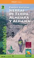
Wandelkaart Parque Natural Sierras de Tejeda, Almijara y Alhama | Editorial Piolet
Een prachtige kaartenset op heel gedetaileerd nivo van de Sierra de Tejeda, opgedeeld in een west en oost gedeelte. Het nationale park igt ten noorden van Nerja, tussen Malaga en Motril.  Alle noodzakelijke details staan er op die je nodig hebt voor het wandelen. Hoogtelijnen, schaduwwerking in de kleuren, ingetekende wandelpaden en routesuggesties. Met name in nationale parken en daarom heen in zuidelijk Europa is een geode kaart best handig: er zijn veel ezel- en geitenpaadjes die voor verwarring zorgen.  Van de uitgever Topographic map of the whole 'Natural Park of Sierras de Tejeda, Almijara and Alhama', more than 40,000 hectares of protected area with an impressive natural wealth. The peaks, some over 2,000 m high, are a natural border between the provinces of Granada and Malaga. The rugged and rugged landscapes make this area an ideal place for hiking enthusiasts of all levels. From a cultural point of view, Muslim heritage is present throughout the territory, with whitewashed v…
19,95
Wandelkaart Montsec d'Ares i Montsec de Rúbies | Editorial Piolet
Mooie 2-delige kaarten set. 1. Montsect de rubies o de Meia 2. Montsec d'ares - congost de mont-rebei   Folder that includes two maps: the Montsec d'Ares and the Montsec de Rúbies or de Meià. These two maps give continuity to those already published in the area: Montsec d'Estall, Sant Llorenç de Montgai and Les Avellanes. The entire collection is published at 1: 20,000 scale   The Montsecs are a reference area for hikers, lovers of the via ferrata, climbers and cyclists, who, with this publication, can plan a large number of excursions and mountain activities through this territory, which extends from the border with Aragon (Congost de Mont-rebei) to the buttresses of Santa María de Meià.   Cova de Montardit en els feixants del Montsec
20,95
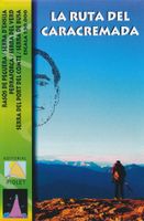
Wandelkaart La Ruta del Caracremada | Editorial Piolet
De Spaanse uitgever Editorial Piolet maakt bijzonder gedetailleerde kaarten van deelgebieden in Spanje, geschikt voor wandelaars en MTB-ers. Van ouds her zijn ze begonnen in de regio rond Barcelona maar ze breiden steeds meer uit richting andere delen van Spanje,   De kaarten hebben een topografische ondergrond met hoogtelijnen, toppen, schaduwtekening bij bergruggen, wegen en dorpen, gehuchten en zelfs boerderijen. Daarbij hebben ze enkele wandelpaden gemarkeerd, met name de GR paden en de PR paden, de regionale lange-afstands paden. Andere wandelpaden staan wel ingetekend, maar met de gewone zwarte lijntjes in plaats van een opvallende kleur. Ook worden op bepaalde kaarten MTB routes weergegeven, maar dat is eerder een uitzondering dan een regel. Met symbolen zijn andere handige zaken aangeduid als campings, bezienswaardigheden, grotten en zelfs hier en daar een lokale bar!    La Ruta del Caracremada, a hiking circuit in the Catalan Pyrenees just north-west of Berga, presented at 1…
12,95
Wandelgids Camino Catalan | Editorial Piolet
Walking routes from Calalonia to La Rioja and Navarre.    For the first time these largely unknown pilgrim routes that connect Catalonia to the Camino Francés are collected in one guide. 62 stages along 6 different interconnected routes offer the chance to explore a range of fascinating landscapes.   Over 1600 kms of detailed route notes. 62 colour maps and contour guides Detailed city and town maps. Information on pilgrim hostels and hotels. Over 100 colour photos and illustrations. Historical notes on places of interest. Langs de plaatsen: Barcelona - Monserrat - Girona - Lleida - Hueasca - Puente la Reina - Tortosa - Zaragosa - Logrono
27,50

Klanten-reviews van Wandelkaart Toubkal, Hoge Atlas - Marokko | Editorial Piolet

Er zijn nog geen beoordelingen voor dit productBen jij de eerste die een review plaatst?

Meer over Wandelkaart Toubkal, Hoge Atlas - Marokko | Editorial Piolet

Productomschrijving

Uitstekende wandelkaart met veel topografische details op scheur- en watervast papier. O.a. hoogtelijnen, berghutten en wandelpaden zijn ingetekend. Geschikt voor GPS. 

Most of the region shown on the map is within the limits of the Toubkal National Park. Due to its location, only 70 km away from the city Marrakech, it`s the most visited park in all os Morocco. Its a region wiht an exceptional  natural and scenic heritage, in an area containing the highest mountains in northem Africa. This area is also home to a diverse collections of vegetacion and animal life, as well as several human sttlements inhabited by Berbers who live in harminy with their environment.   We recommend hiring a hiking guide to reach the región because of the treacherous topogragraphy, with numerous valleys and mountains, where it is dificult to navigate. A guide is also useul to facilitate communication wiht the native people.

Dorpen: 

El Bour, Imlil, Oukaimeden, Tioudou, Bou, Iguenouane, Aksoual, Tiziane, Azrou n'Tamadoute, Adrar Iferouane, Tifidern, Takatert, Lago de Ifni, Akioud

Productinformatie

    Verken gerelateerde categorieën

    Webshop.nl maakt gebruik van cookies. Ga je verder op onze website, ga dan akkoord met het plaatsen van cookies en de verwerking van deze data door ons en vermelde partners.