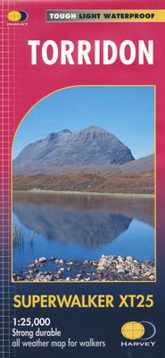
Wandelkaart Torridon | Harvey Maps

0
Een bijzonder handige kaart van dit gebied. Op waterafstotend papier met veel details. ncludes Slioch, Beinn Eighe, Liathach and Beinn Alligin.   Detailed map for hillwalkers of the Torridon Hills at the popular 1:25,000 scale.   Places of interest.   Includes 9 Munros, 9 Corbetts and 3 Grahams.   Tough, light, durable and 100% waterproof Genuine,...

Verkopers met dit product

Verkoper
Bezorging
Prijs
DeZwerver.nl logo
DeZwerver.nl
niet bekend
24,95

Anderen bekeken ook

Wandelkaart Arran including Arran Coastal Way | Harvey Maps
Een bijzonder handige kaart van dit gebied. Op waterafstotend papier met veel details.    Features the renowned Goat Fell, A'Chir ridge, Beinn Bharrain, Glen Sannox & Glen Rosa. Detailed map for hillwalkers of the whole island at the popular 1:25,000 scale. The 100km (62 miles) Arran Coastal Way is also shown. The route links the coastline of the island with the villages and the stunning scenery Arran has to offer. Includes Gaelic-English glossary and information on local archaeological and historical sites. Landscape and wildlife information from the National Trust for Scotland Includes 4 Corbetts and 1 Graham.   Tough, light, durable and 100% waterproof Genuine, original, HARVEY mapping Opens directly to either side of the sheet Easy to re-fold  
24,95
Nieuw
Wandelkaart Assynt & Coigach | Harvey Maps
"This is a fabulous map for a fabulous area; for the first time it shows crags, bouldering areas and clear details in what could seem a maze of rock and water. It must surely set the standard for all future maps." John Mackenzie, the Earl of Cromartie.   Detailed map for hillwalkers and climbers of the spectacular peaks of Assynt at 1:40,000 scale.   Includes Quinag, Suilven, Stac Pollaidh, Cul Mor and Ben More Assynt.   Enlargements at 1:15,000 scale of Stac Pollaidh, Suilven and Quinag on the reverse.   Climbing crags are highlighted and a climbing route on Stac Pollaidh is included.   The map area includes 2 Munros, 9 Corbetts and 6 Grahams.
29,95
Nieuw
Wandelkaart Brecon Beacons West | Harvey Maps
Includes Pen y Fan, Foel Fraith, Fan Fawr and Fan Gyhirych.   Detailed map for hillwalkers of the western part of the Brecon Beacons National Park at the popular scale of 1:25,000.   New, Superwalker XT25 of the Brecon Beacons National Park on 2 sheets. Brecon Beacons WEST - This map covers Pen y Fan, Fforest Fawr and, the Black Mountain in the far west. Brecon Beacons National Park boasts a magnificent array of Old Red Sandstone peaks, open moorland and green valleys covering 500 square miles (1344 Square km) of beautiful mid-Wales countryside. Revised and re-designed they have got everything. Genuine original HARVEY mapping at 1:25,000. Ideal for walking. Clear, easy to read. Easy to re-fold, Opens directly to either side of the sheet. Slim and flexible. Light to carry. Tearproof, durable, AND - 100% waterproof as standard.
24,95
Nieuw
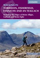
Wandelgids Walking in Torridon, Fisherfield, Fannichs and An Teallach | Cicerone
Guide to 50 walks and easy scrambles in north-western Scotland, covering Southern Torridon, Northern Torridon, Letterewe and Fisherfield, and the Fannichs. Ascents of 27 Munros, 20 Corbetts and 14 Grahams are included, with highlights including Liathach, Beinn Eighe, Beinn Alligin, An Teallach and Slioch. The walks are suitable for those with good navigation skills who are competent in a mountain environment.   All the walks in the guide are graded, with summary statistics provided, and each includes clear route description and mapping. There's also a route summary table to help with choosing appropriate walks. Background information on local geology, wildlife and history, and planning details on when to go, where to stay and what to take are included to make the most out of any trip to Torridon.   The region boasts spectacular and distinctive landscapes and breathtaking views. Steep-sided rocky mountains rise above long winding lochs, both freshwater and sea. From the hills there are…
23,95
Nieuw
Wandelkaart Brecon Beacons Oost | Harvey Maps
Includes Pen y Fan and the Black Mountains.   Detailed map for hillwalkers of the western part of the Brecon Beacons National Park at the popular scale of 1:25,000.   NEW Superwalker XT25 of the Brecon Beacons. The Brecon Beacons National Park on 2 sheets. Revised and re-designed. Brecon Beacons EAST - The area covered on this sheet includes Pen y Fan and the Black Mountains. They have got everything. Genuine original HARVEY mapping at 1:25,000. Ideal for walking. Clear, easy to read. Easy to re-fold. Opens directly to either side of the sheet. Slim and flexible, light to carry, tearproof, durable AND, 100% waterproof as standard.    
24,95
Wandelkaart Ben Nevis | Harvey Maps
Een bijzonder mooie en handige kaart van dit prachtige bergachtige gebied. Op waterafstotend papier met veel details. HARVEY Superwalker map at 1:25,000 scale Detailed map of Ben Nevis for walkers and climbers This map for hillwalkers covers Fort William through Glen Nevis to Loch Treig. From the Grey Corries south to Kinlochleven. Ben Nevis, the Aonachs and the Mamores are among the 20 Munros and 4 Corbetts. Clear and easy to read with all the detail needed for ascending Britain's highest mountain. Enlargement of Ben Nevis summit showing the safety bearings in case of a descent in bad weather. As used by the Lochaber Mountain Rescue Team.
24,95
Wandelkaart Munro and Corbett Chart | Harvey Maps
Alle Munro's en Corbetts op 1 kaart!  First published in 1996 this current edition of our best selling chart used for monitoring and recording your progress in completing the Munros and Corbetts has been brought up to date to include the height revisions of 2009 and 2011 according to the Munro Society. It also includes the Grahams and the Donalds. It can be removed from the cover without damage and wall mounted. Based on the 1997 edition of Munro's Tables progress can be monitored filling in the targets or the symbols on the map and by recording the date of each ascent. The symbols have been updated to make them easier to read, and can now be identified clearly by the colour blind. This Munro map is a chart which shows and lists all Munros (mountains over 3000ft), Corbetts (over 2500ft), Grahams and Donalds (over 2000ft). A selection of other hills are named for information.   Size 880x1145mm.   Space for recording your date of ascent.   Target to fill in as you complete the challenge…
17,95

Klanten-reviews van Wandelkaart Torridon | Harvey Maps

Er zijn nog geen beoordelingen voor dit productBen jij de eerste die een review plaatst?

Meer over Wandelkaart Torridon | Harvey Maps

Productomschrijving

Een bijzonder handige kaart van dit gebied. Op waterafstotend papier met veel details.

ncludes Slioch, Beinn Eighe, Liathach and Beinn Alligin.   Detailed map for hillwalkers of the Torridon Hills at the popular 1:25,000 scale.   Places of interest.   Includes 9 Munros, 9 Corbetts and 3 Grahams.   Tough, light, durable and 100% waterproof Genuine, original, HARVEY mapping Opens directly to either side of the sheet Easy to re-fold

Verken gerelateerde categorieën

Webshop.nl maakt gebruik van cookies. Ga je verder op onze website, ga dan akkoord met het plaatsen van cookies en de verwerking van deze data door ons en vermelde partners.