webshop.nl
Categorieën
  Sluiten

Meer Harvey Maps
Meer Harvey Maps in Literatuur boeken

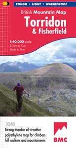
Wandelkaart Torridon & Fisherfield | Harvey Maps

0
"HARVEY British Mountain Maps are a joy to use. The detail and accuracy make them my first choice when I am researching a route or just out on the hills for fun". Peter Macfarlane, outdoor writer and photographer.   Detailed map of the giants of Torridon and the remote hills of Fisherfield on one sheet at 1:40,000 scale.   Summit enlargements of Be...

Webshops met dit product

Webshop
Bezorging
Prijs

Anderen bekeken ook

Wandelkaart Torridon & Fisherfield | Harvey Maps
"HARVEY British Mountain Maps are a joy to use. The detail and accuracy make them my first choice when I am researching a route or just out on the hills for fun". Peter Macfarlane, outdoor writer and photographer.   Detailed map of the giants of Torridon and the remote hills of Fisherfield on one sheet at 1:40,000 scale.   Summit enlargements of Beinn Alligin, Beinn Eighe, Liathach and An Teallach.   Includes 18 Munros, 12 Corbetts and 9 Grahams.     The giants of Torridon and the remote hills of Fisherfields on one sheet. The map area includes 18 Munros and 12 Corbetts. There are also 1:15000 enlargements of An Teallach, Beinn Alligin, Beinn Eighe and Liathach on the reverse. Climbing crags are highlighted and climbing crag route diagrams are also included. Harvey British Mountain maps are a joy to use. The detail and accuracy make them my first choice when I am researching a route or out on the hills.
29,95
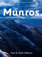
Wandelgids The Munros | Pocket Mountains
The Munros are mountains in Scotland with a height of over 3000ft and take their name from the first list of such hills published in 1891 by Victorian mountaineer Sir Hugh Munro, 4th Baronet of Lindertis. Revised several times in the years since, the official list now features 282 peaks. This guide is for anyone who wants to climb these mountains and aims to provide reliable routes and tips for ascending them safely.   The Munros will ensure you reach parts of Scotland you might otherwise overlook, spend memorable evenings in pubs, bothies and wild camps, and have encounters with other walkers, locals and wildlife that enhance the adventure regardless of whether you get to the top of one Munro or all of them. Plaatsen in het boekje A’ Bhuidheanach Bheag, A’ Chailleach (Fannichs), A’ Chailleach (Monadhliath), A’ Chralaig, Ghlas-bheinn, A’ Mhaighdean, A’ Mharconaich, Am Basteir, Am Bodach, Am Faochagach, An Caisteal, An Coileachan, An Gearanach, An Riabhachan, An Sgarsoch, An Socach (Dee…
20,95
Wandelgids Walking in Torridon, Fisherfield, Fannichs and An Teallach
Guide to 50 walks and easy scrambles in north-western Scotland, covering Southern Torridon, Northern Torridon, Letterewe and Fisherfield, and the Fannichs. Ascents of 27 Munros, 20 Corbetts and 14 Grahams are included, with highlights including Liathach, Beinn Eighe, Beinn Alligin, An Teallach and Slioch. The walks are suitable for those with good navigation skills who are competent in a mountain environment.   All the walks in the guide are graded, with summary statistics provided, and each includes clear route description and mapping. There's also a route summary table to help with choosing appropriate walks. Background information on local geology, wildlife and history, and planning details on when to go, where to stay and what to take are included to make the most out of any trip to Torridon.   The region boasts spectacular and distinctive landscapes and breathtaking views. Steep-sided rocky mountains rise above long winding lochs, both freshwater and sea. From the hills there are …
23,95
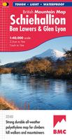
Wandelkaart Schiehallion / Ben Lawers & Glen Lyon | Harvey Maps
"I've spent most of my climbing career searching for new crags and bouldering areas and until Harvey Maps came along it was a process of trial and error. Their attention to detail is unmatched and they have led me successfully to all sorts of new adventures." Kevin Howett, Development Officer for the Mountaineering Council of Scotland and Author of 'Rock Climbing in Scotland' and SMC's 'Highland Outcrops' Guide.   Detailed map of 42 challenging Perthshire hills on one sheet at 1:40,000 scale.   Map extension covers Ben Chonzie.   Includes 27 Munros, 15 Corbetts and 4 Grahams   Schiehallion, Ben Lawers & Glen Lyon is the current new publication in this highly successful and innovative British Mountain Map Series. There are over 42 challenging Perthshire hills on this one sheet including 27 Munros and 15 Corbetts. Climbing Crags are highlighted & named. Climbing Crag route diagrams are also shown. Again this map is printed on polyethylene which is durable, tearproof & 100% waterproof. Th…
29,95

Klanten-reviews van Wandelkaart Torridon & Fisherfield | Harvey Maps

Er zijn nog geen beoordelingen voor dit productBen jij de eerste die een review plaatst?

Meer over Wandelkaart Torridon & Fisherfield | Harvey Maps

Productomschrijving

"HARVEY British Mountain Maps are a joy to use. The detail and accuracy make them my first choice when I am researching a route or just out on the hills for fun". Peter Macfarlane, outdoor writer and photographer.   Detailed map of the giants of Torridon and the remote hills of Fisherfield on one sheet at 1:40,000 scale.   Summit enlargements of Beinn Alligin, Beinn Eighe, Liathach and An Teallach.   Includes 18 Munros, 12 Corbetts and 9 Grahams.     The giants of Torridon and the remote hills of Fisherfields on one sheet. The map area includes 18 Munros and 12 Corbetts. There are also 1:15000 enlargements of An Teallach, Beinn Alligin, Beinn Eighe and Liathach on the reverse. Climbing crags are highlighted and climbing crag route diagrams are also included. Harvey British Mountain maps are a joy to use. The detail and accuracy make them my first choice when I am researching a route or out on the hills.

Productspecificaties

Artikelnummer(s)
Brand
Harvey Maps

Verken gerelateerde categorieën

Webshop.nl maakt gebruik van cookies. Ga je verder op onze website, ga dan akkoord met het plaatsen van cookies en de verwerking van deze data door ons en vermelde partners.