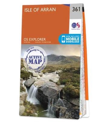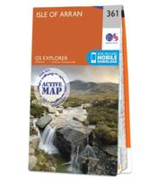
Wandelkaart - Topografische kaart 361 OS Explorer Map | Active Isle of Arran | Ordnance Survey

0
Met zijn 4cm voor 1 km (2 ½ cm voor 1 mijl) schaal, is de OS Explorer kaartenserie de ideale en meest gedetailleerde kaartenreeks voor mensen die graag outdoor-activiteiten zoals fietsen, wandelen, paardrijden, klimmen en watersporten. Deze kaart is nog gedetailleerder dan de 'gewone' Landranger maps. Voor- en achterzijde bedrukt! Zeker op de moor...

Verkopers met dit product

Verkoper
Bezorging
Prijs
DeZwerver.nl logo
DeZwerver.nl
2,95
25,96

Anderen bekeken ook

Nieuw
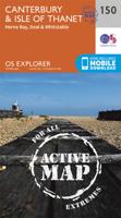
Wandelkaart - Topografische kaart 150 OS Explorer Map | Active Canterbury / Isle of Thanet | Ordnance Survey
Discover Canterbury, city of saints and kings, ancient heartland of England at the foot of the Kent Downs and the head of the River Stour Valley with its vineyards. Follow the river to the coast to discover unspoiled Deal, artistic Margate and picturesque Whitstable.  Starting in Canterbury, take the Stour Valley Walk to Sandwich and the long sweeping sand and shingle beach of Sandwich Bay  Walk the Long Rock from Whitstable to Herne Bay before taking the Thanet Coastal Path around the Isle of Thanet and its three famous Georgian and Victorian resorts of Margate, Ramsgate and Broadstairs   Take the National Trails of the England Coast Path and North Downs Way or choose from a lattice of other popular recreational paths  Met zijn 4cm voor 1 km (2 ½ cm voor 1 mijl) schaal, is de OS Explorer kaartenserie de ideale en meest gedetailleerde kaartenreeks voor mensen die graag outdoor-activiteiten zoals fietsen, wandelen, paardrijden, klimmen en watersporten.   Deze kaart is nog gedetailleerd…
25,95
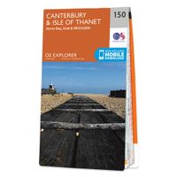
Wandelkaart - Topografische kaart 150 OS Explorer Map Canterbury, Isle of Thanet | Ordnance Survey
Discover Canterbury, city of saints and kings, ancient heartland of England at the foot of the Kent Downs and the head of the River Stour Valley with its vineyards. Follow the river to the coast to discover unspoiled Deal, artistic Margate and picturesque Whitstable.  Starting in Canterbury, take the Stour Valley Walk to Sandwich and the long sweeping sand and shingle beach of Sandwich Bay  Walk the Long Rock from Whitstable to Herne Bay before taking the Thanet Coastal Path around the Isle of Thanet and its three famous Georgian and Victorian resorts of Margate, Ramsgate and Broadstairs   Take the National Trails of the England Coast Path and North Downs Way or choose from a lattice of other popular recreational paths  Met zijn 4cm voor 1 km (2 ½ cm voor 1 mijl) schaal, is de OS Explorer kaartenserie de ideale en meest gedetailleerde kaartenreeks voor mensen die graag outdoor-activiteiten zoals fietsen, wandelen, paardrijden, klimmen en watersporten. Deze kaart is nog gedetailleer…
19,50
Nieuw
Wandelkaart - Topografische kaart 438 OS Explorer Map | Active Dornoch / Tain | Ordnance Survey
Explore Dornoch Firth, a National Scenic Area renowned for its beauty and rare wildlife. Stroll the golden sandy beaches of Dornoch, stretching for miles of golden sand.   - Visit Dornoch Cathedral and climb Fyrish to the west of Alness, where a sculpted monument offers amazing views over the Cromarty Firth - Discover Tain, Scotland’s oldest royal burgh, and climb Tain Hill for magnificent views over Dornoch Firth - Walk, hike, cycle, climb or kayak through the glens and shorelines of Easter Ross   OS Explorer Active Maps:   - 1:25,000 scale (4 cm to 1 km – 2½ inches to 1 mile). - Laminated with a weatherproof finish, also suitable for dry-wipe pens. - Great for walkers, hikers, cyclists, families, dog walkers, and horse riders. - Includes roads, rights of way, permissive paths and bridleways, plus essential visitor information. - Free digital download included. - Other Ordnance Survey Explorer maps of Easter Ross include Black Isle map 432 and Lairg, Bonar Bridge & Golspie map 441.
25,95
Nieuw
Wandelkaart - Topografische kaart 146 OS Explorer Map | Active Dorking / Box Hill / Reigate | Ordnance Survey
Unearth the rich history and pastoral charms of the Surrey Hills, an Area of Outstanding Natural Beauty, and visit the historic market towns of Dorking, Leatherhead, Reigate and Caterham. Climb Box Hill, the world’s favourite cyclist hill climb, for stunning views of the North Downs.    Marvel at the 18th-century landscape park of Painshill, the Edwardian charm of Polesden Lacey and Reigate’s medieval castle  Spot Adonis blue butterflies and bee orchids, picnic by the Stepping Stones or climb Box Hill for its sensational vistas of the North Downs and High Weald  Ramble, hike and cycle along paths including the North Downs Way, Greensand Way and Mole Gap Trail    Met zijn 4cm voor 1 km (2 ½ cm voor 1 mijl) schaal, is de OS Explorer kaartenserie de ideale en meest gedetailleerde kaartenreeks voor mensen die graag outdoor-activiteiten zoals fietsen, wandelen, paardrijden, klimmen en watersporten.   Deze kaart is nog gedetailleerder dan de 'gewone' Landranger maps. Voor- en achterzijde be…
25,95
Wandelkaart - Topografische kaart 146 OS Explorer Map Dorking, Box Hill, Reigate | Ordnance Survey
Unearth the rich history and pastoral charms of the Surrey Hills, an Area of Outstanding Natural Beauty, and visit the historic market towns of Dorking, Leatherhead, Reigate and Caterham. Climb Box Hill, the world’s favourite cyclist hill climb, for stunning views of the North Downs.    Marvel at the 18th-century landscape park of Painshill, the Edwardian charm of Polesden Lacey and Reigate’s medieval castle  Spot Adonis blue butterflies and bee orchids, picnic by the Stepping Stones or climb Box Hill for its sensational vistas of the North Downs and High Weald  Ramble, hike and cycle along paths including the North Downs Way, Greensand Way and Mole Gap Trail    Met zijn 4cm voor 1 km (2 ½ cm voor 1 mijl) schaal, is de OS Explorer kaartenserie de ideale en meest gedetailleerde kaartenreeks voor mensen die graag outdoor-activiteiten zoals fietsen, wandelen, paardrijden, klimmen en watersporten. Deze kaart is nog gedetailleerder dan de 'gewone' Landranger maps. Voor- en achterzijde b…
19,50
Nieuw
Wandelkaart - Topografische kaart 149 OS Explorer Map | Active Sittingbourne / Faversham | Ordnance Survey
Explore the serene Isle of Sheppey and follow the Saxon Shore Way to discover the towns of Sittingbourne and Faversham. Further inland, the Kent Downs – an Area of Outstanding Natural Beauty – are beckoning.    Sail, kayak, fly kites or just relax on the sandy and pebbled beaches of Sheppey, or go birdwatching at the Swale National Nature Reserve  Discover Faversham, home of Britain’s oldest brewer and nearby Oare Gunpowder Works Country Park, where gunpowder was manufactured for the battles of Trafalgar and Waterloo  Walk, ramble or cycle along the Saxon Shore Way through Faversham and Sittingbourne, or head inland to the North Downs Way, a National Trail Met zijn 4cm voor 1 km (2 ½ cm voor 1 mijl) schaal, is de OS Explorer kaartenserie de ideale en meest gedetailleerde kaartenreeks voor mensen die graag outdoor-activiteiten zoals fietsen, wandelen, paardrijden, klimmen en watersporten.   Deze kaart is nog gedetailleerder dan de 'gewone' Landranger maps. Voor- en achterzijde bedrukt!…
25,95
Nieuw
Wandelkaart - Topografische kaart 163 OS Explorer Map | Active Gravesend / Rochester | Ordnance Survey
Immerse yourself in Gravesend with its maritime history, Charles Dickens links and even a Cold War bunker! Contrast the medieval magnificence of Rochester where the cathedra was founded in 604 and the imposing Rochester Castle keeps watch over the Medway crossing.   Explore the Hoo Peninsula and the North Kent marshes that inspired Charles Dickens to write Great Expectations Discover the Medway towns of Chatham and Gillingham, home to the Historic Dockyard Chatham and the Royal Engineers Museum Walk and cycle along the Saxon Shore Way and other popular recreational paths including the Wealdway and North Downs Way Met zijn 4cm voor 1 km (2 ½ cm voor 1 mijl) schaal, is de OS Explorer kaartenserie de ideale en meest gedetailleerde kaartenreeks voor mensen die graag outdoor-activiteiten zoals fietsen, wandelen, paardrijden, klimmen en watersporten.   Deze kaart is nog gedetailleerder dan de 'gewone' Landranger maps. Voor- en achterzijde bedrukt! Zeker op de moors en andere natuurgebieden …
25,95
Nieuw
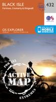
Wandelkaart - Topografische kaart 432 OS Explorer Map | Active Black Isle | Ordnance Survey
Met zijn 4cm voor 1 km (2 ½ cm voor 1 mijl) schaal, is de OS Explorer kaartenserie de ideale en meest gedetailleerde kaartenreeks voor mensen die graag outdoor-activiteiten zoals fietsen, wandelen, paardrijden, klimmen en watersporten.   Deze kaart is nog gedetailleerder dan de 'gewone' Landranger maps. Voor- en achterzijde bedrukt! Zeker op de moors en andere natuurgebieden van onschatbare waarden met echt alle aspecten van het landschap op de kaart ingetekend. Zeer goede detailkaart met topografische ondergrond. Hierop zijn toeristische symbolen van bezienswaardigheden ingetekend, daarnaast staan bijvoorbeeld campings en jeugdherbergen vermeld en - voor wandelaars het belangrijkst - alle right of way paden en Lange afstands Wandelpaden zijn er op te vinden. De ideale kaart voor het wandelen in Engeland, Wales of Schotland.   These highly detailed maps show all the administrative boundaries, settlements as small as isolated farms, the road network down to unfenced roads and country t…
25,95
Nieuw
Wandelkaart - Topografische kaart 162 OS Explorer Map | Active Greenwich and Gravesend | Ordnance Survey
Consider yourself at home as you explore London's East End, a byword for cheeky Cockneys, gruesome murders and political activism. See the Thames in a new light in Greenwich, where you can stand on the Meridian Line at the Royal Observatory and climb aboard the Cutty Sark.    Explore the maritime town of Gravesend, visit a Cold War bunker  Uncover London's history as an Imperial trading hub at West India Docks, built in 1802  Walk and cycle along the London Loop through West Thurrock and Sidcup, and other recreational paths including the Thames Path National Trail through the heart of London Met zijn 4cm voor 1 km (2 ½ cm voor 1 mijl) schaal, is de OS Explorer kaartenserie de ideale en meest gedetailleerde kaartenreeks voor mensen die graag outdoor-activiteiten zoals fietsen, wandelen, paardrijden, klimmen en watersporten. Deze kaart is nog gedetailleerder dan de 'gewone' Landranger maps. Voor- en achterzijde bedrukt! Zeker op de moors en andere natuurgebieden van onschatbare waarden …
25,95
Wandelkaart - Topografische kaart 149 OS Explorer Map Sittingbourne, Faversham | Ordnance Survey
Explore the serene Isle of Sheppey and follow the Saxon Shore Way to discover the towns of Sittingbourne and Faversham. Further inland, the Kent Downs – an Area of Outstanding Natural Beauty – are beckoning.  Sail, kayak, fly kites or just relax on the sandy and pebbled beaches of Sheppey, or go birdwatching at the Swale National Nature Reserve  Discover Faversham, home of Britain’s oldest brewer and nearby Oare Gunpowder Works Country Park, where gunpowder was manufactured for the battles of Trafalgar and Waterloo  Walk, ramble or cycle along the Saxon Shore Way through Faversham and Sittingbourne, or head inland to the North Downs Way, a National Trail Met zijn 4cm voor 1 km (2 ½ cm voor 1 mijl) schaal, is de OS Explorer kaartenserie de ideale en meest gedetailleerde kaartenreeks voor mensen die graag outdoor-activiteiten zoals fietsen, wandelen, paardrijden, klimmen en watersporten. Deze kaart is nog gedetailleerder dan de 'gewone' Landranger maps. Voor- en achterzijde bedrukt! …
19,50

Klanten-reviews van Wandelkaart - Topografische kaart 361 OS Explorer Map | Active Isle of Arran | Ordnance Survey

Er zijn nog geen beoordelingen voor dit productBen jij de eerste die een review plaatst?

Meer over Wandelkaart - Topografische kaart 361 OS Explorer Map | Active Isle of Arran | Ordnance Survey

Productomschrijving

Met zijn 4cm voor 1 km (2 ½ cm voor 1 mijl) schaal, is de OS Explorer kaartenserie de ideale en meest gedetailleerde kaartenreeks voor mensen die graag outdoor-activiteiten zoals fietsen, wandelen, paardrijden, klimmen en watersporten.

Deze kaart is nog gedetailleerder dan de 'gewone' Landranger maps. Voor- en achterzijde bedrukt! Zeker op de moors en andere natuurgebieden van onschatbare waarden met echt alle aspecten van het landschap op de kaart ingetekend. Zeer goede detailkaart met topografische ondergrond. Hierop zijn toeristische symbolen van bezienswaardigheden ingetekend, daarnaast staan bijvoorbeeld campings en jeugdherbergen vermeld en - voor wandelaars het belangrijkst - alle right of way paden en Lange afstands Wandelpaden zijn er op te vinden. De ideale kaart voor het wandelen in Engeland, Wales of Schotland.   Experience ‘Scotland in miniature’ on the Isle of Arran, with its rocky, wild highlands in the north and lush lowlands in the south. Climb Goat Fell, the highest point on the Isle of Arran, for spectacular panoramic views or explore the mysterious standing stones on Machrie Moor.   Take the Arran Coastal Way to discover the King’s Cave in the sandstone cliffs and the beaches of Blackwaterfoot Visit Brodick Castle, with its subline views across to the Ayrshire coast, or take a boat to Holy Isle with its ancient spiritual heritage and unspoiled beauty Walk, hike or cycle along the Arran Coastal Path, climb jagged summits and rocky ridges and glimpse red squirrels, red deer, golden eagles and otters     OS Explorer Active Maps:   1:25 000 scale (4 cm to 1 km – 2½ inches to 1 mile). Laminated with a weatherproof finish, also suitable for dry-wipe pens.  Great for walkers, hikers, cyclists, families, dog walkers, and horse riders. Includes roads, rights of way, permissive paths and bridleways, plus essential visitor information. Free digital download included. Other Ordnance Survey Explorer maps of Kintyre include Kintyre South map 356 and Kintyre North map 357


Verken gerelateerde categorieën

Webshop.nl maakt gebruik van cookies. Ga je verder op onze website, ga dan akkoord met het plaatsen van cookies en de verwerking van deze data door ons en vermelde partners.