webshop.nl
Categorieën
  Sluiten

Meer National Geographic
Meer National Geographic in Literatuur boeken

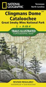
Wandelkaart - Topografische kaart 317 Clingmans Dome Cataloochee - Gre

0
Prachtige geplastificeerde kaart van het bekende nationaal park. Met alle recreatieve voorzieningen als campsites, maar ook met topografische details en wandelroutes ed. Door uitgekiend kleurgebruik zeer prettig in gebruik. Scheur en watervast! This title provides an increased scale of one of the most visited National Parks in the US, and one of ou...

Webshops met dit product

Webshop
Bezorging
Prijs

Anderen bekeken ook

Wandelkaart - Topografische kaart 317 Clingmans Dome Cataloochee - Gre
Prachtige geplastificeerde kaart van het bekende nationaal park. Met alle recreatieve voorzieningen als campsites, maar ook met topografische details en wandelroutes ed. Door uitgekiend kleurgebruik zeer prettig in gebruik. Scheur en watervast! This title provides an increased scale of one of the most visited National Parks in the US, and one of our more popular map titles. This increased scale will provide greater detail to the backcountry users and Appalachian Trail through-hikers.   Great Smoky Mountains National Park is a hiker's paradise with over 800 miles of maintained trails ranging from short legstretchers to strenuous treks that may require backcountry camping. But hiking is not the only reason for visiting the Smokies. Car camping, fishing, picnicking, wildlife viewing and auto touring are popular activities.   Coverage Highlights Areas and places featured in this map series (TI316 and TI317) include: • Appalachian Trail • Benton Mackaye Trail • Mountains-to-Sea Trail • Back…
14,95
Wandelkaart - Topografische kaart 316 Cades Cove - Elkmont - Great Smo
Prachtige geplastificeerde kaart van het bekende nationaal park. Met alle recreatieve voorzieningen als campsites, maar ook met topografische details en wandelroutes ed. Door uitgekiend kleurgebruik zeer prettig in gebruik. Scheur en watervast!   This title provides an increased scale of one of the most visited National Parks in the US, and one of our more popular map titles. This increased scale will provide greater detail to the backcountry users and Appalachian Trail through-hikers.   Great Smoky Mountains National Park is a hiker's paradise with over 800 miles of maintained trails ranging from short legstretchers to strenuous treks that may require backcountry camping. But hiking is not the only reason for visiting the Smokies. Car camping, fishing, picnicking, wildlife viewing and auto touring are popular activities.   Coverage Highlights Areas and places featured in this map series (TI316 and TI317) include: • Appalachian Trail • Benton Mackaye Trail • Mountains-to-Sea Trail • Ba…
14,95
Wandelkaart - Topografische kaart 747 Green Mountain National Forest N
Prachtige geplastificeerde kaart van het bekende nationaal park. Met alle recreatieve voorzieningen als campsites, maar ook met topografische details en wandelroutes ed. Door uitgekiend kleurgebruik zeer prettig in gebruik. Scheur en watervast! National Geographic's Green Mountain National Forest North Trails Illustrated topographic map is the most comprehensive available for outdoor enthusiasts of all types. Designed to be easy-to-read, yet highly detailed – this map includes a comprehensive road and trail network distinguishing between major, secondary and 4x4 roads, hiking, horse, biking, multi-use and non-motorized winter trails. All forest roads are labeled with their official road number and trails are clearly identified with their given name. Land management boundaries are color-coded showing National Forest, Ranger District, Wilderness Areas, Conservation Areas and more, plus the locations of private land within the Green Mountain National Forest. The renowned Appalachian Trail…
17,95
Wandelkaart - Topografische kaart 748 Green Mountain National Forest S
Prachtige geplastificeerde kaart van het bekende nationaal park. Met alle recreatieve voorzieningen als campsites, maar ook met topografische details en wandelroutes ed. Door uitgekiend kleurgebruik zeer prettig in gebruik. Scheur en watervast! National Geographic's Green Mountain National Forest South Trails Illustrated topographic map is the most comprehensive available for outdoor enthusiasts of all types. Designed to be easy-to-read, yet highly detailed – this map includes a comprehensive road and trail network distinguishing between major, secondary and 4x4 roads, hiking, horse, biking, multi-use and non-motorized winter trails. All forest roads are labeled with their official road number and trails are clearly identified with their given name. Land management boundaries are color-coded showing National Forest, Ranger District, Wilderness Areas, Conservation Areas and more, plus the locations of private land within the Green Mountain National Forest. The renowned Appalachian Trail…
17,95
Wandelkaart - Topografische kaart 747 Green Mountain National Forest N
Prachtige geplastificeerde kaart van het bekende nationaal park. Met alle recreatieve voorzieningen als campsites, maar ook met topografische details en wandelroutes ed. Door uitgekiend kleurgebruik zeer prettig in gebruik. Scheur en watervast! National Geographic's Green Mountain National Forest North Trails Illustrated topographic map is the most comprehensive available for outdoor enthusiasts of all types. Designed to be easy-to-read, yet highly detailed – this map includes a comprehensive road and trail network distinguishing between major, secondary and 4x4 roads, hiking, horse, biking, multi-use and non-motorized winter trails. All forest roads are labeled with their official road number and trails are clearly identified with their given name. Land management boundaries are color-coded showing National Forest, Ranger District, Wilderness Areas, Conservation Areas and more, plus the locations of private land within the Green Mountain National Forest. The renowned Appalachian Trail…
17,95
Wandelkaart - Topografische kaart 201 Trails Illustrated Yellowstone N
Prachtige geplastificeerde kaart van het bekende nationaal park. Met alle recreatieve voorzieningen als campsites, maar ook met topografische details en wandelroutes ed. Door uitgekiend kleurgebruik zeer prettig in gebruik. Scheur en watervast! National Geographic's Trails Illustrated map of Yellowstone National Park is designed to meet the needs of outdoor enthusiasts by combining valuable information with unmatched detail of America's first national park. Expertly researched and created in partnership with local land management agencies, this map features key points of interest including Mammoth Hot Springs, Canyon Village, Yellowstone Lake, Yellowstone Falls, Grant Village, and Old Faithful geyser area.   With over 1,000 miles of mapped trails, the Yellowstone National Park map can guide you off the beaten path and back again. The clearly marked trails include mileages between intersections. Trail summaries provide elevation, duration, and difficulty for a variety of suggested hikes…
16,95
Wandelkaart - Topografische kaart 261 Grand Canyon | National Geograph
Prachtige geplastificeerde kaart van het bekende nationaal park. Met alle recreatieve voorzieningen als campsites, maar ook met topografische details en wandelroutes ed. Door uitgekiend kleurgebruik zeer prettig in gebruik. Scheur en watervast!   Explore the uniquely inspiring and wondrous landscape of the Grand Canyon with National Geographic's Trails Illustrated map of Grand Canyon National Park, North and South Rims. Expertly researched and created in partnership with local land management agencies, this map is designed to meet the needs of outdoor enthusiasts with unmatched detail of the heart of the park. Key areas of interest featured on this map include Colorado River miles 60-98, North and South Rim visitor centers, Grand Canyon Village, Tusayan, Bright Angel Trail (plus elevation profile), West Rim Trail, Kaibab Trail, Arizona Trail, and more.   With miles of mapped trails in some of the most breathtaking scenery in the entire country, the Grand Canyon North and South Rims map…
16,95

Klanten-reviews van Wandelkaart - Topografische kaart 317 Clingmans Dome Cataloochee - Gre

Er zijn nog geen beoordelingen voor dit productBen jij de eerste die een review plaatst?

Meer over Wandelkaart - Topografische kaart 317 Clingmans Dome Cataloochee - Gre

Productomschrijving

Prachtige geplastificeerde kaart van het bekende nationaal park. Met alle recreatieve voorzieningen als campsites, maar ook met topografische details en wandelroutes ed. Door uitgekiend kleurgebruik zeer prettig in gebruik. Scheur en watervast! This title provides an increased scale of one of the most visited National Parks in the US, and one of our more popular map titles. This increased scale will provide greater detail to the backcountry users and Appalachian Trail through-hikers.   Great Smoky Mountains National Park is a hiker's paradise with over 800 miles of maintained trails ranging from short legstretchers to strenuous treks that may require backcountry camping. But hiking is not the only reason for visiting the Smokies. Car camping, fishing, picnicking, wildlife viewing and auto touring are popular activities.   Coverage Highlights Areas and places featured in this map series (TI316 and TI317) include: • Appalachian Trail • Benton Mackaye Trail • Mountains-to-Sea Trail • Backcountry Campsites • Detailed Trail Mileages • Footbridges • Fords/Stream Crossings • Nature/Interpretive Trails • Scenic Overlooks/Roadside Pull-outs • Cades Cove Driving Loop • Chilowee Mountain, Little Mountain, and Cataloochee Divide • Blue Ridge Parkway • National Forest Service Lands (Cherokee, Pisgah and Nantahala National Forests) • Little Tennessee and Tuckasegee Rivers • Chilhowee and Fontana Lakes • Maryville, Tennessee - Gatlinburg, Tennessee - Waynesville, North Carolina

Productspecificaties

Artikelnummer(s)
Brand
National Geographic

Verken gerelateerde categorieën

Webshop.nl maakt gebruik van cookies. Ga je verder op onze website, ga dan akkoord met het plaatsen van cookies en de verwerking van deze data door ons en vermelde partners.