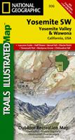
Wandelkaart - Topografische kaart 306 Yosemite SW - Yosemite Valley & Wawona | National Geographic

0
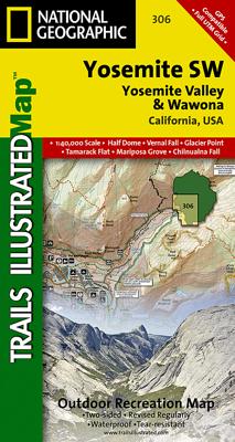
Prachtige geplastificeerde kaart van het nationaal park. Met alle recreatieve voorzieningen als campsites, maar ook met topografische details en wandelroutes ed. Door uitgekiend kleurgebruik zeer prettig in gebruik. Scheur en watervast!   Coverage of the Yosemite Valley and Wawona area of Yosemite National Park includes Sierra National Forest, Yos...

Verkopers met dit product

Verkoper
Bezorging
Prijs
DeZwerver.nl logo
DeZwerver.nl
2,95
14,95

Anderen bekeken ook

Wandelkaart - Topografische kaart 306 Yosemite SW - Yosemite Valley & Wawona | National Geographic
Prachtige geplastificeerde kaart van het nationaal park. Met alle recreatieve voorzieningen als campsites, maar ook met topografische details en wandelroutes ed. Door uitgekiend kleurgebruik zeer prettig in gebruik. Scheur en watervast!   Coverage of the Yosemite Valley and Wawona area of Yosemite National Park includes Sierra National Forest, Yosemite Wilderness, Stanislaus National Forest. Yosemite Valley, Pioneer Yosemite History Center, Badger Pass Ski Area. Includes UTM grids for use with your GPS unit.
14,95
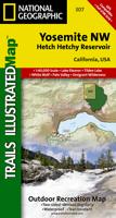
Wandelkaart - Topografische kaart 307 Yosemite NW - Hetch Hetchy Reservoir | National Geographic
Prachtige geplastificeerde kaart van het nationaal park. Met alle recreatieve voorzieningen als campsites, maar ook met topografische details en wandelroutes ed. Door uitgekiend kleurgebruik zeer prettig in gebruik. Scheur en watervast! Coverage of the Yosemite Valley and Wawona area of Yosemite National Park includes Sierra National Forest, Yosemite Wilderness, Stanislaus National Forest. Yosemite Valley, Pioneer Yosemite History Center, Badger Pass Ski Area. Includes UTM grids for use with your GPS unit.
14,95
Wandelkaart - Topografische kaart 206 Yosemite National Park | National Geographic
Prachtige geplastificeerde kaart van het bekende nationaal park. Met alle recreatieve voorzieningen als campsites, maar ook met topografische details en wandelroutes ed. Door uitgekiend kleurgebruik zeer prettig in gebruik. Scheur en watervast! Coverage includes Stanislaus National Forest, Emigrant Wilderness, Carson Iceberg Wilderness, Toiyabe National Forest, Hoover Wilderness, Inyo National Forst, Yosemite Wilderness, Sierra National Forest, Ansel Adams Wilderness. Detail on Yosemite Valley and Tuolumne Meadows. Includes UTM grids for use with your GPS unit. Coverage includes Stanislaus National Forest, Emigrant Wilderness, Carson Iceberg Wilderness, Toiyabe National Forest, Hoover Wilderness, Inyo National Forst, Yosemite Wilderness, Sierra National Forest, Ansel Adams Wilderness. Detail on Yosemite Valley and Tuolumne Meadows
16,95
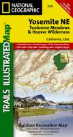
Wandelkaart - Topografische kaart 308 Yosemite NE - Tuolumne Meadows and Hoover Wilderness | National Geographic
Prachtige geplastificeerde kaart van het nationaal park. Met alle recreatieve voorzieningen als campsites, maar ook met topografische details en wandelroutes ed. Door uitgekiend kleurgebruik zeer prettig in gebruik. Scheur en watervast! Coverage of the Tuolomne Meadows and Hoover Wilderness area of Yosemite National Park includes Ansel Adams Wilderness, Yosemite Wilderness, Mono Basin National Forest Scenic Area, Monroe Hall Research Natural Area, Humbolt - Toiyabe National Forest, Twin Lakes. Includes UTM grids for use with your GPS unit.
14,95
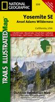
Wandelkaart 309 Yosemite SE - Ansel Adams Wilderness | National Geographic
Prachtige geplastificeerde kaart van het nationaal park. Met alle recreatieve voorzieningen als campsites, maar ook met topografische details en wandelroutes ed. Door uitgekiend kleurgebruik zeer prettig in gebruik. Scheur en watervast! Coverage of the Tuolomne Meadows and Hoover Wilderness area of Yosemite National Park includes Ansel Adams Wilderness, Yosemite Wilderness, Mono Basin National Forest Scenic Area, Monroe Hall Research Natural Area, Humbolt - Toiyabe National Forest, Twin Lakes. Includes UTM grids for use with your GPS unit.
14,95
Reisgids - Wandelgids Yosemite, Sequoia & Kings Canyon National Park | Lonely Planet
Uitstekende beschrijvingen met veel praktische informatie over dit NP. Wandelingen, overnachtingen, geschiedenis en wildlife. Lonely Planet's Yosemite, Sequoia and Kings Canyon National Parks is your passport to the most relevant, up-to-date advice on what to see and skip.Climb Half Dome, gaze at Mono Lake, and ski in Yosemite; all with your trusted travel companion. Get to the heart of Yosemite, Sequoia and Kings Canyon National Parks and begin your journey now!   Inside the Lonely Planet's Yosemite, Sequoia and Kings Canyon National Parks Travel Guide:   User-friendly highlights and itineraries help you tailor your trip to your personal needs and interests   Insider tips to save time and money and get around like a local, avoiding crowds and trouble spots   Essential info at your fingertips - hours of operation, phone numbers, websites, transit tips, prices, emergency information, park seasonality, hiking trail junctions, viewpoints, landscapes, elevations, distances, diffi…
23,95
Wandelkaart Yosemite & Central California | ITMB
The USA is blessed with many wonderful parks, forests, and natural monuments that have been preserved for all to enjoy. The second most-visited national park (after Yellowstone) is Yosemite (pronounced Yo-sem-i-tee), in the eastern portion of central California. Side 1 covers the central portion of California from a bit north of Sacramento to greater Los Angeles and focusses on major motorways and highways. A list of Top Attractions is included. Side 2 concentrates on Yosemite National Park, located east of the San Francisco region close to Nevada. There are several paved access roads into the park from the west and one from the east (none from the north or south). There are numerous camping/RV areas inside the park. As well as motels and resorts, mostly located in the vicinity of Yosemite Village The Top Attractions are all noted, including Glacier Point, the Mariposa Grove od giant sequoia trees, and Olmstead Point. Just outside the park boundary, visitors can ride the Sugar Pine Ra…
13,95
Wegenkaart - landkaart Planning Map Yosemite National Park | Lonely Planet
Handige kaart van dit Nationale Park. Goed te gebruiken als overzichtskaart en planningskaart om voor te bereiden wat je waar kunt doen. Op de ene kant een kaart van het park en op de andere zijde een globale kaart met inzetten van de hoogtepunten. Durable and waterproof, with a handy slipcase and an easy-fold format, Lonely Planet's Yosemite National Park Planning Map helps you get around with ease. Get more from your map and your trip with images and information about top attractions, itinerary suggestions, a transport guide, planning information, themed lists and practical travel tips. Durable and waterproof Easy-fold format and convenient size Handy slipcase Full color and easy to use Before-you-go info Beautiful imagery Tailored itineraries Can't-miss regional highlights Detailed town index Transport planner Themed lists Covers Yosemite Valley, El Capitan, Half Dome, Yosemite Falls, Wawona, Mariposa Grove, Chilnualna Falls, Pioneer Yosemite History Center, Tioga Ro…
10,95
Reisgids Best of Yosemite | Moon Travel Guides
Whether you're visiting the park for a day hike or spending a long weekend under the stars, escape to the great outdoors with Moon Best of Yosemite. Inside you'll find: Easy itineraries for one to three days in Yosemite National Park, from a morning drive along the Tioga Pass Road, to a day hike along the Panorama Trail, to a full weekend exploring the park The top hikes in Yosemite: Whether you're looking to stretch your legs for a couple hours or challenge yourself to an epic trek, you'll find trailheads, detailed trail descriptions, individual maps, mileage, and elevation gains Can't-miss experiences: Make it the perfect getaway for you with the best waterfalls, views, picnic spots, and more. Ride the open-air tram through Yosemite Valley or hike downhill from Glacier Point past roaring waterfalls. Admire the towering trees in the Mariposa Grove of Giant Sequoias, or spot black bears and bighorn sheep Stunning full-color photos and maps throughout, plus a full-color foldout …
23,50
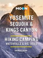
Campinggids - Campergids - Wandelgids Yosemite - Sequoia - Kings Canyon | Moon
Explore granite domes, thundering waterfalls, and towering trees: Moon Yosemite, Sequoia & Kings Canyon reveals the best of these stunning national parks. Inside you'll find: Flexible Itineraries: Unique and adventure-packed ideas for day hikers, winter visitors, families with kids, campers, and more The Best Hikes in Each Park: Detailed hike descriptions, individual trail maps, mileage and elevation gains, and backpacking options Experience the Outdoors: Ride the open-air tram through Yosemite Valley or hike downhill from Glacier Point past roaring waterfalls. Drive the legendary Generals Highway or take a scenic bike ride to pristine lakes (and yes, more waterfalls!). Go for a horse-drawn wagon ride on a history tour or take a rock-climbing lesson. Walk among the goliaths of Sequoia's Giant Forest and stop at a historic lodge for dinner and a well-deserved drink How to Get There: Up-to-date information on traveling between the parks, gateway towns, park entrances, park fees, and tou…
23,95

Klanten-reviews van Wandelkaart - Topografische kaart 306 Yosemite SW - Yosemite Valley & Wawona | National Geographic

Er zijn nog geen beoordelingen voor dit productBen jij de eerste die een review plaatst?

Meer over Wandelkaart - Topografische kaart 306 Yosemite SW - Yosemite Valley & Wawona | National Geographic

Productomschrijving

Prachtige geplastificeerde kaart van het nationaal park. Met alle recreatieve voorzieningen als campsites, maar ook met topografische details en wandelroutes ed. Door uitgekiend kleurgebruik zeer prettig in gebruik. Scheur en watervast!   Coverage of the Yosemite Valley and Wawona area of Yosemite National Park includes Sierra National Forest, Yosemite Wilderness, Stanislaus National Forest. Yosemite Valley, Pioneer Yosemite History Center, Badger Pass Ski Area. Includes UTM grids for use with your GPS unit.

Productinformatie

    Verken gerelateerde categorieën

    Webshop.nl maakt gebruik van cookies. Ga je verder op onze website, ga dan akkoord met het plaatsen van cookies en de verwerking van deze data door ons en vermelde partners.