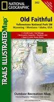
Wandelkaart - Topografische kaart 302 Old Faithful, Yellowstone National Park SW | National Geographic

0
Prachtige geplastificeerde kaart van het bekende nationaal park. Met alle recreatieve voorzieningen als campsites, maar ook met topografische details en wandelroutes ed. Door uitgekiend kleurgebruik zeer prettig in gebruik. Scheur en watervast!   Beautiful waterproof and tear-resistant topographical hiking map of a well-loved National Park, with c...

Verkopers met dit product

Verkoper
Bezorging
Prijs
DeZwerver.nl logo
DeZwerver.nl
2,95
14,95

Anderen bekeken ook

Wandelkaart - Topografische kaart 302 Old Faithful, Yellowstone National Park SW | National Geographic
Prachtige geplastificeerde kaart van het bekende nationaal park. Met alle recreatieve voorzieningen als campsites, maar ook met topografische details en wandelroutes ed. Door uitgekiend kleurgebruik zeer prettig in gebruik. Scheur en watervast!   Beautiful waterproof and tear-resistant topographical hiking map of a well-loved National Park, with campsites and walking routes clearly marked. Coverage of the Old Faithful area of Yellowstone National Park includes Heart Lake BMA, Pitchstone Plateau, Bechler Ranger Station, South Entrance, Teton Wilderness, John D. Rockefeller Jr Memorial Parkway, Jedediah Smith Wilderness, Winegar Hole Wilderness, Bechler Canyon, Cascade Corner, Firehole BMA, Shoshone Lake, Western half of Yellowstone Lake. Includes UTM grids for use with your GPS unit.
14,95
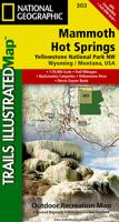
Wandelkaart - Topografische kaart 303 Mammoth Hot Springs Yellowstone National Park | National Geographic
Prachtige geplastificeerde kaart van het nationaal park. Met alle recreatieve voorzieningen als campsites, maar ook met topografische details en wandelroutes ed. Door uitgekiend kleurgebruik zeer prettig in gebruik. Scheur en watervast! Coverage of the Old Faithful area of Yellowstone National Park includes Heart Lake BMA, Pitchstone Plateau, Bechler Ranger Station, South Entrance, Teton Wilderness, John D. Rockefeller Jr Memorial Parkway, Jedediah Smith Wilderness, Winegar Hole Wilderness, Bechler Canyon, Cascade Corner, Firehole BMA, Shoshone Lake, Western half of Yellowstone Lake. Includes UTM grids for use with your GPS unit.
14,95
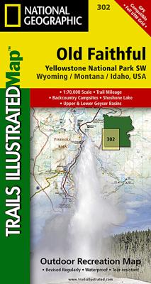
Wandelkaart - Topografische kaart 201 Trails Illustrated Yellowstone National Park | National Geographic
Prachtige geplastificeerde kaart van het bekende nationaal park. Met alle recreatieve voorzieningen als campsites, maar ook met topografische details en wandelroutes ed. Door uitgekiend kleurgebruik zeer prettig in gebruik. Scheur en watervast! National Geographic's Trails Illustrated map of Yellowstone National Park is designed to meet the needs of outdoor enthusiasts by combining valuable information with unmatched detail of America's first national park. Expertly researched and created in partnership with local land management agencies, this map features key points of interest including Mammoth Hot Springs, Canyon Village, Yellowstone Lake, Yellowstone Falls, Grant Village, and Old Faithful geyser area.   With over 1,000 miles of mapped trails, the Yellowstone National Park map can guide you off the beaten path and back again. The clearly marked trails include mileages between intersections. Trail summaries provide elevation, duration, and difficulty for a variety of suggested hike…
16,95
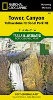
Wandelkaart - Topografische kaart 304 Tower - Canyon - Yellowstone National Park NE | National Geographic
Prachtige geplastificeerde kaart van het nationaal park. Met alle recreatieve voorzieningen als campsites, maar ook met topografische details en wandelroutes ed. Door uitgekiend kleurgebruik zeer prettig in gebruik. Scheur en watervast!   Coverage of the Tower / Canyon area of Yellowstone National Park includes Canyon Village, Tower - RooseveltWashburn BMA, Antelope BMA, Mirror Plateau BMA, Absaroka Beartooth Wilderness, Gallatin National Forest, Northeast entrance. Includes UTM grids for use with your GPS unit.
14,95
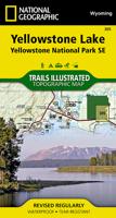
Wandelkaart 305 Yellowstone Lake | National Geographic
Prachtige geplastificeerde kaart van het nationaal park. Met alle recreatieve voorzieningen als campsites, maar ook met topografische details en wandelroutes ed. Door uitgekiend kleurgebruik zeer prettig in gebruik. Scheur en watervast! National Geographic's Trails Illustrated map of the Yellowstone Lake area of Yellowstone National Park is designed to meet the needs of outdoor enthusiasts with unmatched detail of the south-east section of the national park. Expertly researched and created in partnership with local land management agencies, this map features key points of interest including Yellowstone lake shown with contours and bathe metric shading, Lake Village, Grant Village, East Entrance Station, Heart Lake, Bridger-Teton National Forest, Shoshone National Forest, Teton Wilderness, and North Absaroka Wilderness.   With many miles of mapped trails and marked Bear Management Zones the Yellowstone Lake map can guide you off the beaten path and back again. The clearly marked trails…
14,95
Wegenkaart - landkaart Yellowstone National Park and Wyoming | ITMB
The USA is a vast and wonderful land to explore. ITMB is steadily increasing our coverage of this important travel destination and this month concentrates on the State of Wyoming, with a detailed travel map on one side, including small portions of adjacent states of Utah, Colorado, Nebraska, South Dakota, Montana, and Idaho. The state is lightly populated, with Cheyanne as its capital and main city. Interstates 80 and 90 both traverse the state, with Interstate 25 being the only north-south motorway. Yellowstone National Park occupies the northwest corner of the state and also occupies the second side of the sheet with an extremely detailed map. Yellowstone is the first area in the world to be proclaimed as a national protected area (Banff was second), and Yellowstone remains the paramount preserved wilderness environment in the world. There are several small urban areas within the park for accommodations and servicing, such as West Thumb, Canyon City, and Mammoth Hot Springs. The mai…
13,95
Wandelkaart - Topografische kaart 206 Yosemite National Park | National Geographic
Prachtige geplastificeerde kaart van het bekende nationaal park. Met alle recreatieve voorzieningen als campsites, maar ook met topografische details en wandelroutes ed. Door uitgekiend kleurgebruik zeer prettig in gebruik. Scheur en watervast! Coverage includes Stanislaus National Forest, Emigrant Wilderness, Carson Iceberg Wilderness, Toiyabe National Forest, Hoover Wilderness, Inyo National Forst, Yosemite Wilderness, Sierra National Forest, Ansel Adams Wilderness. Detail on Yosemite Valley and Tuolumne Meadows. Includes UTM grids for use with your GPS unit. Coverage includes Stanislaus National Forest, Emigrant Wilderness, Carson Iceberg Wilderness, Toiyabe National Forest, Hoover Wilderness, Inyo National Forst, Yosemite Wilderness, Sierra National Forest, Ansel Adams Wilderness. Detail on Yosemite Valley and Tuolumne Meadows
16,95
Wandelkaart - Topografische kaart 248 Katmai National Park & Preserve | National Geographic
Prachtige geplastificeerde kaart van het nationaal park. Met alle recreatieve voorzieningen als campsites, maar ook met topografische details en wandelroutes ed. Door uitgekiend kleurgebruik zeer prettig in gebruik. Scheur en watervast! This two-sided map includes Katmai National Park and Wilderness in its entirety, Becharof National Wildlife Refuge, Becharof Wilderness Area, Alaska Peninsula National Wildlife Refuge, Alagnak Wild River Katmai National Preserve, McNeil River State Game Refuge, McNeil River State Game Sanctuary, Iliamna Lake, Kukaklek Lake, Naknek Lake, Kvichak Bay, Becharof LAke, Upper Ugashik Lake, Puale Bay, Katmai Bay, and the Shelikof Strait. Also included are Mt Katmai, Trident Bolcano, Novatupta, Mt. Mageik, Mt. Martin, Three Forks Overlook, and Brooks Camp. The map features Wilderness Safety tips, land use regulations, and information on how best to react to bear encounters. Beautiful cartography shows the mountains, rivers, marsh areas, and natural features of…
16,95
Reisgids - Wandelgids Yellowstone & Grand Teton National Park | Lonely Planet
Uitstekende beschrijvingen met veel praktische informatie over dit NP. Wandelingen, overnachtingen, geschiedenis en wildlife.  Lonely Planet's Yellowstone and Grand Teton National Parks is your passport to the most relevant, up-to-date advice on what to see and skip, and what hidden discoveries await you. Watch Old Faithful erupt, spot wildlife and climb Mt Teton; all with your trusted travel companion. Get to the heart of Yellowstone and Grand Teton National Parks and begin your journey now!         Inside the Lonely Planet's Yellowstone and Grand Teton National Parks Travel Guide:   User-friendly highlights and itineraries help you tailor your trip to your personal needs and interests   Insider tips to save time and money and get around like a local, avoiding crowds and trouble spots   Essential info at your fingertips - hours of operation, phone numbers, websites, transit tips, prices, emergency information, park seasonality, hiking trail junctions, viewpoints, landsca…
23,95
Wandelkaart 223 North Cascades National Park | National Geographic
Prachtige geplastificeerde kaart van het bekende nationaal park. Met alle recreatieve voorzieningen als campsites, maar ook met topografische details en wandelroutes ed. Door uitgekiend kleurgebruik zeer prettig in gebruik. Scheur en watervast!   Explore the alpine forests, wild rivers, jagged peaks, and abundant glaciers of North Cascades National Park with National Geographic’s Trails Illustrated map. Expertly researched and created in partnership with local land management agencies, this map features key points of interest including Baker Lake; Rockport State Park; Chelan and Ross Lake National Recreation Areas; Stephen Mather, Mount Baker, and Pasayten Wilderness Areas; Snoqualmie and Okanogan Wenatchee National Forests; and portions of the Sauk, Skagit, and Suiattle rivers.   With miles of clearly marked trails including the popular Pacific Crest and Pacific Northwest trails, this map can guide you off the beaten path and back again. Mileages between intersections are shown and t…
16,95

Klanten-reviews van Wandelkaart - Topografische kaart 302 Old Faithful, Yellowstone National Park SW | National Geographic

Er zijn nog geen beoordelingen voor dit productBen jij de eerste die een review plaatst?

Meer over Wandelkaart - Topografische kaart 302 Old Faithful, Yellowstone National Park SW | National Geographic

Productomschrijving

Prachtige geplastificeerde kaart van het bekende nationaal park. Met alle recreatieve voorzieningen als campsites, maar ook met topografische details en wandelroutes ed. Door uitgekiend kleurgebruik zeer prettig in gebruik. Scheur en watervast!   Beautiful waterproof and tear-resistant topographical hiking map of a well-loved National Park, with campsites and walking routes clearly marked. Coverage of the Old Faithful area of Yellowstone National Park includes Heart Lake BMA, Pitchstone Plateau, Bechler Ranger Station, South Entrance, Teton Wilderness, John D. Rockefeller Jr Memorial Parkway, Jedediah Smith Wilderness, Winegar Hole Wilderness, Bechler Canyon, Cascade Corner, Firehole BMA, Shoshone Lake, Western half of Yellowstone Lake. Includes UTM grids for use with your GPS unit.

Productinformatie

    Verken gerelateerde categorieën

    Webshop.nl maakt gebruik van cookies. Ga je verder op onze website, ga dan akkoord met het plaatsen van cookies en de verwerking van deze data door ons en vermelde partners.