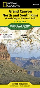
Wandelkaart - Topografische kaart 261 Grand Canyon | National Geograph
Prachtige geplastificeerde kaart van het bekende nationaal park. Met alle recreatieve voorzieningen als campsites, maar ook met topografische details en wandelroutes ed. Door uitgekiend kleurgebruik zeer prettig in gebruik. Scheur en watervast! Explore the uniquely inspiring and wondrous landscape of the Grand Canyon with National Geographic's Trails Illustrated map of Grand Canyon National Park, North and South Rims. Expertly researched and created in partnership with local land management agencies, this map is designed to meet the needs of outdoor enthusiasts with unmatched detail of the heart of the park. Key areas of interest featured on this map include Colorado River miles 60-98, North and South Rim visitor centers, Grand Canyon Village, Tusayan, Bright Angel Trail (plus elevation profile), West Rim Trail, Kaibab Trail, Arizona Trail, and more. With miles of mapped trails in some of the most breathtaking scenery in the entire country, the Grand Canyon North and South Rims map…
16,95


