webshop.nl
Categorieën
  Sluiten

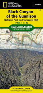
Wandelkaart - Topografische kaart 245 Black Canyon of the Gunnison National Park | National Geographic

Prachtige geplastificeerde kaart van het bekende nationaal park. Met alle recreatieve voorzieningen als campsites, maar ook met topografische details en wandelroutes ed. Door uitgekiend kleurgebruik zeer prettig in gebruik. Scheur en watervast! Beautiful waterproof and tear-resistant topographical hiking map of a well-loved National Park, with camp...
16,95

Webshops met dit product

Webshop
Bezorging
Prijs

Anderen bekeken ook

Wandelkaart - Topografische kaart 261 Grand Canyon | National Geographic
Prachtige geplastificeerde kaart van het bekende nationaal park. Met alle recreatieve voorzieningen als campsites, maar ook met topografische details en wandelroutes ed. Door uitgekiend kleurgebruik zeer prettig in gebruik. Scheur en watervast!   Explore the uniquely inspiring and wondrous landscape of the Grand Canyon with National Geographic's Trails Illustrated map of Grand Canyon National Park, North and South Rims. Expertly researched and created in partnership with local land management agencies, this map is designed to meet the needs of outdoor enthusiasts with unmatched detail of the heart of the park. Key areas of interest featured on this map include Colorado River miles 60-98, North and South Rim visitor centers, Grand Canyon Village, Tusayan, Bright Angel Trail (plus elevation profile), West Rim Trail, Kaibab Trail, Arizona Trail, and more.   With miles of mapped trails in some of the most breathtaking scenery in the entire country, the Grand Canyon North and South Rims map…
16,95
Wandelkaart - Topografische kaart 263 Grand Canyon West | National Geographic
Prachtige geplastificeerde kaart van het nationaal park. Met alle recreatieve voorzieningen als campsites, maar ook met topografische details en wandelroutes ed. Door uitgekiend kleurgebruik zeer prettig in gebruik. Scheur en watervast! National Geographic's Trails Illustrated map of Grand Canyon West covers some of the less frequented but just as wondrous landscape of Grand Canyon National Park, from Powell Plateau to the park's western boundary. Expertly researched and created in partnership with the National Park Service, U.S. Forest Service, Bureau of Land Management and others, the map also covers the surrounding areas of Kaibab National Forest, Hualapai Havasupai Indian Reservations and Parashant National Monument. With so much of the area being backcountry, the map also includes useful backcountry information, regulations and safety tips, in addition to a backcountry use area guide, color-coded by degree of experience required.   Clearly marked trails, including unmaintained pri…
16,95
Wandelkaart - Topografische kaart 201 Trails Illustrated Yellowstone National Park | National Geographic
Prachtige geplastificeerde kaart van het bekende nationaal park. Met alle recreatieve voorzieningen als campsites, maar ook met topografische details en wandelroutes ed. Door uitgekiend kleurgebruik zeer prettig in gebruik. Scheur en watervast! National Geographic's Trails Illustrated map of Yellowstone National Park is designed to meet the needs of outdoor enthusiasts by combining valuable information with unmatched detail of America's first national park. Expertly researched and created in partnership with local land management agencies, this map features key points of interest including Mammoth Hot Springs, Canyon Village, Yellowstone Lake, Yellowstone Falls, Grant Village, and Old Faithful geyser area.   With over 1,000 miles of mapped trails, the Yellowstone National Park map can guide you off the beaten path and back again. The clearly marked trails include mileages between intersections. Trail summaries provide elevation, duration, and difficulty for a variety of suggested hikes…
16,95
Wandelkaart - Topografische kaart 803 Lake Tahoe Basin | National Geographic
Prachtige geplastificeerde kaart van het bekende nationaal park. Met alle recreatieve voorzieningen als campsites, maar ook met topografische details en wandelroutes ed. Door uitgekiend kleurgebruik zeer prettig in gebruik. Scheur en watervast! The largest alpine lake in North America, Lake Tahoe straddles the border of California and Nevada. It's unusually clear waters and surrounding Sierra Nevada mountains make it one of the most beautiful lakes in the world. National Geographic's Trails Illustrated map of Lake Tahoe Basin delivers unmatched detail and valuable information to assist you in enjoying the year-round recreational opportunities this region offers. Expertly researched and created in partnership with local land management agencies, this map includes Desolation Wilderness; Prosser Creek Reservoir; Granite Chief and Mount Rose wilderness areas; and El Dorado, Humboldt-Toiyabe and Tahoe National Forests. In addition, the following state parks are included: Donner Memorial, Ed…
17,95
Wandelkaart - Topografische kaart 314 Many Glacier - Glacier and Waterton Lakes National Parks | National Geographic
Prachtige geplastificeerde kaart van het bekende nationaal park. Met alle recreatieve voorzieningen als campsites, maar ook met topografische details en wandelroutes ed. Door uitgekiend kleurgebruik zeer prettig in gebruik. Scheur en watervast!   Located just north of Kalispell in Montana's northwest corner, Glacier National contains an abundance of recreational opportunities for outdoor enthusiasts of all interests.   This detailed topographic recreation map contains carefully researched trails, campsites, forest service roads, and points-of-interests, for the Many Glacier section of the park. Two additional maps for the North Fork and the Two Medicine regions of the park along with a comprehensive Glacier National Park Trails Illustrated map are also available. An enhanced scale of 1:50,000, useful UTM and Latitude/Longitude grids, mileage charts, and other navigation features make the North Fork sectional the best map available for the western side of the park.   The North Side of t…
14,95
Wandelkaart - Topografische kaart 254 Chilkoot Trail | National Geographic
Prachtige geplastificeerde kaart van het nationaal park. Met alle recreatieve voorzieningen als campsites, maar ook met topografische details en wandelroutes ed. Door uitgekiend kleurgebruik zeer prettig in gebruik. Scheur en watervast!   National Geographic's Trails Illustrated map for Chilkoot Trail in Klondike Gold Rush National Historic Park in the Alaskan panhandle is perfect for hiking, camping, and wildlife viewing in this scenic, rugged frontier. Created in partnership with local land management agencies, this expertly researched map features key areas of interest including Chilkoot Trail National Historic Site; portions of the Klondike Highway; Happy Camp; Taiya Inlet; the town of Skagway; Klondike Gold Rush National Historical Park; Skagway River; Dyea; and Deep, Bennett, Crater, Long, and Lindeman lakes.   The print map includes insets of historic routes to the Klondike gold fields, Historic Dyea, and Skagway Historic District with some of the prominent gold rush-era buil…
16,95
Wandelkaart - Topografische kaart 255 Glacier Bay National Park & Preserve | National Geographic
Prachtige geplastificeerde kaart van het nationaal park. Met alle recreatieve voorzieningen als campsites, maar ook met topografische details en wandelroutes ed. Door uitgekiend kleurgebruik zeer prettig in gebruik. Scheur en watervast! This Trails Illustrated map for Glacier Bay National Park, Glacier Bay National Preserve, and surrounding area and surrounding area in Alaska's panhandle is perfect for hiking, camping, boating, paddling, and wildlife viewing in this scenic, rugged frontier.   This two-sided map includes Glacier Bay National Park, Glacier Bay National Preserve, Glacier Bay Wilderness, portions of Tongass National Forest, Chicagof Island, Endicott River Wilderness, Haines State Forest and Resource Management Area, Chilkat State Park, Chilkat Islands, Sullivan Island State Marine Park, Pleasant Island, Lemesurier Island, Inian Islands, and Tatshenshini Alsek Park. Waterways include the Gulf of Alaska, Glacier Bay, Cross Sound, Icy Strait, Lynn Canal, Geikie Inlet, Muir In…
16,95
Wandelkaart 223 North Cascades National Park | National Geographic
Prachtige geplastificeerde kaart van het bekende nationaal park. Met alle recreatieve voorzieningen als campsites, maar ook met topografische details en wandelroutes ed. Door uitgekiend kleurgebruik zeer prettig in gebruik. Scheur en watervast!   Explore the alpine forests, wild rivers, jagged peaks, and abundant glaciers of North Cascades National Park with National Geographic’s Trails Illustrated map. Expertly researched and created in partnership with local land management agencies, this map features key points of interest including Baker Lake; Rockport State Park; Chelan and Ross Lake National Recreation Areas; Stephen Mather, Mount Baker, and Pasayten Wilderness Areas; Snoqualmie and Okanogan Wenatchee National Forests; and portions of the Sauk, Skagit, and Suiattle rivers.   With miles of clearly marked trails including the popular Pacific Crest and Pacific Northwest trails, this map can guide you off the beaten path and back again. Mileages between intersections are shown and th…
16,95
Wandelkaart - Topografische kaart 316 Cades Cove - Elkmont - Great Smoky Mountains National Park | National Geographic
Prachtige geplastificeerde kaart van het bekende nationaal park. Met alle recreatieve voorzieningen als campsites, maar ook met topografische details en wandelroutes ed. Door uitgekiend kleurgebruik zeer prettig in gebruik. Scheur en watervast!   This title provides an increased scale of one of the most visited National Parks in the US, and one of our more popular map titles. This increased scale will provide greater detail to the backcountry users and Appalachian Trail through-hikers.   Great Smoky Mountains National Park is a hiker's paradise with over 800 miles of maintained trails ranging from short legstretchers to strenuous treks that may require backcountry camping. But hiking is not the only reason for visiting the Smokies. Car camping, fishing, picnicking, wildlife viewing and auto touring are popular activities.   Coverage Highlights Areas and places featured in this map series (TI316 and TI317) include: • Appalachian Trail • Benton Mackaye Trail • Mountains-to-Sea Trail • Ba…
14,95
Wandelkaart - Topografische kaart 317 Clingmans Dome Cataloochee - Great Smoky Mountains National Park | National Geographic
Prachtige geplastificeerde kaart van het bekende nationaal park. Met alle recreatieve voorzieningen als campsites, maar ook met topografische details en wandelroutes ed. Door uitgekiend kleurgebruik zeer prettig in gebruik. Scheur en watervast! This title provides an increased scale of one of the most visited National Parks in the US, and one of our more popular map titles. This increased scale will provide greater detail to the backcountry users and Appalachian Trail through-hikers.   Great Smoky Mountains National Park is a hiker's paradise with over 800 miles of maintained trails ranging from short legstretchers to strenuous treks that may require backcountry camping. But hiking is not the only reason for visiting the Smokies. Car camping, fishing, picnicking, wildlife viewing and auto touring are popular activities.   Coverage Highlights Areas and places featured in this map series (TI316 and TI317) include: • Appalachian Trail • Benton Mackaye Trail • Mountains-to-Sea Trail • Back…
14,95

Klanten-reviews van Wandelkaart - Topografische kaart 245 Black Canyon of the Gunnison National Park | National Geographic

Er zijn nog geen beoordelingen voor dit productBen jij de eerste die een review plaatst?

Meer over Wandelkaart - Topografische kaart 245 Black Canyon of the Gunnison National Park | National Geographic

Productomschrijving

Prachtige geplastificeerde kaart van het bekende nationaal park. Met alle recreatieve voorzieningen als campsites, maar ook met topografische details en wandelroutes ed. Door uitgekiend kleurgebruik zeer prettig in gebruik. Scheur en watervast! Beautiful waterproof and tear-resistant topographical hiking map of a well-loved National Park, with campsites and walking routes clearly marked. This two-sided map includes Black Canyon National Park in its entirety, and Gunnison Gorge Wilderness, and portions of Gunnison Gorge National Conservation Area. South Rim trails include Rim Rock Trail, Uplands Trail, Oak Flat Loop, Cedar Point Trail, and Warner Point Trail. The North Rim trails include Chasm View Trail, North Vista Trail, and Deadhorse Trail. Campgounds, fishing spots, overlooks, view points, visitor centers, and cultural sites thoughout the park are shown, as well as rapids and ratings along the Gunnison River. Includes UTM grids for use with your GPS unit.

Verken gerelateerde categorieën

Webshop.nl maakt gebruik van cookies. Ga je verder op onze website, ga dan akkoord met het plaatsen van cookies en de verwerking van deze data door ons en vermelde partners.