webshop.nl
Categorieën
  Sluiten

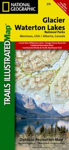
Wandelkaart - Topografische kaart 215 Glacier - Waterton Lakes National Park | National Geographic

Prachtige geplastificeerde kaart van het bekende nationaal park. Met alle recreatieve voorzieningen als campsites, maar ook met topografische details en wandelroutes ed. Door uitgekiend kleurgebruik zeer prettig in gebruik. Scheur en watervast! Waterton Lakes National Park, Canada includes Waterton Park, Upper and Middle Waterton Lakes, The Border ...
16,95

Webshops met dit product

Webshop
Bezorging
Prijs

Anderen bekeken ook

Wandelkaart - Topografische kaart 314 Many Glacier - Glacier and Waterton Lakes National Parks | National Geographic
Prachtige geplastificeerde kaart van het bekende nationaal park. Met alle recreatieve voorzieningen als campsites, maar ook met topografische details en wandelroutes ed. Door uitgekiend kleurgebruik zeer prettig in gebruik. Scheur en watervast!   Located just north of Kalispell in Montana's northwest corner, Glacier National contains an abundance of recreational opportunities for outdoor enthusiasts of all interests.   This detailed topographic recreation map contains carefully researched trails, campsites, forest service roads, and points-of-interests, for the Many Glacier section of the park. Two additional maps for the North Fork and the Two Medicine regions of the park along with a comprehensive Glacier National Park Trails Illustrated map are also available. An enhanced scale of 1:50,000, useful UTM and Latitude/Longitude grids, mileage charts, and other navigation features make the North Fork sectional the best map available for the western side of the park.   The North Side of t…
14,95
Wandelkaart 16 Waterton Lakes NP | Gem Trek Maps
The Waterton Lakes National Park map is one of our most popular trail map-guides for the Canadian Rockies. This map covers all of Waterton Lakes National Park, the eastern end of Akamina-Kishinena Provincial Park, and the Goat Haunt or northern area of Glacier National Park, Montana, at the south end of Upper Waterton Lake. The front of the map covers all of the hiking and biking trails departing from Waterton townsite, Red Rock Parkway, Akamina Parkway, and the Goat Haunt region of Glacier National Park. Popular trails covered include Carthew-Alderson, Crypt Lake, Goat Lake, Twin Lakes, Forum and Wall lakes, and the Tamarack Trail. Also on the front is an inset map (1:35,000) of Waterton townsite, with accommodation and services marked for your convenience. On the back of the map are trail descriptions of more than 20 of the best day hikes in the area, ranging from short interpretive walks to strenuous hikes up to alpine meadows. There are also trail descriptions of four classic bike-…
17,95
Wandelkaart - Topografische kaart 255 Glacier Bay National Park & Preserve | National Geographic
Prachtige geplastificeerde kaart van het nationaal park. Met alle recreatieve voorzieningen als campsites, maar ook met topografische details en wandelroutes ed. Door uitgekiend kleurgebruik zeer prettig in gebruik. Scheur en watervast! This Trails Illustrated map for Glacier Bay National Park, Glacier Bay National Preserve, and surrounding area and surrounding area in Alaska's panhandle is perfect for hiking, camping, boating, paddling, and wildlife viewing in this scenic, rugged frontier.   This two-sided map includes Glacier Bay National Park, Glacier Bay National Preserve, Glacier Bay Wilderness, portions of Tongass National Forest, Chicagof Island, Endicott River Wilderness, Haines State Forest and Resource Management Area, Chilkat State Park, Chilkat Islands, Sullivan Island State Marine Park, Pleasant Island, Lemesurier Island, Inian Islands, and Tatshenshini Alsek Park. Waterways include the Gulf of Alaska, Glacier Bay, Cross Sound, Icy Strait, Lynn Canal, Geikie Inlet, Muir In…
16,95
Reisgids Fodor's the Complete Guide to the National Parks of the USA | Fodor's Travel
Whether you want to hike through the jaw-dropping scenery of Acadia, see rare wildlife and natural wonders in Yellowstone, or go river-rafting in the Grand Canyon, the local Fodor's travel experts in all the National Parks are here to help! Fodor's Complete Guide to the National Parks of the USA is packed with maps, carefully curated recommendations, and everything else you need to simplify your trip-planning process and make the most of your time. This brand new title has been designed with an easy-to-read layout, fresh information, and beautiful color photos. Fodor's Complete Guide to the National Parks of the USA travel guide includes: AN ILLUSTRATED ULTIMATE EXPERIENCES GUIDE to the top things to see and do MULTIPLE ITINERARIES to effectively organize your days and maximize your time MORE THAN 70 DETAILED MAPS to help you navigate confidently COLOR PHOTOS throughout to spark your wanderlust! HONEST RECOMMENDATIONS FROM LOCALS on the best sights, restaurants, hotels, activitie…
26,95
Wandelkaart - Topografische kaart 744 Adirondack Park - Northville - Raquette Lake | National Geographic
Prachtige geplastificeerde kaart van het bekende nationaal park. Met alle recreatieve voorzieningen als campsites, maar ook met topografische details en wandelroutes ed. Door uitgekiend kleurgebruik zeer prettig in gebruik. Scheur en watervast! National Geographic's Trails Illustrated map of Adirondack Park Northville/Raquette Lake is a two-sided, waterproof, topographic trail map designed to meet the needs of outdoor enthusiasts with unmatched durability and detail. This map was created in cooperation with the Adirondack Mountain Club and is loaded with valuable recreation information for boating, hiking, fishing, sailing, cycling, ice fishing, skiing, and snowmobiling. Trails and major roads are clearly distinguished, from the picturesque foothills to the northern peaks and around lakes of all sizes. Campgrounds, climbing areas, marinas, and museums are labeled and easy to find and boundaries for park lands, wilderness, primitive, forest, and protected areas are clearly marked. Disco…
17,95
Wandelkaart - Topografische kaart 201 Trails Illustrated Yellowstone National Park | National Geographic
Prachtige geplastificeerde kaart van het bekende nationaal park. Met alle recreatieve voorzieningen als campsites, maar ook met topografische details en wandelroutes ed. Door uitgekiend kleurgebruik zeer prettig in gebruik. Scheur en watervast! National Geographic's Trails Illustrated map of Yellowstone National Park is designed to meet the needs of outdoor enthusiasts by combining valuable information with unmatched detail of America's first national park. Expertly researched and created in partnership with local land management agencies, this map features key points of interest including Mammoth Hot Springs, Canyon Village, Yellowstone Lake, Yellowstone Falls, Grant Village, and Old Faithful geyser area.   With over 1,000 miles of mapped trails, the Yellowstone National Park map can guide you off the beaten path and back again. The clearly marked trails include mileages between intersections. Trail summaries provide elevation, duration, and difficulty for a variety of suggested hikes…
16,95
Reisgids Banff, Jasper and Glacier National Park | Lonely Planet
Uitgebreide beschrijving van alle recreatieve mogelijkheden van deze nationale parken. De perfecte reisgids voor zowel de georganiseerde als de zelfstandige reiziger. Naast een algemene inleiding van het land / streek vol met praktische informatie over hoe je er het beste kunt reizen: slapen, eten, vervoer, excursies ... alles kun je er in vinden. Engelstalig. Lonely Planet Lonely Planet's Banff, Jasper and Glacier National Parks is your passport to the most relevant, up-to-date advice on what to see and skip. Hike the Skyline Trail, watch for bears, and ride the rapids; all with your trusted travel companion. Get to the heart of Banff, Jasper and Glacier National Parks and begin your journey now!   Inside the Lonely Planet's Banff, Jasper and Glacier National Parks Travel Guide:   User-friendly highlights and itineraries help you tailor your trip to your personal needs and interests   Insider tips to save time and money and get around like a local, avoiding crowds and trouble…
23,95
Wandelkaart 223 North Cascades National Park | National Geographic
Prachtige geplastificeerde kaart van het bekende nationaal park. Met alle recreatieve voorzieningen als campsites, maar ook met topografische details en wandelroutes ed. Door uitgekiend kleurgebruik zeer prettig in gebruik. Scheur en watervast!   Explore the alpine forests, wild rivers, jagged peaks, and abundant glaciers of North Cascades National Park with National Geographic’s Trails Illustrated map. Expertly researched and created in partnership with local land management agencies, this map features key points of interest including Baker Lake; Rockport State Park; Chelan and Ross Lake National Recreation Areas; Stephen Mather, Mount Baker, and Pasayten Wilderness Areas; Snoqualmie and Okanogan Wenatchee National Forests; and portions of the Sauk, Skagit, and Suiattle rivers.   With miles of clearly marked trails including the popular Pacific Crest and Pacific Northwest trails, this map can guide you off the beaten path and back again. Mileages between intersections are shown and th…
16,95
Wandelkaart - Topografische kaart 803 Lake Tahoe Basin | National Geographic
Prachtige geplastificeerde kaart van het bekende nationaal park. Met alle recreatieve voorzieningen als campsites, maar ook met topografische details en wandelroutes ed. Door uitgekiend kleurgebruik zeer prettig in gebruik. Scheur en watervast! The largest alpine lake in North America, Lake Tahoe straddles the border of California and Nevada. It's unusually clear waters and surrounding Sierra Nevada mountains make it one of the most beautiful lakes in the world. National Geographic's Trails Illustrated map of Lake Tahoe Basin delivers unmatched detail and valuable information to assist you in enjoying the year-round recreational opportunities this region offers. Expertly researched and created in partnership with local land management agencies, this map includes Desolation Wilderness; Prosser Creek Reservoir; Granite Chief and Mount Rose wilderness areas; and El Dorado, Humboldt-Toiyabe and Tahoe National Forests. In addition, the following state parks are included: Donner Memorial, Ed…
17,95
Wandelkaart - Topografische kaart 254 Chilkoot Trail | National Geographic
Prachtige geplastificeerde kaart van het nationaal park. Met alle recreatieve voorzieningen als campsites, maar ook met topografische details en wandelroutes ed. Door uitgekiend kleurgebruik zeer prettig in gebruik. Scheur en watervast!   National Geographic's Trails Illustrated map for Chilkoot Trail in Klondike Gold Rush National Historic Park in the Alaskan panhandle is perfect for hiking, camping, and wildlife viewing in this scenic, rugged frontier. Created in partnership with local land management agencies, this expertly researched map features key areas of interest including Chilkoot Trail National Historic Site; portions of the Klondike Highway; Happy Camp; Taiya Inlet; the town of Skagway; Klondike Gold Rush National Historical Park; Skagway River; Dyea; and Deep, Bennett, Crater, Long, and Lindeman lakes.   The print map includes insets of historic routes to the Klondike gold fields, Historic Dyea, and Skagway Historic District with some of the prominent gold rush-era buil…
16,95

Klanten-reviews van Wandelkaart - Topografische kaart 215 Glacier - Waterton Lakes National Park | National Geographic

Er zijn nog geen beoordelingen voor dit productBen jij de eerste die een review plaatst?

Meer over Wandelkaart - Topografische kaart 215 Glacier - Waterton Lakes National Park | National Geographic

Productomschrijving

Prachtige geplastificeerde kaart van het bekende nationaal park. Met alle recreatieve voorzieningen als campsites, maar ook met topografische details en wandelroutes ed. Door uitgekiend kleurgebruik zeer prettig in gebruik. Scheur en watervast! Waterton Lakes National Park, Canada includes Waterton Park, Upper and Middle Waterton Lakes, The Border Ranges, Akamina Kishinena Provincial Park, Blood Timber Reserve, and more. Glacier National Park, Montana includes the entire national park area, with detailed trails, and topographic information. Includes the Lewis and Clark Range, Many Glacier, Lake McDonald, Great Bear Wilderness, Flathead National Forest, Columbia Falls, Horse Reservoir, St. Mary Lake, and much more. Includes UTM grids for use with your GPS unit.
Webshop.nl maakt gebruik van cookies. Ga je verder op onze website, ga dan akkoord met het plaatsen van cookies en de verwerking van deze data door ons en vermelde partners.