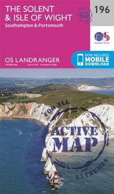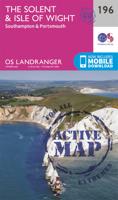
Wandelkaart - Topografische kaart 196 Landranger Active The Solent / the Isle of Wight | Ordnance Survey

0
Explore the sandy beaches, historic houses and distinctive ‘chines’ of the Isle of Wight and soak up the beauty and tranquillity that made it a favourite with the likes of Queen Victoria and Alfred Lord Tennyson. Discover the vibrant maritime cities of Southampton and Portsmouth. Visit the Mayflower Pilgrims’ Memorial, Portsmouth Historic Dockyard...

Verkopers met dit product

Verkoper
Bezorging
Prijs
DeZwerver.nl logo
DeZwerver.nl
2,95
25,95

Anderen bekeken ook

Wandelkaart - Topografische kaart 196 Landranger Active The Solent / the Isle of Wight | Ordnance Survey
Explore the sandy beaches, historic houses and distinctive ‘chines’ of the Isle of Wight and soak up the beauty and tranquillity that made it a favourite with the likes of Queen Victoria and Alfred Lord Tennyson. Discover the vibrant maritime cities of Southampton and Portsmouth. Visit the Mayflower Pilgrims’ Memorial, Portsmouth Historic Dockyard and the must-see Mary Rose See royal Osborne House in East Cowes, imposing Carisbrooke Castle and the iconic Needles with unrivalled views of the Solent Walk, hike and cycle along the Solent Way and other popular recreational paths    Zeer goede detailkaart met topografische ondergrond. Kleurgebruik is goed over nagedacht: bijzonder goed leesbaar en helder kaartbeeld. Hierop zijn toeristische symbolen van bezienswaardigheden ingetekend, daarnaast staan bijvoorbeeld campings en jeugdherbergen vermeld en - voor wandelaars het belangrijkst - alle right of way paden en Lange afstands Wandelpaden zijn er op te vinden. De ideale kaart voor het wan…
25,95
Wandelkaart - Topografische kaart 196 Landranger The Solent & The Isle of Wight | Ordnance Survey
Explore the sandy beaches, historic houses and distinctive ‘chines’ of the Isle of Wight and soak up the beauty and tranquillity that made it a favourite with the likes of Queen Victoria and Alfred Lord Tennyson. Discover the vibrant maritime cities of Southampton and Portsmouth. Visit the Mayflower Pilgrims’ Memorial, Portsmouth Historic Dockyard and the must-see Mary Rose See royal Osborne House in East Cowes, imposing Carisbrooke Castle and the iconic Needles with unrivalled views of the Solent Walk, hike and cycle along the Solent Way and other popular recreational paths    Zeer goede detailkaart met topografische ondergrond. Kleurgebruik is goed over nagedacht: bijzonder goed leesbaar en helder kaartbeeld. Hierop zijn toeristische symbolen van bezienswaardigheden ingetekend, daarnaast staan bijvoorbeeld campings en jeugdherbergen vermeld en - voor wandelaars het belangrijkst - alle right of way paden en Lange afstands Wandelpaden zijn er op te vinden. De ideale kaart voor h…
19,50
Reisgids Dorset, Hampshire and the Isle of Wight | Rough Guides
Zeer goede reisgids voor zowel de georganiseerde maar vooral voor de zelfstandige reiziger. Boordevol informatie over reizen, slapen, eten, maar ook musea en cultuur. Voor veel landen meestal completer en beter dan de Lonely Planet ! This Dorset, Hampshire & the Isle of Wight guidebook is perfect for independent travellers planning a longer trip. It features all of the must-see sights and a wide range of off-the-beaten-track places. It also provides detailed practical information on preparing for a trip and what to do on the ground. And this Dorset, Hampshire & the Isle of Wight travel guidebook is printed on paper from responsible sources, and verified to meet the FSC's strict environmental and social standards.   This Dorset, Hampshire & the Isle of Wight guidebook covers: Bournemouth and Poole, the Isle of Purbeck, Central Dorset, Western Dorset, East Dorset and the Avon Valley, the New Forest, Winchester and Northern Hampshire, Southampton, Portsmouth and around, the Isle of Wight…
23,50
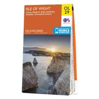
Wandelkaart - Topografische kaart 29 OS Explorer Map | Active Isle of Wight | Ordnance Survey
Een van de beste detailkaarten die er op de wereld gemaakt worden: zeer gedetailleerd, prachtig helder kleurgebruik, veel topografische aspecten en - zeer belangrijk - allerlei toeristische en recreatieve aspecten zijn ingetekend. De perfecte kaart voor vakantie en vrije tijd: wandelen, fietsen of gewoon de omgeving verkennen. Door de grootte van de kaart, voor- en achterzijde, bestrijkt het een behoorlijk groot gebied!   These highly detailed maps show all the administrative boundaries, settlements as small as isolated farms, road network down to unfenced roads and country tracks, and field boundaries (hedges and drystone walls) which make navigation across the countryside much easier. Steep gradients on roads are indicated. Various landmarks, eg. powerlines, archaeological sites, windmills, churches and lighthouses are shown, and additional graphics indicate natural terrain features such as cliffs, scree, mud and vegetation variations. Contour interval is 5 metres in the lower parts…
25,95
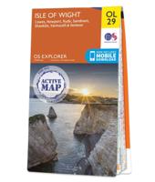
Wandelkaart - Topografische kaart OL29 OS Explorer Map Isle of Wight | Ordnance Survey
Een van de beste detailkaarten die er op de wereld gemaakt worden: zeer gedetailleerd, prachtig helder kleurgebruik, veel topografische aspecten en - zeer belangrijk - allerlei toeristische en recreatieve aspecten zijn ingetekend. De perfecte kaart voor vakantie en vrije tijd: wandelen, fietsen of gewoon de omgeving verkennen. Door de grootte van de kaart, voor- en achterzijde, bestrijkt het een behoorlijk groot gebied! These highly detailed maps show all the administrative boundaries, settlements as small as isolated farms, road network down to unfenced roads and country tracks, and field boundaries (hedges and drystone walls) which make navigation across the countryside much easier. Steep gradients on roads are indicated. Various landmarks, eg. powerlines, archaeological sites, windmills, churches and lighthouses are shown, and additional graphics indicate natural terrain features such as cliffs, scree, mud and vegetation variations. Contour interval is 5 metres in the lower parts o…
19,50
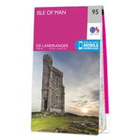
Wandelkaart - Topografische kaart 95 Landranger Active Isle of Man | Ordnance Survey
Zeer goede detailkaart met topografische ondergrond. Kleurgebruik is goed over nagedacht: bijzonder goed leesbaar en helder kaartbeeld. Hierop zijn toeristische symbolen van bezienswaardigheden ingetekend, daarnaast staan bijvoorbeeld campings en jeugdherbergen vermeld en - voor wandelaars het belangrijkst - alle right of way paden en Lange afstands Wandelpaden zijn er op te vinden. De ideale kaart voor het wandelen in Engeland, Wales of Schotland. De kaarten zijn te gebruiken met GPS (UTM OSGB36), de legenda is in het Engels, Frans en Duits.    Plaatsen op deze kaart: Douglas, Onchan, Laxey, Maughold, Ramsey, Bride, Sulby, Andreas, Jurby West, Kirk Michael, Ballaugh, Peel, St John’s, Glenmaye, Ballasalla, Castletown Port St Mary and Port Erin  
25,95
Wandelkaart - Topografische kaart 195 Landranger Active Bournemouth / Purbeck | Ordnance Survey
Take a walk on the sunny side of life in beautiful south Dorset. Relax on Bournemouth’s sandy beaches or explore the Jurassic Coast peninsula of the Isle of Purbeck, home to the world-famous beaches of Swanage and Lulworth Cove.   Visit the charming riverside town of Wimborne Minster set amidst the Cranborne Chase Area of Outstanding Natural Beauty From the market town of Ringwood, explore the New Forest National Park  Walk, hike and cycle along the South West Coast Path through the Dorset and East Devon Coast World Heritage Site    Zeer goede detailkaart met topografische ondergrond. Kleurgebruik is goed over nagedacht: bijzonder goed leesbaar en helder kaartbeeld. Hierop zijn toeristische symbolen van bezienswaardigheden ingetekend, daarnaast staan bijvoorbeeld campings en jeugdherbergen vermeld en - voor wandelaars het belangrijkst - alle right of way paden en Lange afstands Wandelpaden zijn er op te vinden. De ideale kaart voor het wandelen in Engeland, Wales of Schotland. De kaar…
25,95
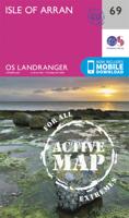
Wandelkaart - Topografische kaart 69 Landranger Active Isle of Arran | Ordnance Survey
Zeer goede detailkaart met topografische ondergrond. Kleurgebruik is goed over nagedacht: bijzonder goed leesbaar en helder kaartbeeld. Hierop zijn toeristische symbolen van bezienswaardigheden ingetekend, daarnaast staan bijvoorbeeld campings en jeugdherbergen vermeld en - voor wandelaars het belangrijkst - alle right of way paden en Lange afstands Wandelpaden zijn er op te vinden. De ideale kaart voor het wandelen in Engeland, Wales of Schotland. De kaarten zijn te gebruiken met GPS (UTM OSGB36), de legenda is in het Engels, Frans en Duits.    Plaatsen op deze kaart:  Lochranza, Sannox, Pirnmill, Corrie, Brodick, Auchencar, Machrie, Lamlash, Shiskine, Blackwaterfoot, Whiting Bay, Kilmory, Kildonan, Peninver, Saddell, Carradale, Grogport, Crossaig.  
25,95
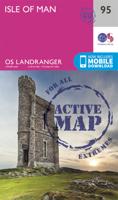
Wandelkaart - Topografische kaart 095 Landranger Isle of Man | Ordnance Survey
Zeer goede detailkaart met topografische ondergrond. Kleurgebruik is goed over nagedacht: bijzonder goed leesbaar en helder kaartbeeld. Hierop zijn toeristische symbolen van bezienswaardigheden ingetekend, daarnaast staan bijvoorbeeld campings en jeugdherbergen vermeld en - voor wandelaars het belangrijkst - alle right of way paden en Lange afstands Wandelpaden zijn er op te vinden. De ideale kaart voor het wandelen in Engeland, Wales of Schotland. De kaarten zijn te gebruiken met GPS (UTM OSGB36), de legenda is in het Engels, Frans en Duits.    Plaatsen op deze kaart: Douglas, Onchan, Laxey, Maughold, Ramsey, Bride, Sulby, Andreas, Jurby West, Kirk Michael, Ballaugh, Peel, St John’s, Glenmaye, Ballasalla, Castletown Port St Mary and Port Erin  
19,50
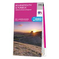
Wandelkaart - Topografische kaart 195 Landranger Bournemouth & Purbeck | Ordnance Survey
Take a walk on the sunny side of life in beautiful south Dorset. Relax on Bournemouth’s sandy beaches or explore the Jurassic Coast peninsula of the Isle of Purbeck, home to the world-famous beaches of Swanage and Lulworth Cove.   Visit the charming riverside town of Wimborne Minster set amidst the Cranborne Chase Area of Outstanding Natural Beauty From the market town of Ringwood, explore the New Forest National Park  Walk, hike and cycle along the South West Coast Path through the Dorset and East Devon Coast World Heritage Site    Zeer goede detailkaart met topografische ondergrond. Kleurgebruik is goed over nagedacht: bijzonder goed leesbaar en helder kaartbeeld. Hierop zijn toeristische symbolen van bezienswaardigheden ingetekend, daarnaast staan bijvoorbeeld campings en jeugdherbergen vermeld en - voor wandelaars het belangrijkst - alle right of way paden en Lange afstands Wandelpaden zijn er op te vinden. De ideale kaart voor het wandelen in Engeland, Wales of Schotland.…
19,50

Klanten-reviews van Wandelkaart - Topografische kaart 196 Landranger Active The Solent / the Isle of Wight | Ordnance Survey

Er zijn nog geen beoordelingen voor dit productBen jij de eerste die een review plaatst?

Meer over Wandelkaart - Topografische kaart 196 Landranger Active The Solent / the Isle of Wight | Ordnance Survey

Productomschrijving

Explore the sandy beaches, historic houses and distinctive ‘chines’ of the Isle of Wight and soak up the beauty and tranquillity that made it a favourite with the likes of Queen Victoria and Alfred Lord Tennyson. Discover the vibrant maritime cities of Southampton and Portsmouth. Visit the Mayflower Pilgrims’ Memorial, Portsmouth Historic Dockyard and the must-see Mary Rose See royal Osborne House in East Cowes, imposing Carisbrooke Castle and the iconic Needles with unrivalled views of the Solent Walk, hike and cycle along the Solent Way and other popular recreational paths    Zeer goede detailkaart met topografische ondergrond. Kleurgebruik is goed over nagedacht: bijzonder goed leesbaar en helder kaartbeeld. Hierop zijn toeristische symbolen van bezienswaardigheden ingetekend, daarnaast staan bijvoorbeeld campings en jeugdherbergen vermeld en - voor wandelaars het belangrijkst - alle right of way paden en Lange afstands Wandelpaden zijn er op te vinden. De ideale kaart voor het wandelen in Engeland, Wales of Schotland. De kaarten zijn te gebruiken met GPS (UTM OSGB36), de legenda is in het Engels, Frans en Duits.    Plaatsen op deze kaart: Southhampton, Portsmouth, Totton, Lymington, Fareham, Gosport, Cadnam, Lyndhurst, Brockenhurst, Hythe, Beaulieu, Calshot, East, Boldre, Netley, Warsash, Botley, Wickham, Hambledon, Southwick, Cowes, Newport, Ryde, Sandown, Shanklin, Ventnor, Godshill, Blackgang, Brighstone, Shalfleet, Yarmouth, the Needles.

Productinformatie

    Verken gerelateerde categorieën

    Webshop.nl maakt gebruik van cookies. Ga je verder op onze website, ga dan akkoord met het plaatsen van cookies en de verwerking van deze data door ons en vermelde partners.