webshop.nl
Categorieën
  Sluiten

Meer Ordnance Survey
Meer Ordnance Survey in Reisgidsen & talen boeken

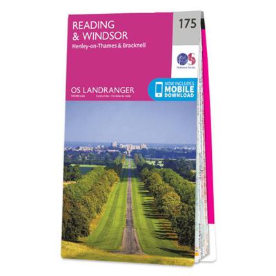
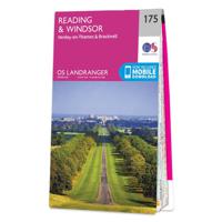
Wandelkaart - Topografische kaart 175 Landranger Reading & Windsor, He

0
Zeer goede detailkaart met topografische ondergrond. Kleurgebruik is goed over nagedacht: bijzonder goed leesbaar en helder kaartbeeld. Hierop zijn toeristische symbolen van bezienswaardigheden ingetekend, daarnaast staan bijvoorbeeld campings en jeugdherbergen vermeld en - voor wandelaars het belangrijkst - alle right of way paden en Lange afstand...

Webshops met dit product

Webshop
Bezorging
Prijs

Anderen bekeken ook

Wandelkaart - Topografische kaart 175 Landranger Reading & Windsor, He
Zeer goede detailkaart met topografische ondergrond. Kleurgebruik is goed over nagedacht: bijzonder goed leesbaar en helder kaartbeeld. Hierop zijn toeristische symbolen van bezienswaardigheden ingetekend, daarnaast staan bijvoorbeeld campings en jeugdherbergen vermeld en - voor wandelaars het belangrijkst - alle right of way paden en Lange afstands Wandelpaden zijn er op te vinden. De ideale kaart voor het wandelen in Engeland, Wales of Schotland. De kaarten zijn te gebruiken met GPS (UTM OSGB36), de legenda is in het Engels, Frans en Duits.    Plaatsen op deze kaart: Reading, Windsor, Slough, Maidenhead, Gerrards Cross, Beaconsfield, High Wycombe, Chalfont St. Giles, Burnham, Cookham Rise, Marlow, Lane End, Frieth, Ibstone, Northend, Nettlebed, Henley-on-Thames, Watlington, Benson, Wallingford, Woodcote, Tokers Green, Somming Common, Purley on Thames, Theale, Shinfield, Twyford, Hurst, Newell Green, Cranbourne, Ascot, Bracknell, Wokingham, Barkham, Finchampstead, Crowthorne, Bagshot,…
19,50
Wandelkaart - Topografische kaart 186 Landranger Aldershot & Guildford
Zeer goede detailkaart met topografische ondergrond. Kleurgebruik is goed over nagedacht: bijzonder goed leesbaar en helder kaartbeeld. Hierop zijn toeristische symbolen van bezienswaardigheden ingetekend, daarnaast staan bijvoorbeeld campings en jeugdherbergen vermeld en - voor wandelaars het belangrijkst - alle right of way paden en Lange afstands Wandelpaden zijn er op te vinden. De ideale kaart voor het wandelen in Engeland, Wales of Schotland. De kaarten zijn te gebruiken met GPS (UTM OSGB36), de legenda is in het Engels, Frans en Duits.    Plaatsen op deze kaart: Aldershot, Guilford, Farnham, Godalming, Haslemere, Woking, Farnborough, Camberley, Fleet, Mortimer, Swallowfield, Crowthorne, Bagshot, Addlestone, Bramley, Sandhurst, Hartley Witney, Sherfield on Loddon, Hook, Old Basing, Pirbright, Odiham, Upton Grey, South Warnborough, Bentley, Bentworth, Alton, Elstead, Fernsham, Witley, Rowly, Chiddingfold, Hindhead, Bordon, Selbourne, Four Marks, Privett, Liss, Steep, Liphook, Fern…
19,50
Wandelkaart - Topografische kaart 171 OS Explorer Map Chiltern Hills W
Plunge into lovely countryside as you explore the west Chiltern Hills, an Area of Outstanding Natural Beauty on London’s doorstep. Roam hills clothed in ancient woods and chalk-fed streams, then refresh yourself in the historic market towns of Henley-on-Thames and Wallingford, home of Agatha Christie.    Enjoy Henley-on-Thames, a quintessentially English town set along an exceptionally beautiful stretch of the River Thames  Experience the unique chalk landscape of the Chilterns and glimpse rare butterflies, birds of prey and orchids  Walk or cycle beloved recreational paths including the Chiltern Way, Oxfordshire Way and a section of the ancient Ridgeway, Britain’s oldest road  Met zijn 4cm voor 1 km (2 ½ cm voor 1 mijl) schaal, is de OS Explorer kaartenserie de ideale en meest gedetailleerde kaartenreeks voor mensen die graag outdoor-activiteiten zoals fietsen, wandelen, paardrijden, klimmen en watersporten. Deze kaart is nog gedetailleerder dan de 'gewone' Landranger maps. Voor- e…
19,50
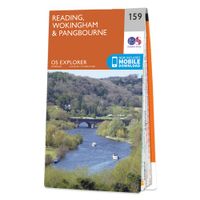
Wandelkaart - Topografische kaart 159 OS Explorer Map Reading, Wokingh
Experience everything Reading has to offer and discover the charms of Wokingham and of Pangbourne, an idyllic waterside town on the River Thames among the gorgeous North Wessex Downs. Follow the Thames Path through Pangbourne and Reading where it skirts the evocative, 900-year-old ruins of Reading Abbey.     Visit Basildon Park, immortalised in Pride & Prejudice, and neighbouring Beale Wildlife Park for a wilder experience  Swim in the Thames Lido or visit the award-winning, much-loved Museum of English Rural Life (MERL)  Walk, hike or cycle along this peaceful stretch of the Thames Path or other recreational paths including the Blackwater Valley Path Met zijn 4cm voor 1 km (2 ½ cm voor 1 mijl) schaal, is de OS Explorer kaartenserie de ideale en meest gedetailleerde kaartenreeks voor mensen die graag outdoor-activiteiten zoals fietsen, wandelen, paardrijden, klimmen en watersporten. Deze kaart is nog gedetailleerder dan de 'gewone' Landranger maps. Voor- en achterzijde bedrukt! Zeke…
19,50
Wandelkaart - Topografische kaart 170 OS Explorer Map Abingdon, Wantag
Discover the Vale of White Horse, rolling hills dominated by the extraordinary, eponymous White Horse, an enigmatic Bronze Age chalk carving which can be seen for miles leaping across the hillside. Explore the historic market towns of Abingdon-on-Thames, dating back to Saxon times; Wantage, birthplace of King Alfred the Great; Wallingford and Faringdon, known for its 100-foot high folly tower.     Visit the iconic White Horse and the ancient landscape that surrounds it, including Uffington Castle and Dragon Hill, where St George slew the dragon  Follow streams flowing through the chalk uplands and discover unique locations like the Manger and its Giant Steps, remnants of the Ice Age  Walk, hike or cycle along the ancient Ridgeway through the wold or a number of other popular recreational paths including sections of the Thames Path, Lambourn Valley Way and Chiltern Way    Met zijn 4cm voor 1 km (2 ½ cm voor 1 mijl) schaal, is de OS Explorer kaartenserie de ideale en meest gedetaillee…
19,50
Wandelkaart - Topografische kaart 172 OS Explorer Map Chiltern Hills E
Discover the east Chiltern Hills where they meet the Thames Valley, replete with lovely countryside, beautiful views and rich history. Delight in the unrivalled sailing reaches of Maidenhead; the Georgian architecture of High Wycome, the onetime furniture capital of England and the market town of Rickmansworth, set in beautiful country but a stone’s throw from London.    Bathe in natural beauty, from carpets of bluebells in the beech woods to red kites on the chalk grasslands and wildflower meadows where rare butterflies like the Adonis Blue flutter  Discover stately homes and historic houses including the gorgeous Italianate mansion of Clevedon, the charming Tudor manor Chenies and Milton’s Cottage where Paradise Lost was finished  Walk, cycle or hike a wide range of recreational paths including the Chiltern Way, South Bucks Way, Shakespeare’s Way and the Thames Path  Met zijn 4cm voor 1 km (2 ½ cm voor 1 mijl) schaal, is de OS Explorer kaartenserie de ideale en meest gedetailleerd…
19,50

Klanten-reviews van Wandelkaart - Topografische kaart 175 Landranger Reading & Windsor, He

Er zijn nog geen beoordelingen voor dit productBen jij de eerste die een review plaatst?

Meer over Wandelkaart - Topografische kaart 175 Landranger Reading & Windsor, He

Productomschrijving

Zeer goede detailkaart met topografische ondergrond. Kleurgebruik is goed over nagedacht: bijzonder goed leesbaar en helder kaartbeeld. Hierop zijn toeristische symbolen van bezienswaardigheden ingetekend, daarnaast staan bijvoorbeeld campings en jeugdherbergen vermeld en - voor wandelaars het belangrijkst - alle right of way paden en Lange afstands Wandelpaden zijn er op te vinden. De ideale kaart voor het wandelen in Engeland, Wales of Schotland. De kaarten zijn te gebruiken met GPS (UTM OSGB36), de legenda is in het Engels, Frans en Duits.    Plaatsen op deze kaart: Reading, Windsor, Slough, Maidenhead, Gerrards Cross, Beaconsfield, High Wycombe, Chalfont St. Giles, Burnham, Cookham Rise, Marlow, Lane End, Frieth, Ibstone, Northend, Nettlebed, Henley-on-Thames, Watlington, Benson, Wallingford, Woodcote, Tokers Green, Somming Common, Purley on Thames, Theale, Shinfield, Twyford, Hurst, Newell Green, Cranbourne, Ascot, Bracknell, Wokingham, Barkham, Finchampstead, Crowthorne, Bagshot, Camberley, Chobham, Bisley, Pirbright, Frimley, Yateley, Hartley Wintney, Mattingley, Sherfield on Loddon, Monk Sherborne, Tadley, Silchester, Riseley and Burghfield Common.

Productspecificaties

Artikelnummer(s)
Brand
Ordnance Survey

Verken gerelateerde categorieën

Webshop.nl maakt gebruik van cookies. Ga je verder op onze website, ga dan akkoord met het plaatsen van cookies en de verwerking van deze data door ons en vermelde partners.