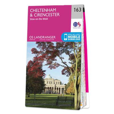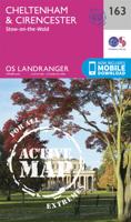
Wandelkaart - Topografische kaart 163 Landranger Cheltenham & Cirencester, Stow-on-the-Wold - Cotswolds | Ordnance Survey

0
Zeer goede detailkaart met topografische ondergrond. Kleurgebruik is goed over nagedacht: bijzonder goed leesbaar en helder kaartbeeld. Hierop zijn toeristische symbolen van bezienswaardigheden ingetekend, daarnaast staan bijvoorbeeld campings en jeugdherbergen vermeld en - voor wandelaars het belangrijkst - alle right of way paden en Lange afstan...

Verkopers met dit product

Webshop
Bezorging
Prijs
DeZwerver.nl logo
DeZwerver.nl
niet bekend
19,50

Anderen bekeken ook

Wandelgids The Cotswolds | Pocket Mountains
Handige compacte wandelgids met 40 dagwandelingen. Deze gids bevat kleine kaartjes en leuke uitgebreide informatie over wat er langs de route te zien is. Goede wandelkaarten zijn echter we noodzakelijk voor deze tochten: de Ordnance Survey explorer maps of Landanger maps zijn zeer geschikt.   From upland outlooks and secret valleys to rolling pastures and honey stone villages, nature and history weave together in the Cotswolds to create a landscape that is the epitome of rural England. In these 40 walks Dominic North unlocks the secrets of the Cotswolds, from the hills and lanes in the north to the languid riverbanks and ancient woods of the south. Along the way discover sleepy villages, grand country houses and architectural curiosities, and then reach out to explore three of England's most celebrated cities, Bath, Oxford and Stratford-upon-Avon. Plaatsen in het boekje Bath, Bathampton, Batsford, Belas Knap, Bibury, Blenheim Park, Blockley, Bourton-on-the-Hill, Bourton-on-the-Water, …
10,95
Reisgids Cotswolds | Rough Guides
Handige pocketgids met enkele auto- en wandelroutes.   Inspirational and informative new pocket guide, with free eBook, making the most of holidaying at home in the UK through clearly laid-out walks and tours.   Explore the best of the Cotswolds with this unique travel guide, packed full of insider information and stunning images. From making sure you don't miss out on must-see, top attractions like Stratford-upon-Avon, Cheltenham and Gloucester to discovering cultural gems including the stunning National Arboretum in Westonbirt, a picturesque hike along the Cotswold Way, and a typical Cotswold-stone manor house at Snowshill Manor, the easy-to-follow, ready-made walking and driving routes will save you time, and help you plan and enhance your staycation in the Cotswolds.   Features of this travel guide to the Cotswolds: - Eight walks and tours: detailed itineraries feature all the best places to visit, including where to eat along the way - Local highlights: discover the area's…
12,95
Wandelkaart - Topografische kaart 173 Landranger Swindon & Devizes, Marlborough & Trowbridge | Ordnance Survey
Zeer goede detailkaart met topografische ondergrond. Kleurgebruik is goed over nagedacht: bijzonder goed leesbaar en helder kaartbeeld. Hierop zijn toeristische symbolen van bezienswaardigheden ingetekend, daarnaast staan bijvoorbeeld campings en jeugdherbergen vermeld en - voor wandelaars het belangrijkst - alle right of way paden en Lange afstands Wandelpaden zijn er op te vinden. De ideale kaart voor het wandelen in Engeland, Wales of Schotland. De kaarten zijn te gebruiken met GPS (UTM OSGB36), de legenda is in het Engels, Frans en Duits.    Plaatsen op deze kaart: Swindon, Devizes, Marlborough, Cricklade, Stanton Fitzwarren, Wroughton, Rockley, Uffcott, Clench Commeon, Pewsey, Rushall, Chirton, All Cannings, Bishops Cannongs, Avebury, Cherhill, Winterbourne Bassett, Wotton Bassett, Hook, Purton, Minety, Charlton, Brinkworth, Malmesbury, Hankerton, Oaksey, Tetbury, Leigherton, Didmarton, Sherston, Hullavington, Castle Combe, Dauntsey, Kington Langley, Ford, Chippenham, Colerne, Br…
19,50
Reisgids The Cotswolds | Rough Guides
Zeer goede reisgids voor zowel de georganiseerde maar vooral voor de zelfstandige reiziger. Boordevol informatie over reizen, slapen, eten, maar ook musea en cultuur. Voor Europese landen meestal completer en beter dan de Lonely Planet ! This Cotswolds, Stratford-upon-Avon & Oxford guidebook is perfect for independent travellers planning a longer trip. It features all of the must-see sights and a wide range of off-the-beaten-track places. It also provides detailed practical information on preparing for a trip and what to do on the ground. And this Cotswolds, Stratford-upon-Avon & Oxford travel guidebook is printed on paper from responsible sources, and verified to meet the FSC's strict environmental and social standards.   This Cotswolds, Stratford-upon-Avon & Oxford guidebook covers: Cheltenham, South Cotswolds, Central Cotswolds, Stratford-Upon-Avon, Oxfordshire Cotswolds, Banbury, North Oxfordshire, Oxford.   Inside this Cotswolds, Stratford-upon-Avon & Oxford travel book, yo…
22,50
Wandelkaart - Topografische kaart OL45 OS Explorer Map The Cotswolds | Ordnance Survey
Met zijn 4cm voor 1 km (2 ½ cm voor 1 mijl) schaal, is de OS Outdoor Leisure kaartenserie de ideale en meest gedetailleerde kaartenreeks voor mensen die graag outdoor-activiteiten zoals fietsen, wandelen, paardrijden, klimmen en watersporten.   Deze kaart is nog gedetailleerder dan de 'gewone' Landranger maps. Voor- en achterzijde bedrukt! Zeker op de moors en andere natuurgebieden van onschatbare waarden met echt alle aspecten van het landschap op de kaart ingetekend. Zeer goede detailkaart met topografische ondergrond. Hierop zijn toeristische symbolen van bezienswaardigheden ingetekend, daarnaast staan bijvoorbeeld campings en jeugdherbergen vermeld en - voor wandelaars het belangrijkst - alle right of way paden en Lange afstands Wandelpaden zijn er op te vinden. De ideale kaart voor het wandelen in Engeland, Wales of Schotland.   These highly detailed maps show all the administrative boundaries, settlements as small as isolated farms, the road network down to unfenced roads and co…
19,50
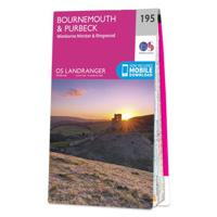
Wandelkaart - Topografische kaart 195 Landranger Bournemouth & Purbeck | Ordnance Survey
Take a walk on the sunny side of life in beautiful south Dorset. Relax on Bournemouth’s sandy beaches or explore the Jurassic Coast peninsula of the Isle of Purbeck, home to the world-famous beaches of Swanage and Lulworth Cove.   Visit the charming riverside town of Wimborne Minster set amidst the Cranborne Chase Area of Outstanding Natural Beauty From the market town of Ringwood, explore the New Forest National Park  Walk, hike and cycle along the South West Coast Path through the Dorset and East Devon Coast World Heritage Site    Zeer goede detailkaart met topografische ondergrond. Kleurgebruik is goed over nagedacht: bijzonder goed leesbaar en helder kaartbeeld. Hierop zijn toeristische symbolen van bezienswaardigheden ingetekend, daarnaast staan bijvoorbeeld campings en jeugdherbergen vermeld en - voor wandelaars het belangrijkst - alle right of way paden en Lange afstands Wandelpaden zijn er op te vinden. De ideale kaart voor het wandelen in Engeland, Wales of Schotland.…
19,50
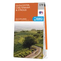
Wandelkaart - Topografische kaart 179 OS Explorer Map Gloucester, Cheltenham, Stroud | Ordnance Survey
The essential map for outdoor activities in Gloucester, Cheltenham and Stroud. The OS Explorer Map is the Ordnance Survey's most detailed folding map and is recommended for anyone enjoying outdoor activities including walking, horse riding and off-road cycling. This map now comes with a digital version which you can download to your smartphone or tablet.Providing complete GB coverage, the OS Explorer map series details information essential in the great outdoors, including youth hostels, pubs and visitor information. Rights of way, fences, permissive paths and bridleways are clearly shown, ensuring you have the best information to get the most out of your time in the countryside. FeaturesCotswold Way Severn Way Gloucestershire Way Macmillan Way Wysis WayCotswold Way (National Trail) GloucesterCheltenhamGloucester Stroud1:25 000 scale (4 cm to 1 km - 2.5 inches to 1 mile) Met zijn 4cm voor 1 km (2 ½ cm voor 1 mijl) schaal, is de OS Explorer kaartenserie de ideale en meest gedetailleerd…
19,50
Reisgids The Cotswolds Guide Book | Goldeneye
The definitive guide to The Cotswolds. In this fully revised and updated Cotswolds guide book, Cotswold specialist, William Fricker, provides his insightful advice on what to see and where to stay in this wonderful area of England. Offering a unique perspective on this glorious corner of Britain, William reveals little-known corners of the Cotswolds that will delight and surprise. Discover the most beautiful villages and valleys in this Area of Outstanding Natural Beauty. Experience a full range of activities from visiting gardens to exploring the brilliant architecture of the country houses, barns and churches. Enjoy a wide range of interesting and luxurious places to stay, from B&B's to country houses to inns and restaurants with rooms. Immerse yourself in the best variety of eateries, from delis and coffee shops, to dining pubs and traditional hostelries, as well as the best local craftspeople, and art galleries. Includes over 340 photographs and illustrations really bringing your …
26,50
Wandelkaart - Topografische kaart 169 Landranger Ipswich & The Naze, Clacton-on-sea | Ordnance Survey
Zeer goede detailkaart met topografische ondergrond. Kleurgebruik is goed over nagedacht: bijzonder goed leesbaar en helder kaartbeeld. Hierop zijn toeristische symbolen van bezienswaardigheden ingetekend, daarnaast staan bijvoorbeeld campings en jeugdherbergen vermeld en - voor wandelaars het belangrijkst - alle right of way paden en Lange afstands Wandelpaden zijn er op te vinden. De ideale kaart voor het wandelen in Engeland, Wales of Schotland. De kaarten zijn te gebruiken met GPS (UTM OSGB36), de legenda is in het Engels, Frans en Duits.    Plaatsen op deze kaart:  Ipswich, Harwich, Felixstowe, Clacton-on-Sea, Frinton-on-Sea, Walton-on-the-Naze, Brightlinsea, St. Osyth, Great Bentley, Thorpe-le-Soken, Weeley, Balls Green, Great Oakley, Wix, Manningtree, Ramsey, Brantham, Holbrook, Trimley St. Mary, Bawdsey, Kirton, Newbourne, Capel St. Mary, Hintlesham, Martlesham Heath, Alderton, Hollesley, Orford, Woodbridge, Sutton, Playford, Claydon and Somersham  
19,50
Wegenkaart - landkaart The Cotswolds | Philip's Maps
A new edition of this double-sided map of the Cotswolds clearly featuring places of tourist and historic interest in an easy-to-read style of mapping, alongside six handy town centre plans. This leisure and tourist map of the Cotswolds gives detailed coverage of the area's road network at a scale of approximately 2 miles to 1 inch (1:125,000). The coverage stretches from Abingdon in the east to Gloucester in the west, and from Swindon in the south to Great Malvern in the north. The map shows places of tourist and historic interest, including castles, camping and caravanning sites, country parks, galleries, gardens, golf courses, museums, nature trails, historic sites, sports venues, theatres and wildlife parks. An index to principal places of interest is also featured. With some of the most enchanting towns and cities in England in the area - all with extraordinary history and notable natural beauty - use the Philip's Leisure Map to explore and delight in the Cotswold magic. Includ…
11,50

Klanten-reviews van Wandelkaart - Topografische kaart 163 Landranger Cheltenham & Cirencester, Stow-on-the-Wold - Cotswolds | Ordnance Survey

Er zijn nog geen beoordelingen voor dit productBen jij de eerste die een review plaatst?

Meer over Wandelkaart - Topografische kaart 163 Landranger Cheltenham & Cirencester, Stow-on-the-Wold - Cotswolds | Ordnance Survey

Productomschrijving

Zeer goede detailkaart met topografische ondergrond. Kleurgebruik is goed over nagedacht: bijzonder goed leesbaar en helder kaartbeeld. Hierop zijn toeristische symbolen van bezienswaardigheden ingetekend, daarnaast staan bijvoorbeeld campings en jeugdherbergen vermeld en - voor wandelaars het belangrijkst - alle right of way paden en Lange afstands Wandelpaden zijn er op te vinden. De ideale kaart voor het wandelen in Engeland, Wales of Schotland. De kaarten zijn te gebruiken met GPS (UTM OSGB36), de legenda is in het Engels, Frans en Duits.    Plaatsen op deze kaart: Cheltenham, Cirencester, Stow-on-the-Wold, Northleach, Burford, Carterton, Lechlade on Thames, Fairford, Farringdon, Highworth, Cricklade, Tetbury, Crudwell, Oaksey, Minety, Broad Blunsdon, Longcot, Whelford, South Cerney, Kemble, Tarlton, Rodmarton, Poulton, Bagendon, Barnsley, Quenington, Alvescot, Bibury, Winson, Chedworth, Aldsworth, Great Barrington, Serborne, Chalford, Bisley, Duntisbourne Abbots, Cranham, Colesbourne, Birdlip, Withington, Andoversford, Bourton-on-the-Water, Shurdington, Bishop’s Cleeve, Winchcombe, Charlton Abbots, Naunton, Upper Slaugher, Kineton, Condicote, Bledington and Chastleton, with the Cotswold Hills.


Verken gerelateerde categorieën

Webshop.nl maakt gebruik van cookies. Ga je verder op onze website, ga dan akkoord met het plaatsen van cookies en de verwerking van deze data door ons en vermelde partners.