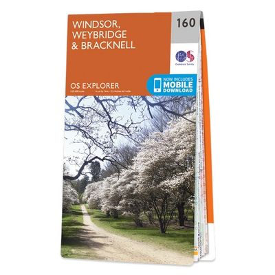
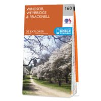
Wandelkaart - Topografische kaart 160 OS Explorer Map Windsor, Weybridge, Bracknell | Thames Path | Ordnance Survey

0
Follow the Thames Path through Windsor, home to the world’s largest and oldest inhabited castle, to Egham, Staines and Weybridge with its motoring and aviation museums. Walk in the footsteps of King John as you take the Three Castles Path from Windsor Castle southwest past Bracknell and Wokingham.     Enjoy a royal encounter at Windsor Castle, ho...

Verkopers met dit product

Verkoper
Bezorging
Prijs
DeZwerver.nl logo
DeZwerver.nl
2,95
19,50

Anderen bekeken ook

Wandelkaart - Topografische kaart 160 OS Explorer Map Windsor, Weybridge, Bracknell | Thames Path | Ordnance Survey
Follow the Thames Path through Windsor, home to the world’s largest and oldest inhabited castle, to Egham, Staines and Weybridge with its motoring and aviation museums. Walk in the footsteps of King John as you take the Three Castles Path from Windsor Castle southwest past Bracknell and Wokingham.     Enjoy a royal encounter at Windsor Castle, home to British kings and queens for over 1,000 years and Her Majesty the Queen’s favourite residence  Discover the pretty villages of Chertsey and Chobham, Ascot Racecourse and the London Bus Museum in Weybridge  Walk, ramble or cycle along the Thames Path and recreational paths including the Blackwater Valley Path, Colne Valley Way and Three Castles Path Met zijn 4cm voor 1 km (2 ½ cm voor 1 mijl) schaal, is de OS Explorer kaartenserie de ideale en meest gedetailleerde kaartenreeks voor mensen die graag outdoor-activiteiten zoals fietsen, wandelen, paardrijden, klimmen en watersporten. Deze kaart is nog gedetailleerder dan de 'gewone' Landr…
19,50
Wandelkaart - Topografische kaart 160 OS Explorer Map | Active Windsor / Weybridge / Bracknell | Ordnance Survey
Follow the Thames Path through Windsor, home to the world’s largest and oldest inhabited castle, to Egham, Staines and Weybridge with its motoring and aviation museums. Walk in the footsteps of King John as you take the Three Castles Path from Windsor Castle southwest past Bracknell and Wokingham.     Enjoy a royal encounter at Windsor Castle, home to British kings and queens for over 1,000 years and Her Majesty the Queen’s favourite residence  Discover the pretty villages of Chertsey and Chobham, Ascot Racecourse and the London Bus Museum in Weybridge  Walk, ramble or cycle along the Thames Path and recreational paths including the Blackwater Valley Path, Colne Valley Way and Three Castles Path Met zijn 4cm voor 1 km (2 ½ cm voor 1 mijl) schaal, is de OS Explorer kaartenserie de ideale en meest gedetailleerde kaartenreeks voor mensen die graag outdoor-activiteiten zoals fietsen, wandelen, paardrijden, klimmen en watersporten.   Deze kaart is nog gedetailleerder dan de 'gewone' Landra…
25,95
Wandelkaart - Topografische kaart 159 OS Explorer Map Reading, Wokingham & Pangbourne Map | Thames Path | Ordnance Survey
Experience everything Reading has to offer and discover the charms of Wokingham and of Pangbourne, an idyllic waterside town on the River Thames among the gorgeous North Wessex Downs. Follow the Thames Path through Pangbourne and Reading where it skirts the evocative, 900-year-old ruins of Reading Abbey.     Visit Basildon Park, immortalised in Pride & Prejudice, and neighbouring Beale Wildlife Park for a wilder experience  Swim in the Thames Lido or visit the award-winning, much-loved Museum of English Rural Life (MERL)  Walk, hike or cycle along this peaceful stretch of the Thames Path or other recreational paths including the Blackwater Valley Path Met zijn 4cm voor 1 km (2 ½ cm voor 1 mijl) schaal, is de OS Explorer kaartenserie de ideale en meest gedetailleerde kaartenreeks voor mensen die graag outdoor-activiteiten zoals fietsen, wandelen, paardrijden, klimmen en watersporten. Deze kaart is nog gedetailleerder dan de 'gewone' Landranger maps. Voor- en achterzijde bedrukt! Zek…
19,50
Wandelkaart - Topografische kaart 175 Landranger Reading & Windsor, Henley-on-Thames & Bracknell | Ordnance Survey
Zeer goede detailkaart met topografische ondergrond. Kleurgebruik is goed over nagedacht: bijzonder goed leesbaar en helder kaartbeeld. Hierop zijn toeristische symbolen van bezienswaardigheden ingetekend, daarnaast staan bijvoorbeeld campings en jeugdherbergen vermeld en - voor wandelaars het belangrijkst - alle right of way paden en Lange afstands Wandelpaden zijn er op te vinden. De ideale kaart voor het wandelen in Engeland, Wales of Schotland. De kaarten zijn te gebruiken met GPS (UTM OSGB36), de legenda is in het Engels, Frans en Duits.    Plaatsen op deze kaart: Reading, Windsor, Slough, Maidenhead, Gerrards Cross, Beaconsfield, High Wycombe, Chalfont St. Giles, Burnham, Cookham Rise, Marlow, Lane End, Frieth, Ibstone, Northend, Nettlebed, Henley-on-Thames, Watlington, Benson, Wallingford, Woodcote, Tokers Green, Somming Common, Purley on Thames, Theale, Shinfield, Twyford, Hurst, Newell Green, Cranbourne, Ascot, Bracknell, Wokingham, Barkham, Finchampstead, Crowthorne, Bagshot…
19,50
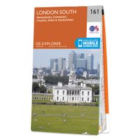
Wandelkaart - Topografische kaart 161 OS Explorer Map London South (greenw.m) | Ordnance Survey
Follow the Thames Path through the heart of London’s oldest and most historic areas. Discover Westminster, a square mile densely packed with some of the world’s most famous attractions: Buckingham Palace, Westminster Abbey, Westminster Cathedral and the Palace of Westminster, home to the Houses of Parliament.    Visit the World Heritage Sites of Kew Gardens, Maritime Greenwich including the Royal Observatory and the Palace of Westminster & Abbey complex  Explore the suburbs of Croydon, Esher and Twickenham, home of English rugby and Horace Walpole’s miniature Gothic castle, Strawberry Hill  Walk or cycle the Thames Path National Trail or recreational paths including the London Loop and Vanguard Way  Met zijn 4cm voor 1 km (2 ½ cm voor 1 mijl) schaal, is de OS Explorer kaartenserie de ideale en meest gedetailleerde kaartenreeks voor mensen die graag outdoor-activiteiten zoals fietsen, wandelen, paardrijden, klimmen en watersporten. Deze kaart is nog gedetailleerder dan de 'gewone' L…
19,50
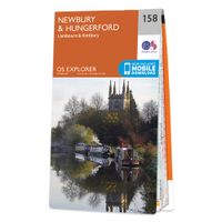
Wandelkaart - Topografische kaart 158 OS Explorer Map Newbury, Hungerford | Ordnance Survey
Enjoy everything rural Berkshire has to offer, from the iconic racecourse at Newbury to the beautiful Kennet & Avon Canal and Wilton Windmill, Wiltshire’s only working windmill. Base yourself in charming villages like Lambourn and Kintbury to explore the ‘Valley of the Racehorse’.    Visit Highclere Castle, instantly recognisable as the real-life Downton Abbey and only six miles from Newbury  Explore peaceful water meadows, rolling hills and ruined castles like Donnington among the stunning landscape of the North Wessex Downs  Walk, hike or cycle along recreational paths including the Lambourn Valley Way, Test Way and Wayfarer’s Walk   Met zijn 4cm voor 1 km (2 ½ cm voor 1 mijl) schaal, is de OS Explorer kaartenserie de ideale en meest gedetailleerde kaartenreeks voor mensen die graag outdoor-activiteiten zoals fietsen, wandelen, paardrijden, klimmen en watersporten. Deze kaart is nog gedetailleerder dan de 'gewone' Landranger maps. Voor- en achterzijde bedrukt! Zeker op de moors e…
19,50
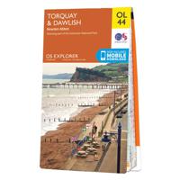
Wandelkaart - Topografische kaart OL44 OS Explorer Map Torquay & Dawlish | Ordnance Survey
Met zijn 4cm voor 1 km (2 ½ cm voor 1 mijl) schaal, is de OS Explorer kaartenserie de ideale en meest gedetailleerde kaartenreeks voor mensen die graag outdoor-activiteiten zoals fietsen, wandelen, paardrijden, klimmen en watersporten. Deze kaart is nog gedetailleerder dan de 'gewone' Landranger maps. Voor- en achterzijde bedrukt! Zeker op de moors en andere natuurgebieden van onschatbare waarden met echt alle aspecten van het landschap op de kaart ingetekend. Zeer goede detailkaart met topografische ondergrond. Hierop zijn toeristische symbolen van bezienswaardigheden ingetekend, daarnaast staan bijvoorbeeld campings en jeugdherbergen vermeld en - voor wandelaars het belangrijkst - alle right of way paden en Lange afstands Wandelpaden zijn er op te vinden. De ideale kaart voor het wandelen in Engeland, Wales of Schotland. Ingetekende Langeafstandswandelroute South west coast Path Map sheet OL 44 Map is the perfect map for exploring the Eastern edge of Dartmoor national park and the c…
19,50
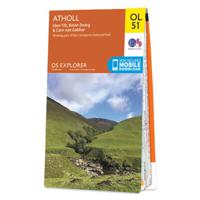
Wandelkaart - Topografische kaart OL51 OS Explorer Map Atholl | Ordnance Survey
Met zijn 4cm voor 1 km (2 ½ cm voor 1 mijl) schaal, is de OS Explorer kaartenserie de ideale en meest gedetailleerde kaartenreeks voor mensen die graag outdoor-activiteiten zoals fietsen, wandelen, paardrijden, klimmen en watersporten. Deze kaart is nog gedetailleerder dan de 'gewone' Landranger maps. Voor- en achterzijde bedrukt! Zeker op de moors en andere natuurgebieden van onschatbare waarden met echt alle aspecten van het landschap op de kaart ingetekend. Zeer goede detailkaart met topografische ondergrond. Hierop zijn toeristische symbolen van bezienswaardigheden ingetekend, daarnaast staan bijvoorbeeld campings en jeugdherbergen vermeld en - voor wandelaars het belangrijkst - alle right of way paden en Lange afstands Wandelpaden zijn er op te vinden. De ideale kaart voor het wandelen in Engeland, Wales of Schotland.   Covering part of the Cairngorms National Park, and including ten of the Munros OS Explorer Map OL 51 is a rugged area with few roads or marked paths. This map rep…
19,50
Wandelkaart - Topografische kaart OL32 OS Explorer Map Winchester | Ordnance Survey
Met zijn 4cm voor 1 km (2 ½ cm voor 1 mijl) schaal, is de OS Explorer kaartenserie de ideale en meest gedetailleerde kaartenreeks voor mensen die graag outdoor-activiteiten zoals fietsen, wandelen, paardrijden, klimmen en watersporten. Deze kaart is nog gedetailleerder dan de 'gewone' Landranger maps. Voor- en achterzijde bedrukt! Zeker op de moors en andere natuurgebieden van onschatbare waarden met echt alle aspecten van het landschap op de kaart ingetekend. Zeer goede detailkaart met topografische ondergrond. Hierop zijn toeristische symbolen van bezienswaardigheden ingetekend, daarnaast staan bijvoorbeeld campings en jeugdherbergen vermeld en - voor wandelaars het belangrijkst - alle right of way paden en Lange afstands Wandelpaden zijn er op te vinden. De ideale kaart voor het wandelen in Engeland, Wales of Schotland.   Map sheet OL 32 in the OS Explorer map series is the ideal map for days out in the Winchester area. Winchester, capital of England in Saxon times is a beautiful c…
19,50
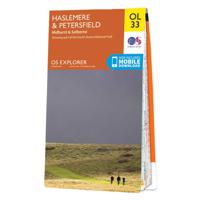
Wandelkaart - Topografische kaart OL33 OS Explorer Map Haslemere & Petersfield | Ordnance Survey
Met zijn 4cm voor 1 km (2 ½ cm voor 1 mijl) schaal, is de OS Explorer kaartenserie de ideale en meest gedetailleerde kaartenreeks voor mensen die graag outdoor-activiteiten zoals fietsen, wandelen, paardrijden, klimmen en watersporten. Deze kaart is nog gedetailleerder dan de 'gewone' Landranger maps. Voor- en achterzijde bedrukt! Zeker op de moors en andere natuurgebieden van onschatbare waarden met echt alle aspecten van het landschap op de kaart ingetekend. Zeer goede detailkaart met topografische ondergrond. Hierop zijn toeristische symbolen van bezienswaardigheden ingetekend, daarnaast staan bijvoorbeeld campings en jeugdherbergen vermeld en - voor wandelaars het belangrijkst - alle right of way paden en Lange afstands Wandelpaden zijn er op te vinden. De ideale kaart voor het wandelen in Engeland, Wales of Schotland.   Map sheet number OL 33 covers Haslemere, Petersfield, Midhurst and Selborne. Highlights include the South Downs National Park, Surrey Hills and the Sussex Border …
19,50

Klanten-reviews van Wandelkaart - Topografische kaart 160 OS Explorer Map Windsor, Weybridge, Bracknell | Thames Path | Ordnance Survey

Er zijn nog geen beoordelingen voor dit productBen jij de eerste die een review plaatst?

Meer over Wandelkaart - Topografische kaart 160 OS Explorer Map Windsor, Weybridge, Bracknell | Thames Path | Ordnance Survey

Productomschrijving

Follow the Thames Path through Windsor, home to the world’s largest and oldest inhabited castle, to Egham, Staines and Weybridge with its motoring and aviation museums. Walk in the footsteps of King John as you take the Three Castles Path from Windsor Castle southwest past Bracknell and Wokingham.    
  • Enjoy a royal encounter at Windsor Castle, home to British kings and queens for over 1,000 years and Her Majesty the Queen’s favourite residence 
  • Discover the pretty villages of Chertsey and Chobham, Ascot Racecourse and the London Bus Museum in Weybridge 
  • Walk, ramble or cycle along the Thames Path and recreational paths including the Blackwater Valley Path, Colne Valley Way and Three Castles Path

Met zijn 4cm voor 1 km (2 ½ cm voor 1 mijl) schaal, is de OS Explorer kaartenserie de ideale en meest gedetailleerde kaartenreeks voor mensen die graag outdoor-activiteiten zoals fietsen, wandelen, paardrijden, klimmen en watersporten.

Deze kaart is nog gedetailleerder dan de 'gewone' Landranger maps. Voor- en achterzijde bedrukt! Zeker op de moors en andere natuurgebieden van onschatbare waarden met echt alle aspecten van het landschap op de kaart ingetekend. Zeer goede detailkaart met topografische ondergrond. Hierop zijn toeristische symbolen van bezienswaardigheden ingetekend, daarnaast staan bijvoorbeeld campings en jeugdherbergen vermeld en - voor wandelaars het belangrijkst - alle right of way paden en Lange afstands Wandelpaden zijn er op te vinden. De ideale kaart voor het wandelen in Engeland, Wales of Schotland.   These highly detailed maps show all the administrative boundaries, settlements as small as isolated farms, the road network down to unfenced roads and country tracks, and field boundaries (hedges and drystone walls) which make navigation across the countryside much easier. Steep gradients on roads are indicated. Various landmarks, e.g. powerlines, archaeological sites, windmills, churches and lighthouses are shown and additional graphics indicate natural terrain features such as cliffs, scree, mud and vegetation variations. The contour interval is 5 metres in the lower parts of the country and 10 metres in the uplands, and spot heights are marked. Each map covers an area of 30 x 20km (i.e. approx. 19 x 12 miles), with some double-sided maps covering more, as indicated in the individual descriptions. The maps are fully GPS compatible, with the National Grid shown at 1km intervals and latitude and longitude indicated by margin ticks at 1'.   The Explorer series has replaced the earlier, green-cover Pathfinder maps. The Explorer series is now complete and covers all of England, Wales & Scotland. Some sheets for popular areas like the National Parks are still branded as Outdoor Leisure (OL) maps, but are now included in this series as the cartography is the same as that in the Explorer Maps. The Explorer maps offer a substantial improvement on the Pathfinder series, with greater use of colour, larger area per map, and stronger emphasis on information for ramblers and tourists.   This series is ideal for walking and other outdoor pursuits and each map shows a large amount of information for ramblers and tourists. Public rights of way are shown (except in Scotland), together with other routes with public access: National Trails and Recreational Paths, permitted paths and bridleways, and selected cycle routes. Open access land created under the Countryside and Rights of Way Act 2000 is marked. Tourist information includes caravan and camp sites, Park & Ride locations, recreation/leisure/sport centres, museums, historic buildings, English Heritage and National Trust sites, rural pubs, etc. The map legend is in English only, except for the tourist information content which is also in French and German
Productinformatie

    Verken gerelateerde categorieën

    Webshop.nl maakt gebruik van cookies. Ga je verder op onze website, ga dan akkoord met het plaatsen van cookies en de verwerking van deze data door ons en vermelde partners.