webshop.nl
Categorieën
  Sluiten

Meer Ordnance Survey
Meer Ordnance Survey in Reisgidsen & talen boeken

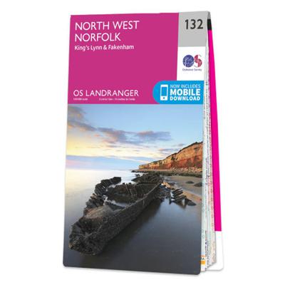
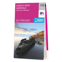
Wandelkaart - Topografische kaart 132 Landranger North West Norfolk, K

0
Zeer goede detailkaart met topografische ondergrond. Kleurgebruik is goed over nagedacht: bijzonder goed leesbaar en helder kaartbeeld. Hierop zijn toeristische symbolen van bezienswaardigheden ingetekend, daarnaast staan bijvoorbeeld campings en jeugdherbergen vermeld en - voor wandelaars het belangrijkst - alle right of way paden en Lange afstand...

Webshops met dit product

Webshop
Bezorging
Prijs

Anderen bekeken ook

Wandelkaart - Topografische kaart 132 Landranger North West Norfolk, K
Zeer goede detailkaart met topografische ondergrond. Kleurgebruik is goed over nagedacht: bijzonder goed leesbaar en helder kaartbeeld. Hierop zijn toeristische symbolen van bezienswaardigheden ingetekend, daarnaast staan bijvoorbeeld campings en jeugdherbergen vermeld en - voor wandelaars het belangrijkst - alle right of way paden en Lange afstands Wandelpaden zijn er op te vinden. De ideale kaart voor het wandelen in Engeland, Wales of Schotland. De kaarten zijn te gebruiken met GPS (UTM OSGB36), de legenda is in het Engels, Frans en Duits.    Plaatsen op deze kaart: King’s Lynn, Fakenham, Dereham, Wells-next-the-Sea, Hunstanton, Holme next the Sea, Brancaster, Burnham Market, Docking, North Creake, South Creake, Binham, Little Walshingham, Syderstone, Great Bircham, Heacham, Snettisham, Dersingham, Wolferton, Hillington, Grimston, Gayton, Middleton, Watlington, Narborough, East Rudham, Great Ryburgh, Guist,North Elmham, Beetlay, Litcham, Great Massingham, Whissonsett, Harpley
19,50
Wandelgids The Peddars Way and Norfolk Coast Path | Cicerone
Uitstekende wandelgids van de Peddars Way en de Norfolk Coast Path, waarbij naast alle noodzakelijke informatie ook gebruik gemaakt wordt van de echte topografische kaart. The Peddars Way and Norfolk Coast Path National Trail is an easy-to-follow 130-mile trail that combines the best of inland and coastal walking in Norfolk, and one that, being well waymarked, largely flat and within easy reach of public transport for most of its length, is ideal for people new to long-distance walks.   Described here in 11 stages, the route can be walked in just over a week but also easily split into day walks or over a series of weekends, with full information about access to start and finish points for each stage by public transport. This handy guidebook is illustrated throughout with extracts of OS 1:50,000 mapping and stunning photographs depicting the Trail in all seasons and describes points of interest along the way, including the Nofolk Songlines sculptures, and also facilities available in th…
18,50
Wandelkaart - Topografische kaart 133 Landranger North East Norfolk, C
Zeer goede detailkaart met topografische ondergrond. Kleurgebruik is goed over nagedacht: bijzonder goed leesbaar en helder kaartbeeld. Hierop zijn toeristische symbolen van bezienswaardigheden ingetekend, daarnaast staan bijvoorbeeld campings en jeugdherbergen vermeld en - voor wandelaars het belangrijkst - alle right of way paden en Lange afstands Wandelpaden zijn er op te vinden. De ideale kaart voor het wandelen in Engeland, Wales of Schotland. De kaarten zijn te gebruiken met GPS (UTM OSGB36), de legenda is in het Engels, Frans en Duits.    Plaatsen op deze kaart: Sheringham, Cromer, Holt, Clay next the Sea, Roughton, Overstrand, Mundesley, Trunch, Matlaske, Briston, Erpingham, Walcott, Happisnurgh, North Walsham, Saxthorpe, Hindolveston, Foulsham, Cawston, Aylsham, Honing, Stalham, Smallburgh, Buxton, Reepham, Bawdeswell, Lyng, Attlebridge, Coltishall, Ludham, Horning, Spixworth, Sprowston, Horsford, Taverham, Honingham, Mattishall and Swanton Morley.
19,50
Wandelkaart Peddars Way & Norfolk Coast Path | Harvey Maps
Mooie, duidelijke kaart van de Peddars Way  in het oosten van Engeland. Geplastificeerd met veel extra informatie en uitsnedes van de route.   The Peddars Way and Norfolk Coast Path is considered by many to be one of the most accessible National Trails, making it a perfect trail for first time long-distance walkers, or one for the winter months due to Norfolk’s dry climate.   Linking the forests and heathland of the Brecks with the coast, Peddars Way is steeped in ancient legend. It offers a wonderfully remote-feeling adventure with some spectacular historic sites to visit along the way.   The Norfolk Coast Path is a beautiful walk among sand dunes, marshes and Nature Reserves. It goes through the North Norfolk Area of Oustanding Natural Beauty and has some of the best birdwatching in the UK.   Combining both Peddars Way and the Norfolk Coast Path is a moderate long-distance walk that takes most people 7-10 days to complete but can be easily broken into shorter walks.   This map covers…
25,95
Wandelkaart - Topografische kaart 182 Landranger Weston-super-Mare, Br
Zeer goede detailkaart met topografische ondergrond. Kleurgebruik is goed over nagedacht: bijzonder goed leesbaar en helder kaartbeeld. Hierop zijn toeristische symbolen van bezienswaardigheden ingetekend, daarnaast staan bijvoorbeeld campings en jeugdherbergen vermeld en - voor wandelaars het belangrijkst - alle right of way paden en Lange afstands Wandelpaden zijn er op te vinden. De ideale kaart voor het wandelen in Engeland, Wales of Schotland. De kaarten zijn te gebruiken met GPS (UTM OSGB36), de legenda is in het Engels, Frans en Duits.    Plaatsen op deze kaart: Weston-super-Mare, Bridgewater, Nailsea, Street, Wells, Gladstonbury, Highbridge, Burnham-on-Sea, Yatton, Backwell, Claveham, Dundry, Chew Magna, Congresbury, Blagdon, Banwell, Bleadon, Brean, Berrow, East Brent, Axbridge, Winscombe, Cheddar, Chewton Mendip, Westbury-sub-Mendip, Wedmore, Wookey, Coxley, Pilton, Meare, Catcott, Westhay, Woolavington, Childon Polden, Westonzoyland, Othery, North Petherton, Enmore, Canningt…
19,50
Wandelkaart - Topografische kaart 168 Landranger Colchester, Halstead
Zeer goede detailkaart met topografische ondergrond. Kleurgebruik is goed over nagedacht: bijzonder goed leesbaar en helder kaartbeeld. Hierop zijn toeristische symbolen van bezienswaardigheden ingetekend, daarnaast staan bijvoorbeeld campings en jeugdherbergen vermeld en - voor wandelaars het belangrijkst - alle right of way paden en Lange afstands Wandelpaden zijn er op te vinden. De ideale kaart voor het wandelen in Engeland, Wales of Schotland. De kaarten zijn te gebruiken met GPS (UTM OSGB36), de legenda is in het Engels, Frans en Duits.    Plaatsen op deze kaart: Colchester, Burnham-on-Crouch, Hullbridge, South Woodham Ferrers, Cock Clarks, Maylandsea, Southminster, Tillingham, Bradwell on Sea, Maldon, Tollesbury, Great Totham, Tiptree, Witham, Kelvedon, Silver End, Layer de la Haye, Marks Tey, Coggeshall, Earls Colne, Halstead, Wivenhoe, West Mersea, Brightlingsea, Clacton-on-Sea, St Osyth, Little Clacton, Great Bentley, Weeley, Great Oackley, Elmstead Market, Wix, Manningtree, …
19,50
Fietskaart 09 Cycling guides Norfolk | Goldeneye
Norfolk is the fourth largest county in England and one of the most rural. It is also one of the flattest and our circular routes have been chosen to explore the quiet lanes linking the isolated and picturesque villages and places of interest. This is ideal cycling territory and fortunately, the Norfolk County Council (and its District Councils) are seriously committed in providing and developing cycling routes and in promoting a cycling culture that is sustainable and family friendly. Some of their routes are illustrated, hitherto.   The County has been described as flat (rather gentle undulations) and does not in fact rise much over 300 feet, but it offers great scenic interest; the dark forests of Breckland, the rolling chalk lands of the northwest, the unique watery patch of the Broads, and a coastline of great variety. Ancient churches and picturesque villages are there in abundance, the latter often decorated with the attractive signs designed by Harry Carter in the 1950’s.   Rec…
14,95

Klanten-reviews van Wandelkaart - Topografische kaart 132 Landranger North West Norfolk, K

Er zijn nog geen beoordelingen voor dit productBen jij de eerste die een review plaatst?

Meer over Wandelkaart - Topografische kaart 132 Landranger North West Norfolk, K

Productomschrijving

Zeer goede detailkaart met topografische ondergrond. Kleurgebruik is goed over nagedacht: bijzonder goed leesbaar en helder kaartbeeld. Hierop zijn toeristische symbolen van bezienswaardigheden ingetekend, daarnaast staan bijvoorbeeld campings en jeugdherbergen vermeld en - voor wandelaars het belangrijkst - alle right of way paden en Lange afstands Wandelpaden zijn er op te vinden. De ideale kaart voor het wandelen in Engeland, Wales of Schotland. De kaarten zijn te gebruiken met GPS (UTM OSGB36), de legenda is in het Engels, Frans en Duits.    Plaatsen op deze kaart: King’s Lynn, Fakenham, Dereham, Wells-next-the-Sea, Hunstanton, Holme next the Sea, Brancaster, Burnham Market, Docking, North Creake, South Creake, Binham, Little Walshingham, Syderstone, Great Bircham, Heacham, Snettisham, Dersingham, Wolferton, Hillington, Grimston, Gayton, Middleton, Watlington, Narborough, East Rudham, Great Ryburgh, Guist,North Elmham, Beetlay, Litcham, Great Massingham, Whissonsett, Harpley

Productspecificaties

Artikelnummer(s)
Brand
Ordnance Survey

Verken gerelateerde categorieën

Webshop.nl maakt gebruik van cookies. Ga je verder op onze website, ga dan akkoord met het plaatsen van cookies en de verwerking van deze data door ons en vermelde partners.