webshop.nl
Categorieën
  Sluiten

Meer Ordnance Survey

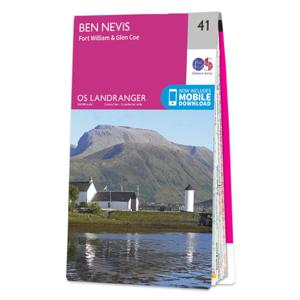
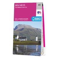
Wandelkaart - Topografische kaart 041 Landranger Ben Nevis, Fort Willi

0
Zeer goede detailkaart met topografische ondergrond. Kleurgebruik is goed over nagedacht: bijzonder goed leesbaar en helder kaartbeeld. Hierop zijn toeristische symbolen van bezienswaardigheden ingetekend, daarnaast staan bijvoorbeeld campings en jeugdherbergen vermeld en - voor wandelaars het belangrijkst - alle right of way paden en Lange afstand...

Webshops met dit product

Webshop
Bezorging
Prijs

Anderen bekeken ook

Wandelkaart - Topografische kaart 041 Landranger Ben Nevis, Fort Willi
Zeer goede detailkaart met topografische ondergrond. Kleurgebruik is goed over nagedacht: bijzonder goed leesbaar en helder kaartbeeld. Hierop zijn toeristische symbolen van bezienswaardigheden ingetekend, daarnaast staan bijvoorbeeld campings en jeugdherbergen vermeld en - voor wandelaars het belangrijkst - alle right of way paden en Lange afstands Wandelpaden zijn er op te vinden. De ideale kaart voor het wandelen in Engeland, Wales of Schotland. De kaarten zijn te gebruiken met GPS (UTM OSGB36), de legenda is in het Engels, Frans en Duits.    Plaatsen op deze kaart: Fort William, Glen Coe, Dalness, Kentallen, South Ballachulish, Glencoe, Kinlochleven, North Ballachulish, Inchree, Blarmachfoldach, Stronchreggan, Duisky, Corpach, Torlundy, Muirshearlich, Gairlochy, Clunes, Stronenaba, Spean Bridge, Achlauchrach, Fersir.   Ingetekende GR-Routes West Highland Way
19,50
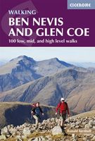
Wandelgids Ben Nevis and Glen Coe | Cicerone
Uitstekende wandelgids van Ben Nevis en Glen Coe. Goed beschreven met veel praktische informatie om de route te kunnen lopen, inclusief redelijke kaarten. This guidebook details 100 walking routes around Ben Nevis and Glen Coe, centred in 10 areas including Fort William and Glen Nevis, the Aonachs, the Mamores, Kinlochleven, Glen Coe, Glen Etive, Black Mount and Ben Cruachan. Routes are graded according to difficulty, and range between short, easy strolls and long, challenging walks with overnight bothy stays. The region's 44 Munro summits are covered, including 2 easy scrambles and the formidable traverse of Aonach Eagach's iconic jagged ridge.    Alongside step-by-step route descriptions and mapping, the guide presents practical advice on transport, access, safety and where to stay plus background information on the area's fascinating geology.     Many of the routes reflect the author's belief that the best rewards often lie off the popular tourist trails. Yet the highlights are all …
20,95
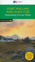
Wandelgids 07 Pathfinder Guides Fort William & Glen Coe | Ordnance Sur
Wandelgids van een deel Schotland. Deze gids bevat 28 dagwandelingen, variërend van korte tochten tot pittige dagtochten. De bijbehorende kaarten zijn uitstekend: men heeft de topografische kaarten van Ordnance Survey gebruikt waarop de route is ingetekend. Daarnaast praktische informatie over de wandeling en wat beschrijvingen van het gebied. Fort William and Glen Coe encompass one of the greatest areas of sea and mountain landscape in Scotland, backed by some of the biggest and most demanding peaks. This is Scotland's fjord land, a drowned coastland with long sea arms wending far inland, and steep climbs from sea level to Ben Nevis, the highest summit in Britain.   This walking guidebook contains 28 carefully selected walking routes around Fort William and Glen Coe of 5km (3 miles) to 16km (10 miles), each planned and tested by experienced walkers. Each route includes a full description, an extract of the OS Explorer 1 25 000 scale map, photos and notes of key features and wildlife t…
18,50
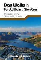
Wandelgids Day Walks in Fort William and Glen Coe | Vertebrate Publish
Day Walks in Fort William & Glen Coe features 20 routes between 4.4 and 14.4 miles (7km and 23.2km) in length, spread across the Scottish Highlands. Researched and written by experienced and knowledgeable authors Helen and Paul Webster, founders of the Walkhighlands website, the walks range from gentle rambles to more challenging day walks, all through grand and impressive landscapes.   Split into four sections – Glen Coe & Glen Etive; Kinlochleven & the Mamores; Fort William & the Great Glen; and The Road to the Isles – this guidebook explores the best that the Highlands has to offer.   Together with stunning photography, each route features Ordnance Survey 1:25,000 maps, easy-to-follow directions, details of distance and navigation information, and refreshment stops and local information.
20,95
Wandelgids Ben Nevis and Glen Coe | Cicerone
Uitstekende wandelgids van Ben Nevis en Glen Coe. Goed beschreven met veel praktische informatie om de route te kunnen lopen, inclusief redelijke kaarten. This guidebook details 100 walking routes around Ben Nevis and Glen Coe, centred in 10 areas including Fort William and Glen Nevis, the Aonachs, the Mamores, Kinlochleven, Glen Coe, Glen Etive, Black Mount and Ben Cruachan. Routes are graded according to difficulty, and range between short, easy strolls and long, challenging walks with overnight bothy stays. The region's 44 Munro summits are covered, including 2 easy scrambles and the formidable traverse of Aonach Eagach's iconic jagged ridge.    Alongside step-by-step route descriptions and mapping, the guide presents practical advice on transport, access, safety and where to stay plus background information on the area's fascinating geology.     Many of the routes reflect the author's belief that the best rewards often lie off the popular tourist trails. Yet the highlights are all …
20,95
Wandelgids Walking The Munros Vol 1 Southern, Central and Western High
Uitstekende wandelgids van het zuiden, midden en westen van de Schotse Hooglanden. Goed beschreven met veel praktische informatie om de route te kunnen lopen, inclusief redelijke kaarten. Guidebook to walking the Munros in southern, central and western Highlands. Describes 69 challenging routes across 139 of the iconic 3000ft+ mountains covering areas such as Glencoe, Bridge of Orchy and Mull. Includes routes up Ben More, Ben Alder, Ben Lomond and Ben Nevis, the highest mountain in the British Isles. Volume 1 of two guidebooks.   Seasons The guide is intended for summer hillwalkers (usually April/May to October in Scotland). In winter conditions the routes become more serious mountaineering expeditions requiring appropriate skills, equipment and experience.   Centres Arrochar, Crianlarich, Killin, Pitlochry, Tyndrum, Glencoe, Fort William, Spean Bridge, Dalwhinnie, Braemar, Glenshee   Difficulty Most of the Munros are straightforward walks but some involve ridge walking, scr…
20,95
Wandelkaart Ben Nevis | Harvey Maps
Een bijzonder mooie en handige kaart van dit prachtige bergachtige gebied. Op waterafstotend papier met veel details. HARVEY Superwalker map at 1:25,000 scale Detailed map of Ben Nevis for walkers and climbers This map for hillwalkers covers Fort William through Glen Nevis to Loch Treig. From the Grey Corries south to Kinlochleven. Ben Nevis, the Aonachs and the Mamores are among the 20 Munros and 4 Corbetts. Clear and easy to read with all the detail needed for ascending Britain's highest mountain. Enlargement of Ben Nevis summit showing the safety bearings in case of a descent in bad weather. As used by the Lochaber Mountain Rescue Team.
24,95

Klanten-reviews van Wandelkaart - Topografische kaart 041 Landranger Ben Nevis, Fort Willi

Er zijn nog geen beoordelingen voor dit productBen jij de eerste die een review plaatst?

Meer over Wandelkaart - Topografische kaart 041 Landranger Ben Nevis, Fort Willi

Productomschrijving

Zeer goede detailkaart met topografische ondergrond. Kleurgebruik is goed over nagedacht: bijzonder goed leesbaar en helder kaartbeeld. Hierop zijn toeristische symbolen van bezienswaardigheden ingetekend, daarnaast staan bijvoorbeeld campings en jeugdherbergen vermeld en - voor wandelaars het belangrijkst - alle right of way paden en Lange afstands Wandelpaden zijn er op te vinden. De ideale kaart voor het wandelen in Engeland, Wales of Schotland. De kaarten zijn te gebruiken met GPS (UTM OSGB36), de legenda is in het Engels, Frans en Duits.    Plaatsen op deze kaart: Fort William, Glen Coe, Dalness, Kentallen, South Ballachulish, Glencoe, Kinlochleven, North Ballachulish, Inchree, Blarmachfoldach, Stronchreggan, Duisky, Corpach, Torlundy, Muirshearlich, Gairlochy, Clunes, Stronenaba, Spean Bridge, Achlauchrach, Fersir.   Ingetekende GR-Routes West Highland Way

Productspecificaties

Artikelnummer(s)
Brand
Ordnance Survey
Webshop.nl maakt gebruik van cookies. Ga je verder op onze website, ga dan akkoord met het plaatsen van cookies en de verwerking van deze data door ons en vermelde partners.