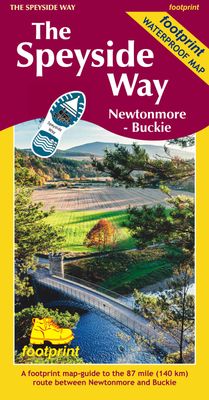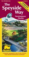
Wandelkaart The Speyside Way | Footprint maps

0
The Speyside Way is one of 'Scotland's Great Trails'. It runs between Newtonmore, in the heart of Strathspey, 87 miles to Buckie, on the Moray Firth. The route passes through some of Scotland's most beautiful landscapes.  ...

Verkopers met dit product

Verkoper
Bezorging
Prijs
DeZwerver.nl logo
DeZwerver.nl
niet bekend
17,95

Anderen bekeken ook

Wandelgids The Speyside Way | Rucksack Readers
Deze gids een goede beschrijving van de lange afstands route. De kaarten zijn schetsmatig maar wel duidelijk. The Speyside Way is one of Scotland’s Great Trails. It runs for 80 miles (128 km) from the fishing port of Buckie to Aviemore in the foothills of the Cairngorms. Following the lovely valley of the River Spey, you walk through countryside rich in malt whisky and wildlife, along riverside paths, railway trackbed and forest and moorland tracks.   The second edition was fully revised, with mapping from Footprint in six panels, updated plans of villages along the Way, including a fresh Grantown plan and directions from the terminus in Buckie. In 2016 we released the revised version of this essential trail guide, with fresh photos, new mapping and many other updates. These included documenting the 6.5-mile route extension to Kincraig, which opened in 2015, and 11-mile Badenoch Way.   This guidebook contains all you need to plan and enjoy the Speyside Way:   the Way step-by-step,…
22,50
Wandelgids The Rob Roy Way | Rucksack Readers
Deze gids geeft een goede beschrijving van de lange afstands route. De kaarten zijn schetsmatig maar wel duidelijk. The Rob Roy Way is one of Scotland's Great Trails and is very popular with both walkers and cyclists. It runs through many places linked with Scotland's most famous outlaw, Rob Roy MacGregor (1671-1734). The route starts at Drymen (near Glasgow) and ends at Pitlochry in the eastern Highlands, so it takes you away from the crowds following the West Highland Way to some of Scotland's finest lochs and glens.   Its main spine runs for 79 miles (127 km) and is waymarked. There is an optional extra 17 miles if you take the wilderness extension through Glen Almond and Glen Quaich. Most walkers complete it in 6-8 days and most cyclists in 3-4 days.   The main route goes through Loch Ard forest to Aberfoyle, goes beside Lochs Venachar, Lubnaig and Tay and passes through superb scenery, with interesting aqueducts, viaducts and a 3600 year-old stone circle. The terrain is a mi…
22,50
Wandelkaart The Dales Way | Footprint maps
Handzame wandelkaart voor de Dales Way in Noord Engeland.  The Dales Way is a 79 mile (127km) long distance trail in the north of England, running between Ilkley, in North Yorkshire and Bowness-on-Windermere, in Cumbria. Much of the route passes through the Yorkshire Dales and Lake District National Parks. Starting out in Ilkley, the route runs along Wharfedale, passing the impressive ruins of Bolton Priory and the attractive market town of Grassington. It continues along the River Wharfe through dramatic limestone scenery before it crosses The Pennines to reach Dentdale and Sedbergh. It then skirts the Howgill Fells and crosses the M6 motorway to finish overlooking Lake Windermere.   This map-guide is laid out for walkers travelling from Ilkley to Bowness, although walkers travelling in the opposite direction should find it equally useful. Each panel includes a detailed route map, route profile and helpful notes on navigation.   There are link routes from Bradford, Leeds and Harrogat…
12,95
Wandelgids Loch Lomond & Cowal Way | Rucksack Readers
"Lavishly illustrated guidebook with route map plus practical information" - Scots Magazine The Loch Lomond & Cowal Way is one of Scotland's Great Trails. It runs for 57 miles (91 km) across the Cowal peninsula, which lies west of Glasgow and is easily reached by public transport, road and ferry. The route starts at Portavadie on Loch Fyne and ends at Inveruglas on Loch Lomond. The trail is waymarked and undulating, with rugged terrain and glorious views over the Isle of Bute and the Firth of Clyde. The area is rich in history and heritage, with wildlife sightings including red squirrel, red deer and golden eagle. Cowal has ferries to Bute, to Kintyre and (in season) across Loch Lomond to join the West Highland Way. It’s the missing link that enables Scotland’s ultimate long-distance walk, from Kintyre all the way to Inverness. In 2018 the route’s name was extended to "Loch Lomond & Cowal Way" to reflect the fact that over 50% of it runs within the Loch Lomond & Trossachs National Par…
19,95
Wandelkaart The Fife Pilgrim Way | Footprint maps
A handy, waterproof map breaking down the Fife Pilgrim Way into seven sections. The Fife Pilgrim Way runs between North Queensferry or Culross and St Andrews. It is designed as a varied route for residents and visitors alike, and it is possible to walk the entire signposted path or explore particular sections using the map.   The route follows in the footsteps of Medieval pilgrims, passing many sites which reflect Fife's rich history, and which would be familiar to those travellers long ago. The Fife Coastal Path map is based on OS data at a scale of 1:40,000 which gives a detailed guide with grading of the entire 64 miles (104 km) of the route. The map is part of Stirling Surveys' popular Footprint series.   For every copy of this map sold, a donation goes towards the practical management of The Fife Pilgrim Way.
17,95
Reisgids Scotlands Highlands and Islands | Lonely Planet
De perfecte reisgids voor zowel de georganiseerde als de zelfstandige reiziger. Naast een algemene inleiding van het land / streek vol met praktische informatie over hoe je er het beste kunt reizen: slapen, eten, vervoer, excursies ... alles kun je er in vinden. Engelstalig. Lonely Planet The wild landscapes of Scotland’s Highlands and islands offer the ultimate escape – one of the last corners of Europe where you can discover genuine solitude. Lonely Planet will get you to the heart of Scotland’s Highlands & Islands, with amazing travel experiences and the best planning advice.   Lonely Planet's local travel experts reveal all you need to know to plan the trip of a lifetime in this latest edition of our guide to Scotland's Highlands & Islands. Discover Scotland's Highlands & Islands' most popular experiences and best kept secrets from watching dolphins playing in the Moray Firth near Inverness; to summiting the highest mountain in the UK, the mighty Ben Nevis; and discovering a d…
23,95
Wandelkaart Southern Upland Way | Harvey Maps
Southern Upland Way is Britain's first official coast to coast long distance footpath and is one of Scotland's Great Trails. It runs 340km (212 miles) from Portpatrick on the south west coast of Scotland to Cockburnspath on the eastern seaboard. It offers superb and varied walking country, still undiscovered by many enthusiasts. The Way provides a real challenge for the experienced walker, yet some of the shorter stretches are suitable for families and the less ambitious.
28,50
Wandelgids Weekend Walks Moray | Pocket Mountains
The Moray coastline has a string of superb sandy beaches, and towns such as Buckie, Lossiemouth and Nairn (historically part of Morayshire) have long been popular for family holidays.   For the walker there are cliffs, arches and stacks as well as sand and dunes, whilst offshore it may be possible to glimpse the famous Moray Firth dolphins. Set back from the coast are fine stone-built towns such as Forres and the small Cathedral city of Elgin.   From here heading southwards the character of the countryside changes to one of wide, spacious glens and sweeping, purple heather moors and hills. This is Speyside - Malt whisky country par excellence. The main centres here are Keith, Aberlour and attractive Dufftown, as the hills slowly merge into the Cairngorms National Park.   This latest pocket guide features 40 of the best walks in this popular area in an attractive and accessible format.
10,95
Wandelgids St. Cuthbert's Way | Rucksack Readers
Lange afstandswandelgids van de St. Cuthbert's Way wandeling. Wandelgids met kaarten en beschrijving. op waterbestendig papier, in spiraalbinding. Follow the footsteps of St Cuthbert in this easy-going walk of 63 miles (101 km) from Melrose Abbey in the Scottish Borders to the Holy Island of Lindisfarne in Northumberland. St Cuthbert's Way is one of Scotland's Great Trails, and it is also one of England's great trails. Starting from the ruins of Melrose Abbey, it winds alongside the River Tweed, and after about 31 miles you walk across the border into England on high ground.   The Way includes a section of Roman road and passes castles, hill forts and historic ruins along the way. Most people will complete it comfortably within 5 or 6 days. Its summit is Wideopen Hill (369m/1210ft), and its barefoot finale is the Pilgrim Way to Lindisfarne with its priory and castle.   The route is fully waymarked, the gradients are modest and it has welcoming B&Bs and pubs at strategic intervals…
22,50

Klanten-reviews van Wandelkaart The Speyside Way | Footprint maps

Er zijn nog geen beoordelingen voor dit productBen jij de eerste die een review plaatst?

Meer over Wandelkaart The Speyside Way | Footprint maps

Productomschrijving

The Speyside Way is one of 'Scotland's Great Trails'. It runs between Newtonmore, in the heart of Strathspey, 87 miles to Buckie, on the Moray Firth. The route passes through some of Scotland's most beautiful landscapes.  

Verken gerelateerde categorieën

Webshop.nl maakt gebruik van cookies. Ga je verder op onze website, ga dan akkoord met het plaatsen van cookies en de verwerking van deze data door ons en vermelde partners.