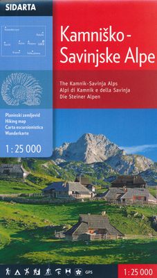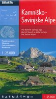
Wandelkaart The Kamnik-Savinja Alps, Kamnisko Savinjske Alpe | Sidarta

0
Deze dubbelzijdige detailkaart (1:25.000) heeft ingetekende wandelroutes waarbij met verschillende kleuren de moeilijkheidsgraad wordt aangegeven, een aanduiding van de berghutten (met op de achterzijde meer informatie over deze hutten als openingstijden en capaciteit) en andere handige zaken voor wandelaars. Zelfs benzinepompen en busstops zijn v...

Verkopers met dit product

Webshop
Bezorging
Prijs
DeZwerver.nl logo
DeZwerver.nl
niet bekend
14,95

Anderen bekeken ook

Wandelkaart Julische Alpen - Triglav National Park | Sidarta
Dit is de overzichtskaart 50.000 van de Julische Alpen, er zijn daarnaast van uitgever Sidarta nog 3 hele goede deelkaarten 25.000 van dit gebied.   Deze dubbelzijdige detailkaart (1:50.000) heeft ingetekende wandelroutes waarbij met verschillende kleuren de moeilijkheidsgraad wordt aangegeven, een aanduiding van de berghutten (met op de achterzijde meer informatie over deze hutten als openingstijden en capaciteit) en andere handige zaken voor wandelaars. Zelfs benzinepompen en busstops zijn vermeld.    Daarnaast kent de kaart veel topografische details als hoogtelijnen, terrein-informatie en naamsaanduidingen. Door graden-aanduiding aan de zijkant is de kaart GPS toepasbaar.   - Julian Alps- Julijske Alpe - Triglav National Park hiking map 1:50,000 Slovenie - All alpine paths graded easy, difficult, very difficult - Marked tourist paths around Bled, Kranjska Gora, Bovec, kobarid - 'Walks of Peace' trail marked a historical path round the frontline from the 1st World War (The isonco F…
14,95
Reisinspiratieboek - Reisboek Book of the Alps | Marmota Maps
The Book of the Alps  the great illustrated book about the Alps.290 pages with over 1000 illustrations, graphics, and maps on geography, sports, history, culture, climate, environment and much more. Understand the Alps like never before.Created in cooperation with the Alpine clubs of Germany, Austria, and South Tyrol. CONTENTS The Book of the Alps has 46 chapters in seven subject areas: Geography   Flora and Fauna   Climate and Environment    Alpinism   Mountain Sports   Society and Economy   Arts and Culture   GEOGRAPHY Geological Formation Ice Age Mountains Valleys Mountain Passes Lakes and Rivers Glaciers The Alps are unique. How did they form and evolve? How do glaciers, passes, valleys, lakes, and rivers shape the landscape? Answers to these and many more questions can be found in the geography chapter.   FLORA AND FAUNA Biodiversity Plants Forests Animals National Parks The Alpine environment is fascinating. Alpine flowers such as the edelweiss and Alpine anima…
44,95
Fietskaart 01 Cycling guides Cornwall | Goldeneye
Our maps are double-sided, printed on an A2 sheet with a concertina fold. This allows for easy folding and folding, and an ease of access to the mapping. The material is rain and tear-resistant. Our early maps were designed at the scale of 2 miles to 1 inch/1:126,720. The later designs along with digitalisation are 1: 100,000. We were encouraged by the Cycle Touring Club to convert our cartography toward the cycle market (to replace the out-of-print Bartholomew series). As time and the series progressed we have added more data: The National Cycle Network routes, Regional Routes, and Traffic-Free Family Routes, as and when they are developed. These routes are in addition to the Circular Routes Goldeneye Commissioned at the outset of our publishing schedule. We are also adding to new editions; bike shops, cycle hire, and tea rooms, along with the tourist attractions already featured. Our plan is to make available digital versions for cell phones and tablets and to update, on an annual b…
15,95
Wandelkaart Suva Planina - Servië | Geokarta
One side topographic marked with footpaths, ski trails, ski lifts, camp sites, picnic sites, mountain huts, also notable features in the landscape. Other side further information, additional words and pics of notable features, mountain huts etc. Suva Mountains with the Gorges of the Jelašnicka River on a detailed contoured map at 1:55,000, plus extensive information on the tourist facilities in the area with colour photos of mountain shelters, notes on fauna and flora, etc. The map has contours at 20m intervals with relief shading and colouring for woodlands. Different levels of protection zones are marked and areas where hunting is allowed are indicated. An overprint highlights waymarked hiking trails including the 130km long-distance trail across the Niš range. Also marked are different types of tourist accommodation including campsites and hunting lodges, paragliding sites, skiing areas, etc. The map has latitude and longitude lines at intervals of 5’. Map legend includes English. …
13,95
Wandelkaart 69 Serra de Tramuntana + GR-221 | Editorial Alpina
Kaartenset van 4 kaarten op stevig papier voor de hele Serra de Tramuntana met de GR221. Zeer gedetailleerde wandelkaart van een klein gebied. Met ingetekende wandelroutes en andere informatie. Spaanstalig, maar uitstekende kaart. Coordinaten zijn weergegeven, dus GPS compatible met UTM grid.    Op de topografische wandelkaart worden o.a. berghutten, campings aangeduid en hoogtelijnen, ingetekende wandelroutes en de GR paden (doorgaande langeafstandswandelpaden). De kaart is inclusief een Spaanstalig boekje met extra informatie over aanwezige voorzieningen en enkele routes.   Gebied: Andratx, Sóller, Estellencs, Banyalbufar, Lluc, Orient, Sa Calobra, Pollenca, Alcúdia, Deià, Valldemossa, Peguera, Puig Major, Puig Roig, Tomir, Puig de n'Ali, Puig de Galatzó.   Mallorca’s Serra de Tramuntana mountains presented by Editorial Alpina at 1:25,000 on a set of four light, contoured and GPS compatible maps with an overprint for local hiking trails, GR221 long-distance route, sites for various …
28,95
Wandelkaart Beskid Slaski - Wista en Szczyrk - Beskiden | Sygnatura
De kaart beslaat de hele Silezische Beskiden, van Bielsko-Biała tot Zwardoń en van de Shelter bij Tułem tot Kotlina Żywiecka.   Vertaling van Google Translate:    De legende bevat ongeveer 90 karakters, beschreven in 5 talen (PL, GB, D, SK, F). Zeer levendige, kleurrijke schaduwen en contourlijnen om de 20 m geven het terrein duidelijk weer. De karakteristieke kenmerken van de kaart zijn: een dicht netwerk van paden en wegen, overzichtelijke accommodaties en toeristische, paard- en skiroutes, maar ook fiets- en skiroutes, overzichtelijke skiliften en kabelbanen, zorgvuldig berekende passeertijden, GPS-raster, gedetailleerde gebouwen duidelijk zichtbaar, zelfs in bossen.   De gids op de achterkant van de kaart is zeer gevarieerd en kleurrijk. Naast geografische informatie over het gebergte is er gedetailleerde informatie over alle PTTK-schuilplaatsen met hun foto's. Ook andere accommodaties in de bergen werden niet vergeten. Er is: een schema van paden met plastic schaduw, dekking voor…
9,95
Fotoboek Alpenglow - The Finest Climbs on the 4000m Peaks of the Alps | Benn Tibbetts
ALPENGLOW takes the reader through a journey of personal adventure, immersive art and breathtaking scenery, combining inspiration with detailed local knowledge. Climbing the 4000m peaks of the Alps is one of the great and enduring challenges in mountaineering. It is a project that requires endurance, courage, skill, and humility.   Whether you are a lover of mountain landscapes, an aspiring alpinist, or already a veteran of many adventures, this book will provide a wealth of original and inspiring material to help with planning future excursions or simply immersing yourself in the beauty of the high mountain   Drawings The photography in the book is matched by a series of finely wrought pencil drawings. Several of these are available as luxury prints to complement the book.   Finsteraarhorn pencil drawing (12 x 8 cm) example   The drawings for this project are usually smaller than a typical postcard. Each one is based on photographs and made with finely-sharpened pencils whilst…
72,95
Wandelkaart Walker's Haute Route: Chamonix to Zermatt | Knife Edge Outdoor
Een hele goede kaart van én van de grote wandeltochten in de Alpen: Haute Route Chamonix-Zermatt. Deze wandelkaart op scheur- en watervast papier gedrukt geeft de hele route weer op een gedetailleerde schaal. Alle noodzakelijke informatie vind je er op terug.   The best sheet map for the Walker's Haute Route: Chamonix to Zermatt. This is the only map available that displays the entire route and numerous variants on a single sheet: perfect for planning and navigation. 1:40,000 - larger scale and more detail than any other map. 1:10,000: for select areas where navigation is challenging. Made specifically for the Walker's Haute Route by Knife Edge Outdoor Guidebooks:   - English/French/German map key - 1:40,000/1:10,000 - Numerous variants - Includes free GPX downloads for the trail - GPS compatible - Tougher than traditional maps: try to tear me! - More water-resistant than traditional maps - Lighter than traditional maps - Huts/accommodation marked on the map   The Walker's Haute Route…
23,95
Wandelkaart Tatry Zachodnie | Sygnatura
Goede wandelkaart van het grote westelijke deel van het Tatra gebergte, zowel aan de Poolse als aan de SLowaakse kant. Wandelpaden, campings, hutten, alles staat er op.  Western Tatra Mountains in Poland and Slovakia at 1:25,000 on a contoured and GPS compatible map from CartoMedia highlighting waymarked hiking trails, mountain huts and campsites, places of interest, etc, Coverage extends from Zakopane westwards to Habovka. On the reverse are panels with an overview of the waymarked hiking trails for planning longer routes, a road map showing access to this part of the Tatra Mountains from both sides of the border, a directory of local mountain huts and other useful tourist information, etc.   Maps in the Cartomedia hiking series present topography is by contours at 20m intervals, enhanced by relief shading and, where appropriate, graphic relief for exposed rocky areas. Waymarked hiking trails indicate approximate walking times in both directions and possible danger points. Most title…
9,95
Fietskaart Cycling guides Exmoor - North Devon | Goldeneye
Scheur- en watervast foetskaart van Exmoor en Noord Devon met ingetekende fietsroutes.   Our maps are double-sided, printed on an A2 sheet with a concertina fold. This allows for easy folding and folding, and an ease of access to the mapping. The material is rain and tear-resistant. Our early maps were designed at the scale of 2 miles to 1 inch/1:126,720. The later designs along with digitalisation are 1: 100,000. We were encouraged by the Cycle Touring Club to convert our cartography toward the cycle market (to replace the out-of-print Bartholomew series). As time and the series progressed we have added more data: The National Cycle Network routes, Regional Routes, and Traffic-Free Family Routes, as and when they are developed. These routes are in addition to the Circular Routes Goldeneye Commissioned at the outset of our publishing schedule. We are also adding to new editions; bike shops, cycle hire, and tea rooms, along with the tourist attractions already featured. Our plan is to …
12,95

Klanten-reviews van Wandelkaart The Kamnik-Savinja Alps, Kamnisko Savinjske Alpe | Sidarta

Er zijn nog geen beoordelingen voor dit productBen jij de eerste die een review plaatst?

Meer over Wandelkaart The Kamnik-Savinja Alps, Kamnisko Savinjske Alpe | Sidarta

Productomschrijving

Deze dubbelzijdige detailkaart (1:25.000) heeft ingetekende wandelroutes waarbij met verschillende kleuren de moeilijkheidsgraad wordt aangegeven, een aanduiding van de berghutten (met op de achterzijde meer informatie over deze hutten als openingstijden en capaciteit) en andere handige zaken voor wandelaars. Zelfs benzinepompen en busstops zijn vermeld.   Daarnaast kent de kaart veel topografische details als hoogtelijnen, terrein-informatie en naamsaanduidingen. Door graden-aanduiding aan de zijkant is de kaart GPS toepasbaar.   The map covers the all region of the Kamnik-Savinja Alps. Beside the waymarked paths, unmarked trails and ski tours the map includes also: sports climbing areas,  natural and cultural points of interest and paragliding take-off sites

Verken gerelateerde categorieën

Webshop.nl maakt gebruik van cookies. Ga je verder op onze website, ga dan akkoord met het plaatsen van cookies en de verwerking van deze data door ons en vermelde partners.