webshop.nl

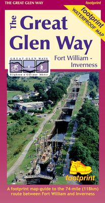
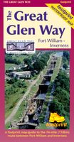
Wandelkaart The Great Glen Way | Footprint maps

0
The complete map/guide of both routes between Fort William and Inverness.   Also contains compact and concise practical information for walkers.   For every copy of this map sold, a donation goes towards the practical management of the Great Glen Way.  ...

Webshops met dit product

Webshop
Bezorging
Prijs
DeZwerver.nl logo
DeZwerver.nl
niet bekend
17,95

Anderen bekeken ook

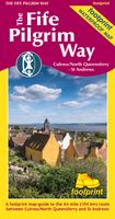
Wandelkaart The Fife Pilgrim Way | Footprint maps
A handy, waterproof map breaking down the Fife Pilgrim Way into seven sections. The Fife Pilgrim Way runs between North Queensferry or Culross and St Andrews. It is designed as a varied route for residents and visitors alike, and it is possible to walk the entire signposted path or explore particular sections using the map.   The route follows in the footsteps of Medieval pilgrims, passing many sites which reflect Fife's rich history, and which would be familiar to those travellers long ago. The Fife Coastal Path map is based on OS data at a scale of 1:40,000 which gives a detailed guide with grading of the entire 64 miles (104 km) of the route. The map is part of Stirling Surveys' popular Footprint series.   For every copy of this map sold, a donation goes towards the practical management of The Fife Pilgrim Way.
17,95
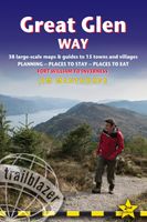
Wandelgids Great Glen Way | Trailblazer Guides
Goede wandelgids waarin met veel details alle etappes zijn beschreven. Tevens informatie over overnachtingen en openbaar vervoer. All-in-one, practical guide to walking the Great Glen Way long-distance footpath. The trail begins where the West Highland Way ends - at Fort William - and follows the Great Glen faultline to finish at Inverness after 79 miles (127km). The trail passes Loch Lochy, Loch Oich and Loch Ness and also follows the towpath of the Caledonian Canal.   It's a relatively easy week-long walk amongst beautiful Highland scenery but there's a high level option between Fort Augustus and Drumnadrochit that gives even better mountain views. This 2nd edition has been re-walked and fully updated. * Includes 38 detailed walking maps: the largest-scale maps available - at just under 1:20,000 (8cm or 31/8 inches to 1 mile) these are bigger than even the most detailed walking maps currently available in the shops * Unique mapping features - walking times, directions, tricky juncti…
19,95
Wandelkaart The Fife Coastal Path | Footprint maps
A handy, waterproof map breaking down the Fife Pilgrim Way into seven sections. The Fife Pilgrim Way runs between North Queensferry or Culross and St Andrews. It is designed as a varied route for residents and visitors alike, and it is possible to walk the entire signposted path or explore particular sections using the map.   The route follows in the footsteps of Medieval pilgrims, passing many sites which reflect Fife's rich history, and which would be familiar to those travellers long ago. The Fife Coastal Path map is based on OS data at a scale of 1:40,000 which gives a detailed guide with grading of the entire 64 miles (104 km) of the route. The map is part of Stirling Surveys' popular Footprint series.   For every copy of this map sold, a donation goes towards the practical management of The Fife Pilgrim Way.
17,95
Wandelgids The Great Glen Way | Rucksack Readers
Uitgevoerd in de vorm van een klapper, met ringband geeft deze gids een goede beschrijving van de lange afstands route. De kaarten zijn schetsmatig maar wel duidelijk. The Great Glen Way is one of Scotland’s Great Trails and offers a superb experience for both walkers and cyclists. The Way runs for 77 miles (124 km) along Scotland’s Great Glen between Fort William and Inverness. It follows the scenic Caledonian Canal and runs beside four of the Highlands’ loveliest lochs – including Loch Ness, famous for its monster legend and for Urquhart Castle.   This new edition of our popular guidebook has been fully revised in 2019-20 after extensive fieldwork. It includes new large-scale mapping (1:38,000) with mileage markers and a kilometre grid, many updates and fresh photos, and is in our slim pocket-friendly format, still on rainproof paper.   This guidebook contains all you need to plan and enjoy the Great Glen Way – on foot or on a bike:   detailed mapping on 13 pages at 1:38,000 hi…
24,95
Wandelkaart Fort William | Footprint maps
Gedetailleerde wandelkaart van dit gedeelte van Schotland. Ook zeer geschikt voor de mountainbike. Op de achterzijde detailkaartjes met wandel- en mountainbikeroutes. Inclusief veel praktische informatie. This specially produced map & guide shows all the paths, tracks and trails in this popular part of Western Scotland, rightly called The Outdoor Capital of the UK. The map also includes lots of other useful information for when you're out and about; from where to get a bite to eat to hiring or fixing your bike.   Use the main map to plan your own route or use the individual maps overleaf to follow one of the suggested routes which have been carefully selected to take in some the best trails and views in the area.   Side 1: an overview map of Glen Nevis, Caledonian Canal, Spean Bridge & Nevis range   Side 2: nine specially surveyed routes for walkers, mountain bikers and trail runners. Each route is shown on its own map and is accompanied by detailed navigation notes.
14,95
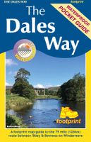
Wandelkaart The Dales Way | Footprint maps
Handzame wandelkaart voor de Dales Way in Noord Engeland.  The Dales Way is a 79 mile (127km) long distance trail in the north of England, running between Ilkley, in North Yorkshire and Bowness-on-Windermere, in Cumbria. Much of the route passes through the Yorkshire Dales and Lake District National Parks. Starting out in Ilkley, the route runs along Wharfedale, passing the impressive ruins of Bolton Priory and the attractive market town of Grassington. It continues along the River Wharfe through dramatic limestone scenery before it crosses The Pennines to reach Dentdale and Sedbergh. It then skirts the Howgill Fells and crosses the M6 motorway to finish overlooking Lake Windermere.   This map-guide is laid out for walkers travelling from Ilkley to Bowness, although walkers travelling in the opposite direction should find it equally useful. Each panel includes a detailed route map, route profile and helpful notes on navigation.   There are link routes from Bradford, Leeds and Harrogat…
12,95
Wandelkaart Ben Nevis | Harvey Maps
Een bijzonder mooie en handige kaart van dit prachtige bergachtige gebied. Op waterafstotend papier met veel details. HARVEY Superwalker map at 1:25,000 scale Detailed map of Ben Nevis for walkers and climbers This map for hillwalkers covers Fort William through Glen Nevis to Loch Treig. From the Grey Corries south to Kinlochleven. Ben Nevis, the Aonachs and the Mamores are among the 20 Munros and 4 Corbetts. Clear and easy to read with all the detail needed for ascending Britain's highest mountain. Enlargement of Ben Nevis summit showing the safety bearings in case of a descent in bad weather. As used by the Lochaber Mountain Rescue Team.
24,95
Wandelkaart Arran including Arran Coastal Way | Harvey Maps
Een bijzonder handige kaart van dit gebied. Op waterafstotend papier met veel details.    Features the renowned Goat Fell, A'Chir ridge, Beinn Bharrain, Glen Sannox & Glen Rosa. Detailed map for hillwalkers of the whole island at the popular 1:25,000 scale. The 100km (62 miles) Arran Coastal Way is also shown. The route links the coastline of the island with the villages and the stunning scenery Arran has to offer. Includes Gaelic-English glossary and information on local archaeological and historical sites. Landscape and wildlife information from the National Trust for Scotland Includes 4 Corbetts and 1 Graham.   Tough, light, durable and 100% waterproof Genuine, original, HARVEY mapping Opens directly to either side of the sheet Easy to re-fold  
24,95
Wandelgids Loch Ness, Inverness, Black Isle and Affric | Pocket Mountains
Handige compacte wandelgids met 40 dagwandelingen. Deze gids bevat kleine kaartjes en leuke uitgebreide informatie over wat er langs de route te zien is. Goede wandelkaarten zijn echter we noodzakelijk voor deze tochten: de Ordnance Survey explorer maps of Landanger maps zijn zeer geschikt.   A guide to 40 favourite walks around Loch Ness, Inverness, Black Isle and Glen Affric. Loch Ness, with its legendary monster, is the most famous of all lochs. It holds more water than all the lakes of England and Wales combined and the countryside around it features an equally great variety of walks, with more waymarked trails and easy routes suitable for families than many other parts of the Highlands. Further north lies the magnificent Glen Affric - Scotland's most beautiful glen.   This is a wonderful area of the Highlands for walkers, having the highest mountains north of the Great Glen but also some splendid lower-level and forest walks. To the east is the fertile Black Isle, packed with cha…
10,95

Klanten-reviews van Wandelkaart The Great Glen Way | Footprint maps

Er zijn nog geen beoordelingen voor dit productBen jij de eerste die een review plaatst?

Meer over Wandelkaart The Great Glen Way | Footprint maps

Productomschrijving

The complete map/guide of both routes between Fort William and Inverness.   Also contains compact and concise practical information for walkers.   For every copy of this map sold, a donation goes towards the practical management of the Great Glen Way.  

Verken gerelateerde categorieën

Webshop.nl maakt gebruik van cookies. Ga je verder op onze website, ga dan akkoord met het plaatsen van cookies en de verwerking van deze data door ons en vermelde partners.