webshop.nl

Wandelkaart The Fife Pilgrim Way | Footprint maps

0
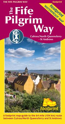
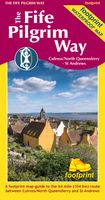
A handy, waterproof map breaking down the Fife Pilgrim Way into seven sections. The Fife Pilgrim Way runs between North Queensferry or Culross and St Andrews. It is designed as a varied route for residents and visitors alike, and it is possible to walk the entire signposted path or explore particular sections using the map.   The route follows in ...

Verkopers met dit product

Webshop
Bezorging
Prijs
DeZwerver.nl logo
DeZwerver.nl
niet bekend
17,95

Anderen bekeken ook

Wandelkaart The Fife Coastal Path | Footprint maps
A handy, waterproof map breaking down the Fife Pilgrim Way into seven sections. The Fife Pilgrim Way runs between North Queensferry or Culross and St Andrews. It is designed as a varied route for residents and visitors alike, and it is possible to walk the entire signposted path or explore particular sections using the map.   The route follows in the footsteps of Medieval pilgrims, passing many sites which reflect Fife's rich history, and which would be familiar to those travellers long ago. The Fife Coastal Path map is based on OS data at a scale of 1:40,000 which gives a detailed guide with grading of the entire 64 miles (104 km) of the route. The map is part of Stirling Surveys' popular Footprint series.   For every copy of this map sold, a donation goes towards the practical management of The Fife Pilgrim Way.
17,95
Wandelkaart The Dales Way | Footprint maps
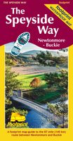
Handzame wandelkaart voor de Dales Way in Noord Engeland.  The Dales Way is a 79 mile (127km) long distance trail in the north of England, running between Ilkley, in North Yorkshire and Bowness-on-Windermere, in Cumbria. Much of the route passes through the Yorkshire Dales and Lake District National Parks. Starting out in Ilkley, the route runs along Wharfedale, passing the impressive ruins of Bolton Priory and the attractive market town of Grassington. It continues along the River Wharfe through dramatic limestone scenery before it crosses The Pennines to reach Dentdale and Sedbergh. It then skirts the Howgill Fells and crosses the M6 motorway to finish overlooking Lake Windermere.   This map-guide is laid out for walkers travelling from Ilkley to Bowness, although walkers travelling in the opposite direction should find it equally useful. Each panel includes a detailed route map, route profile and helpful notes on navigation.   There are link routes from Bradford, Leeds and Harrogat…
12,95
Wandelgids Fife | Hallewell Publications
Rewalked and updated in 2021, Walks Fife including St Andrews & the Lomond Hills covers the county of Fife, which lies between the estuaries of the Rivers Forth and Tay. There are a lot of coastal walks (along sections of the Fife Coastal Path), plus walks in and around the historic town of St Andrews and some good hill walks in the Lomond Hills. The 27 walks featured range from 0.5 miles to 13 miles (1.5-21km). Routes include: West and East Lomond, Bishop Hill and St Andrews to Crail. Now on its 3rd edition, Walks Fife is part of a popular series of A6 pocket walking guides which describe routes which are suitable for walkers of all abilities and to suit all tastes. Route descriptions are accompanied by 2-colour sketch maps. The guides are illustrated with line illustrations, and will provide walkers with a good introduction to what each area covered has to offer.  
5,95
Wandelkaart Settle to Carlisle Way | Harvey Maps
Mooie, duidelijke kaart van de Settle to Carlisle Way in Noord-Engeland. Geplastificeerd met veel extra informatie en uitsnedes van de route. Settle Carlisle Way is a walking route linking the stations of the famous and scenic Settle-Carlisle Railway Line. This map gives you the chance to walk up and ride back on the train, or to hop off at one station and rejoin a later train further on. The route starts in picturesque Settle and passes through the beautiful Yorkshire Dales and the sheltered Eden Valley, ending in central Carlisle. The entire route is on the one map. Tough and 100% waterproof Compact and light - the map itself weighs just 60gms - a third of the weight of a laminated map, and much less bulky. And you can fold or refold it time and again, or stuff it in your pocket and it won't fall to pieces. Shows the entire route on one sheet. Information on finding accommodation, camping, food. Directions to the start. Also Ranger Service contact numbers and enlargements of towns/v…
21,50
Wandelkaart Glyndwr's Way | Harvey Maps
XT40. Leap forward in technical excellence. Tough, light and 100% waterproof   Compact and light - the map itself weighs just 60gms - a third of the weight of a laminated map, and much less bulky. And you can fold or refold it time and again, or stuff it in your back pocket and it won't fall to pieces. Shows the entire route on one sheet.   Glyndwr's Way is a 217km (135 mile) long National Trail meandering through the open moorland, rolling farmland, woodland and forest of mid-Wales. The Way starts at Knighton and ends in Welshpool. It takes you to some of the finest landscape features in Wales including the tranquil Radnorshire Hills, the shores of the Clywedog Reservoir and heather clad Plynlimon. There are also spectacular views over Cadair Idris, Lake Vyrnwy, the Cambrian mountains and Y Golfa. The highest point on the route is Foel Fadian at 510m (1530ft).    The map is arranged in panels so that at any one time you only have to have the part you need open. It is supplied folded…
25,95
Wandelkaart Cape Wrath Trail South | Harvey Maps
Een bijzonder handige kaart van dit lange-afstands-wandelpad. Op waterafstotend papier met veel details. Het enige dat je eigenlijk een beetje mist is een overzicht. Verder uitstekend en voldoende voor de route. XT40 - Leap forward in technical excellence. Tough, light and 100% waterproof   Compact and light - the map itself weighs just 60gms - a third of the weight of a laminated map, and much less bulky. And you can fold or refold it time and again, or stuff it in your back pocket and it won't fall to pieces. Shows the entire route on one sheet.   The Cape Wrath Trail is a challenging route from Fort William to Cape Wrath. It is around 200 miles long and passes through some of Scotland's wildest and most spectacular scenery.   This map covers the southern section of the route, from Fort William to Strathcarron.   The trail has evolved from use and is not an officially recognised National Trail. There is no single definitive route. There are various ways of tackling the traverse all …
28,50
Wandelkaart Anglesey Coastal Path | Harvey Maps
Een bijzonder handige kaart van dit lange-afstands-wandelpad. Op waterafstotend papier met veel details. Het enige dat je eigenlijk een beetje mist is een overzicht. Verder uitstekend en voldoende voor de route. Entire route on one map   The 200km (125 mile) long Anglesey Coastal Path is a long distance route that follows much of the island's coastline and comprises one section of the Wales Coast Path. The path primarily caters for walkers however, cyclists and horse riders can also enjoy certain sections.   The path falls within a designated Area of Outstanding Natural Beauty which covers 95% of the coast. It passes through landscape that includes a mixture of farmland, coastal heath, dunes, salt-marsh, foreshore, cliffs and a few small pockets of woodland.   Tough, light, durable and 100% waterproof Includes Rights of Way Genuine original HARVEY mapping Route clearly marked
25,95
Fietskaart Cycle Map Pennine Cycleway South | Sustrans
The official route map for the 136-mile (219km) southern part of the Pennine Cycleway on National Cycle Network Route 68 from Derby to Settle.   This linear map shows the route and immediate surrounding area over a series of separate map panels. The full colour map based on Ordnance Survey data shows clearly mapped cycle routes on traffic-free paths, quiet lanes and roads, with easy to read contours, route profiles and mile markers. Also features detailed inset maps for the major towns and cities, tourist info and cycle shop and hire information, and other local routes.   The southern half of the Pennine Cycleway is a beautiful, yet challenging ride which takes you through the dramatic scenery of the Peak District and the South Pennines. The route takes you from the bustling railway city of Derby to the historic town of Settle, taking in the famous spa town of Buxton and the lovely Yorkshire town of Holmfirth, renowned location of the TV classic “Last of the Summer Wine”.   This secti…
13,50
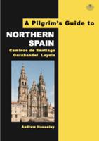
Pelgrimsroute Northern Spain | Pilgrim Book Services Ltd
The ancient pilgrimage path in Spain to the tomb of St James has undergone a contemporary revival. Embracing spirituality in its widest sense, modern day pilgrims come from across the world to experience the tranquility, camaraderie and scenery that help towards self-discovery, personal healing and a thoroughly memorable experience. The first walking guide in the Pilgrims Guides Series, this comprehensive aid features 1:50 000 topographical mapping from the National Geographic Institute of Spain for each of the 32 'recommended' stages of the Camino Frances, including its variants, the three stages to Cape Finisterre, and the two routes to Muxia. Each stage map features a start and finish inset and terrain guide, plus several separate town and city maps. In addition, there is a region map showing the entire route, plus plans of the three major cathedrals. Descriptions of the route help the pilgrim to stay on track. Descriptions of the monuments and towns to be seen along the way featur…
27,95

Klanten-reviews van Wandelkaart The Fife Pilgrim Way | Footprint maps

Er zijn nog geen beoordelingen voor dit productBen jij de eerste die een review plaatst?

Meer over Wandelkaart The Fife Pilgrim Way | Footprint maps

Productomschrijving

A handy, waterproof map breaking down the Fife Pilgrim Way into seven sections. The Fife Pilgrim Way runs between North Queensferry or Culross and St Andrews. It is designed as a varied route for residents and visitors alike, and it is possible to walk the entire signposted path or explore particular sections using the map.   The route follows in the footsteps of Medieval pilgrims, passing many sites which reflect Fife's rich history, and which would be familiar to those travellers long ago. The Fife Coastal Path map is based on OS data at a scale of 1:40,000 which gives a detailed guide with grading of the entire 64 miles (104 km) of the route. The map is part of Stirling Surveys' popular Footprint series.   For every copy of this map sold, a donation goes towards the practical management of The Fife Pilgrim Way.

Verken gerelateerde categorieën

Webshop.nl maakt gebruik van cookies. Ga je verder op onze website, ga dan akkoord met het plaatsen van cookies en de verwerking van deze data door ons en vermelde partners.