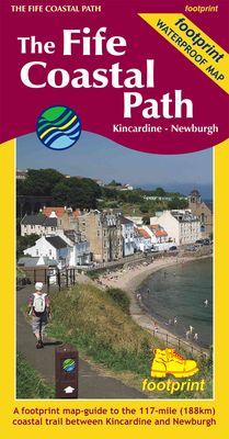
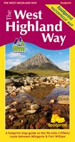
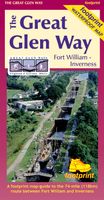
Wandelkaart The Fife Coastal Path | Footprint maps

0
A handy, waterproof map breaking down the Fife Pilgrim Way into seven sections. The Fife Pilgrim Way runs between North Queensferry or Culross and St Andrews. It is designed as a varied route for residents and visitors alike, and it is possible to walk the entire signposted path or explore particular sections using the map.   The route follows in ...

Verkopers met dit product

Verkoper
Bezorging
Prijs
DeZwerver.nl logo
DeZwerver.nl
2,95
17,95

Anderen bekeken ook

Wandelkaart The Fife Pilgrim Way | Footprint maps
A handy, waterproof map breaking down the Fife Pilgrim Way into seven sections. The Fife Pilgrim Way runs between North Queensferry or Culross and St Andrews. It is designed as a varied route for residents and visitors alike, and it is possible to walk the entire signposted path or explore particular sections using the map.   The route follows in the footsteps of Medieval pilgrims, passing many sites which reflect Fife's rich history, and which would be familiar to those travellers long ago. The Fife Coastal Path map is based on OS data at a scale of 1:40,000 which gives a detailed guide with grading of the entire 64 miles (104 km) of the route. The map is part of Stirling Surveys' popular Footprint series.   For every copy of this map sold, a donation goes towards the practical management of The Fife Pilgrim Way.
17,95
Wandelkaart Anglesey Coastal Path | Harvey Maps
Een bijzonder handige kaart van dit lange-afstands-wandelpad. Op waterafstotend papier met veel details. Het enige dat je eigenlijk een beetje mist is een overzicht. Verder uitstekend en voldoende voor de route. Entire route on one map   The 200km (125 mile) long Anglesey Coastal Path is a long distance route that follows much of the island's coastline and comprises one section of the Wales Coast Path. The path primarily caters for walkers however, cyclists and horse riders can also enjoy certain sections.   The path falls within a designated Area of Outstanding Natural Beauty which covers 95% of the coast. It passes through landscape that includes a mixture of farmland, coastal heath, dunes, salt-marsh, foreshore, cliffs and a few small pockets of woodland.   Tough, light, durable and 100% waterproof Includes Rights of Way Genuine original HARVEY mapping Route clearly marked
25,95
Wandelgids Moray Coast Trail | Rucksack Readers
The Mary Queen of Scots Way stretches across central Scotland from coast to coast, linking many places associated with Mary Queen of Scots. It runs for 107 miles (172 km) from Arrochar on Loch Long in the west to St Andrews on the Fife coast, and links with four of Scotland’s Great Trails: the Loch Lomond & Cowal Way, the West Highland Way, the Rob Roy Way and the Fife Coastal Path. This route, however, has no official status: there is no dedicated MQS waymarking, although the guidebook gives detailed directions and parts of it are easy to follow. Some sections are unsuitable for novice walkers unless accompanied by somebody with map and compass skills.   The Way goes through richly varied scenery, starting from a rugged sea loch, crossing Loch Lomond and traversing its National Park to the hills of central Scotland, ending on a sandy beach on the Fife coast. It passes mountains, lochs and waterfalls; castles, hill forts and aqueducts; and is broken into manageable sections which end …
19,95
Wandelkaart The Great Trossachs Path | Harvey Maps
Een bijzonder handige kaart van dit lange-afstands-wandelpad. Op waterafstotend papier met veel details. Het enige dat je eigenlijk een beetje mist is een overzicht. Verder uitstekend en voldoende voor de route. Entire route on one map   This is a 48km (30 miles) long distance path which links together three of Scotlands's Great Trails: the West Highland Way, the Rob Roy Way and the Three Lochs Way.   The Great Trossachs Path is a fantastic walk on its own or can be extended by connecting to one of the other Great Trails. Other waymarked routes within the Great Trossachs Forest are also shown and the map includes a generous amount of the fine broadleaved woodland of the Forest north and south of the Trail.   The Path is suitable for walkers and cyclists.   Tough, light, durable and 100% waterproof Genuine original HARVEY mapping Route clearly marked
16,55
Wandelgids Exploring the Fife Coastal Path | Birlinn
This is the ideal guide to the whole route, so rich in history and natural beauty. Designed to be used by walkers on the Path or visitors to any point along it, it introduces a wealth of castles, churches, harbours, monuments and red-roofed houses. Hamish Brown gives practical advice on all aspects of walking the Path, whether you are making a seven-day trip along its whole length or walking a short section on a Sunday afternoon. Revising his earlier guide to the route, he explores every part of the Fife coast, including the famous Forth bridges, the charming East Neuk fishing villages of Pittenweem, Elie and St Monans, as well as Anstruther, Crail and St Andrews. Along the way he provides a mass of fascinating information about people and places that can be read for pleasure and kept as the souvenir of a unique and unforgettable part of Scotland.
20,95
Wandelgids Fife Coastal Path | Rucksack Readers
The Fife Coastal Path runs around the coastline of eastern Scotland for 117 miles (187 km) from Kincardine on the Forth to Newburgh on the Tay. Starting west of the famous Forth bridges, the route heads through former mining towns towards the villages of Fife's East Neuk (corner), with their rich tradition of smuggling and fishing. After rounding Fife Ness, the route follows the coastline through St Andrews, golf capital of the world and former religious centre of Scotland.Fife has long played an important part in Scottish history and the route passes many castles, towers and churches. There are splendid views along the coast and over the Firths of Forth and Tay, with great chances to sight seabirds, seals and dolphins. The villages have welcoming pubs, famous fish-and-chip shops and good B&Bs. Transport by train and bus makes for easy access throughout. The guidebook contains everything you need to plan and enjoy the Fife Coastal Path – on foot, or on a bike where cycling is appropri…
23,95
Wandelkaart Cape Wrath Trail North | Harvey Maps
Een bijzonder handige kaart van dit lange-afstands-wandelpad. Op waterafstotend papier met veel details. Het enige dat je eigenlijk een beetje mist is een overzicht. Verder uitstekend en voldoende voor de route.   XT40 - Leap forward in technical excellence. Tough, light and 100% waterproof   Compact and light - the map itself weighs just 60gms - a third of the weight of a laminated map, and much less bulky. And you can fold or refold it time and again, or stuff it in your back pocket and it won't fall to pieces. Shows the entire route on one sheet.   The Cape Wrath Trail is a challenging route from Fort William to Cape Wrath. It is around 200 miles long and passes through some of Scotland's wildest and most spectacular scenery.   This map covers the northern section of the route, from Strathcarron to Cape Wrath.   The trail has evolved from use and is not an officially recognised National Trail. There is no single definitive route. There are various ways of tackling the traverse all …
28,50
Wandelkaart Cape Wrath Trail South | Harvey Maps
Een bijzonder handige kaart van dit lange-afstands-wandelpad. Op waterafstotend papier met veel details. Het enige dat je eigenlijk een beetje mist is een overzicht. Verder uitstekend en voldoende voor de route. XT40 - Leap forward in technical excellence. Tough, light and 100% waterproof   Compact and light - the map itself weighs just 60gms - a third of the weight of a laminated map, and much less bulky. And you can fold or refold it time and again, or stuff it in your back pocket and it won't fall to pieces. Shows the entire route on one sheet.   The Cape Wrath Trail is a challenging route from Fort William to Cape Wrath. It is around 200 miles long and passes through some of Scotland's wildest and most spectacular scenery.   This map covers the southern section of the route, from Fort William to Strathcarron.   The trail has evolved from use and is not an officially recognised National Trail. There is no single definitive route. There are various ways of tackling the traverse all …
28,50
Wandelkaart 3 South West Coast Path 3 | Harvey Maps
Een bijzonder handige kaart voor een deel van dit lange-afstands-wandelpad (Minehead tot St Ives) van het in totaal maar liefst 1014 km lange South West Coast Path. Op waterafstotend papier met veel details, uitstekend en voldoende voor dit deel van de route. De totale route bestaat uit 3 kaarten.    The South West Coast path is a 1014km (630mile) long distance path and the longest National Trail in England. The path stretches from Minehead in Somerset to Poole in Dorset. - This updated Trail Map covers the third and final section of the South West Coast Path from Plymouth to Poole Harbour which is 339km (211 miles).   - Includes the Jurassic Coast World Heritage Site and Durdle Door, the famous sea arch in Dorset. - The entire route on 3 sheets. This is map 3 of 3, a good two weeks? walking on one map.   - The XT40 is based on original HARVEY mapping with all the detail a walker would expect on a map at 1:40,000 scale. - Clear and easy to read mapping which is uncluttered by inf…
25,95
Wandelgids Fife | Hallewell Publications
Rewalked and updated in 2021, Walks Fife including St Andrews & the Lomond Hills covers the county of Fife, which lies between the estuaries of the Rivers Forth and Tay. There are a lot of coastal walks (along sections of the Fife Coastal Path), plus walks in and around the historic town of St Andrews and some good hill walks in the Lomond Hills. The 27 walks featured range from 0.5 miles to 13 miles (1.5-21km). Routes include: West and East Lomond, Bishop Hill and St Andrews to Crail. Now on its 3rd edition, Walks Fife is part of a popular series of A6 pocket walking guides which describe routes which are suitable for walkers of all abilities and to suit all tastes. Route descriptions are accompanied by 2-colour sketch maps. The guides are illustrated with line illustrations, and will provide walkers with a good introduction to what each area covered has to offer.  
5,95

Klanten-reviews van Wandelkaart The Fife Coastal Path | Footprint maps

Er zijn nog geen beoordelingen voor dit productBen jij de eerste die een review plaatst?

Meer over Wandelkaart The Fife Coastal Path | Footprint maps

Productomschrijving

A handy, waterproof map breaking down the Fife Pilgrim Way into seven sections. The Fife Pilgrim Way runs between North Queensferry or Culross and St Andrews. It is designed as a varied route for residents and visitors alike, and it is possible to walk the entire signposted path or explore particular sections using the map.   The route follows in the footsteps of Medieval pilgrims, passing many sites which reflect Fife's rich history, and which would be familiar to those travellers long ago. The Fife Coastal Path map is based on OS data at a scale of 1:40,000 which gives a detailed guide with grading of the entire 64 miles (104 km) of the route. The map is part of Stirling Surveys' popular Footprint series.   For every copy of this map sold, a donation goes towards the practical management of The Fife Pilgrim Way.

Verken gerelateerde categorieën

Webshop.nl maakt gebruik van cookies. Ga je verder op onze website, ga dan akkoord met het plaatsen van cookies en de verwerking van deze data door ons en vermelde partners.