webshop.nl

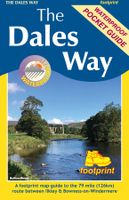
Wandelkaart The Dales Way | Footprint maps

0
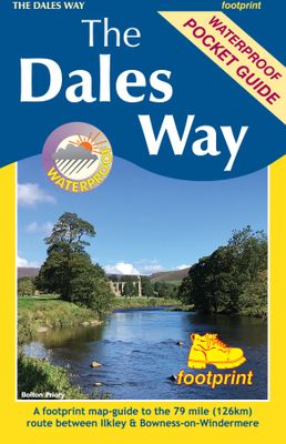
Handzame wandelkaart voor de Dales Way in Noord Engeland.  The Dales Way is a 79 mile (127km) long distance trail in the north of England, running between Ilkley, in North Yorkshire and Bowness-on-Windermere, in Cumbria. Much of the route passes through the Yorkshire Dales and Lake District National Parks. Starting out in Ilkley, the route runs al...

Webshops met dit product

Webshop
Bezorging
Prijs
DeZwerver.nl logo
DeZwerver.nl
niet bekend
12,95

Anderen bekeken ook

Wandelgids Dales Way | Trailblazer Guides
The popular Dales Way long-distance footpath begins in Ilkley, West Yorkshire and runs for 84 miles (135km) to end in the Lake District, in Bowness-on-Windermere. It follows riverside paths along the River Wharf towards Ribblehead and the watershed of northern England, then meanders along the river valleys of Dentdale, the River Mint and the River Kent dropping down into the Lake District to end beside Lake Windermere. It's a relatively easy walk that takes about a week. Includes 40 large-scale maps (3 1/8 inches to 1 mile); 9 town plans and 8 overview maps. Full details of all accommodations and campsites, restaurants and pubs; plus full public transport information. Plus day-walks. - 40 large-scale walking maps - at just under 1:20,000 - showing route times, places to stay, points of interest and much more - 9 town plans - 8 area maps and trail profiles - Itineraries for all walkers - whether walking the route in its entirety over a week or sampling the highlights on day walks and s…
19,95
Reisboek - Wandelgids Wild Swimming Walks Peak District | Wild Things Publishing
The best-selling Wild Swimming Walks series returns with adventures in Britain's oldest National Park. Ascend to the highest tarns and descend through a valley of secret waterfalls * Walk through woodland gorges carved by cascades * Follow bucolic river valleys dipping as you walk. Wild Swimming Walks Peak Disitrict leads you on 28 adventures in the soaring landscape of the Peak District. Find secret waterfalls, remote lakes and sparkling river pools. Complete with photos, maps and practical guidance, rich in local history and stories, this book will appeal to wild swimmers, family explorers, nature lovers and walkers alike.   JOIN THE ADVENTURE with the best-selling Wild Swimming Walks series and explore Britain’s oldest national park from the gritstone edges of the Hope Valley, to the magical streams on the moorlands of Bleaklow, through to the picturesque limestone river dales of the White Peak.   Scramble up streams and waterfalls at Black Clough Explore fairy pools and mossy…
20,95
Wandelkaart Settle to Carlisle Way | Harvey Maps
Mooie, duidelijke kaart van de Settle to Carlisle Way in Noord-Engeland. Geplastificeerd met veel extra informatie en uitsnedes van de route. Settle Carlisle Way is a walking route linking the stations of the famous and scenic Settle-Carlisle Railway Line. This map gives you the chance to walk up and ride back on the train, or to hop off at one station and rejoin a later train further on. The route starts in picturesque Settle and passes through the beautiful Yorkshire Dales and the sheltered Eden Valley, ending in central Carlisle. The entire route is on the one map. Tough and 100% waterproof Compact and light - the map itself weighs just 60gms - a third of the weight of a laminated map, and much less bulky. And you can fold or refold it time and again, or stuff it in your pocket and it won't fall to pieces. Shows the entire route on one sheet. Information on finding accommodation, camping, food. Directions to the start. Also Ranger Service contact numbers and enlargements of towns/v…
21,50
Wandelkaart - Topografische kaart OL19 OS Explorer Map | Active Howgill Fells and Upper Eden Valley | Ordnance Survey
Een van de beste detailkaarten die er op de wereld gemaakt worden: zeer gedetailleerd, prachtig helder kleurgebruik, veel topografische aspecten en - zeer belangrijk - allerlei toeristische en recreatieve aspecten zijn ingetekend. De perfecte kaart voor vakantie en vrije tijd: wandelen, fietsen of gewoon de omgeving verkennen. Door de grootte van de kaart, voor- en achterzijde, bestrijkt het een behoorlijk groot gebied! Explore Howgill Fells in the Yorkshire Dales National Park and the North Pennines Area of Outstanding Natural Beauty with the Eden Valley running in between. Visit Sedbergh, a quaint market town at the confluence of four rivers and ancient trade routes, and Appleby-in-Westmorland, home of the famous horse fair since the seventeenth century.   Climb the Howgill Fells for incredible views of the Lake District and Yorkshire Dales and ascend the heights of Wild Boar Fell, High Seat and Cautley Spout, England’s highest waterfall   Follow A Pennine Journey through spect…
28,50
Wandelkaart National Trail Map Pennine Way | Collins
Overzichtskaart op vrij grove schaal van deze LAW Lange Afstands Wandeling in Engeland. Let op: je kunt er niet op lopen. Wel met veel informatie op de kaart, goed ingetekend, een route-schema op de achterzijde en een beschrijving van een aantal bezienswaardigheden.  Perfect guide and map for planning your adventure along the iconic Pennine Way.   Highlights of this Planning Map include:   More than 20 highlighted places of interest with detailed descriptions and attractive photographs, including: Hadrian’s Wall, Tan Hill, and Cauldron Snout A comprehensive index to more than 1000 cities, towns and villages A clear, visible route plotted across the map Advice on safety and security when travelling along the route, as well as the countryside code and the code of conduct The Pennine Way is the oldest of the 16 National Trails and runs along The Pennines, linking the Peak District National Park with the Cheviot Hills. Starting in Edale, Derbyshire, the walk covers 268 miles (431 km) and …
11,50
Wandelgids Wales Coast Path: Snowdonia and Ceredigion | Northern Eye Books
Official Guide: Wales Coast Path: Snowdonia & Ceredigion Coast One of seven Official Guides to the Wales Coast Path This Official Guide to the Snowdonia & Ceredigion Coast section of the Wales Coast Path contains everything local and long-distance walkers need to enjoy the path.   Cardigan Bay probably offers a more diverse walking experience than any other section of the Wales Coast Path. The stretch covered in this book – from Porthmadog in the north to Cardigan in the south – largely covers two contrasting Welsh counties.   The first 97 kilometres pass through Gwynedd, along the western edge of the Snowdonia National Park. Here, just before the rivers that rise in the highest of the Welsh mountains reach the sea, they fan out to form broad estuaries that provide rich pickings for waders and other birdlife. The estuaries of the Dwyryd, the Mawddach and the Dyfi are the largest of these. Between them are some very large dune systems, including Morfa Harlech and Morfa Dyffryn – home t…
23,95
Fietskaart 14 Cycling guides Suffolk | Goldeneye
To be confronted with the variety and complexity of the cycling routes, trails and paths in Suffolk can be a bewildering experience.  For it appears that the Suffolk County Council and the three District Councils are all trying hard to promote their areas. This is indeed encouraging for the growth of cycling, but it can be confusing.  Our purpose is to provide clear, easy to use and easy to follow, cycling maps, and to illustrate these in a comprehensive form.    Suffolk must be one of the most charming of counties to explore by bicycle. When Al Churcher delivered his routes to us at Goldeneye we couldn’t keep him quiet, such was his enthusiasm and wonder at Suffolk’s country lanes and byways. He has cycled all over the UK, Canada, Mallorca, New Zealand and Sicily, but Suffolk remained a firm favourite.    The inland scenery is not spectacular for the county’s main glory lies with its attractive villages; the local architecture jealously preserved from modern depredation. There is an …
15,95
Wandelgids Coast to Coast Path: St Bees to Robin Hood's Bay | Trailblazer Guides
Goede wandelgids van de hele route van kust naar kust. Met veel details zijn alle etappes beschreven. Tevens informatie over overnachtingen en openbaar vervoer. All the information you need to enjoy your hiking adventure from Coast to Coast in this updated 10th edition. Fully re-walked and revised 10th edition of this classic 191-mile walk from the Irish Sea to the North Sea. Crossing three national parks - the Lake District, the Yorkshire Dales, and the North York Moors - it samples the very best of the English countryside - rugged mountains and lakes, gentle dales and stone-built villages; wild moorland; sea cliffs and fishing villages.   The guide includes:109 large-scale walking maps - at just under 1:20,000 - showing route times, places to stay, places to eat, points of interest, and 9 town plans14 colour stage maps to help plan your walk, including hills and descentsPlaces to stay with reviews - campsites, bunkhouses, hostels, B&Bs, pubs and hotelsPlaces to eat with reviews -…
19,95
Wandelgids Viewpoints Yorkshire Dales ( | Northern Eye Books
One of eight books in the popular Yorkshire Dales: Top 10 Walks series. Handy, pocket-sized, full colour walking guides written by experts. This attractive and cleverly structured guide gives walkers ten easy, circular walks to the most amazing viewpoints in the Yorkshire Dales National Park in a popular pocketable format.   With clear information, an overview and introduction for each walk, expertly written numbered directions, large scale Ordnance Survey maps, superb eye-grabbing panoramic photographs, and interpretation of points of interest along the way, these guides set a new standard in clarity and ease-of-use. Featured walks include: Crummack Dales, Orton & Beacon Hill, Malham & Watlowes Valley, Trollers Gill & Appletreewick, Twistleton Scars, Upper Wharfesdale, Flasby Fell, Capplestone Gate, Semerwater and Dentdale & Deepdale. Frank Kew is a retired lecturer, author and tour leader with a detailed knowledge of bucolic landscapes, villages, tea shops and pubs of the Yorkshire …
10,95
Wandelkaart The Fife Pilgrim Way | Footprint maps
A handy, waterproof map breaking down the Fife Pilgrim Way into seven sections. The Fife Pilgrim Way runs between North Queensferry or Culross and St Andrews. It is designed as a varied route for residents and visitors alike, and it is possible to walk the entire signposted path or explore particular sections using the map.   The route follows in the footsteps of Medieval pilgrims, passing many sites which reflect Fife's rich history, and which would be familiar to those travellers long ago. The Fife Coastal Path map is based on OS data at a scale of 1:40,000 which gives a detailed guide with grading of the entire 64 miles (104 km) of the route. The map is part of Stirling Surveys' popular Footprint series.   For every copy of this map sold, a donation goes towards the practical management of The Fife Pilgrim Way.
17,95

Klanten-reviews van Wandelkaart The Dales Way | Footprint maps

Er zijn nog geen beoordelingen voor dit productBen jij de eerste die een review plaatst?

Meer over Wandelkaart The Dales Way | Footprint maps

Productomschrijving

Handzame wandelkaart voor de Dales Way in Noord Engeland. 

The Dales Way is a 79 mile (127km) long distance trail in the north of England, running between Ilkley, in North Yorkshire and Bowness-on-Windermere, in Cumbria. Much of the route passes through the Yorkshire Dales and Lake District National Parks. Starting out in Ilkley, the route runs along Wharfedale, passing the impressive ruins of Bolton Priory and the attractive market town of Grassington. It continues along the River Wharfe through dramatic limestone scenery before it crosses The Pennines to reach Dentdale and Sedbergh. It then skirts the Howgill Fells and crosses the M6 motorway to finish overlooking Lake Windermere.   This map-guide is laid out for walkers travelling from Ilkley to Bowness, although walkers travelling in the opposite direction should find it equally useful. Each panel includes a detailed route map, route profile and helpful notes on navigation.   There are link routes from Bradford, Leeds and Harrogate to the start of the route at Ilkley.

Verken gerelateerde categorieën

Webshop.nl maakt gebruik van cookies. Ga je verder op onze website, ga dan akkoord met het plaatsen van cookies en de verwerking van deze data door ons en vermelde partners.