webshop.nl
Categorieën
  Sluiten

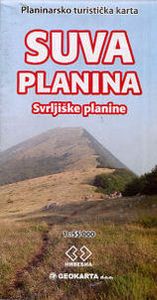
Wandelkaart Suva Planina - Servië | Geokarta

One side topographic marked with footpaths, ski trails, ski lifts, camp sites, picnic sites, mountain huts, also notable features in the landscape. Other side further information, additional words and pics of notable features, mountain huts etc. Suva Mountains with the Gorges of the Jelašnicka River on a detailed contoured map at 1:55,000, plus ext...
13,95

Webshops met dit product

Webshop
Bezorging
Prijs

Anderen bekeken ook

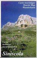
Wandelkaart A06 Siniscola | Abies
Siniscola area at 1:25,000 in a series of contoured maps from Ed. Abies. Overprint highlights campsites and agriturismo accommodation, climbing sites, wild sheep and bird watching sites and archaeological remains. This title has no UTM grid. Main series at 1:60,000 (Nos. 1 to 12) The maps have contours at 100m intervals and colouring for woodlands and maquis shrubland. Local trails are highlighted, with additional overprint for selected hiking, mountain bike and kayaking routes listed on the reverse of the maps with brief notes and grading for the degree of difficulty. All the maps have a UTM grid for GPS users. Very extensive range of symbols highlight numerous places of interest and tourist facilities, including campsites and caravan parks, beaches, sport and recreational sites, archaeological remains and nuraghi, etc. The maps also indicate places where typical local products can be purchased. On the reverse each title has descriptions of its main places of interest, beaches, etc.…
12,95
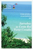
Wandelkaart A15 Sarrabus da Costa Rei a Porto Corallo | Abies
Sarrabus is a territory that is not known by everybody yet. Here lies its charm and this has made possible to keep this environmental area out of big building speculations and also out of history. In fact it preserves little traces of the past, and paradoxically the remains from the prehistoric age are more meaningful than those back to more recent times. We can find traces from the most remote past not far from the State Road SS125, that from Muravera goes to Costa Rei, by visiting the nuraghe Murtas, the nuraghe S’Aqua Secis and the megalithic complexes of Scalas and Cuili Piras. They are about ten menhirs, almost fully intact, arranged in groups and fixed in the ground in the original orthostatic position. They have been put in relation with the position of the sun and the moon, at dawn and at sunset. In fact they were used as a very precise astronomic calendar but also for religious purposes since they represented both the masculine divinity and the fertility according to the worsh…
12,95
Wandelkaart - Topografische kaart 747 Green Mountain National Forest North - Moosalamoo NRA - Rutland | National Geographic
Prachtige geplastificeerde kaart van het bekende nationaal park. Met alle recreatieve voorzieningen als campsites, maar ook met topografische details en wandelroutes ed. Door uitgekiend kleurgebruik zeer prettig in gebruik. Scheur en watervast! National Geographic's Green Mountain National Forest North Trails Illustrated topographic map is the most comprehensive available for outdoor enthusiasts of all types. Designed to be easy-to-read, yet highly detailed – this map includes a comprehensive road and trail network distinguishing between major, secondary and 4x4 roads, hiking, horse, biking, multi-use and non-motorized winter trails. All forest roads are labeled with their official road number and trails are clearly identified with their given name. Land management boundaries are color-coded showing National Forest, Ranger District, Wilderness Areas, Conservation Areas and more, plus the locations of private land within the Green Mountain National Forest. The renowned Appalachian Trail…
17,95
Wandelkaart - Topografische kaart 748 Green Mountain National Forest South - Robert T. Stafford White Rocks NRA - Manchester | National Geographic
Prachtige geplastificeerde kaart van het bekende nationaal park. Met alle recreatieve voorzieningen als campsites, maar ook met topografische details en wandelroutes ed. Door uitgekiend kleurgebruik zeer prettig in gebruik. Scheur en watervast! National Geographic's Green Mountain National Forest South Trails Illustrated topographic map is the most comprehensive available for outdoor enthusiasts of all types. Designed to be easy-to-read, yet highly detailed – this map includes a comprehensive road and trail network distinguishing between major, secondary and 4x4 roads, hiking, horse, biking, multi-use and non-motorized winter trails. All forest roads are labeled with their official road number and trails are clearly identified with their given name. Land management boundaries are color-coded showing National Forest, Ranger District, Wilderness Areas, Conservation Areas and more, plus the locations of private land within the Green Mountain National Forest. The renowned Appalachian Trail…
17,95
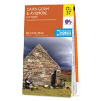
Wandelkaart - Topografische kaart OL57 OS Explorer Map Cairn Gorm & Aviemore | Ordnance Survey
Met zijn 4cm voor 1 km (2 ½ cm voor 1 mijl) schaal, is de OS Outdoor Leisure kaartenserie de ideale en meest gedetailleerde kaartenreeks voor mensen die graag outdoor-activiteiten zoals fietsen, wandelen, paardrijden, klimmen en watersporten. Deze kaart is nog gedetailleerder dan de 'gewone' Landranger maps. Voor- en achterzijde bedrukt! Zeker op de moors en andere natuurgebieden van onschatbare waarden met echt alle aspecten van het landschap op de kaart ingetekend. Zeer goede detailkaart met topografische ondergrond. Hierop zijn toeristische symbolen van bezienswaardigheden ingetekend, daarnaast staan bijvoorbeeld campings en jeugdherbergen vermeld en - voor wandelaars het belangrijkst - alle right of way paden en Lange afstands Wandelpaden zijn er op te vinden. De ideale kaart voor het wandelen in Engeland, Wales of Schotland.   Map sheet number OL 57 in the OS Explorer series covers the Cairngorms National Park in Scotland. This area of National Park around Cairn Gorm and Aviemore …
19,50
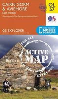
Wandelkaart 57 OS Explorer Map | Active Cairn Gorm, Aviemore ACTIVE | Ordnance Survey
Met zijn 4cm voor 1 km (2 ½ cm voor 1 mijl) schaal, is de OS Outdoor Leisure kaartenserie de ideale en meest gedetailleerde kaartenreeks voor mensen die graag outdoor-activiteiten zoals fietsen, wandelen, paardrijden, klimmen en watersporten.   Deze kaart is nog gedetailleerder dan de 'gewone' Landranger maps. Voor- en achterzijde bedrukt! Zeker op de moors en andere natuurgebieden van onschatbare waarden met echt alle aspecten van het landschap op de kaart ingetekend. Zeer goede detailkaart met topografische ondergrond. Hierop zijn toeristische symbolen van bezienswaardigheden ingetekend, daarnaast staan bijvoorbeeld campings en jeugdherbergen vermeld en - voor wandelaars het belangrijkst - alle right of way paden en Lange afstands Wandelpaden zijn er op te vinden. De ideale kaart voor het wandelen in Engeland, Wales of Schotland.   Map sheet number OL 57 in the OS Explorer series covers the Cairngorms National Park in Scotland. This area of National Park around Cairn Gorm and Aviemor…
25,95
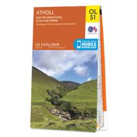
Wandelkaart - Topografische kaart OL51 OS Explorer Map Atholl | Ordnance Survey
Met zijn 4cm voor 1 km (2 ½ cm voor 1 mijl) schaal, is de OS Explorer kaartenserie de ideale en meest gedetailleerde kaartenreeks voor mensen die graag outdoor-activiteiten zoals fietsen, wandelen, paardrijden, klimmen en watersporten. Deze kaart is nog gedetailleerder dan de 'gewone' Landranger maps. Voor- en achterzijde bedrukt! Zeker op de moors en andere natuurgebieden van onschatbare waarden met echt alle aspecten van het landschap op de kaart ingetekend. Zeer goede detailkaart met topografische ondergrond. Hierop zijn toeristische symbolen van bezienswaardigheden ingetekend, daarnaast staan bijvoorbeeld campings en jeugdherbergen vermeld en - voor wandelaars het belangrijkst - alle right of way paden en Lange afstands Wandelpaden zijn er op te vinden. De ideale kaart voor het wandelen in Engeland, Wales of Schotland.   Covering part of the Cairngorms National Park, and including ten of the Munros OS Explorer Map OL 51 is a rugged area with few roads or marked paths. This map repl…
19,50
Wandelkaart - Topografische kaart OL32 OS Explorer Map Winchester | Ordnance Survey
Met zijn 4cm voor 1 km (2 ½ cm voor 1 mijl) schaal, is de OS Explorer kaartenserie de ideale en meest gedetailleerde kaartenreeks voor mensen die graag outdoor-activiteiten zoals fietsen, wandelen, paardrijden, klimmen en watersporten. Deze kaart is nog gedetailleerder dan de 'gewone' Landranger maps. Voor- en achterzijde bedrukt! Zeker op de moors en andere natuurgebieden van onschatbare waarden met echt alle aspecten van het landschap op de kaart ingetekend. Zeer goede detailkaart met topografische ondergrond. Hierop zijn toeristische symbolen van bezienswaardigheden ingetekend, daarnaast staan bijvoorbeeld campings en jeugdherbergen vermeld en - voor wandelaars het belangrijkst - alle right of way paden en Lange afstands Wandelpaden zijn er op te vinden. De ideale kaart voor het wandelen in Engeland, Wales of Schotland.   Map sheet OL 32 in the OS Explorer map series is the ideal map for days out in the Winchester area. Winchester, capital of England in Saxon times is a beautiful ci…
19,50
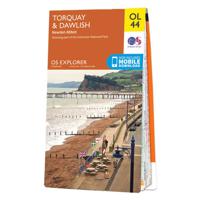
Wandelkaart - Topografische kaart OL44 OS Explorer Map Torquay & Dawlish | Ordnance Survey
Met zijn 4cm voor 1 km (2 ½ cm voor 1 mijl) schaal, is de OS Explorer kaartenserie de ideale en meest gedetailleerde kaartenreeks voor mensen die graag outdoor-activiteiten zoals fietsen, wandelen, paardrijden, klimmen en watersporten. Deze kaart is nog gedetailleerder dan de 'gewone' Landranger maps. Voor- en achterzijde bedrukt! Zeker op de moors en andere natuurgebieden van onschatbare waarden met echt alle aspecten van het landschap op de kaart ingetekend. Zeer goede detailkaart met topografische ondergrond. Hierop zijn toeristische symbolen van bezienswaardigheden ingetekend, daarnaast staan bijvoorbeeld campings en jeugdherbergen vermeld en - voor wandelaars het belangrijkst - alle right of way paden en Lange afstands Wandelpaden zijn er op te vinden. De ideale kaart voor het wandelen in Engeland, Wales of Schotland. Ingetekende Langeafstandswandelroute South west coast Path Map sheet OL 44 Map is the perfect map for exploring the Eastern edge of Dartmoor national park and the co…
19,50
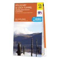
Wandelkaart - Topografische kaart OL49 OS Explorer Map Pitlochry & Loch Tummel | Ordnance Survey
Met zijn 4cm voor 1 km (2 ½ cm voor 1 mijl) schaal, is de OS Explorer kaartenserie de ideale en meest gedetailleerde kaartenreeks voor mensen die graag outdoor-activiteiten zoals fietsen, wandelen, paardrijden, klimmen en watersporten. Deze kaart is nog gedetailleerder dan de 'gewone' Landranger maps. Voor- en achterzijde bedrukt! Zeker op de moors en andere natuurgebieden van onschatbare waarden met echt alle aspecten van het landschap op de kaart ingetekend. Zeer goede detailkaart met topografische ondergrond. Hierop zijn toeristische symbolen van bezienswaardigheden ingetekend, daarnaast staan bijvoorbeeld campings en jeugdherbergen vermeld en - voor wandelaars het belangrijkst - alle right of way paden en Lange afstands Wandelpaden zijn er op te vinden. De ideale kaart voor het wandelen in Engeland, Wales of Schotland.   OS Explorer Map OL 49 shows Loch Tummel, eastern Loch Rannoch and the surrounding towns of Pitlochry, Aberfeldy and Kinloch Rannoch. Loch Tummel (and the Clunie D…
19,50

Klanten-reviews van Wandelkaart Suva Planina - Servië | Geokarta

Er zijn nog geen beoordelingen voor dit productBen jij de eerste die een review plaatst?

Meer over Wandelkaart Suva Planina - Servië | Geokarta

Productomschrijving

One side topographic marked with footpaths, ski trails, ski lifts, camp sites, picnic sites, mountain huts, also notable features in the landscape. Other side further information, additional words and pics of notable features, mountain huts etc. Suva Mountains with the Gorges of the Jelašnicka River on a detailed contoured map at 1:55,000, plus extensive information on the tourist facilities in the area with colour photos of mountain shelters, notes on fauna and flora, etc. The map has contours at 20m intervals with relief shading and colouring for woodlands. Different levels of protection zones are marked and areas where hunting is allowed are indicated. An overprint highlights waymarked hiking trails including the 130km long-distance trail across the Niš range. Also marked are different types of tourist accommodation including campsites and hunting lodges, paragliding sites, skiing areas, etc. The map has latitude and longitude lines at intervals of 5’. Map legend includes English. On the reverse are extensive bilingual notes on the area and its tourist facilities illustrated with numerous photos.  
Webshop.nl maakt gebruik van cookies. Ga je verder op onze website, ga dan akkoord met het plaatsen van cookies en de verwerking van deze data door ons en vermelde partners.