webshop.nl
Categorieën
  Sluiten

Meer Harvey Maps
Meer Harvey Maps in Thrillers & fantasy boeken

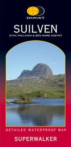
Wandelkaart Suilven / Stac Pollaidh & Ben More Assynt harve | Harvey M

0
Suilven covers the spectacular group of remote northerly munros popular with walkers and climbers. The map area includes Suilven, Canisp, CulMor,Breabag Stac Pollaidh, Conival & Ben More Assynt. This map continues to add to our superb coverage of these iconic mountains and is based on new survey from air photography, ground checked by our own surve...

Webshops met dit product

Webshop
Bezorging
Prijs

Anderen bekeken ook

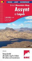
Wandelkaart Assynt & Coigach | Harvey Maps
"This is a fabulous map for a fabulous area; for the first time it shows crags, bouldering areas and clear details in what could seem a maze of rock and water. It must surely set the standard for all future maps." John Mackenzie, the Earl of Cromartie.   Detailed map for hillwalkers and climbers of the spectacular peaks of Assynt at 1:40,000 scale.   Includes Quinag, Suilven, Stac Pollaidh, Cul Mor and Ben More Assynt.   Enlargements at 1:15,000 scale of Stac Pollaidh, Suilven and Quinag on the reverse.   Climbing crags are highlighted and a climbing route on Stac Pollaidh is included.   The map area includes 2 Munros, 9 Corbetts and 6 Grahams.
29,95
Wandelkaart Suilven / Stac Pollaidh / Lochinver | Harvey Maps
Detailed map for runners and walkers of Suilven and the surrounding area at the magic scale of 1:40,000. Covers a large area yet is handily compact. Pocket perfect! This is a fantastic and beautiful area, with Suilven at its centre. The map includes the two Munros of Ben More Assynt and Conival, as well as other famous mountains such as Cul Mor, Cul Beag, Canisp and Stac Pollaidh. Coverage is extended to the north with an inset of Quinag. The map shows 2 Munros, 8 Corbetts and 3 Grahams. Fully detailed genuine HARVEY mapping Use without a map case: tough and 100% waterproof Opens directly to either side of the sheet
19,50
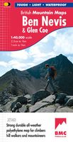
Wandelkaart Ben Nevis & Glen Coe | Harvey Maps
"This excellent Ben Nevis and Glen Coe map provides all the details needed for safe navigation on these iconic mountains". Cameron McNeish, outdoor writer and broadcaster.   Detailed map for hillwalkers and climbers of Ben Nevis and Glen Coe at 1:40,000 scale.   Section on navigation on Ben Nevis and detailed 1:15,000 enlargement of the summit with bad visibility descent route.   The map area includes 44 Munros, 14 Corbetts and 9 Grahams.     Serious map for serious mountains. The latest addition to the British Mountain Map series is a real heavyweight. Ben Nevis/Glencoe is the first Scottish title in this highly successful & innovative range. The map at 1:40000 has 43 Munros & 14 Corbetts on one sheet & is printed on polyethylene which is durable, tearproof & 100% waterproof. There is also colour shading for easy identification of hills and valleys & weighs less than half the weight of a laminated map. The reverse of the map has an enlargement of Ben Nevis summit, a Geological map, na…
29,95
Wandelkaart Ben Nevis | Harvey Maps
Een bijzonder mooie en handige kaart van dit prachtige bergachtige gebied. Op waterafstotend papier met veel details. HARVEY Superwalker map at 1:25,000 scale Detailed map of Ben Nevis for walkers and climbers This map for hillwalkers covers Fort William through Glen Nevis to Loch Treig. From the Grey Corries south to Kinlochleven. Ben Nevis, the Aonachs and the Mamores are among the 20 Munros and 4 Corbetts. Clear and easy to read with all the detail needed for ascending Britain's highest mountain. Enlargement of Ben Nevis summit showing the safety bearings in case of a descent in bad weather. As used by the Lochaber Mountain Rescue Team.
24,95
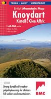
Wandelkaart Knoydart / Kintail & Glen Affric | Harvey Maps
"Clarity is the hallmark of this map. It covers magnificently honed peaks set above western seas and lochs, inviting exploration of one of Scotland's superlative and remote mountain regions", the late Irvine Butterfield, author of The High Mountains.   Detailed map of ‘Britain's last wilderness’ at 1:40,000 scale.   Includes Kintail and Glen Affric.   Detailed crag information for climbers.   Includes 43 Munros, 21 Corbetts and 7 Grahams.   Knoydart & Kintail, seventh in this highly successful & innovative British Mountain Map series, is a long awaited title. It is the only detailed map to cover this famous wilderness area on one sheet. This all weather map for climbers, hillwalkers, mountaineers & mountain bikers includes 43 Munros & 21 Corbetts. It is printed on polyethylene which is durable, tearproof & 100% waterproof. Colour shading is used for easy identification of hills & valleys & the map weighs less than half the weight of a laminated map. There is also an extension covering …
29,95

Klanten-reviews van Wandelkaart Suilven / Stac Pollaidh & Ben More Assynt harve | Harvey M

Er zijn nog geen beoordelingen voor dit productBen jij de eerste die een review plaatst?

Meer over Wandelkaart Suilven / Stac Pollaidh & Ben More Assynt harve | Harvey M

Productomschrijving

Suilven covers the spectacular group of remote northerly munros popular with walkers and climbers. The map area includes Suilven, Canisp, CulMor,Breabag Stac Pollaidh, Conival & Ben More Assynt. This map continues to add to our superb coverage of these iconic mountains and is based on new survey from air photography, ground checked by our own surveyors, themselves experienced hillwalkers.

Productspecificaties

Artikelnummer(s)
Brand
Harvey Maps

Verken gerelateerde categorieën

Webshop.nl maakt gebruik van cookies. Ga je verder op onze website, ga dan akkoord met het plaatsen van cookies en de verwerking van deze data door ons en vermelde partners.