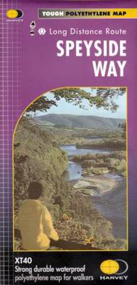
Wandelkaart Speyside Walk (Schotland) | Harvey Maps

0
Een bijzonder handige kaart van dit lange-afstands-wandelpad van 144 km. Op waterafstotend papier met veel details, uitstekend en voldoende voor deze route. A leap forward in technical excellence: Tough, durable and 100% waterproof - virtually indestructible in normal use. Compact and light - the map itself weighs just 60gms - a third of the weigh...

Verkopers met dit product

Verkoper
Bezorging
Prijs
DeZwerver.nl logo
DeZwerver.nl
2,95
25,95

Anderen bekeken ook

Wandelkaart Speyside Walk (Schotland) | Harvey Maps
Een bijzonder handige kaart van dit lange-afstands-wandelpad van 144 km. Op waterafstotend papier met veel details, uitstekend en voldoende voor deze route. A leap forward in technical excellence: Tough, durable and 100% waterproof - virtually indestructible in normal use. Compact and light - the map itself weighs just 60gms - a third of the weight of a bulky laminated map. You can fold or refold it time and again, or stuff it in your back pocket and it won't fall to pieces. Shows the entire route on one sheet. 144km (90 miles) from Aviemore to Buckie, via Nethybridge, Grantown and Fochabers, with a spur to Tomintoul. 
25,95
Wandelgids The Speyside Way | Rucksack Readers
Deze gids een goede beschrijving van de lange afstands route. De kaarten zijn schetsmatig maar wel duidelijk. The Speyside Way is one of Scotland’s Great Trails. It runs for 80 miles (128 km) from the fishing port of Buckie to Aviemore in the foothills of the Cairngorms. Following the lovely valley of the River Spey, you walk through countryside rich in malt whisky and wildlife, along riverside paths, railway trackbed and forest and moorland tracks.   The second edition was fully revised, with mapping from Footprint in six panels, updated plans of villages along the Way, including a fresh Grantown plan and directions from the terminus in Buckie. In 2016 we released the revised version of this essential trail guide, with fresh photos, new mapping and many other updates. These included documenting the 6.5-mile route extension to Kincraig, which opened in 2015, and 11-mile Badenoch Way.   This guidebook contains all you need to plan and enjoy the Speyside Way:   the Way step-by-step,…
22,50
Ik ben 18+
Wandelgids 43 Speyside Way - Whisky Trail (Schotland) | Conrad Stein Verlag
Wandelgids met een routebeschrijving van de Speyside weg in Schotland met veel praktische informatie en een goede beschrijving van de route. De kaarten zijn zeer leesbaar, maar wel een beetje grof van schaal.. Duitstalig. Der Speyside Way ist neben dem West Highland Way und dem Southern Upland Way der dritte im Bunde der klassischen schottischen Fernwanderwege. Er führt von Buckie erst an der Nordsee, dann am River Spey entlang durch das Zentrum der schottischen Whiskyherstellung bis in die mächtigen Grampian Mountains. Auf diesem Weg kommen Sie direkt an einigen der renommiertesten Whiskydestillerien vorbei. Die gesamte Tour wird in mehreren abgeschlossenen Einzeletappen beschrieben. Damit haben Wanderer, die nicht den gesamten Weg laufen möchten, die Möglichkeit, sich auf bestimmte Abschnitte des Weges zu beschränken.  Jede Etappenbeschreibung umfasst neben dem Wegverlauf wichtige Tipps zu Übernachtungsmöglichkeiten, Verkehrsverbindungen usw. sowie Informationen zu verschiedenen Asp…
17,50
Wandelkaart Dales Way | Harvey Maps
Mooie, duidelijke kaart van de Dales Way in Noord-Engeland. Geplastificeerd met veel extra informatie en uitsnedes van de route.    A leap forward in technical excellence: Tough, durable and 100% waterproof - this map for walkers is virtually indestructible in normal use. Compact and light - the map itself weighs just 60gms - a third of the weight of a bulky laminated map. You can fold or refold it time and again, or stuff it in your back pocket and it won't fall to pieces.   Shows the entire route on one sheet.   130km (81 miles) from Ilkley in Yorkshire through the Dales via Grassington, Buckden and Dent to Bowness on Windermere in the Lake District. Contains all 3 links: from Leeds, Shipley (Bradford) and Harrogate.   Information on finding accommodation, camping, food. Directions to the start. Also Ranger Service contact numbers and enlargements of towns/villages showing facilities available and tips on weather and clothing     Detailed mapping, full legend. National Grid - can be…
25,95
Wandelkaart Hadrian's Wall | Harvey Maps
Een bijzonder handige kaart van dit lange-afstands-wandelpad. Op waterafstotend papier met veel details. Het enige dat je eigenlijk een beetje mist is een overzicht. Verder uitstekend en voldoende voor de route. Compact and light - the map itself weighs just 60gms - a third of the weight of a laminated map, and much less bulky. And you can fold or refold it time and again, or stuff it in your back pocket and it won't fall to pieces. Entire route on one map. 130km (81 miles) from the Solway Coast to Newcastle. Opportunity to visit a large number of historical sites along the way. Information on finding accommodation, camping, food. Directions to the start. Also Ranger Service contact numbers and enlargements of towns/villages showing facilities available and tips on weather and clothing Detailed mapping, full legend. National Grid - can be used with GPS. 1:40,000 scale. Waterproof. Supplied in clear plastic pocket
25,95
Wandelkaart Cotswold Way | Harvey Maps
Mooie, duidelijke kaart van de Cotswold Way in Engeland. Geplastificeerd met veel extra informatie en uitsnedes van de route.    A leap forward in technical excellence: Tough, durable and 100% waterproof - virtually indestructible in normal use. Compact and light - the map itself weighs just 60gms - a third of the weight of a bulky laminated map. You can fold or refold it time and again, or stuff it in your back pocket and it won't fall to pieces.   Shows the entire route on one sheet.   166km (103miles) of winding trail through the Cotswolds from Chipping Campden to Bath, passing through Broadway, Winchcombe, Stroud, Wooton-under-Edge and Chipping Sodbury.   Information on finding accommodation, camping, food. Directions to the start. Also Ranger Service contact numbers and enlargements of towns/villages showing facilities available and tips on weather and clothing     Detailed mapping, full legend. National Grid - can be used with GPS. 1:40,000 scale. Waterproof. Supplied in clear p…
25,95
Wandelkaart Coast to Coast | Harvey Maps
Een bijzonder handige kaart van dit lange-afstands-wandelpad. Op waterafstotend papier met veel details. Het enige dat je eigenlijk een beetje mist is een overzicht. Verder uitstekend en voldoende voor de route. Leap forward in technical excellence. Tough, light and 100% wateproof Compact and light - the map itself weighs just 60gms - a third of the weight of a laminated map, and much less bulky. And you can fold or refold it time and again, or stuff it in your back pocket and it won't fall to pieces.Shows the 96 mile western half of the route on one sheet. Covers the section from St Bees to Keld. Includes alternative routes. This map is bio-degradable Information on finding accommodation, camping, food. Directions to the start. Also Ranger Service contact numbers and enlargements of towns/villages showing facilities available and tips on weather and clothing Detailed mapping, full legend. National Grid - can be used with GPS. 1:40,000 scale. Waterproof. Supplied in clear plastic pock…
28,50
Wandelkaart Cape Wrath Trail South | Harvey Maps
Een bijzonder handige kaart van dit lange-afstands-wandelpad. Op waterafstotend papier met veel details. Het enige dat je eigenlijk een beetje mist is een overzicht. Verder uitstekend en voldoende voor de route. XT40 - Leap forward in technical excellence. Tough, light and 100% waterproof   Compact and light - the map itself weighs just 60gms - a third of the weight of a laminated map, and much less bulky. And you can fold or refold it time and again, or stuff it in your back pocket and it won't fall to pieces. Shows the entire route on one sheet.   The Cape Wrath Trail is a challenging route from Fort William to Cape Wrath. It is around 200 miles long and passes through some of Scotland's wildest and most spectacular scenery.   This map covers the southern section of the route, from Fort William to Strathcarron.   The trail has evolved from use and is not an officially recognised National Trail. There is no single definitive route. There are various ways of tackling the traverse all …
28,50

Klanten-reviews van Wandelkaart Speyside Walk (Schotland) | Harvey Maps

Er zijn nog geen beoordelingen voor dit productBen jij de eerste die een review plaatst?

Meer over Wandelkaart Speyside Walk (Schotland) | Harvey Maps

Productomschrijving

Een bijzonder handige kaart van dit lange-afstands-wandelpad van 144 km. Op waterafstotend papier met veel details, uitstekend en voldoende voor deze route.

A leap forward in technical excellence: Tough, durable and 100% waterproof - virtually indestructible in normal use.

Compact and light - the map itself weighs just 60gms - a third of the weight of a bulky laminated map. You can fold or refold it time and again, or stuff it in your back pocket and it won't fall to pieces.

Shows the entire route on one sheet.

144km (90 miles) from Aviemore to Buckie, via Nethybridge, Grantown and Fochabers, with a spur to Tomintoul. 

Productinformatie

    Verken gerelateerde categorieën

    Webshop.nl maakt gebruik van cookies. Ga je verder op onze website, ga dan akkoord met het plaatsen van cookies en de verwerking van deze data door ons en vermelde partners.