webshop.nl
Categorieën
  Sluiten

Meer Harvey Maps

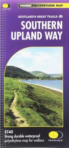
Wandelkaart Southern Upland Way | Harvey Maps

Southern Upland Way is Britain's first official coast to coast long distance footpath and is one of Scotland's Great Trails. It runs 340km (212 miles) from Portpatrick on the south west coast of Scotland to Cockburnspath on the eastern seaboard. It offers superb and varied walking country, still undiscovered by many enthusiasts. The Way provides a ...
28,50

Webshops met dit product

Webshop
Bezorging
Prijs

Anderen bekeken ook

Wandelkaart Southern Upland Way | Harvey Maps
Southern Upland Way is Britain's first official coast to coast long distance footpath and is one of Scotland's Great Trails. It runs 340km (212 miles) from Portpatrick on the south west coast of Scotland to Cockburnspath on the eastern seaboard. It offers superb and varied walking country, still undiscovered by many enthusiasts. The Way provides a real challenge for the experienced walker, yet some of the shorter stretches are suitable for families and the less ambitious.
28,50
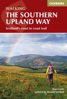
Wandelgids The Southern Upland Way | Cicerone
Uitstekende wandelgids van de Southern Upland Way, waarbij naast alle noodzakelijke informatie ook gebruik gemaakt wordt van de echte topografische kaart.   The Southern Upland Way is Scotland's coast-to-coast walk and the longest of the nation's Great Trails. 215 miles long, it links the pretty harbour village of Portpatrick on the west coast with Cockburnspath, a little south of Dunbar, in the east. The walk is at times a strenuous one, crossing the remote high moorland of the Galloway Hills, Carsphairn range, Lowthers, Ettrick Hills and Lammermuirs, calling for competence, fitness and self-reliance.    This guide presents advice on how best to plan and tackle this challenging but highly rewarding journey. The waymarked trail is presented in fourteen stages of 9–19 miles and suggestions for a rest day exploring Moffat and its environs are also included. It is possible either to backpack, taking advantage of five bothies and unlimited wild camping possibilities, or to stay in towns…
20,95
Wandelkaart Peddars Way & Norfolk Coast Path | Harvey Maps
Mooie, duidelijke kaart van de Peddars Way  in het oosten van Engeland. Geplastificeerd met veel extra informatie en uitsnedes van de route.   The Peddars Way and Norfolk Coast Path is considered by many to be one of the most accessible National Trails, making it a perfect trail for first time long-distance walkers, or one for the winter months due to Norfolk’s dry climate.   Linking the forests and heathland of the Brecks with the coast, Peddars Way is steeped in ancient legend. It offers a wonderfully remote-feeling adventure with some spectacular historic sites to visit along the way.   The Norfolk Coast Path is a beautiful walk among sand dunes, marshes and Nature Reserves. It goes through the North Norfolk Area of Oustanding Natural Beauty and has some of the best birdwatching in the UK.   Combining both Peddars Way and the Norfolk Coast Path is a moderate long-distance walk that takes most people 7-10 days to complete but can be easily broken into shorter walks.   This map covers…
25,95
Wandelkaart Pennine Way South | Harvey Maps
Mooie, duidelijke kaart van het zuidelijke gedeelte van de Pennine Way (Edale to Middleton-in-Teesdale). The whole of the Pennine Way on just 2 maps!   Pennine Way South map covers the route from Edale to Middleton-in-Teesdale.   The Pennine Way is a National Trail. It follows the backbone of England from the Peak District to the Scottish borders. It is one of the toughest UK long distance footpaths, and forms part of the European Footpath Network.   The Pennine Way was Britain's first National Trail, opened in 1965.   Just 2 HARVEY maps cover the whole 431km (268 miles) route. Each starts and finishes near public transport, so no hassle with getting lifts.   Each map also contains lots of information and useful telephone numbers to assist the walker with planning.   Tough, light, durable and 100% waterproof Includes Rights of Way Genuine original HARVEY mapping Route clearly marked
28,50
Wandelkaart Pennine Way North | Harvey Maps
Mooie, duidelijke kaart van het Noordelijke gedeelte van de Pennine Way (Middleton-in-Teesdale naar Kirk Yetholm). The whole of the Pennine Way on just 2 maps!   Pennine Way North map covers the route from Middleton-in-Teesdale to Kirk Yetholm.   The Pennine Way is a National Trail. It follows the backbone of England from the Peak District to the Scottish borders. It is one of the toughest UK long distance footpaths, and forms part of the European Footpath Network.   The Pennine Way was Britain's first National Trail, opened in 1965.   Just 2 HARVEY maps cover the whole 431km (268 miles) route. Each starts and finishes near public transport, so no hassle with getting lifts.   Each map also contains lots of information and useful telephone numbers to assist the walker with planning.   Tough, light, durable and 100% waterproof Includes Rights of Way Genuine original HARVEY mapping Route clearly marked
28,50
Wandelkaart Glyndwr's Way | Harvey Maps
XT40. Leap forward in technical excellence. Tough, light and 100% waterproof   Compact and light - the map itself weighs just 60gms - a third of the weight of a laminated map, and much less bulky. And you can fold or refold it time and again, or stuff it in your back pocket and it won't fall to pieces. Shows the entire route on one sheet.   Glyndwr's Way is a 217km (135 mile) long National Trail meandering through the open moorland, rolling farmland, woodland and forest of mid-Wales. The Way starts at Knighton and ends in Welshpool. It takes you to some of the finest landscape features in Wales including the tranquil Radnorshire Hills, the shores of the Clywedog Reservoir and heather clad Plynlimon. There are also spectacular views over Cadair Idris, Lake Vyrnwy, the Cambrian mountains and Y Golfa. The highest point on the route is Foel Fadian at 510m (1530ft).    The map is arranged in panels so that at any one time you only have to have the part you need open. It is supplied folded …
25,95
Wandelkaart Pennine Way South | Harvey Maps
Mooie, duidelijke kaart van het zuidelijke gedeelte van de Pennine Way (Edale to Middleton-in-Teesdale). The whole of the Pennine Way on just 2 maps!   Pennine Way South map covers the route from Edale to Middleton-in-Teesdale.   The Pennine Way is a National Trail. It follows the backbone of England from the Peak District to the Scottish borders. It is one of the toughest UK long distance footpaths, and forms part of the European Footpath Network.   The Pennine Way was Britain's first National Trail, opened in 1965.   Just 2 HARVEY maps cover the whole 431km (268 miles) route. Each starts and finishes near public transport, so no hassle with getting lifts.   Each map also contains lots of information and useful telephone numbers to assist the walker with planning.   Tough, light, durable and 100% waterproof Includes Rights of Way Genuine original HARVEY mapping Route clearly marked
28,50

Klanten-reviews van Wandelkaart Southern Upland Way | Harvey Maps

Er zijn nog geen beoordelingen voor dit productBen jij de eerste die een review plaatst?

Meer over Wandelkaart Southern Upland Way | Harvey Maps

Productomschrijving

Southern Upland Way is Britain's first official coast to coast long distance footpath and is one of Scotland's Great Trails. It runs 340km (212 miles) from Portpatrick on the south west coast of Scotland to Cockburnspath on the eastern seaboard. It offers superb and varied walking country, still undiscovered by many enthusiasts. The Way provides a real challenge for the experienced walker, yet some of the shorter stretches are suitable for families and the less ambitious.

Productspecificaties

Artikelnummer(s)
Brand
Harvey Maps
Webshop.nl maakt gebruik van cookies. Ga je verder op onze website, ga dan akkoord met het plaatsen van cookies en de verwerking van deze data door ons en vermelde partners.