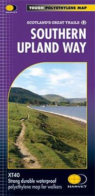
Wandelkaart Southern Upland Way | Harvey Maps

0
Southern Upland Way is Britain's first official coast to coast long distance footpath and is one of Scotland's Great Trails. It runs 340km (212 miles) from Portpatrick on the south west coast of Scotland to Cockburnspath on the eastern seaboard. It offers superb and varied walking country, still undiscovered by many enthusiasts. The Way provides a...

Verkopers met dit product

Verkoper
Bezorging
Prijs
DeZwerver.nl logo
DeZwerver.nl
2,95
28,50

Anderen bekeken ook

Wandelkaart Southern Upland Way | Harvey Maps
Southern Upland Way is Britain's first official coast to coast long distance footpath and is one of Scotland's Great Trails. It runs 340km (212 miles) from Portpatrick on the south west coast of Scotland to Cockburnspath on the eastern seaboard. It offers superb and varied walking country, still undiscovered by many enthusiasts. The Way provides a real challenge for the experienced walker, yet some of the shorter stretches are suitable for families and the less ambitious.
28,50
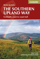
Wandelgids The Southern Upland Way | Cicerone
Uitstekende wandelgids van de Southern Upland Way, waarbij naast alle noodzakelijke informatie ook gebruik gemaakt wordt van de echte topografische kaart.   The Southern Upland Way is Scotland's coast-to-coast walk and the longest of the nation's Great Trails. 215 miles long, it links the pretty harbour village of Portpatrick on the west coast with Cockburnspath, a little south of Dunbar, in the east. The walk is at times a strenuous one, crossing the remote high moorland of the Galloway Hills, Carsphairn range, Lowthers, Ettrick Hills and Lammermuirs, calling for competence, fitness and self-reliance.    This guide presents advice on how best to plan and tackle this challenging but highly rewarding journey. The waymarked trail is presented in fourteen stages of 9–19 miles and suggestions for a rest day exploring Moffat and its environs are also included. It is possible either to backpack, taking advantage of five bothies and unlimited wild camping possibilities, or to stay in town…
20,95
Wandelkaart Rob Roy Way | Harvey Maps
Mooie, duidelijke kaart van de Rob Roy Way in Schotland. Geplastificeerd met veel extra informatie en uitsnedes van de route.    One of Scotland's Great Trails   Rob Roy Way is a walk across part of the Southern Highlands of Scotland taking in some of the most beautiful countryside in the UK. Starting from Drymen it goes north east to finish in Pitlochry. The Way is 77mls or 94 mls (124Km or 151Km) depending on your route choice. The tracks and paths you follow were used by Rob RoyMacGregor in the 17th & 18th centuries, other historical characters throughout the Jacobite uprisings and during the feuds between the local clans. Places you will pass through include Aberfoyle, Callander, Strathyre, Killin or Amulree and Aberfeldy. Lochs you will walk along include Venachar, Lubnaig and Tay passing by Ben Ledi, Ben Chonzie and Ben Lawers.   XT40 New generation of tough polyethylene maps   The HARVEY series of Long Distance Route maps is an established success. Now the advanced technology u…
25,95
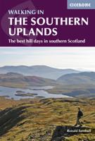
Wandelgids Walking in the Southern Uplands | Cicerone
This guidebook describes 44 routes and over 100 summits stretching across the Southern Uplands of Scotland, stretching south-west from Edinburgh to the English border, including the Galloway and Pentland Hills. The walks range between 2 and 29km, suitable for walkers of all abilities.   The Scottish Southern Uplands is a range that is about as big as the English Pennines. It is wild hill country, with over 80 hills of 2000ft or more, and it boasts a real remoteness that is difficult to find elsewhere. All hillwalkers should experience these wonderfully characterful landscapes: green and gentle, but with hidden surprises and remote escapes.   The routes are suitable from spring to autumn, and on winter days with good weather and snow conditions. Each route provides OS mapping, information on distance, ascent, time, maximum altitude and terrain, as well as details of any variants or shortcuts. With notes on points of interest along the way as well as on transport and accommodation, the …
21,95
Wandelkaart Two Moors Way | Harvey Maps
Een bijzonder handige kaart van dit lange-afstands-wandelpad. Op waterafstotend papier met veel details. Het enige dat je eigenlijk een beetje mist is een overzicht. Verder uitstekend en voldoende voor de route. Duurzame weerbestendige wandelkaart van de Two Moors Way in Devon, Zuidwest-Engeland. De route loopt noord-zuid over een afstand van 163 km tussen Lynmouth en Ivybridge. Op de kaart staan de route, wegkwaliteit, voorzieningen, overnachtingsplekken en andere nuttige informatie aangegeven. The Two Moors Way is a long-distance walking route between Ivybridge on the southern edge of Dartmoor and Lynmouth on the north coast of Exmoor.   It has a total length of 163km (102 miles), making it an ideal week's walk.    The Way links Dartmoor and Exmoor National Parks and passes through varied terrain: high moorland, wooded valleys, and unspoilt rural scenery with a remote and tranquil fee  
25,95
Wandelkaart North Downs Way | Harvey Maps
Mooie, duidelijke kaart van de North Downs Way in Engeland. Geplastificeerd met veel extra informatie en uitsnedes van de route.    XT40 - Leap forward in technical excellence. Tough, light and 100% waterproof   Compact and light - the map itself weighs just 60gms - a third of the weight of a laminated map, and much less bulky. And you can fold or refold it time and again, or stuff it in your back pocket and it won't fall to pieces.   Revised edition and format Shows the entire route on one XT40 map sheet.   The Way is 246km (156 miles). This map covers the whole route from Farnham in the west to Dover on the south east coast.   Information on finding accommodation, camping, food. Directions to the start and end points. Shows facilities available and includes tips on weather and clothing.     Detailed mapping, full legend. National Grid - can be used with GPS. 1:40,000 scale. Waterproof. Supplied in clear plastic pocket.
25,50
Wandelkaart Cleveland Way | Harvey Maps
Mooie, duidelijke kaart van de Cleveland Way in Noord-Engeland. Geplastificeerd met veel extra informatie en uitsnedes van de route.    Leap forward in technical excellence. Tough, light and 100% waterproof Compact and light - the map itself weighs just 60gms - a third of the weight of a laminated map, and much less bulky. And you can fold or refold it time and again, or stuff it in your back pocket and it won't fall to pieces. Shows the entire route on one sheet.   174km (109 miles) from Helmsley across the North York Moors National Park to Saltburn and along the coast via Scarborough ending at Filey.   Information on finding accommodation, camping, food. Directions to the start. Also Ranger Service contact numbers and enlargements of towns/villages showing facilities available and tips on weather and clothing.   Detailed mapping, full legend. National Grid - can be used with GPS. 1:40,000 scale. Waterproof. Supplied in clear plastic pocket
25,95
Wandelkaart Pennine Way South | Harvey Maps
Mooie, duidelijke kaart van het zuidelijke gedeelte van de Pennine Way (Edale to Middleton-in-Teesdale). The whole of the Pennine Way on just 2 maps!   Pennine Way South map covers the route from Edale to Middleton-in-Teesdale.   The Pennine Way is a National Trail. It follows the backbone of England from the Peak District to the Scottish borders. It is one of the toughest UK long distance footpaths, and forms part of the European Footpath Network.   The Pennine Way was Britain's first National Trail, opened in 1965.   Just 2 HARVEY maps cover the whole 431km (268 miles) route. Each starts and finishes near public transport, so no hassle with getting lifts.   Each map also contains lots of information and useful telephone numbers to assist the walker with planning.   Tough, light, durable and 100% waterproof Includes Rights of Way Genuine original HARVEY mapping Route clearly marked  
28,50
Wandelkaart St Oswald's Way | Harvey Maps
Mooie, duidelijke kaart van de St Oswald's Way Noord-Engeland. Geplastificeerd met veel extra informatie en uitsnedes van de route.   From Holy Island to Heavenfield, the 97 mile St Oswald's Way links some of the places associated with St Oswaldwho was the King of Northumbria in the early 7th century. The route runs through the Northumbria National Park following the stunning Northumberland Coast before heading inland across beautiful countryside to Heavenfield. It links with St Cuthbert's Way in the north and Hadrian's Wall Path in the south. Along the way you will encounter rolling farmland, villages, vast sandy beaches and fascinating history.   The HARVEY series of Long Distance Route maps is an established success. Now the advanced technology used in the creation of our best-selling British Mountain Maps is also applied to the route maps.   These maps are a leap forward in technical excellence. They are tough, durable, light and 100% waterproof - virtually indestructible in norma…
25,95
Wandelkaart East Highland Way | Harvey Maps
Mooie, duidelijke kaart van de East highland Way in Engeland. Geplastificeerd met veel extra informatie en uitsnedes van de route.  East Highland Way is an exciting new unofficial long distance route between Fort William and Aviemore. Pioneered by Kevin Langan, this 82 mile trail forms a new link between the northern end of the West Highland Way and the southern end of the Speyside Way. It also joins with the Great Glen Way at Fort William. It is a tranquil route which takes in a varied and wild landscape and includes the ancient Caledonian Forests of Inshriach, loch-side trails and mountain wilderness. Access to accommodation has been carefully considered wherever possible, making this route accessible to walkers of all abilities. The map is arranged in panels so that at any one time you only have to have the part you need open. It is supplied folded in a plastic pocket. The map shows the detail you need for navigation. There is a full key and scale bar.   Information on planning you…
25,95

Klanten-reviews van Wandelkaart Southern Upland Way | Harvey Maps

Er zijn nog geen beoordelingen voor dit productBen jij de eerste die een review plaatst?

Meer over Wandelkaart Southern Upland Way | Harvey Maps

Productomschrijving

Southern Upland Way is Britain's first official coast to coast long distance footpath and is one of Scotland's Great Trails. It runs 340km (212 miles) from Portpatrick on the south west coast of Scotland to Cockburnspath on the eastern seaboard. It offers superb and varied walking country, still undiscovered by many enthusiasts. The Way provides a real challenge for the experienced walker, yet some of the shorter stretches are suitable for families and the less ambitious.

Productinformatie

    Verken gerelateerde categorieën

    Webshop.nl maakt gebruik van cookies. Ga je verder op onze website, ga dan akkoord met het plaatsen van cookies en de verwerking van deze data door ons en vermelde partners.