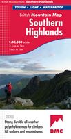
Wandelkaart Southern Highlands | Harvey Maps
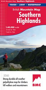
"I've researched Scottish Guidebooks using HARVEY maps. They are the clearest, and the most accurate. They don't fall to pieces in the rain and the geology bits are pure bonus". Ronald Turnbull, author of Walking Loch Lomond and The Trossachs. Detailed map of the Southern Highlands at 1:40,000 scale. Map extensions of Ben Cruachan and Ben Vorlich. This map shows 63 hills over 2,000 feet, including 25 Munros, 24 Corbetts and 14 Grahams. This map covers an area dense with popular hills close to Central Scotland and easily accessed from the motorways. There are 63 popular hills over 2000', climbing crags are highlighted & named and the map covers most of Loch Lomond National Park. Printed on polyethylene the map is durable, tearproof and 100% waterproof. We use colour shading for easy identification of hills and valleys and the map is less than half the weight of a laminated map.
29,95

