Wandelkaart South Downs Way | Vertebrate Publishing

0
The 162-kilometre South Downs Way begins in Winchester and traces a ridgeline along the rolling, green South Downs to the coast at Eastbourne. It is rightly regarded as one of the finest long-distance trails in England. Predominantly bridleway, the trail is generally wide and hard-surfaced and can be walked at any time of year.   The South Downs W...

Verkopers met dit product

Verkoper
Bezorging
Prijs
DeZwerver.nl logo
DeZwerver.nl
2,95
24,50

Anderen bekeken ook

Wandelkaart South Downs Way | Vertebrate Publishing
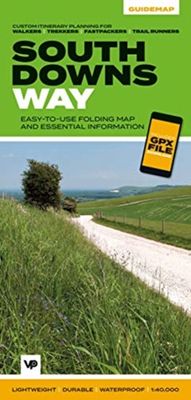
The 162-kilometre South Downs Way begins in Winchester and traces a ridgeline along the rolling, green South Downs to the coast at Eastbourne. It is rightly regarded as one of the finest long-distance trails in England. Predominantly bridleway, the trail is generally wide and hard-surfaced and can be walked at any time of year.   The South Downs Way appeals to people who have different levels of experience and travel at all speeds, and this Vertebrate Publishing Guidemap is unique in that it caters for four categories of user, providing custom itineraries for walkers, trekkers, fastpackers and trail runners. This lightweight, waterproof, durable and easy-to-use folding map features all the essential information for a successful South Downs Way, including 1:40,000-scale mapping for the linear route starting in Winchester and finishing in Eastbourne. It also includes a detailed elevation profile and route planner, safety advice, terrain information and an accommodation directory, and a …
24,50
Wandelgids Day Walks n the South Downs | Vertebrate Publishing
Day Walks on the South Downs features 20 circular routes, between 6 and 14 miles (9km and 22km) in length, suitable for hill walkers of all abilities. The routes are split into three geographical areas - Hampshire, West Sussex and East Sussex - and include walks to the most historic and beautiful areas of the South Downs National Park, including Winchester Hill Fort, Black Down, Chanctonbury Ring, Devil's Dyke, Ditchling Beacon and Beachy Head. This guidebook is written by Deirdre Huston, a South Downs local, keen hill walker and experienced author.   Each route in this guide is described with easy-to-follow directions and details of distance, navigation information, refreshment stops and is plotted on clear and easy to use Ordnance Survey 1:25,000 mapping. Also included is a detailed Appendix.
20,95
Wandelkaart West Highland Way | Vertebrate Publishing
The 153-kilometre West Highland Way encompasses the variety of Scotland's wild places. The route, which begins in Milngavie and finishes in Fort William, passes from Glasgow, Scotland's friendliest city, through lochs and forests, and across wild moors in the shadows of Munros. Offering panoramic views and clear waymarking, it is no wonder this is one of Scotland's most popular long-distance routes.   The West Highland Way appeals to people who have different levels of experience and travel at all speeds, and this Vertebrate Publishing Guidemap is unique in that it caters for four categories of user, providing custom itineraries for walkers, trekkers, fastpackers and trail runners. This lightweight, waterproof, durable and easy-to-use folding map features all the essential information for a successful West Highland Way, including 1:40,000-scale mapping for the linear route starting in Milngavie and finishing in Fort William. It also includes a detailed elevation profile and route plan…
24,50
Wandelgids Great Britain & Ireland | Vertebrate Publishing
Big Trails: Great Britain & Ireland is an inspirational guide to the most iconic, spectacular and popular long-distance trails in England, Scotland, Wales, Northern Ireland, Ireland and the Isle of Man.   The twenty-five featured routes will take you across the best of the British Isles. From the South Downs Way in South-East England and across Wales' mountains in the Cambrian Way, the book delves into the heart of Scotland on the West Highland Way, along the Causeway Coast Way on Northern Ireland’s coast, and into southern Ireland on the Beara Way.   The book is designed to inspire big adventures. Rather than being carried along the route, this guide provides everything you need to plan and explore further, including a general overview of the trails, specific technical information, overview mapping, key information and stunning photography. As well as this, each route specifies approximate timings devised using the Jones–Ross formula, which allows for custom itineraries to be generat…
27,95
Wandelkaart Tour du Mont Blanc Guidemap | Vertebrate Publishing
The white dome of Mont Blanc looms over France, Italy and Switzerland, and it is no wonder that the 169-kilometre Tour du Mont Blanc (TMB) has captured the public imagination to become one of Europe's most popular long-distance trails. The TMB appeals to people who have different levels of experience and travel at all speeds, and this Vertebrate Publishing Guidemap is unique in that it caters for four categories of user, providing custom itineraries for walkers, trekkers, fastpackers and trail runners. This lightweight, waterproof, durable and easy-to-use folding map features all the essential information for a successful TMB, including 1:40,000-scale mapping for the anticlockwise route starting and finishing in the town of Les Houches, south of Chamonix.   It also includes nine route variations, a detailed elevation profile and route planner, safety advice, terrain information and an accommodation directory, and a link to a GPX file download.
24,50
Wandelkaart Hadrian's Wall Path | Vertebrate Publishing
The 138-kilometre Hadrian's Wall Path traces a grey line along Great Whin Sill, the dolerite ridge chosen by the Romans for their historic wall. The route, one of Britain's most popular National Trails, is dotted with milecastles and forts, and attracts trail runners and walkers all year round due to its sweeping views. Beginning in Newcastle, the trail passes through rolling grassy paths and grey-green crags to reach Bowness-on-Solway on the Cumbrian Coast.   Hadrian's Wall Path appeals to people who have different levels of experience and travel at all speeds, and this Vertebrate Publishing Guidemap is unique in that it caters for four categories of user, providing custom itineraries for walkers, trekkers, fastpackers and trail runners. This lightweight, waterproof, durable and easy-to-use folding map features all the essential information for a successful Hadrian's Wall Path, including 1:40,000-scale mapping for the linear route starting in Wallsend and finishing in Bowness-on-Solw…
24,50
Wandelgids South Downs Way | Cicerone
Uitstekende wandelgids van dit geweldige gebied. goed beschreven met veel praktische informatie om de route te kunnen lopen, inclusief een apart boekje met zeer gedetaileerde kaarten. The South Downs Way National Trail is a 100 mile (160km) walk between Eastbourne and Winchester, staying within the glorious South Downs National Park for its entire length. Presented here in 12 stages of up to 12 miles (19km), the route is described in both east-west and west-east. A waymarked trail with very few stiles, it can be walked at any time of year and makes a good introduction to long-distance walking. Step-by-step route descriptions are illustrated with extracts from OS 1:50,000 mapping for every stage, and a separate, conveniently sized booklet with 1:25,000 maps for the entire route is included. The guide provides detailed practical information on getting to the trail, and facilities and accommodation en route. The South Downs Way offers easy walking on ancient and historical tracks, and sh…
24,95
Wandelkaart - Kaart The South Downs Way Map Booklet | Cicerone
All the mapping you need to complete the 100 mile (160km) South Downs Way National Trail, between Eastbourne and Winchester. With easy walking on ancient trackways, the route features wooded areas, river valleys and attractive villages and is rich in natural, geological and historical interest. This booklet of Ordnance Survey 1:25,000 Explorer maps has been designed for convenient use on the trail.   It shows the full and up-to-date line of the route along with the relevant extract from the OS Explorer map legend, and can be used when walking the trail in either direction. Conveniently sized for slipping into a jacket pocket or the top of a rucksack, it comes in a clear PVC sleeve. An accompanying Cicerone guidebook - The South Downs Way - describes the full route in both directions and includes lots of other practical and historical information, for those who prefer a written guide.   The guidebook INCLUDES a copy of this map booklet.
18,50
Fietsgids Bikepacking Scotland | Vertebrate Publishing
Bikepacking Scotland by Markus Stitz features 20 great multi-day off-the-beaten-track cycling adventures across the Scottish mainland and islands.   The book features routes of different lengths which take in the best of the country, from the Ayrshire Alps, Dumfries and Galloway and the Borders in southern Scotland, through Perthshire’s unique drovers’ roads and the grand architecture of the Central Belt, across to Argyll’s islands on ferry-hopping adventures around Islay, a paradise for whisky connoisseurs, and Jura and Mull to spot magnificent golden eagles. And, of course, the Scottish Highlands with an epic tour of the Cairngorms National Park, home to 25 per cent of Britain's rare and endangered species, as well as the author’s own take on the North Coast 500 and more.   Researched and written by the founder of Bikepacking Scotland, and mostly accessible by public transport, each route includes all the information you need to help you plan your ride, with points of interest along…
27,95
Wandelgids Peak Bagging Munros | Vertebrate Publishing
Over 130 years ago, mountaineer Sir Hugh Munro published the first list of Munros ? Scottish mountains with a height over 3,000 feet ? and inspired the hobby of Munro ?bagging?, a pastime which combines rugged adventure on a personal and literal journey around the Scottish Highlands with a nerdy compulsion to maintain a ticklist. Peak Bagging Munros Volume 1 by Nicola Hardy (Munroist number 6,765) features 64 routes designed to link up the 141 most southerly Munros so you can enjoy the challenge of ?compleating? them at your own pace ? over years, months or, in rare cases, even just a few weeks. It presents not only the most efficient routes, but does so in such a way that each route is a fantastic walk or run in its own right.   The featured routes include the iconic Ring of Steall and Ben Nevis via the Carn M?r Dearg Ar?te, alongside classic entry-level walks up the likes of Ben Chonzie, Ben Lomond in Loch Lomond and the Trossachs and Mount Keen in the Cairngorms. To assist you in b…
37,95

Klanten-reviews van Wandelkaart South Downs Way | Vertebrate Publishing

Er zijn nog geen beoordelingen voor dit productBen jij de eerste die een review plaatst?

Meer over Wandelkaart South Downs Way | Vertebrate Publishing

Productomschrijving

The 162-kilometre South Downs Way begins in Winchester and traces a ridgeline along the rolling, green South Downs to the coast at Eastbourne. It is rightly regarded as one of the finest long-distance trails in England. Predominantly bridleway, the trail is generally wide and hard-surfaced and can be walked at any time of year.   The South Downs Way appeals to people who have different levels of experience and travel at all speeds, and this Vertebrate Publishing Guidemap is unique in that it caters for four categories of user, providing custom itineraries for walkers, trekkers, fastpackers and trail runners. This lightweight, waterproof, durable and easy-to-use folding map features all the essential information for a successful South Downs Way, including 1:40,000-scale mapping for the linear route starting in Winchester and finishing in Eastbourne. It also includes a detailed elevation profile and route planner, safety advice, terrain information and an accommodation directory, and a link to a GPX file download.

Productinformatie

    Verken gerelateerde categorieën

    Webshop.nl maakt gebruik van cookies. Ga je verder op onze website, ga dan akkoord met het plaatsen van cookies en de verwerking van deze data door ons en vermelde partners.